All Activity
- Past hour
-
Yes
-
yeah is uncle ok?
-

Central PA Winter 25/26 Discussion and Obs
WmsptWx replied to MAG5035's topic in Upstate New York/Pennsylvania
This would verify a lot of "starts cold, warms up" predictions. -

Central PA Winter 25/26 Discussion and Obs
AccuChris replied to MAG5035's topic in Upstate New York/Pennsylvania
Flakes are flying in Lebanon presently . -
Even if this occurs, why cant it change in 5 years? I forgot the MET who stated it, however the MET on this forum stated that the warm pool is sliding east slowly which should change things.
-

December 2025 regional war/obs/disco thread
WinterWolf replied to Torch Tiger's topic in New England
Way to be TBlizz. Then Goose and Wiz crush hopes with it ain’t happening. Here’s to hoping they are both wrong. -
December 2025 regional war/obs/disco thread
WinterWolf replied to Torch Tiger's topic in New England
Too bad its 15 days away. -
might be 6" depending on ratios in DC
-
Legit lol
-
whoa
-

Winter 2025-26 Short Range Discussion
RCNYILWX replied to SchaumburgStormer's topic in Lakes/Ohio Valley
It's basically the CAMs and RAP against the globals, with the GFS the farthest northeast of these. Wouldn't be surprised at a compromise in which the better f-gen banding and accum axis is indeed farther southwest, while farther north and east we get several hours of pixies accumulating to an inch or two. Could certainly be wrong but my current lean is away from a complete whiff with the first system. Too soon to write off Saturday for adjustments back (a decent % of 06z EPS members still had solid snow up into parts of the metro). -
Rjay last posted on November 30th so yes. Uncle hasn't posted in 3 years (i assume you mean @uncle W)
-

12/12: The little Friday clipper that could? Or won't.
bncho replied to dailylurker's topic in Mid Atlantic
The rich get richer. And the poor get poorer. And the happy get happier. And the sad get sadder. -
Yeah so for me to take any real value of this having meteorological significance I need to see statistical correlating variables, which is why I've done a lot of work around correlations and partial correlations involving ENSO states, rate of change involving the SOI, etc and found minimal forecast/predictability value for snowfall locally. I've been burned by threshold/relational things in the past (SAI being chief among them) and have since really been hesitant on overfitting data to find some grain of predictability to it.
-
Thank you. Seems logical. .
-
I mean...if we can get the ao/nao domain to start latching on to this idea....I know...way out in la la land.

-
Much better.
-
I think another thing is that we all have both recency bias and the feeling that things were better and grander in our younger years - whether it’s winters, pop music, sports teams, movies, etc. .
-
1pm
-
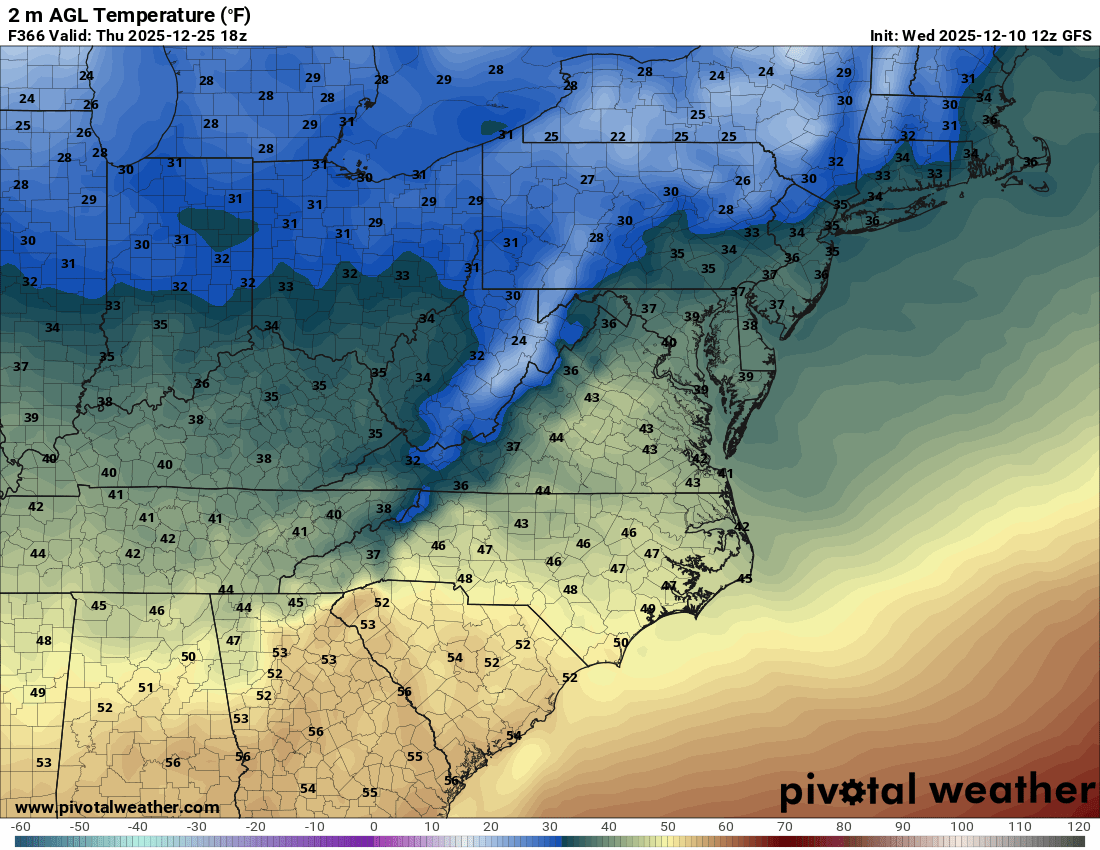
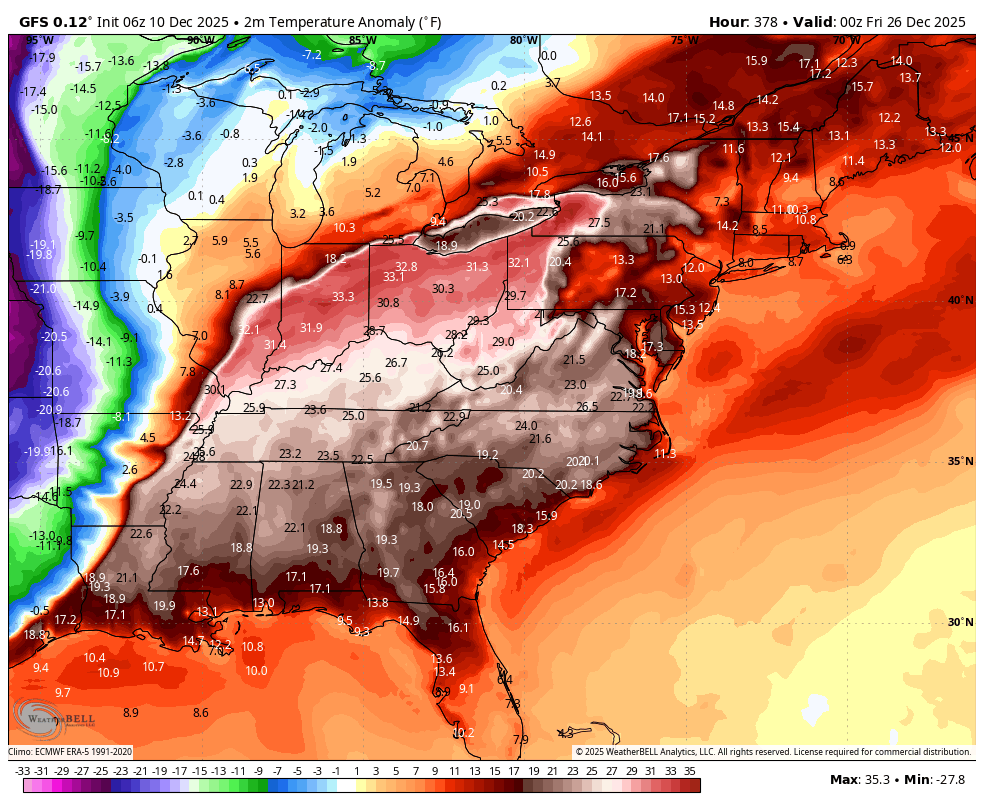
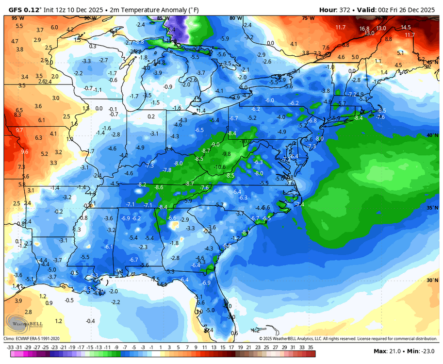
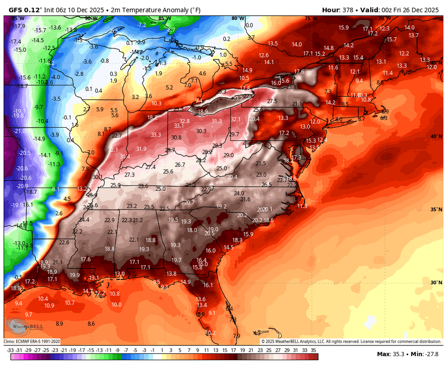
WB 12Z GFS Christmas temp. anomaly compared to 6Z.
-
What does this map show and mean? I paused my eating of crayons to try and learn something. TIA. .
-
I'm fine if this is a one or three day event. I don't want to see this ridge just set up and bake for weeks on end.
-
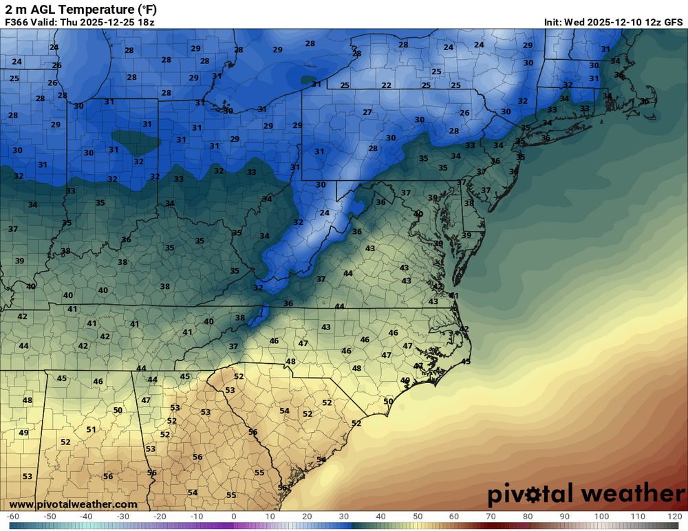
Around 40 for Christmas Day... so not too bad
-

December 2025 Short/Medium Range Forecast Thread
Carvers Gap replied to John1122's topic in Tennessee Valley
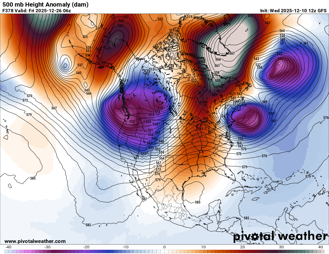
Understandable but still wild....some big swings in the d+10 range. The left is the new GFS run. IF Alaska has a block like that, that trough likely corrects eastward. In that trough is very cold air. At 0z, the pattern was less amplified and blocky. The left has an east based NAO and a full fledged Alaskan block. As a result, the 12z GFS finds a cold front on Christmas Eve. It isn't huge, but interesting to see it parked right in the middle of the warm-up. -
To 20's Christmas morning! lol That -nao is trying