All Activity
- Past hour
-

Septorcher 2026 Discussion - Endless Summer
powderfreak replied to Damage In Tolland's topic in New England
Someone who puts in that much time and effort, surprised he doesn’t just have like a Milwaukee backpack vacuum… some of those things will suck the earth worms out of the ground lol. -
About 6 - 8 hours away
-

Septorcher 2026 Discussion - Endless Summer
Damage In Tolland replied to Damage In Tolland's topic in New England
He was out there from about 11-4:00. Thr thing is… there’s still thousands to come down. -
November 12th
-
Not really. Typical.
-
Septorcher 2026 Discussion - Endless Summer
powderfreak replied to Damage In Tolland's topic in New England
You know he’s emptying that shop vac in your yard when you aren’t looking… -

Septorcher 2026 Discussion - Endless Summer
CoastalWx replied to Damage In Tolland's topic in New England
Do you really need to Sey-Mour-Rain though? -
Noon. Later east of the city
-
How late in the day should do we see the rain clear out?
-
 https://indiagenericstore.com/# online drugs order
 -
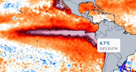
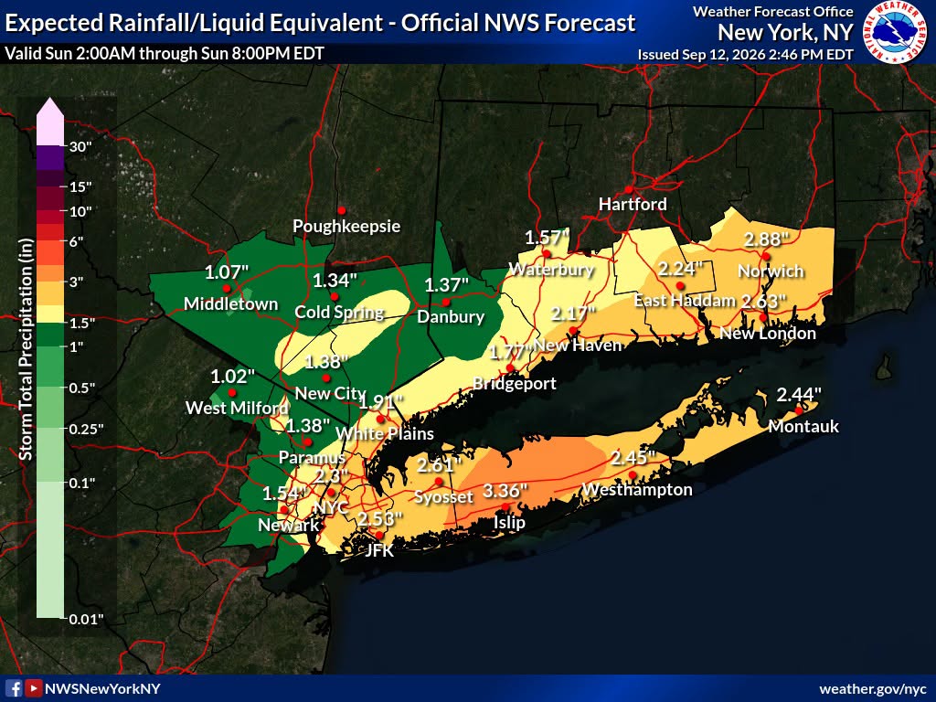
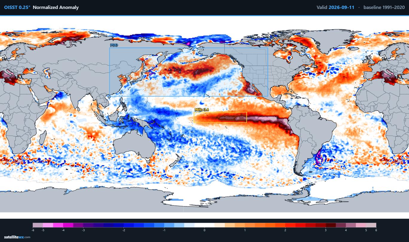
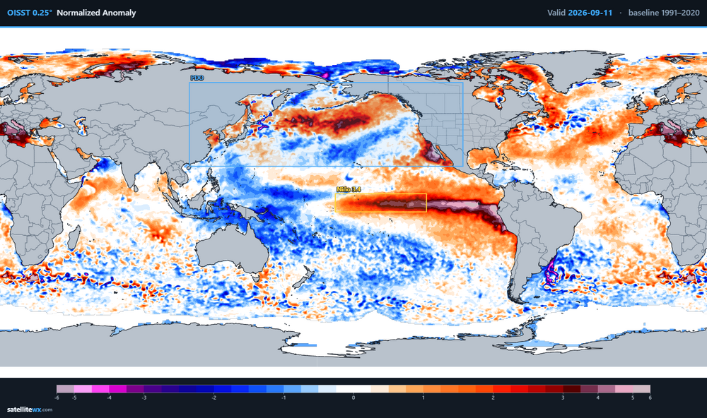
Rain will arrive tonight. A general 1.00"-2.00" rainfall with locally higher amounts in excess of 3.00" appears likely. Clouds will break tomorrow with the mercury rising into the upper 70s. However, the coolest air mass so far this season will then push into the region to begin the work week. Highs Monday through Wednesday will reach the lower and middle 70s. New York City will see lows in the upper 50s to lower 60s. As a result, Central Park will experience its first reading below 60° this season. the timing matches well with the last two El Niño events: 2015-2016: September 14 and 2023-2024: September 15. Wednesday through Friday will see temperatures recover mainly to the upper 70s. However, additional cool air will likely arrive some time during the next weekend. The ENSO Region 1+2 anomaly was +4.6°C and the Region 3.4 anomaly was +2.7°C for the week centered around September 2. For the past six weeks, the ENSO Region 1+2 anomaly has averaged +4.12°C and the ENSO Region 3.4 anomaly has averaged +2.57°C. The ongoing strong El Niño, will continue to strengthen through the mid-fall. The Region 1+2 anomaly surpasses the all-time record of +4.5° that was set during the week centered around June 29, 1983. The SOI was -29.77 today. The preliminary Arctic Oscillation (AO) was +1.761 today. Based on sensitivity analysis applied to the latest guidance, there is an implied near 50% probability that New York City will have a warmer than normal September (1991-2020 normal). September will likely finish with a mean temperature near 69.2° (near normal). Supplemental Information: The projected mean would be 1.2° above the 1981-2010 normal monthly value.
-

Septorcher 2026 Discussion - Endless Summer
Sey-Mour Snow replied to Damage In Tolland's topic in New England
Upton going all in 3-5 locally 7” . Fully expecting scattered showers now -
https://northrxcanada.shop/# best online canadian pharmacy
-
Yup. Wife and I took the dogs for a walk like 40 minutes ago and we both were saying how nice it felt out.
-
Was gunna say. Been overcast since around 330pm. Nice breeze too.
-
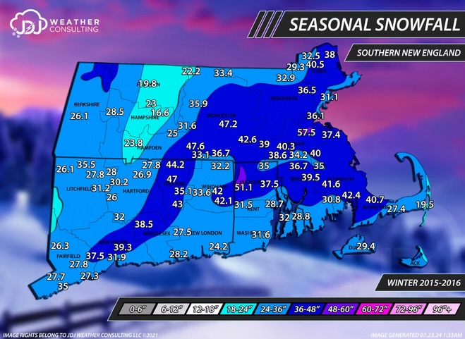
2015-16 wasn’t that bad for snow in southeastern areas…actually kind of impressive considering a near complete shutout in December that season
-
Been overcast here in NJ for a bit now
-

Septorcher 2026 Discussion - Endless Summer
Baroclinic Zone replied to Damage In Tolland's topic in New England
Gotta go back to early June when temps dropped this low. Gorgeous day. 10/10. Autumn is here and it’s glorious. - Today
-

2026-2027 Record-breaking El Nino
Ephesians2 replied to Stormchaserchuck1's topic in Weather Forecasting and Discussion
is that ridge south of the aleutians a nino pattern? -
already pretty neutral looking, we'll almost certainly have a positve PDO by November/December. We also got a pretty good pacific pattern the last two winters even with Nina/-PDO
-
It would really be something if we were completely shut out from this event.
-
buy medicine without prescription: buy medication from india : buy medicine from india to usa
-
I also like the look of the northward moving stuff over southern VA. Hope it holds together for later. It would be real nice if Sept cooperates so that the last two months of summer were above average rainfall
-

2026-2027 Record-breaking El Nino
BuffaloWeather replied to Stormchaserchuck1's topic in Weather Forecasting and Discussion
lol