mitchnick Posted December 26, 2010 Share Posted December 26, 2010 Does it matter at all that the GFS is showing an initial pressure of 1009mb for the low pressure near Florida, when it is more like 1005mb (via Cross City, FL current conditions)? the computers have been behind that curve all afternoon and evening we sit and we wait Link to comment Share on other sites More sharing options...
jrodd321 Posted December 26, 2010 Share Posted December 26, 2010 Just to be clear, you're not including PHL in that, are you? Because verbatim we make out just fine... Yea he means south of Philly. We make out fine, man. Link to comment Share on other sites More sharing options...
ohleary Posted December 26, 2010 Share Posted December 26, 2010 We shall see what nails what come Monday morning. There are other models besides NAM and GFS as someguy has pointed out. Wwhen you can compare the GFS and NAM precip fields inside 24h and they are locked in, should ya doubt it? Plus, have you looked at radar? Link to comment Share on other sites More sharing options...
Terpeast Posted December 26, 2010 Share Posted December 26, 2010 Watch for SLP off the coast of georgia at 1 am (6z). 0z GFS run shows sub 1004 there at 6 hrs... compare that with sfc obs at 1 am. Link to comment Share on other sites More sharing options...
mitchnick Posted December 26, 2010 Share Posted December 26, 2010 elongated 700mb Low is definitely killing us http://www.nco.ncep.noaa.gov/pmb/nwprod/analysis/namer/ruc/hr4/index_700_l_loop.shtml Link to comment Share on other sites More sharing options...
lsukev Posted December 26, 2010 Share Posted December 26, 2010 You'd have to compare it to 00z, which is 7PM. Even though the GFS doesn't start outputting until around 1030, the initialization is showing conditions at 7PM Eastern time. That makes perfect sense, but I seem to remember from earlier posts that the pressure has been below 1009mb for several hours now. Thanks! Link to comment Share on other sites More sharing options...
Srain Posted December 26, 2010 Share Posted December 26, 2010 MODEL DIAGNOSTIC DISCUSSION NWS HYDROMETEOROLOGICAL PREDICTION CENTER CAMP SPRINGS MD 1028 PM EST SAT DEC 25 2010 VALID DEC 26/0000 UTC THRU DEC 29/1200 UTC ...SEE NOUS42 KWNO ADMNFD FOR THE STATUS OF THE UPPER AIR INGEST... 00Z NAM EVALUATION INCLUDING PRELIMINARY MODEL PREFERENCES... NAM INITIALIZATION ERRORS DO NOT SEEM TO DEGRADE ITS SHORT RANGE FORECAST. SHORTWAVE MOVING INTO THE PACIFIC NORTHWEST TUESDAY NIGHT/WEDNESDAY MORNING...PREFERENCE FOR A NON-12Z UKMET COMPROMISE THE NAM HAS TRENDED STRONGER/QUICKER WITH THIS SYSTEM OVER ITS PAST DAY OF RUNS. THE ECMWF HAS TRENDED STRONGER/SLIGHTLY SLOWER WITH THIS SYSTEM OVER ITS PAST COUPLE DAYS OF RUNS. WHEN COMPARING THE GUIDANCE...THE 12Z UKMET IS A SLOW OUTLIER WITH THIS SYSTEMS PROGRESSION...WHICH HAS MINIMAL ENSEMBLE SUPPORT FROM THE 12Z GEFS MEMBERS...BUT NO CANADIAN OR ECMWF MEMBERS. WHILE ITS SOLUTION IS POSSIBLE CONSIDERING BUILDING RIDGING UPSTREAM...WILL FAVOR A NON-12Z UKMET COMPROMISE WITH THIS SYSTEM. SHORTWAVE MOVING ACROSS NORTHWEST MEXICO AND TEXAS MONDAY/TUESDAY/EARLY WEDNESDAY...PREFERENCE FOR A GENERAL MODEL COMPROMISE THE NAM HAS TRENDED SLIGHTLY QUICKER/EASTWARD WITH THIS SYSTEM OVER ITS PAST DAY OF RUNS. THE ECMWF IS ON THE QUICK SIDE OF ITS PAST COUPLE DAYS OF RUNS WITH THIS SYSTEM. THE MODELS SHOW GOOD AGREEMENT WITH THIS SYSTEM...SO WILL PREFER A GENERAL MODEL COMPROMISE HERE. SURFACE LOW APPROACHING VANCOUVER ISLAND MONDAY NIGHT THROUGH SOUTHERN CANADA...PREFERENCE FOR A QUICKER NON-12Z CANADIAN COMPROMISE SOLUTION THE NAM HAS TRENDED NORTH/QUICKER/DEEPER WITH THIS SYSTEM OVER ITS PAST DAY OF RUNS. THREE OF THE ECMWFS PAST FOUR RUNS SHOWED A PROGRESSION THIS QUICK...WITH ITS 00Z RUN THE SLOW OUTLIER OVER ITS PAST COUPLE DAYS OF SOLUTION. WHEN COMPARING THE GUIDANCE...THE 12Z CANADIAN BECOMES A SLOW OUTLIER WITH ITS PROGRESSION. THE 12Z GLOBAL ENSEMBLE MEMBER CLUSTERING FAVORS THE QUICKER NON-12Z CANADIAN CONSENSUS...WHICH MAKES SENSE CONSIDERING THE ZONAL FLOW REGIME IN WHICH IT IS EMBEDDED...SO IT IS PREFERRED. NORTHERN STREAM SYSTEM MOVING ALONG THE US/CANADIAN BORDER...PREFERENCE FOR A QUICKER NON-12Z CANADIAN COMPROMISE SOLUTION THE NAM HAS TRENDED QUICKER WITH THIS SYSTEM OVER ITS PAST DAY OF RUNS. THE ECMWF IS ON THE MORE NEGATIVELY TILTED...QUICK SIDE OF ITS PAST COUPLE DAYS OF RUNS. WHEN COMPARING THE GUIDANCE...THE 12Z CANADIAN WAS ON THE SLOW SIDE OF THE GUIDANCE...WITH A QUICKER NON-12Z CANADIAN CONSENSUS PRESENT. SINCE THE TREND IS QUICKER ON THE NAM/ECMWF...WILL FAVOR A QUICKER NON-12Z CANADIAN COMPROMISE SOLUTION HERE. SOUTHERN STREAM SHORTWAVE MOVING THROUGH THE SOUTHWEST/PLAINS/OHIO VALLEY...PREFERENCE FOR A COMPROMISE OF THE 18Z GFS AND 12Z ECMWF THE NAM HAS TRENDED QUICKER WITH THIS SYSTEM OVER ITS PAST DAY OF RUNS. THE ECMWF IS ON THE QUICK/WEAK SIDE OF ITS PAST COUPLE DAYS OF RUNS WITH THIS SYSTEM. THERE ARE TIMING DIFFERENCES WITH THIS SYSTEM...WITH THE 18Z GFS SPLITTING THE DIFFERENCE. THE 12Z CANADIAN IS THE QUICKEST SOLUTION. AS THE SYSTEM WILL BE MOVING UNDER THE BASE OF NORTHERN STREAM RIDGING IN SOUTHEAST CANADA...IT SHOULD REMAIN PROGRESSION...BUT SINCE THE NORTHERN STREAM RIDGE ITSELF IS PROGRESSIVE...THE SOUTHERN STREAM SHORTWAVES MOVEMENT SHOULD NOT BE EXCEEDINGLY QUICK...RULING OUT THE 12Z CANADIAN. THE 00Z NAM IS THE SLOWEST...AND SINCE IT IS TRENDING QUICKER...THINK ITS SOLUTION REMAINS TOO SLOW AS IT FITS ITS TRADITIONAL BIAS 2-3 DAYS INTO THE FUTURE. DEPTH ISSUES PERSIST WITH THE REMAINING GUIDANCE...AS THE 18Z GFS IS STRONGEST AND THE 12Z ECMWF IS WEAKER. WILL DEAL WITH THE UNCERTAINTY BY COMPROMISING BETWEEN THE 18Z GFS AND 12Z ECMWF. DEEP CYCLONE/NOREASTER MOVING UP THE EAST COAST...PREFERENCE FOR A NON-12Z UKMET COMPROMISE SOLUTION THE NAM HAS TRENDED SLIGHTLY STRONGER WITH THIS SYSTEM OVER ITS PAST DAY OF RUNS BUT HAS OTHERWISE MAINTAINED GOOD CONTINUITY ON ITS TRACK. THE ECMWF HAS TRENDED WESTWARD WITH THIS SYSTEM OVER ITS PAST COUPLE DAYS OF RUNS. THE MODELS SHOW GOOD AGREEMENT WITH THIS SYSTEM FOR THE MOST PART...INCLUDING THE 21Z SREF MEAN...EXCEPT FOR THE 12Z UKMET WHICH FLINGS ITS EASTWARD OFF NOVA SCOTIA RATHER THAN NORTHEAST. WHILE 12 OF THE 90 12Z GLOBAL ENSEMBLE MEMBERS SUPPORT THIS IDEA...THE 12Z UKMET IS ON THE QUICK SIDE OF THOSE MEMBERS. WILL FAVOR A NON-12Z UKMET COMPROMISE WITH THIS SYSTEM. FOR PRECIPITATION/WINTER WEATHER IMPACTS...SEE THE QPF AND WINTER WEATHER DISCUSSIONS AND GRAPHICS FOR MORE DETAILS. ...MODEL TREND GRAPHICS AT WWW.HPC.NCEP.NOAA.GOV/HTML/MODEL2.SHTML... ...500 MB FORECASTS AT WWW.HPC.NCEP.NOAA.GOV/H5PREF/H5PREF.SHTML... ROTH Link to comment Share on other sites More sharing options...
pojrzsho Posted December 26, 2010 Share Posted December 26, 2010 Wwhen you can compare the GFS and NAM precip fields inside 24h and they are locked in, should ya doubt it? Plus, have you looked at radar? OK.....so why does Midlothian, VA ALREADY have 3" of snow according to Midlo? No reason to doubt him, so what would that QPF be at ELEVEN PM12/25 be and what was it progged to be? A serious question, based on NAM and GFS. Link to comment Share on other sites More sharing options...
winterymix Posted December 26, 2010 Share Posted December 26, 2010 elongated 700mb Low is definitely killing us http://www.nco.ncep....00_l_loop.shtml I dunno...the whole storm seems sketchy in our area but the mets. here, almost to a man, advise patience. A general 2 to 6 should calm the savage beasts here for a few days. Gonna check it out in the morning. Where is weatherfella?...he should be knocking back some $28 a bottle pinot grigio and waxing his snow shovel and reminiscing about breaking up with the girl that asked him "Which is it gonna be -- me or the snowstorm?" Link to comment Share on other sites More sharing options...
lsukev Posted December 26, 2010 Share Posted December 26, 2010 Watch for SLP off the coast of georgia at 1 am (6z). 0z GFS run shows sub 1004 there at 6 hrs... compare that with sfc obs at 1 am. Took your advice and went back to the 12Z GFS. The forecasted strength of the SLP near Cross City, FL was 1008mb, so it has been slightly underestimating its strength. Link to comment Share on other sites More sharing options...
Kenny G Posted December 26, 2010 Share Posted December 26, 2010 03Z RUC @ 12 hr shows 992 mb low just east of OBX looks like decent precip in VA Link to comment Share on other sites More sharing options...
mitchnick Posted December 26, 2010 Share Posted December 26, 2010 I dunno...the whole storm seems sketchy in our area but the mets. here, almost to a man, advise patience. A general 2 to 6 should calm the savage beasts here for a few days. Gonna check it out in the morning. Where is weatherfella?...he should be knocking back some $28 a bottle pinot grigio and waxing his snow shovel and reminiscing about breaking up with the girl that asked him "Which is it gonna be -- me or the snowstorm?" if ratios were decent, we could get 6" ala 1/30/10 it was a lot colder though for that storm Link to comment Share on other sites More sharing options...
ohleary Posted December 26, 2010 Share Posted December 26, 2010 OK.....so why does Midlothian, VA ALREADY have 3" of snow according to Midlo? No reason to doubt him, so what would that QPF be at ELEVEN PM12/25 be and what was it progged to be? A serious question, based on NAM and GFS. Looks like GFS nailed it, had Richmond at about .15 for the 6-hr period. NAM was a miss. Look at the QPF fields and the actual SE radar at this time. Envision the storm track, the enhancement of the sfc low and you can see (intiuitively) that the GFS and NAM seem to have a handle on it. At least I can. The only wild card is the low deepening and the precip field being enhanced to the west more for the MA to see more snow. Link to comment Share on other sites More sharing options...
PhineasC Posted December 26, 2010 Share Posted December 26, 2010 I am hugging the SREFs tight tonight. Link to comment Share on other sites More sharing options...
mitchnick Posted December 26, 2010 Share Posted December 26, 2010 if you click the animate box, you can see that snow should push into DCA/BWI shortly GFS gave is some measurable precip while NAM kept it just south, so GFS may be the winner here http://www.marylandw...m/klwxstate.php on another note, check out the 18 hr precip map on the 3z RUC sweet! Link to comment Share on other sites More sharing options...
TUweathermanDD Posted December 26, 2010 Share Posted December 26, 2010 if you click the animate box, you can see that snow should push into DCA/BWI shortly GFS gave is some measurable precip while NAM kept it just south, so GFS may be the winner here http://www.marylandw...m/klwxstate.php on another note, check out the 18 hr precip map on the 3z RUC sweet! RUC getting better every run Mitch, hard to deny it, that and SREF's have been sharp as glass. Must hug them like Phin is. Link to comment Share on other sites More sharing options...
Amped Posted December 26, 2010 Share Posted December 26, 2010 Watch for SLP off the coast of georgia at 1 am (6z). 0z GFS run shows sub 1004 there at 6 hrs... compare that with sfc obs at 1 am. Already 1004 In Jacksonville and Brunswick. Link to comment Share on other sites More sharing options...
Kevin Druff Posted December 26, 2010 Share Posted December 26, 2010 MidlothianWX probably has a bit more than .15" liquid. I am only about 10-12 miles due north of him and i only have a bit more than 2" accumulation (banding FTL) Link to comment Share on other sites More sharing options...
mitchnick Posted December 26, 2010 Share Posted December 26, 2010 RUC getting better every run Mitch, hard to deny it, that and SREF's have been sharp as glass. Must hug them like Phin is. yes they are look at the 700 mb at 18hrs http://www.nco.ncep.noaa.gov/pmb/nwprod/analysis/namer/ruc/hr4/images/ruc_700_018l.gif Link to comment Share on other sites More sharing options...
pojrzsho Posted December 26, 2010 Share Posted December 26, 2010 Looks like GFS nailed it, had Richmond at about .15 for the 6-hr period. NAM was a miss. Look at the QPF fields and the actual SE radar at this time. Envision the storm track, the enhancement of the sfc low and you can see (intiuitively) that the GFS and NAM seem to have a handle on it. At least I can. The only wild card is the low deepening and the precip field being enhanced to the west more for the MA to see more snow. that would be a 20:1 ratio yes? Link to comment Share on other sites More sharing options...
Amped Posted December 26, 2010 Share Posted December 26, 2010 yes they are look at the 700 mb at 18hrs http://www.nco.ncep....uc_700_018l.gif That tends to be too warm at the mid levels. Link to comment Share on other sites More sharing options...
TUweathermanDD Posted December 26, 2010 Share Posted December 26, 2010 yes they are look at the 700 mb at 18hrs http://www.nco.ncep....uc_700_018l.gif Like the look of the UVV's and they have been pushed further and further west on that last frame. Well, this is the last post on my 5 limit, so I'll be watching from here out. Link to comment Share on other sites More sharing options...
lsukev Posted December 26, 2010 Share Posted December 26, 2010 Already 1004 In Jacksonville and Brunswick. Yup, good call. I can't wait to see what happens when it gets over the Gulf Stream. Link to comment Share on other sites More sharing options...
Terpeast Posted December 26, 2010 Share Posted December 26, 2010 Looks like RUC/SREF vs GFS/NAM...we shall see who wins. Link to comment Share on other sites More sharing options...
lsukev Posted December 26, 2010 Share Posted December 26, 2010 I've got a good question regarding the models... thinking about how much trouble the tropical mets have with forecasting the intensity of tropical storms, why do we put so much stock into computer models to accurately forecast the strength of cold core storm systems? Are there less variables at play? Better data input into models? Sorry if this is inappropriate for this thread. Link to comment Share on other sites More sharing options...
PhineasC Posted December 26, 2010 Share Posted December 26, 2010 Looks like RUC/SREF vs GFS/NAM...we shall see who wins. Yeah, it is like night and day. SREFs are as sure as a set of models can be that DCA gets 5-7 inches. The overall model performance on this storm has been putrid. More busts, both good and bad, still to come up the coast, I suspect. Link to comment Share on other sites More sharing options...
mitchnick Posted December 26, 2010 Share Posted December 26, 2010 Yeah, it is like night and day. SREFs are as sure as a set of models can be that DCA gets 5-7 inches. The overall model performance on this storm has been putrid. More busts, both good and bad, still to come up the coast, I suspect. IF SREF's are correct, with decent ratios based on -8C 850's, I could get 10"and you could get 12" its possible, but only if the SREF's are right and a little luck w/ratios a long shot, but possible Link to comment Share on other sites More sharing options...
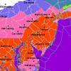
mitchnick Posted December 26, 2010 Share Posted December 26, 2010 hey, GGEM better for MA! 12 hours 24 hours Link to comment Share on other sites More sharing options...
mitchnick Posted December 26, 2010 Share Posted December 26, 2010 GGEM 36 hrs Link to comment Share on other sites More sharing options...
am19psu Posted December 26, 2010 Share Posted December 26, 2010 I've got a good question regarding the models... thinking about how much trouble the tropical mets have with forecasting the intensity of tropical storms, why do we put so much stock into computer models to accurately forecast the strength of cold core storm systems? Are there less variables at play? Better data input into models? Sorry if this is inappropriate for this thread. Quickly, tropical systems are 10 mi wide, extratropical systems are 100 mi or more wide. It matters a lot at the model level. Link to comment Share on other sites More sharing options...

Recommended Posts
Archived
This topic is now archived and is closed to further replies.