hudsonvalley21
-
Posts
4,265 -
Joined
-
Last visited
Content Type
Profiles
Blogs
Forums
American Weather
Media Demo
Store
Gallery
Everything posted by hudsonvalley21
-
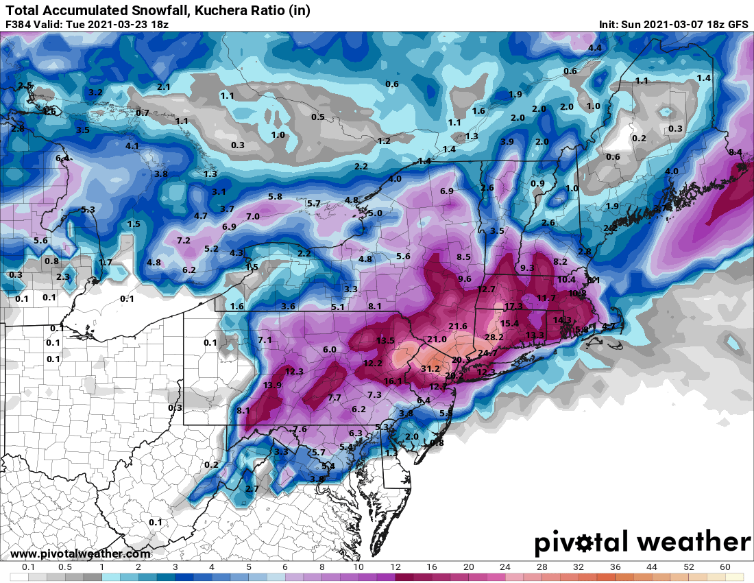
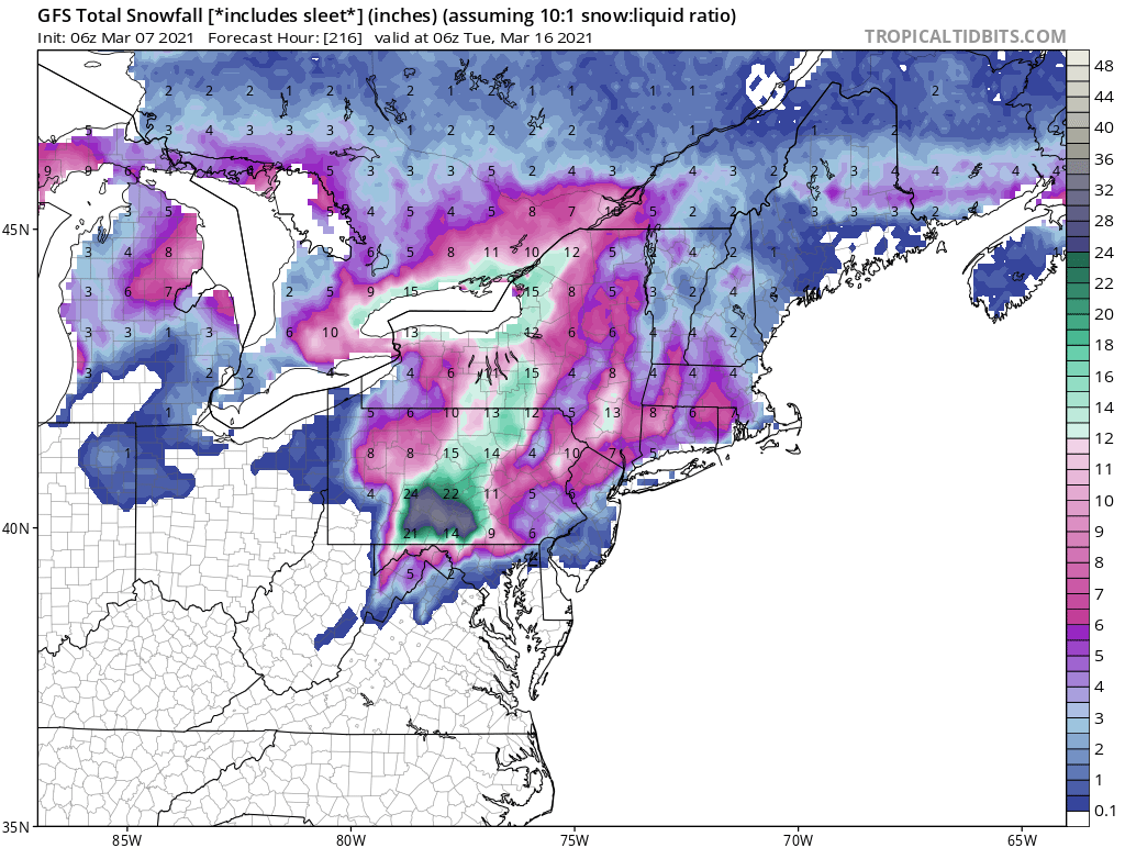
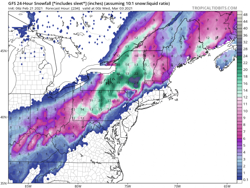
And another map for amusement
-
The Circus is always in town, it never leaves.
-
Subject to change of course

-
Thank you Walt! Your threads are most appreciated and we truly love your insight and sharing with us the knowledge you have. Enjoy the family activities they definitely come first and we will see your future posts at your leisure.
-
March 2021 temperature forecast contest
hudsonvalley21 replied to Roger Smith's topic in Weather Forecasting and Discussion
DCA: +2.0 NYC +1.7 BOS: +2.1 ORD: +2.2 ATL: +2.4 IAH: +2.3 DEN: +1.6 PHX: +1.7 SEA: -1.0 -
Slushy coating today here as well. Yesterday was a total of 2.4”. Snow had a real high water content.
-
With the snow rates currently the salt can’t keep up with the melting process. Now with traffic slowing down the plows can’t do their job. In addition we have a couple more hours of this. Going to be a mess
-
32/31 with moderate snow currently. 0.75” otg so far.
-
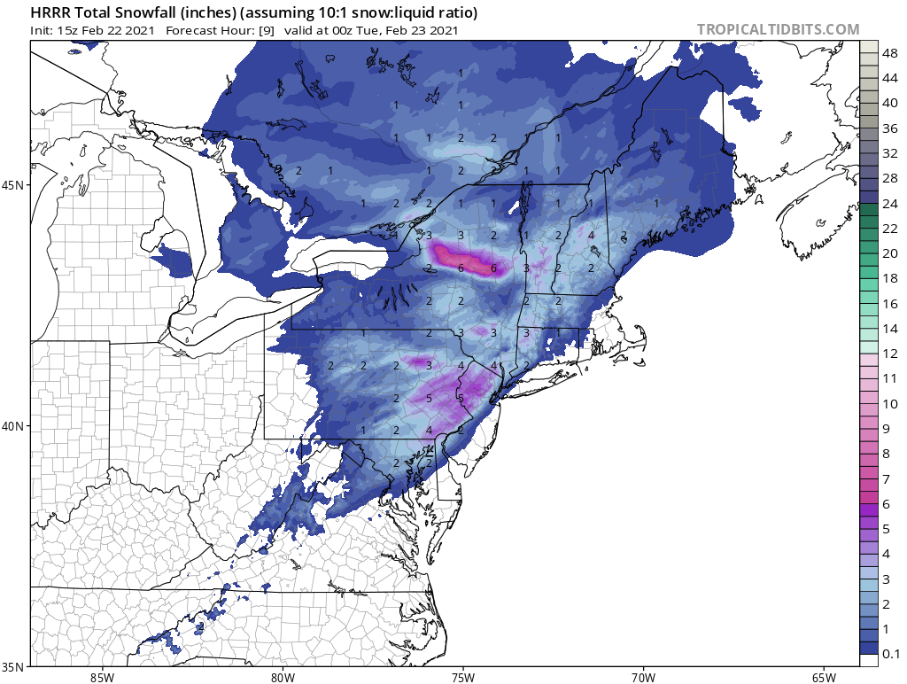
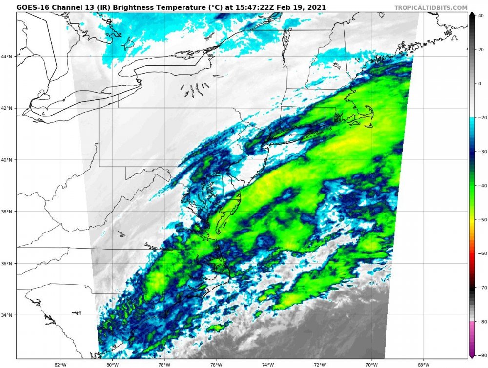
OBS and nowcast 10A-5P both Mon and Tue 2/22-23
hudsonvalley21 replied to wdrag's topic in New York City Metro
32/31 with moderate snow, 0.75” so far. -
Temps jumped 6 degrees from 30 to 36 since 9am. Just backed off 2 degrees with the snowfall 34/22 currently
-
OBS and nowcast 10A-5P both Mon and Tue 2/22-23
hudsonvalley21 replied to wdrag's topic in New York City Metro
Started here about 20 minutes ago. Light snow 34/23. Temp jumped 6 degrees in 3 hours from 30 to 36. Backed down to 34 with the arrival of the snowfall. -
Started here about 20 minutes ago.
-

-
OBS and nowcast 10A-5P both Mon and Tue 2/22-23
hudsonvalley21 replied to wdrag's topic in New York City Metro
31/18 cloudy currently. -
Maybe we could have this trend closer to the coast for next week. It’s long range but we can dream.
-
I’m sure they really appreciate it. 4327F0D7-E876-4D7F-AD35-19D01DA2C2EB.webp
-
5.0” will do it here.
-
OBS and nowcast Thursday morning 2/18 - 11PM Friday 2/19/21
hudsonvalley21 replied to wdrag's topic in New York City Metro
Another couple of hours Sunday that should be about it
-
4.1” for the event so far. Some backend snows will move thru from eastern Pa. in the next few hours. Hope we can get 5” out of the event.
-
Latest radar trends is looking like fringe city up this way. 0.5” OTG
-
Liquid Claritin is more effective

-
Feb 18-19 long duration manageable snow and ice event
hudsonvalley21 replied to wdrag's topic in New York City Metro
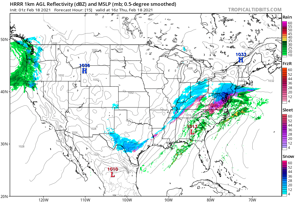
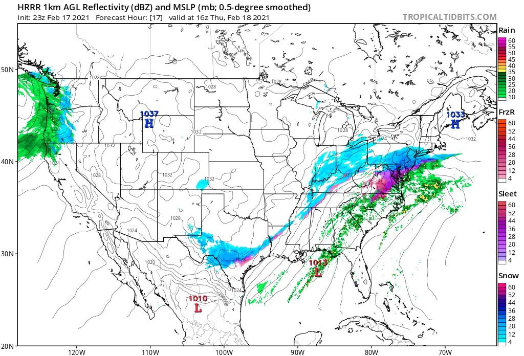
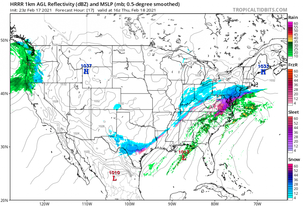
The last few runs of the HRRR is showing the the low in the south further north . The HP to our north has moved west to being directly north of NYC at the US/ Canadian border. could possibly help with the strength with the suppression?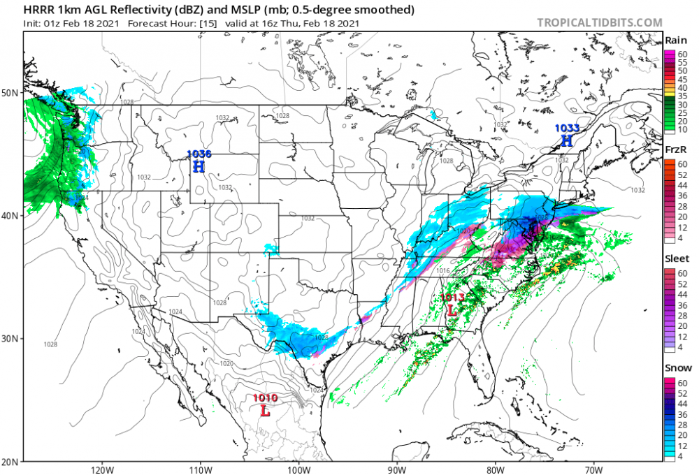
-
Feb 18-19 long duration manageable snow and ice event
hudsonvalley21 replied to wdrag's topic in New York City Metro
Yea it is by a little, I would go with the NAM from today’s 18z runs and forward.