hudsonvalley21
-
Posts
4,265 -
Joined
-
Last visited
Content Type
Profiles
Blogs
Forums
American Weather
Media Demo
Store
Gallery
Everything posted by hudsonvalley21
-
Over this way last night had 0.18 with only a rumble of thunder. Event total ( includes last nights ) 0.24 as of 6am.
-
1.05 is the total here
-
1.05 is the total here.
-
0.87 as of 10:30 pm.
-
0.87 as of 10:30 pm.
-
0.58 here. 45/43 currently.
-
0.58 here. 45/43
-
I’m going to put away the snow shovels to help this thing along

-
Total of 0.20 in the bucket since noon Friday thru noon today.
-
0.20 in the bucket since noon Friday thru noon Monday (today)
-
Horse farms were often visited by many folks to take from their compost piles for garden use and that was back in the 70’s that I remember. The farmers were more than happy to get rid of it.
-
Hope you not finding it on the bottoms of your shoes. And I’m not referring to the twigs
-
Yup big difference. I was at my daughters home in Goshen yesterday and it’s just starting to turn green there with little growth.
-
Walt’s post from the April thread, No thread on my part but three more opportunities for snow lurk in our subforum. later tonight ne PA/nw NJ, probably no big deal tho 1/2" possible higher terrain ne PA. Then the 9th-11th (next Fri-Sun), Potential for a pretty big long duration periodic rain event (1"+) with wind (40kt) for a part of the sub forum coast with high terrain wet snow possible. Ensembles don't favor snow, certainly nothing like the 00z/3 EC snow depth forecast (just nw NYC). There's even something during mid month? Keeping an eye on it. Figure future modeling will shrink the snow, not sure the sizable storm will disappear in what appears to me to be a favorable blocking pattern for a slow mover somewhere along the Mid Atlantic Coast.
-
Walt has mentioned it in the April thread that we have a few more shots at some possible wintery type events in the next couple of weeks. As for the wind events what a year for multiple spring cleanups.
-
That’s what happens when you get old. By the way where’s my blanket.
-
Should I jinx it and say I’m bringing out the lawnmower?
-
April 2021 temperature forecast contest
hudsonvalley21 replied to Roger Smith's topic in Weather Forecasting and Discussion
DCA: +1.2 NYC +1.3 BOS: +1.5 ORD: +1.9 ATL: +0.7 IAH: +1.2 DEN: +2.0 PHX: +1.7 SEA: -0.4 -
0.83 in the bucket as of 4pm. 44/43
-
44/43 with 0.83 in the bucket as of 4pm. Event total of 1.02 in the bucket.
-
Can’t wait to scrape off the windshield with a 1/2” of frozen paste tomorrow morning point and click forecast has a low of 26 overnight IMBY.

-
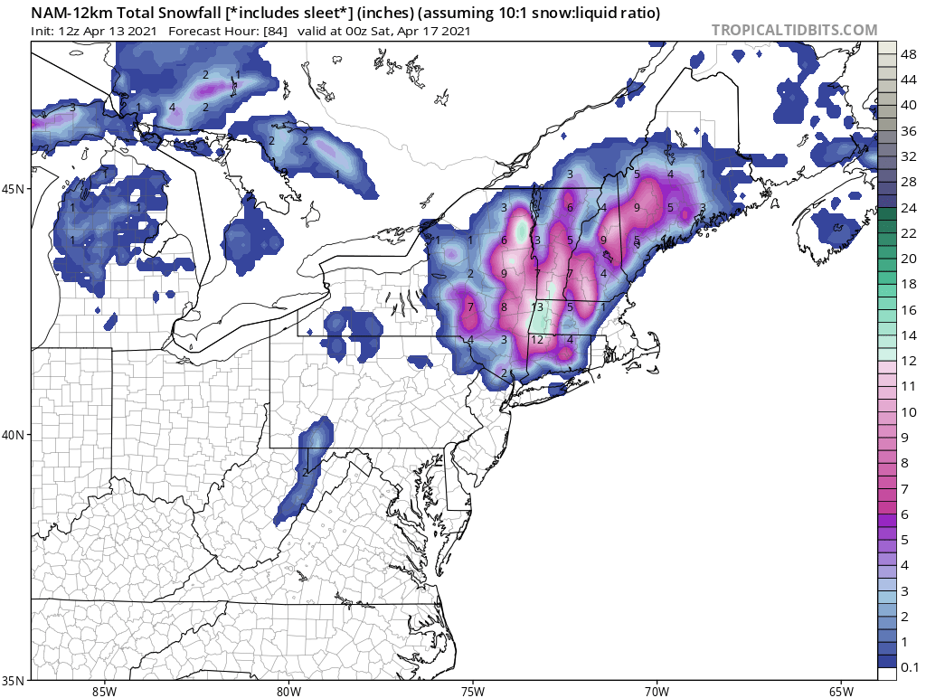
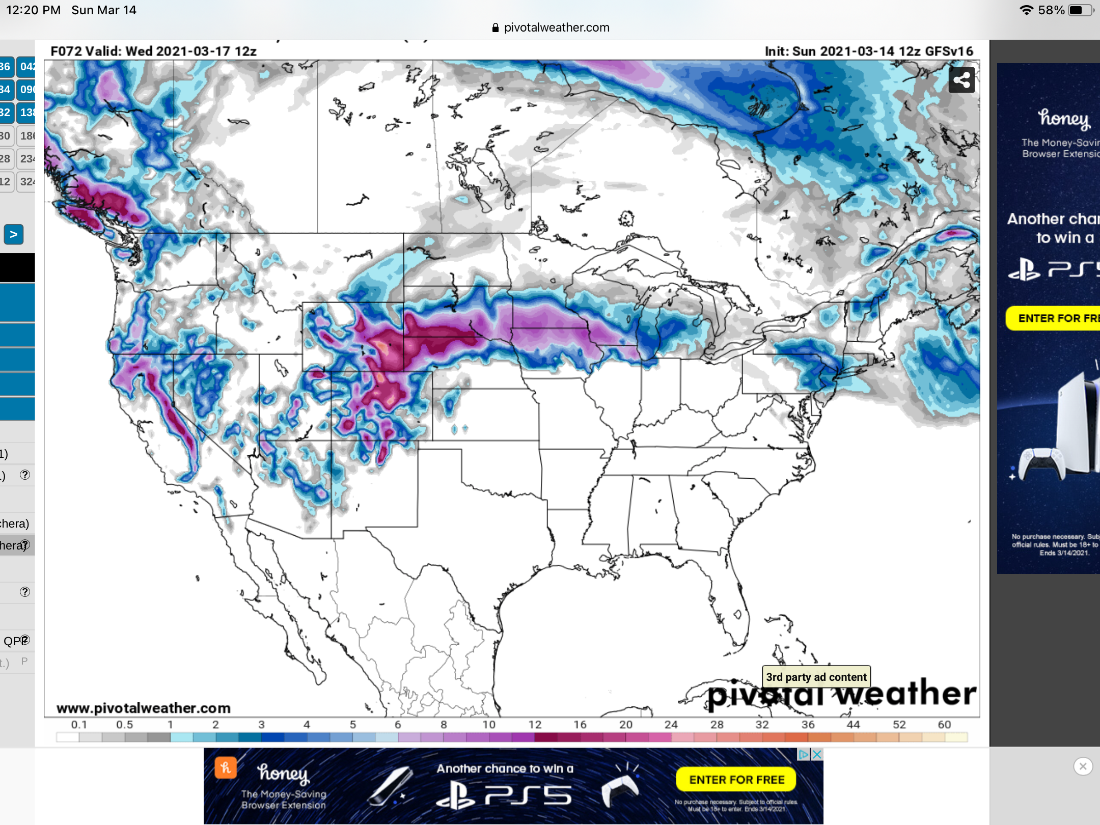
A couple of 12z maps
-
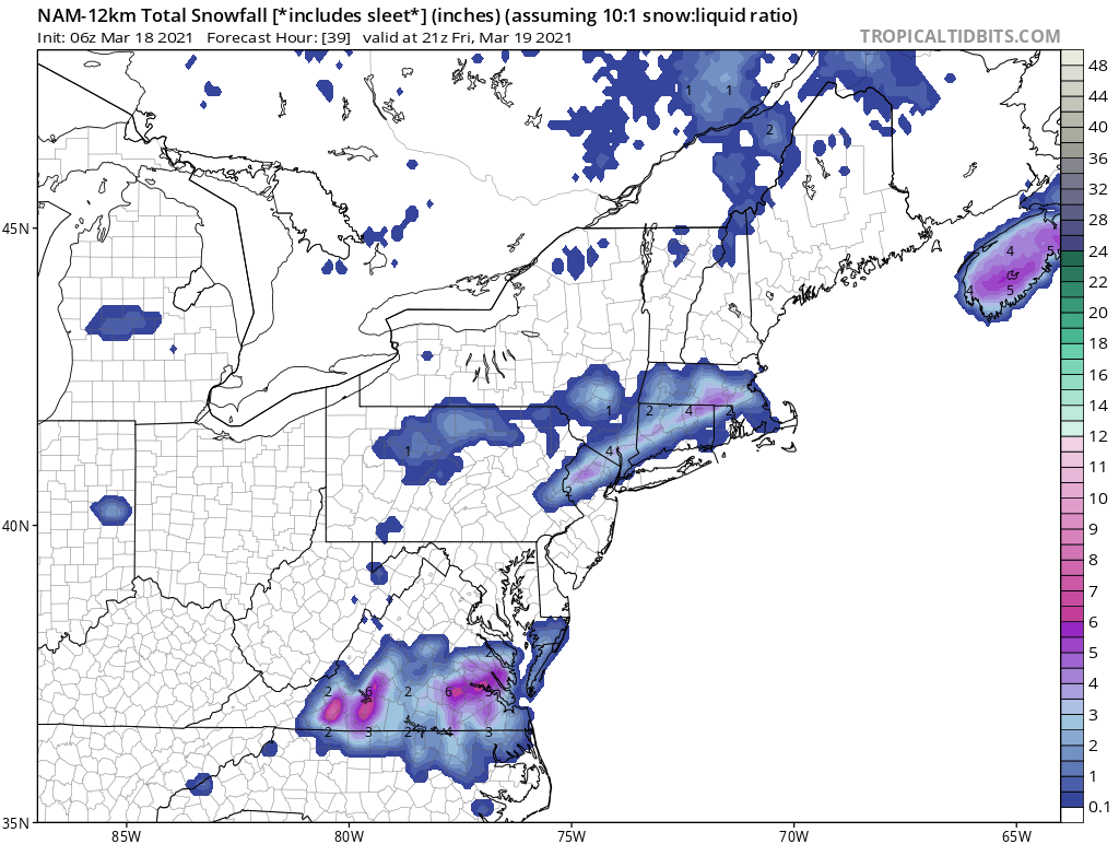
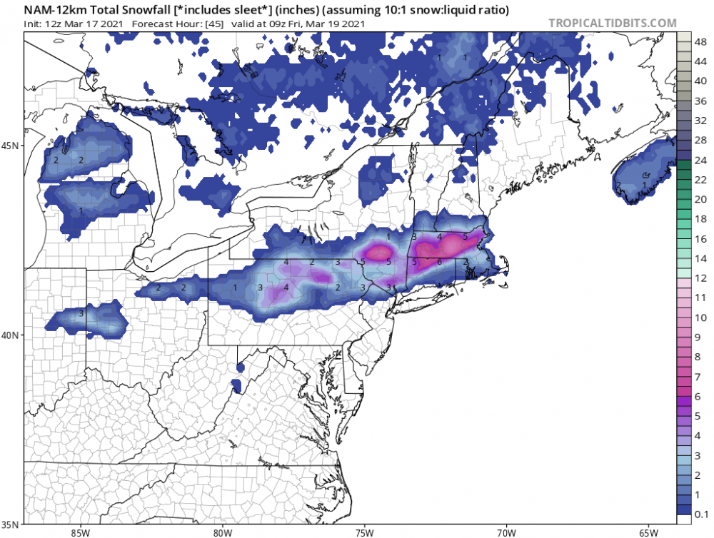
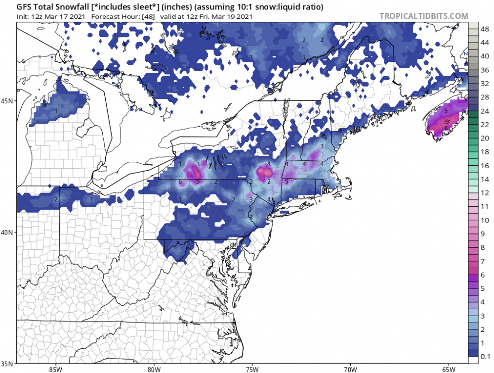
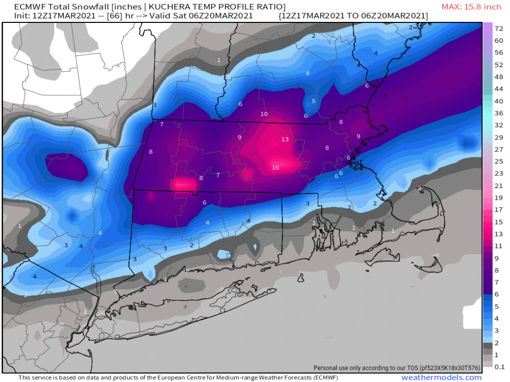
Psssst. Don’t tell anyone, I stole this from the New England thread
-


-
To me it seems that the events at this time of the year (late winter early spring) can give some late 23rd hour surprises.