hudsonvalley21
-
Posts
4,248 -
Joined
-
Last visited
Content Type
Profiles
Blogs
Forums
American Weather
Media Demo
Store
Gallery
Everything posted by hudsonvalley21
-
Unfortunately I think your right. Wait till the first week of January after all the get togethers, I’m thinking it’s going to be ugly.
-
28/16 here currently with partly cloudy skies. Maybe we could drop another degree or two.
-
Currently 28/25 here. It will be interesting too see where the temperatures go later when the clouds set in. Could be some icy spots in the am.
-
That sucks to hear about the job possibilities, I would think they would be totally understanding with your situation. Biggest issue is your family, hope all works out with your wife’s situation. My daughter luckily made it thru her pregnancy and gave birth in August and didn’t get the vaccine. She got her shots in October.
-
I had the doormat version.
-
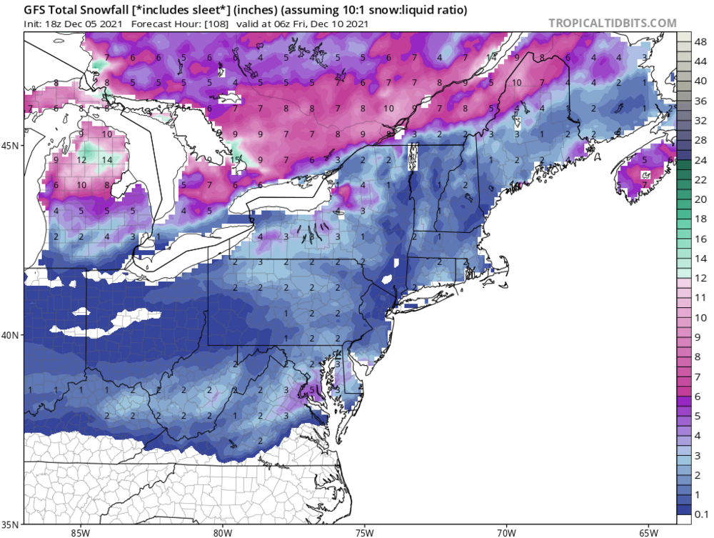
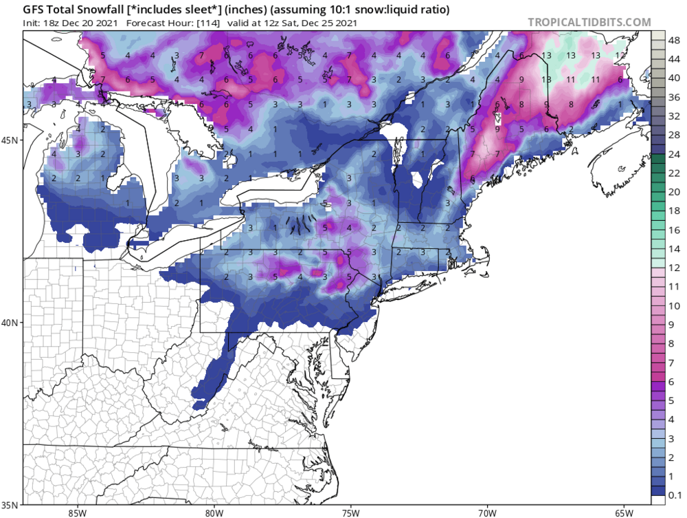
18z GFS is still teasing us for Christmas Eve/ Christmas morning.
-

-
Oh yeah, I usually cut the NAM in half.
-
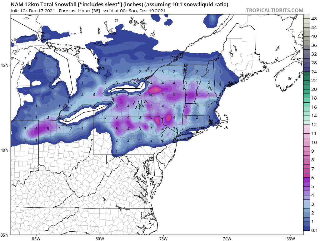
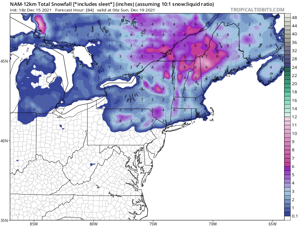
12k NAM from 12z today. It’s been waffling the last few runs.

-
There’s always something to do. At least the weather is nice to do it. 64 here currently.
-
18z NAM came in with a little more vs the 12z run. It’s way out there in the NAM’s run but could be a start to trending to a colder solution.
-
Maybe artificial trees
-
My Davis was showing 66 about an hour ago. Now down to 62, line came thru about 25 minutes ago, not much fanfare. 0.09 in the bucket. Definitely not complaining especially what those folks in Mayfield, Ky went thru. My heart goes out to those folks.
-
63 is still holding here.
-
Temp up 7 degrees last hour to 59 at KSWF dewpt also jumped 7 last hour up to 57
-
Thundershower just moved thru here.
-
Had a couple of rumbles and some lightning flashes here move thru from s/w to n/e. A brief heavy downpour too.
-
So that’s why the crabs glow in the dark
-
Moderate snow here currently. Dusting on grassy surfaces. Temp 31.
-
Wind gust of 44 recorded at KSWF.
-
Absolute perfection
-
Ok Rob, the snowhole is back, lalala it up