hudsonvalley21
-
Posts
4,248 -
Joined
-
Last visited
Content Type
Profiles
Blogs
Forums
American Weather
Media Demo
Store
Gallery
Everything posted by hudsonvalley21
-
1.69 so far here in Orange County, Ny The way the radar is looking we will give the 5-6” of forecasted rain a good shot.

-
1.56 as of 2:30 pm.
-
1.34 as of 12:30 pm
-
1.34 as of 12:30 pm
-
0.94 as of 11:38 am.
-

-
DCA +0.5 NYC +0.7 BOS +0.3 ORD +0.3 ATL +1.7 IAH +0.5 DEN +1.0 PHX +0.4 SEA +0.1
-
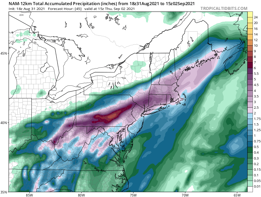
and the 18z NAM

-
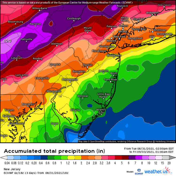
Not such a bad thing missing out on, rare to say that often. recent runs on a few models have bumped the heavier rains up this way. Here is the18z euro as one example.
-
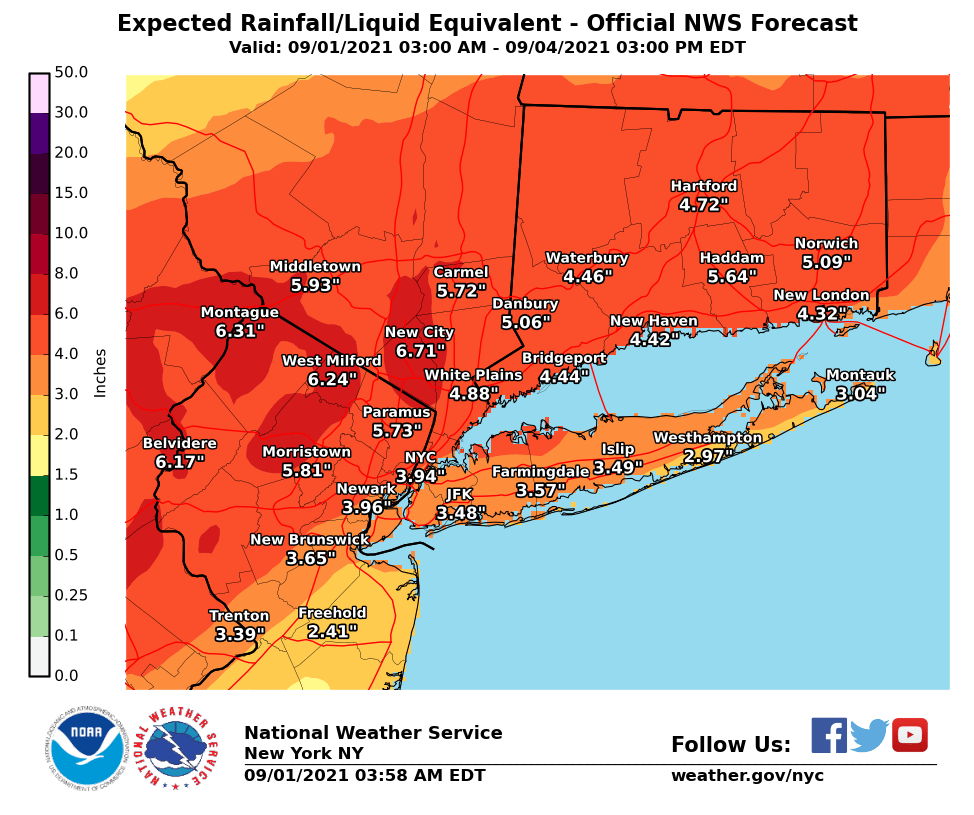
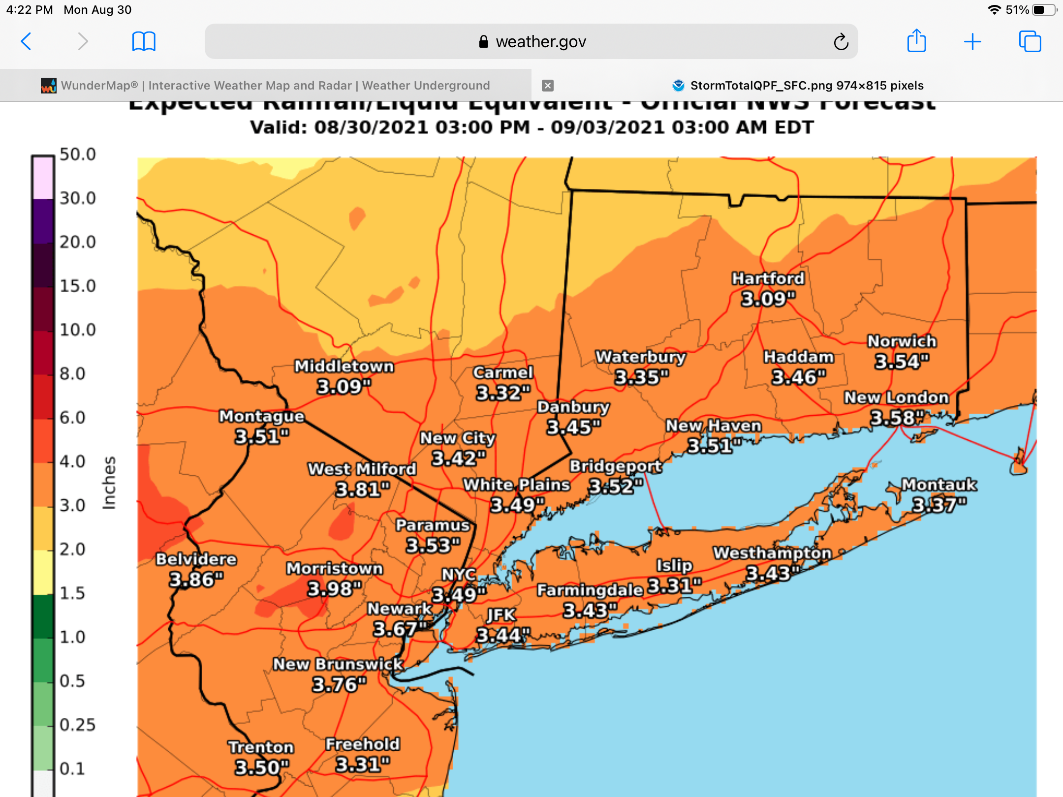
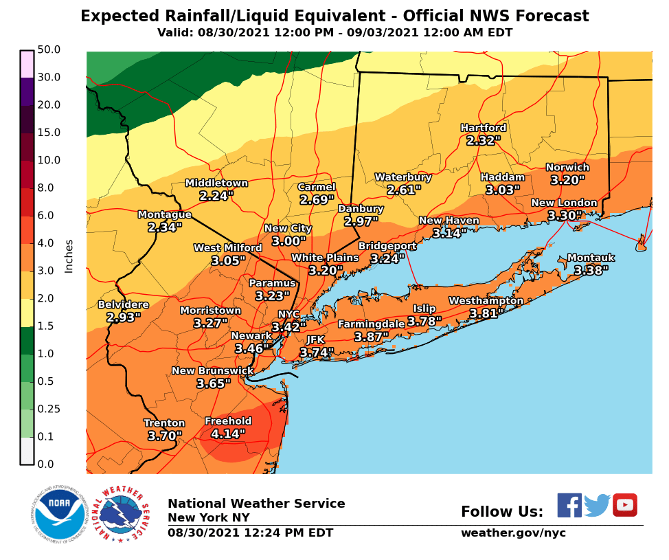
I would not mind being in the jackpot area with an winter event. I would graciously pass with this event. Upton upped the QPF a little with their latest map.

- 511 replies
-
- 3
-

-
- heavy rain
- tropical gusts
- (and 1 more)
-
Beat me, 0.46 here and a rain rate of 7.28 with the line that just came thru.
-
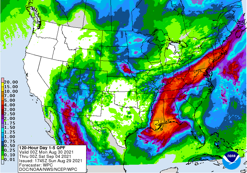
WPC’s latest QPF map still holding serv.
-
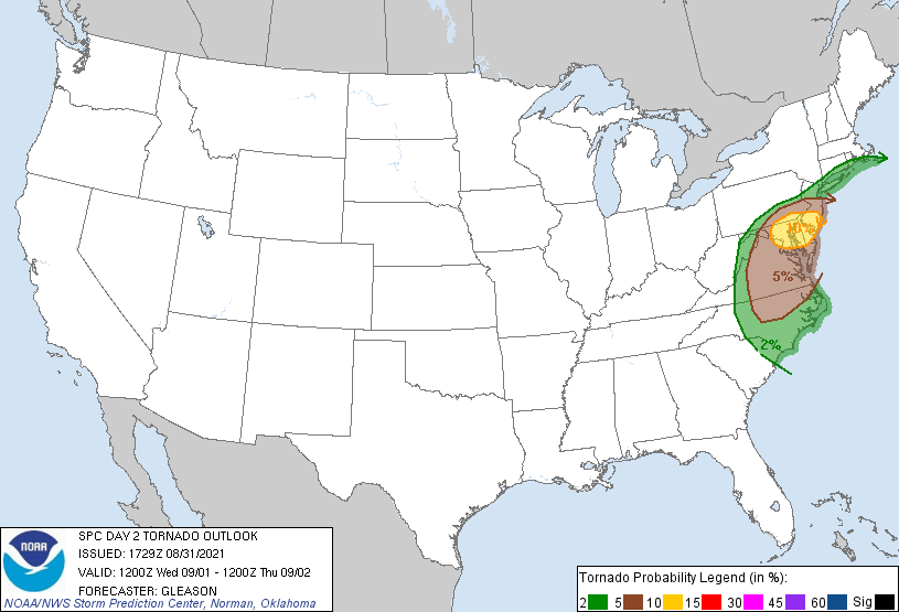
Especially at 100m or 328 feet above the surface mix down slightly and come in contact with higher structures would be catastrophic. Seen in an earlier post of 162kt winds possible at that level.
-
Crossed that bridge a couple of times. One of a kind.
-
Looks like a few more storms are now popping up around the Scranton area too.
-
Had just about another inch of rain since this morning with these torrential showers moving thru.
-
-
From Upton’s QPF reports from Orange County ORANGE COUNTY... TUXEDO PARK 5.01 IN 0405 AM 08/23 AWS US MILITARY ACADEMY 4.87 IN 0355 AM 08/23 RAWS WARWICK 4.78 IN 0405 AM 08/23 NYSM HARRIMAN 2.81 IN 0405 AM 08/23 AWS MONTGOMERY 2.78 IN 0146 AM 08/23 CWOP CHESTER 2.59 IN 0150 AM 08/23 CWOP WEST POINT 2.40 IN 0405 AM 08/23 AWS OTISVILLE 2.33 IN 0405 AM 08/23 NYSM PORT JERVIS 2.19 IN 0405 AM 08/23 AWS MIDDLETOWN 1.97 IN 0146 AM 08/23 CWOP WASHINGTONVILLE 1.90 IN 0150 AM 08/23 CWOP MONTGOMERY AIRPORT 1.67 IN 0403 AM 08/23 AWOS GOSHEN 1.61 IN 0405 AM 08/23 AWS
-
3.04 here. If you look at the maps Wdrag posted, there were 2 reports, one in upper amounts of 3 and the other report of over 4” right across the River from us. I’m thinking that orgographic lifting had an affect to the fluctuation.