hudsonvalley21
-
Posts
4,248 -
Joined
-
Last visited
Content Type
Profiles
Blogs
Forums
American Weather
Media Demo
Store
Gallery
Everything posted by hudsonvalley21
-
33/32 here. 1.11 in the bucket today.
-
Great link. Thanks
-
Nice map to see the temp changes. I was looking at the weather stations on the weatherground site on their map link.
-
Enjoy!
-
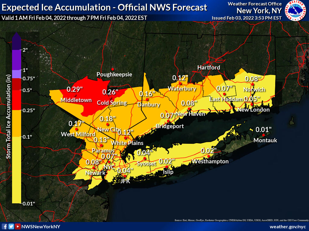
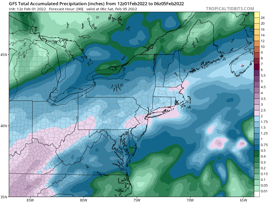
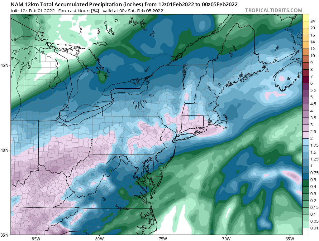
New England Overrunning Event 02/03-02/04/22
hudsonvalley21 replied to dryslot's topic in New England
41 to your southwest in the Hudson valley. -
Glad too see you made it up there.
-
Up here in Orange County a bunch are shutting down.
-

-
Seems like temps are busting on the low side. This might make a difference later on tonight with the changeover time a little sooner. Something to keep an eye on. Currently MGJ 39 and SWF 41.
-
41 here, bustling on the low side with temps. MGJ is at 39 SWF is at 41. These couple of degrees could make a difference overnight, early tomorrow morning.
-
Have a safe ride up and enjoy!
-
Wanted to get some more snow melting in the roof gutters before the rains set in.
-
Also obs. from irishrob17 and wdrag showing the front and it’s progressing from the northwest.
-
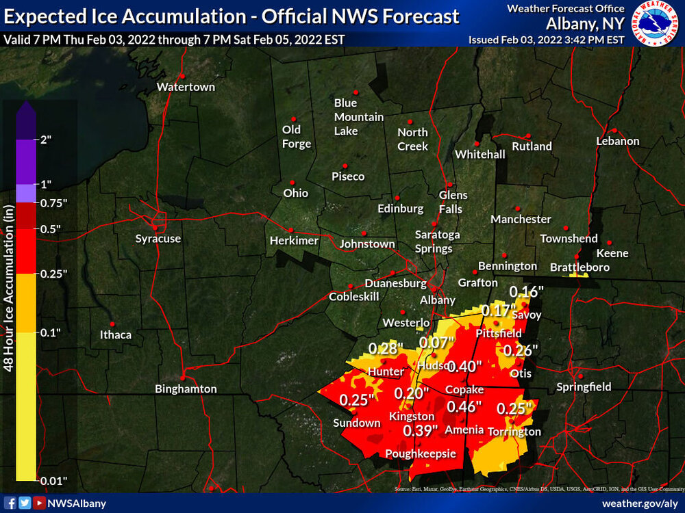
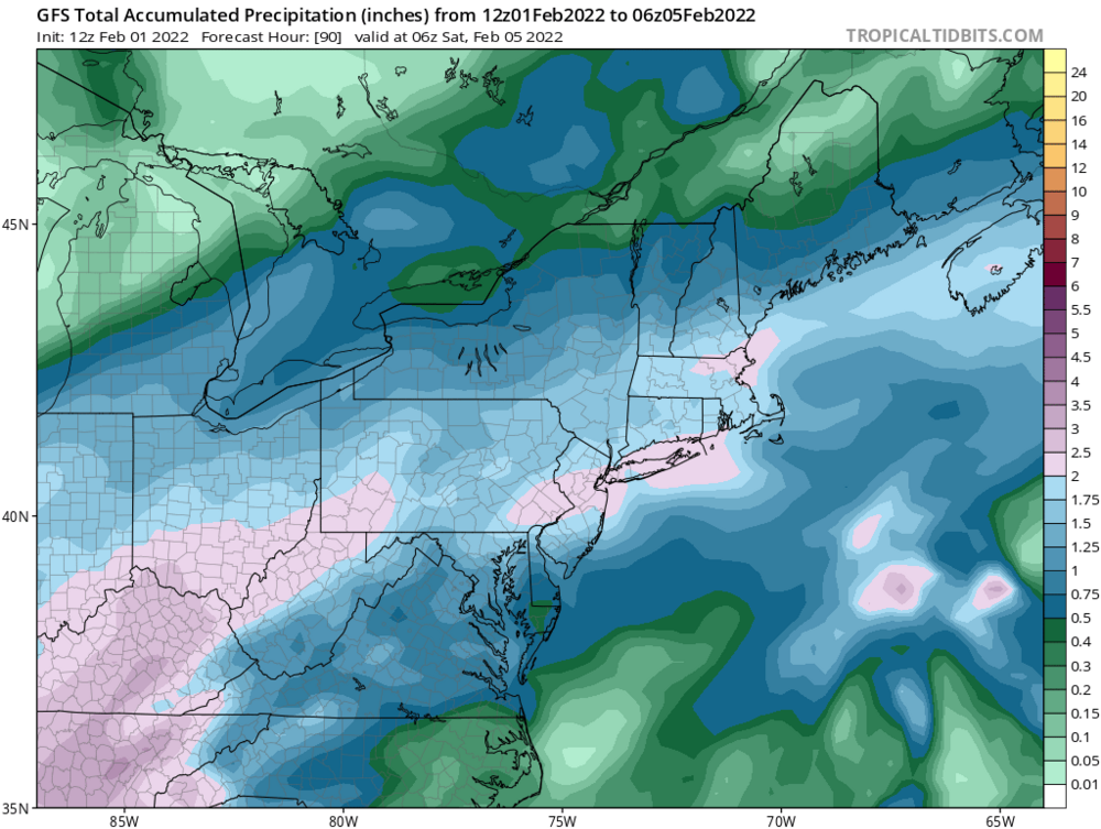
Any way of giving a QPF amount of frozen goods for folks up this way?
-
With forecast highs in the 40’s tomorrow, hopefully it will warm up the surface ground temps some. Another thought is the initial rain will wash off whatever salt is currently down on the roadways currently also.
-
All depends on the surface temperature. Temperature around 32 won’t accumulate as much ice as temps in the mid 20’s.
-
Between 1-2” of QPF would make for a frozen mess.

-
Not looking good for a flight that day. Hopefully the folks in Dallas can work on rescheduling.
-
He’s rolling over in his grave at that one.

-
+1 is the low here.
-
DCA +1.0 NYC +1.0 BOS +0.1 ORD -1.9 ATL +1.4 IAH -0.5 DEN -0.2 PHX +1.0 SEA -0.3
-
Agree, will see what the future runs show. Hopefully by 12z Wednesday we will see a general consensus. The way this season is going, we won’t know till it’s over.
-
Goose egg for the low here. Elevation of 125’ forecast low for tonight is +2, we’ll see what happens.