Typhoon Tip
-
Posts
44,568 -
Joined
-
Last visited
Content Type
Profiles
Blogs
Forums
American Weather
Media Demo
Store
Gallery
Everything posted by Typhoon Tip
-
Depends what we mean by hot "IF" we want to really run with that hypothesis ... I mean yeah .. we've observed some weird 70+ days beginning in February.. But this was consistent with the likes of the last 4 years when that oddity tendency began ... Yet, last spring and the one before ...and the one before, and the one before... etc, all featured cold and snow or snow supporting atmospheres ... late March through mid Mays, similar to this year, and those springs did not flower nearly this robustly. That seems to remove "heat" as an outright culprit. I don't speak for all regions/climate zones... just what we're noticing around town and other areas of this part of Mass. I have buddies with yards from NW RI to southern NH and they're all saying the Lilacs are like flower bombs. Not meaning to be heavy handed ... lol, I mean florists shops keep their blooms chilled for a reason. There's certainly a logic to that. But it seems it hasn't been altogether "hot" in that sense where we are.
-
And to go along with those lofty T1 temperatures ( 980 mb at Logan ) on the 12z NAM FOUS ... the MET machine numbers now 77 Friday at FIT- ASH .. BED up here along the Rt 2. Actually similar numbers PSM/MHT/CON... As far as I can tell, that's probably pure sun until CU detonation ... light wind and just pure unadulterated balm.
-
Anecdotally ... we've been noticing that just about anything that can flower in/do to spring re-awakening has done so much more robustly than recent years, this time. From maple floweretts to Lilac shrubbery ...all these are gracing us with utopic visual displays and aromatic splendor like we've landed on a new Pandora this season. Not sure what it is...but we've been speculating that maybe the air is purer from the recent years 30 someodd % reduction in Industrial farts all over the planet. We've noticed many more prism clarity blue skies when not raining ..with far less of that pall sort of muted color vibe. Well .... like today. It's particularly sharp edged shadows out there with nape-bake pretty much off the scale. And contrary to drought mongering ... we are not really in too bad off of shape in top/root soil moisture. Anyway, this might lend to increased pollen production ?? just a thought - also, we are seeing more honey bees - that's a great sign.
-
Probably should point out ... this is all predicated on the silly assumption that the NAM's 48 - 60 hour handling of ass wiping can ever be done correctly ... let alone what it is designed for... just so we're clear. Still, because the global runs ( Euro ...GGEM ...etc..) have that lingering cyclonic curvature ... staggered back mid-level cool pool aspect ...it does offer some hope for crispy edged TCU. The NAM may just be going over-board in the particulars relative to that overall aspect. Frid-Sunday afternoons..... and this run just being the first of them three days. That said, if this run's metrics played out ... I wouldn't focus on needing idealized mechanics, not when the lapse rates get that volatile. That's getting into butterfly fart sensitivity there. Granted, we're not talking about cotton swab explosions on high res vis satellite loops here. Just whether there's some picturesque golf cart zappers here and there.
-
Look at these numbers (NAM FOUS) for Logan Friday during the day ... That d(t) ( vertical lapse rate) = 19 C between 980 mb at 800 mb level!! C'mon...that's like the inside an a-bomb mushroom cloud. The 51 and 55 on the far left is the R2 sigma level, which I believe is the 700 mb ...showing a slight elevation > 50% relative humidity so the model is seeing cloud contamination in the lifted LCL ... The LIs are listed here too ( just not bold) also, down to 1 ...so modestly unstable. But suspect that's only 'modest' because this is missing substantive DP. The lapse rate here is impressive - I'm a fan of lapse rate. Meanwhile, that 45 and 46 spelled out is the 545 and 546 dm thickness. So, this NAM run has a 20 C (980 ...which is probably about 24 or even 25 in the 2-meter on a WNW katabatic flow) under 545 thickness, with a 800 mb of 1 ?? uh... yeah I bet this has an few over achieving TCU dappled about the open terrain over land ... 54000355123 -1701 213005 45 201101 60000345521 01901 213205 46 201201
-
Heh... ur funny - just say modest instability cumulonimbi ... but you gotta get the word 'hail' in there. lol -
-
The Official, Unofficially Licensed Winter 20/21 Wrap-Up Thread
Typhoon Tip replied to Cold Miser's topic in New England
Far as my irrelevant perspective goes ... this is the fourth winter in a row, where the pith of winter was damped by velocity surplus and not allowed to do much other than watch raging balanced geostrophic wind speeds rip and shear and suppress ( not the same as a 'suppressed flow' in this context) development. There were perhaps exceptions to that general theme ... but speaking in the context of by and large - When the flow relaxed at either ends ? we got amplitude and Oct - early Dec events ...as well as unwanted cold spring ones - relative to personal preference ... I mean I realize there are those that think its reasonable to snow in April but that's your problem LOL. No but the seasonal lag is memoed in environmental science et al at this point, and is to those with objective observation not filtering reality through a want for snow and winter lens ... is real. Any next year's seasonal outlook had better be heavily referencing, if not factoring, this obviously GW/ CC - attributable aspect or nothing in said outlook is worth used toilet paper. -
Also, ... some lingering 500 mb lag cyclonic curvature Fri-Sun, with 74 underneath high sun ... I am noticing some QPF speckles 18z over land them days - maybe we can pop corn
-
Reads like everyone's greened(ing) up well enough as it is... but, between the Euro's better fit for the -PNA hemisphere, and the National Blend machine guidance et al, it looks like we are in for several back to back days of west trajectory, under fairly low RH ceilings under 900 mbs Ts supporting 71 to 77 F ( before applying spikes..) to afternoons. Lows probably 48 to 54. That should "broaden" the broad aspect of the maple leaves ... change the misty virgin greens of the hill fascia into more of that deeper darker lush hue. That extended range 80s the Euro hinted at for several recent cycles may not transpire - or it may yet... but, at least we should get some sort of short sleever afternoons through the period. Seems to be a tussle in the models between the -PNA hemisphere wending the westerly synoptic construct underneath this propensity to keep re-introducing blocking pieces of useless shit turds above it... ( how do I really feel though ? ) ... The flow is getting more nebular above the HC interface out there in time, tho - seems it's just as likely that Maritime trough idea ...pulsing in and out of relevancy deepening on guidance source and cycle, could be either more or less inhibiting...
-
HA holy crap - zactly what I said in my head when I read that headline, 'is this an Onion article - wtf' wow
-
Fwinw - the Euro's mid 80s warmth over the whole OV ..spilling into New England D8.5-10... It's a long way off so but, it's matching the -PNA. Forgetting that range though ...this run is entirely different in handling across mid latitudes of N/A as early as D4 ...6 than the GFS
-
That's interesting... Perhaps the PNA transitioning between modes "led" the way so to speak, wrt to the digging wave back then...destined to carve out a full -latitudue longitudinal R-wave construct like it did. The GFS may presently be picking something up in the physics that results in a similar transition, that the Euro does not see happening. In fact, the 12z Euro on D6 looks even more opposite the GFS ...almost entirely flat with that feature - as it ...it doesn't exist in the Euro. Although the 12z GFS did trend less amped/flatter than the 00z version ...both still ends up carving out a similar trough. There's nothing extraordinary about this particular interval of time ... I'm just curious about which will win -
-
Mm ...I don't think it's a one size fits all cultural activity though. Not that anyone asked... When I 'wasted my time in college,' it really wasn't about opportunities and poetry like that, driving me to go; it was strictly because I was cursed with this unbelievably in-germane fascination and the unexplained obsession with crispy TCUs, and wild Nor'easters...hurricanes, tornadoes, ... be it super heat waves, or molecular-stalling cold, hail... lightning...wind. I'd wander out into fields just to find the best vantage to watch thunder clouds rolling out under the tropopause on the horizon ... Come home with sun burns, 'Where have you been...' When I was 10 years old, had a favorite pine tree that grew atop a hill near my street.. I used to get up at dawn in the summer, whole world still zonked out droolin' on pillow... and I'd climb that 50 foot tree clear until the crown sagged - and I was scared of heights technically in any other setting. But I did that because I wanted to see the mid west thunder clouds on the horizons, side lit by the morning sun as the corpuscular rays tipped over the horizon and exposed them from probably hundred mile vantage perspectives. I was f'n nuts about weather. College was not good to me, though. Despite all that passion and wonder, my grades gave A's meaning, just by diametric comparison. I'd often mused that I provided a tremendous sort of community service in a lot of ways ... providing a shimmering metric for other students on what not to do. It's really rather remarkable that I ever graduated. Oh...my transcripts have a few A's and B's in some math courses... exceptions rather than the rule. Pretty much everything thing else was like explaining Navier-Stokes to a coke-bottle and wondering why the coke bottle kept doing so poorly on exams. I really did not have very good grades in my core, Met at all. I had to go back 2 years after graduation and finish Chem II ... it was a disaster. This crippled me and any ambition - tragic really... Put a bad attitude about it all. Meanwhile, I had insights and forecasting skills that transcended all that shit. Not sure where that comes/came from, or even how to quantify what is happening in the formulation - it's just like getting struck by an impression, talking about it...then the impression ends up happening. I'm sure we all have things about us like this - I call it the "Michigan J Frog" effect: https://www.youtube.com/watch?v=bkjsN-J27aU ....after all, I do originally hail from Michigan, and in an uncanny twist, my first name is John so why the hell not.. Whenever no one's looking and it assuredly does not matter, I'm some kind of genius. But you know, this is true for everyone. Not many on the planet is doing what they were truly most gifted at doing - some can find some thing proximal to native facility and do well, and excel...and even fall in love with their acumen/involvement and so forth - but what if Einstein was like the "Def, dumb, blind kid - sure could play pin ball" uncanny at seamstress work and no one, including him, every new it. Anyway, my point was going to be... my college pursuit was all romance and white privilege ...because I didn't have any business being there -
-
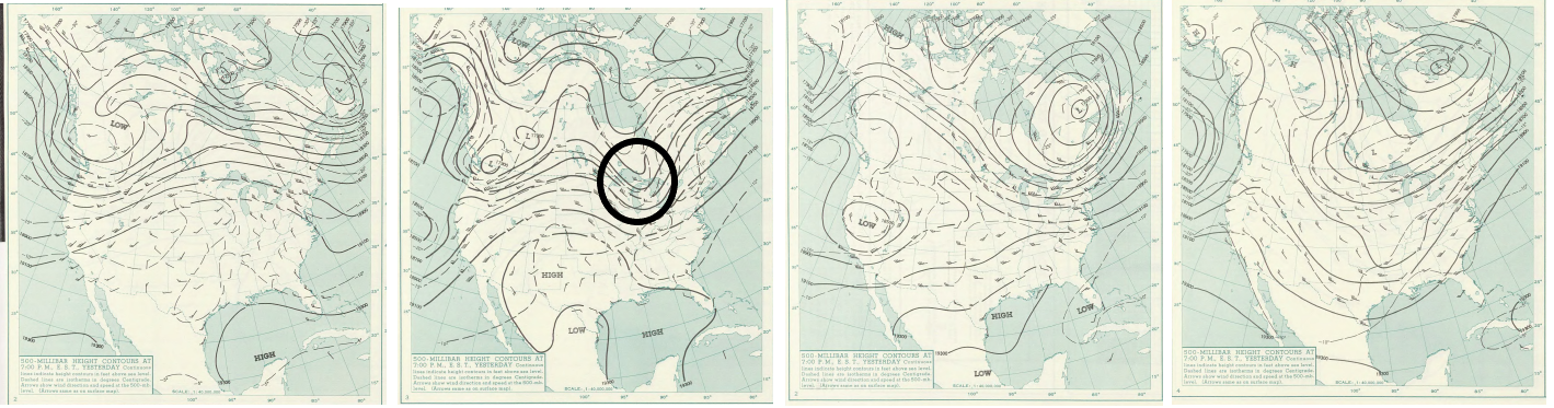
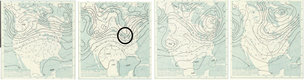
Hey Don ..sup - if ur still around, what was the PNA 6 days and 10 days later in '64 ? I'm curious because I looked up the 12z synopsis/analysis on the 22nd ( far left frame...) from way back then, and noted the robust ridge signature that is consistent with -PNA. Firstly, not "AS" robust as a -2.573 index could correlate with but ... these things are never 1::1 either. Secondly, the 2nd from the left is 72 hours out in time ...so the 25th of May 1964, and we note an interesting trough digging N of the Great Lakes? I just spent time railing against the GFS for overnight charts that - indeed! - demo uncanningly similar evolution to that feature back when, perhaps to my chagrin. Note, both eras have robust -PNA's implied. Point being --> Thirdly, I am curious where the PNA went back then? If it did flip sign, or if these changes we see in this image imm below...all took place ( back then - ) during a persisting -PNA. Lastly ... note where this ended up by the 1st of June that year... pretty ugly looking autumn at the wrong end of the calendar look there - ah-eesh. Anyway, could just be coincidence... I am noticing the present operational GFS is trying to part company with it's ensemble mean members, individual and blended average ... with an overall complexion that is the least -PNA out of the cluster. Not sure why it is trying to fight it - other than what I have noted already ad nauseam, that it tends to end up with surplus cold heights on the polar side of the westerlies as a cumulative error ...pretty much on ever run it ever puts on. It's pretty glaring bias actually... But, if the flow is marginally supportive - it may then create faux "synergistic" or constructive interference and cause troughs in its extended ranges to get too robust ...
-
Mm... actually, that's a little less discerned compared to yesterday. When I mentioned that above, I had not yet seen last night's publication - That's still impressive enough, but discrete product read: that's about -1 in the mean there - not sure how 'historic for May' that really is? I think I've seen May pNA handling that deep. Yesterday this product demoed a curve where every member was declining through the -2 axis line there. The MJO is weakened in the RMM ... but the weekly publication/PDF published just yesterday tries to bullet point tell us the RMM is 'artificially' weakening the wave strength and placement - as in false, if I am to gather what they are after. They cite obscure aspects with ENSO coupling with normal seasonal change .., obscuring the RMM forecasts, but I am not sure I buy it. Here, https://www.cpc.ncep.noaa.gov/products/precip/CWlink/MJO/mjoupdate.pdf I think with the lingering ...albeit collapsing La Nina ENSO foot print finally being able to express/transmit more forcing into the westerlies now that the seasonal gradient/CC surplus is dropping and the velocity along with it... the MJO is in fact more favored to be real - not the other way around. Now, they have PHD's and million dollar technologies working together down in those labs so... But, I like things to be logical, regardless of what dimension of reality I personally hail from LOL In NCEP's defense...the AO is modestly negative ... (as is the NAO...) ..these are more correlated with left-RMM phase spaces. The over-arcing problem then also being that these mass-field correlations get less useful ...particularly JJA, as we know - it may be too early just yet to discount? The individual members of the GEFs, the same one that provides the -NAO, dont' look very -NAO as individuals on either D6 or 10...yet somehow together their EOF/ .. functional output still gives us negative roots. The thing that's weird about these teleconnectors is that they are not really UNcorrelated in summer. What they really are, is noisy correlated - so much so that the linear stats end up with N/S or approaching N/S correlation coefficients. But it's really much more like "conditionally correlative" If the pattern footprint is supporting -PNA... the PNA may correlate better during that summer... same with the NAO... It's all a popsicle headache
-
Can I ask you question - You seem pretty spiritually committed to a particular sub-genera of Meteorological phenomenon, one that could only be more systemically inhibited in this region of the planetary-atmospheric coupled climate if it were located oh, say... 20 miles outside Amundsen-Scott, South Pole Reasearch Facility amid the -50 C cryo-misted barrens of Ross Ice Sheet, Antarctica ... Big big TCU there man, no doubt! You have a degree in Meteorology. You are young. Go west young man. Find your home and plug into the realm you were meant - apparently - to be a part. Staying here ? It's like staying in an abusive relationship because one has some unconscious fulfillment of persecution complex - haha... I mean, start hammering away at finding jobs... f* Met gigs for now. You can find some way to pay for an appartment and spend all your free time doing grad courses on-line and eventually hell... 10 years from now you'd still be young with your foot in the door at the operations branch of NSSL ... maybe - Point is, you don't know you can't until you try. Unless you have some entanglements of life that have you manacled to this area ...If so, that's sad and I'm sorry ... Otherwise, get the f outta here man and find her - the metaphoric "her" ..you know what mean
-
GFS introduced this late yesterday and has persisted with it since. It carries a pattern defeating nasty SPV extension/quasi-closed buzz-saw through southern Canada ...spanning it's entire mid and extended range to do it, ending up with it still on the charts festering a cold hell over eastern Canada/NE by and through Day 10. The Euro has never had this feature since yesterday's runs. The GEFs individual members: looks like about 50% of them offer tepid support for troughing at D10 over New England, ... none as deep as the operational that I can tell. While the other 50% offers a bit more support for a different/flat ridge or robust ridge signal over eastern North American mid latitudes. Meanwhile, for the 7 days in the row, the nightly telecon handling of the PNA indicates a marked and concerted decline among the members ... downs -2 or -3 SD and still falling at D10. The means and -PNA et al ...supports the operational Euro more. It matters for spring/warm enthusiasts. The Euro would has every day 72, 74, 76, 78, 82, 84 ... type of steady warming... Clouds would be the only limiting factor... ending on D10 with a discerned synoptic ridge and established continental warm conveyor in the bottom half of the troposphere from the SW U.S. to Maine.. Basically 180 degrees opposite in synoptic layout to the GFS by the end of that run, which has sad buzz saw still cutting into the flow and denying any of the Euro's evolution from about D5 onward.
-
Firstly, it's May 11 ... Now I'm no expert at load balancing but it seems to me there are more days of May yet to come ? Secondly, even considering the dearth of activity as a result: that's typical for May in this region since I've lived here, and it seems less like a joke, and more like spring being spring in NE. Anecdotally .. I seem to recall more of our "severe" ( our version of what severe means anyway ...) as being a June and July thing... It's almost like the termination latitude of the "severe band" if you will, that starts around the Gulf states in mid February, ...then TX/ ... west TX by say early April ... moving N to OK/KAN over to the TV in mid April... Then up toward IA/IL/ S. Lakes to OH/ western PA by mid to late May ... weakening as it goes as far as 'how severe' ... I mean you can obviously still get an EOF5 ... Worcester had one in 1953 that was/is imprisoned in the historic annuls as a EF4 by a 'storm-racist' policy ... It's the Ruben "Hurricane" Carter tornado ...LOL. Anyway ... New England' severe season is like the band at its weakest by the time it gets here and May is too early.
-
That’s a weird sounding Wednesday ... could 72 in the 00z NAM with 538 dm thicknes. Not sure I recall ever seeing that. Unusual. No wonder it’s LIs near 0 This cold pool is getting wrecked by the sun
-
Heh ... reminds me of that age old truism about everyone can’t be rich. the problem is a form of inflation .. Not so much printing mire money, just the valuation trickery - which may be inevitable eventually as any capitalism ages and unavoidable - the intention of profit doesn’t really ever ceiling. It’s inevitably always increasing, dependable over valuing everything given time and speculation’s conversions into appreciation Eventually ... eggs and toast get too difficult ... forget menial savings .. quality of life declines spread out over the ballast population, which now has an advocate like never before for their plights in the same vein as ‘no child left behind’ etc etc But wage increases to even the game - even if its proportionately laughable and not “evening” jack squat. It’s not big corporation that’s footing the bill - it’s mid size down to start ups ... pure capitalism eats its self inevitably but the expose’ is a wildcard - people May one day stop blaming government ... Might be an interesting watershed era if/when that happens
-
Right ..and of course, you have to vet the source the claims that vaccine is still necessary, to make sure they are unaffiliated -
-
Man... Euro's Fri/Sat in a dead heat for top scoring on best days of the season thus far. WNW d-slope flow under 850 mb of +6 C by day ends under a solar max sun, of course that's predicated on the amount of sun ... The basic synoptic/coarse parameters look like 77 F with people driving off roads across fields for having slipped into comas operating heavy machinery on heroin type days - Thing about the Euro, I've noticed it tends to be a bit much with its RH fields at 300, 500, and 700 mb levels in its mid/ext ranges. So, I'm not sure with steadily rising heights those days, and a surface ridge stalled over PA enforcing katabatic flow through NE ..if we're really going to be that overcast ... I bet that's sunnier.
-
I wonder if that comes down to getting cutesy with the modeling parameters specific to geo-classing at regions ... ? I remember pretty clear and cleanly the early stuff from the 1980s and 1980s that was papered on the subject - I know it was significantly more coarse... It's interesting that these later generations are contrary perhaps at more regional scales - I wonder if they 're-ran' those early versions, if they still suggest heavier rain-fall. As far as the 2010 to 2040 ... that may fail, or succeed ... I mean, if get into a drying/drought mode more signIficant at at continental scale, we drop snow anyway - it's an ambrosia of opportunity to mislead due to conflicting layers that 99.9999% of audiences have no f'ing clue how to critically absorb - LOL
-
They will get it wrong because there is no responsibility to real science and vetting practices in media - or eroding ...badly, but - the snow "increase" in the first place was predicted by climate models to occur in a warming atmosphere that holds more PWAT density going into precipitation mechanics. I mean that pertains to all of it.. Not just snow. Rain too... It's not like we dismiss climate change - just wanna make that clear...seeing as despite the drought in New England -LOL... Simply put, they'd be wrong over that as a signal, when the signal is/was the anticedent increase before they got to it. I think- -personally ... what happens is that it continues to snow harder relative to storm, pattern, and seasonal climate inferences ... either scale or dimension, until it declines because more and more of it gradually begins to occur as liquid rain. Who knows when that will be... But obviously, we can always have seasonal anomalies that are at times anti-correlating anyway - those'll get f'up too
-
Mm ... that started the moment along the era-time gone past when the Industrial Media Complex realized how to turn every thumb swipe, mouse click, or television channel ping into a means to moving monies and make profit ... Or, to your point - maybe what you say is just exposing the same phenomenon from a different turn of phrasing... Either way, when the IMC wired economics around informatics, we were doomed to ever see or hear of anything from a truly honest, nor unadulterated delivery. I mean, they always made ..or attempted to do so, make money off news but it's now seems it approaches unconstrained equivocation (or constrained by the 'ethics of profit' ether which means the former - ) Not meaning to bloviate at anyone ...but I cannot impress enough that the urgency of real nature only comes at you at the 'scary' rate of what you see, right now, standing up, walking to the window, and gazing out at the hillsides all afternoon until they fade under the auburn sky of sunset into darkness. Yet, you'll find yourself still standing there ...waiting. Somewhere in the mise en science of the spectacle they create, the engineering to super stimulate people into continuing to swipe, click and ping media tech... there are kernels of dismissible truth, or at worse manageable crisis ... guess what? - somewhere else. Maybe every 100 years some island sinks somewhere ... It's perhaps hard to get people's heads outside of the media bubble ... but nothing out there is really all that real. It's just exposing - nothing more.