

Typhoon Tip
-
Posts
44,568 -
Joined
-
Last visited
Content Type
Profiles
Blogs
Forums
American Weather
Media Demo
Store
Gallery
Everything posted by Typhoon Tip
-
Seriously though ... I have family back in western lower Michigan. The region still has it's ills but by and large, it is apparently improved tremendously. Lots of newer construction and of course, Kalamazoo is a college town with a couple universities and a handful of 2-year CC's. Kids are apparently opting to graduate and stay in the area because houses are so cheap by ours and california/florida type standards, by factors actually. 500 K property here is like 80 ..90 K there. You could sell your house, and by one out right there, and have a puffy nest egg left over... And the only thing sacrificed is big snow winters - lol... which may be worth it, I dunno. But I've been thinking about it. I keep getting mail fliers and postcards, and random cold calls and texts from anxious home buyers. But I don't get it - if they are going to buy my property and raise the fugger and build a new one... how are they going resell ? I'm not sure I get the economic circuitry here. I don't juggle concepts in real-estate economics like atmospheric telecon spreads -
-
I'm a "petty cynicist" ... heh. I sort of automatically attempt to ferret out the "real" motivation when I read/encounter these sort of musings. Humans do that. Throughout history, we cloak real intent/ ambitions behind some other disttracting righteous indignation. In other words, lie what's bugging us, in order to get something else we really want - that which inspires some sort of personal reflection or guilt or something of probably questionable ethicality. In this case, people don't want to work. COVID fears ... that's a seemingly endless cash-in excuse.. For those that will probably still get paid or can rely on supplemental means...etc, my cynicism wonders if that's more instrumental in that morass. That simple. I'm probably wrong to some degree. But I know I'm partially right.
-
- it's 'Planned Obsolescence' coming back. In the late 1950s and 60s there was a legislation and codification of laws against manufacturing practices that attempted to set up time-clock failure. It's a catch-22 in economics, though. Longer ranting version: So they ratified back then.. But, "back then" even the better industrial manufacturing standards were only going to last so long - corporate Americana fought back by espousing "new and improved" to justify raising prices - code for, 'we're no longer screwing the consumer'. Go figure... the 1970s showed really poor base-line economic profiling? It wasn't just oil embargoes causing that. As an aside: American capitalism was always doomed to be a throw-away system. Greed orgasm before projection, stripping environmental resources became easier than recycling to make products that replaced that which was originally destined not to last and just get thrown away. That's why we have all them defunct land-fill hills outside of Americana U.S. ... given kitschy tongue-in-cheek names like "Mt Trashmore" ...etc. Letting off industrial farts from decades ago. They even have stove pipes for out-gassing. This is the interesting aspect... Refinement, in both computer/chip technologies and in material sciences, feed back and that state-of-the-art has sophisticated to the point where they really can put together machines that last - if they want, so putting those in then gives the proxy back to the consumer and the corporation once again, cannot make there economic -relative profit margins again. Which is really got greed ambition built into all that but ... different cynicism. So here's how they combat that: it gets too difficult to prove; component analysis for the elaborate arrays spaghetti logic ... renders to a veritable state of dyscalculia when dissecting modern industrial devices - its impossible to prove in all that where/what/why as failure is often a result of when two parts are operating together, as opposed to just one of them not working at all. That requires secondary and tertiary ... polynomial recursive testing to prove and that cannot be done in practicum. .... and sociopathic industry knows that - SO, "Moore's Law" improves everything, except that which applies to where money is being made? you now ...cars and appliances - yeah, that's not suspect. whatever - There will probably be a crack down again at some point .. cyclic I suppose. For one, the non-sustainability of environmental impact from Humanity's carbon footprint ...isn't just what we burn in the daily fossil fuels. That base-line energy generation is integral in that entire model above, so to really get ahead of what WILL propel this mass-extinction event forward should there be no reduction, will also have to effect this shit above. It's possible to power humanity using technology so slick we don't need the old model of internal combustion turning magnets inside of copper coils - it's like we taken that model as far as it can go, both in practice and in peril, because to continue doing so, will end us. Necessity tends to breed invention - and frankly. I've heard of private scientist that found ways of extracting electricity out of the free air. It's all a f'ing joke anyway.
-
Like we said yesterday ... Too early for then, too late for today. Perfectly wrong timing -
-
So then …. is this what it looks when we’ve entered the “ covid is never going away“ phase? …. A realm where every little f-big itty-bitty nonlinear upward motion along a curve that is physically impossible to be flat, just so CNN gets to make another billion bucks out of blown-out-of-proportion, knee-jerk incendiary rabble rousing bullshit headline tsunami. Got it
-
I think it’s interesting those summers then were hot in aggregate. May be some form of underpinning similarities hm
-
Yeah that Euro-esque idea has been off and on in the last 4 days -worth of modeling cycles. Not sure I buy it ..well, buy for our lat/lon. Who would at this range - right? But, more so because the flow is trying to set up both a +PNA/+PNAP -extension, over the top of that. I don't know if the HC is expanded enough to really push the Pac-relay into N/A that far N ..in fact, it probably hasn't. Push comes to shove, that many isohyses and compressed wind velocity ranging N of Lake Superior will probably confluent, and some sort of BD or frontal ablation into the eastern OV/NE regions is too physically temping for fate to avoid it ha. Chicago may make history there. One note of caution, the Euro tends if anything to bias cool with 850 mb layouts beyond D5. I see it add 2 to 4 C at that level pretty routinely going from D10 to nearer terms in totality. So, whomever does end up SW of that shunt wall .. Put it this way, that D4 has 30 C over Nebraska at 850 and it is precariously prepared to eject - instead, the model mutes the air mass to "only" 22C ... Yeah, someone out there makes a 105
-
Cool effect with the CB's casting shadows over the sea of smoke
-
man...made the mistake of hittin' a 25 mi ride. At first I thought it was the heat - was sweating jungle drops. But I got nauseated mid way through. 12 mi out and my legs were bonking ( burning and gassed ) .. Calf cramping. Couldn't figure it out. Then it dawned on me that it might be mild inhalation issues? I ride 75 mi a week, and run about 30 K worth. I'm into fitness... have been for years. Good diet. No life... all that - So it was unusual to get that nausea ... I finished in okay time. But I canceled my yoga appointment with the hottest instructor on the planet who even laughs at my dumb jokes. But when I called her, she canceled cuz she got a migraine - which she gets those. So it worked out... (actually she's married so I mean that will all respects - ) but yeah the air is blue tinted the whole way.
-
Global warming and elevate water vapor capacitance in the ambience
-
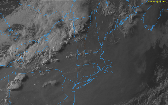
for the time being that looks like it's organizing into a linear complex/derecho up there about ready to threaten NW upstate NY. One can visualize that things sweep being down to about EEN-PSM later this evening perhaps. But not sure if the synoptics support it...just saying the present appeal. You do have minoring CB activity bubbling up NE of ALB and also S Maine coastal plain out ahead, so those betray that axis as having some conditional instability to work with
-
Technically we did tho - in June. Didn't make 100 but .. admittedly subjective, I've often thought of 'big heat' as definable for anything over 95. But it's relative to latitude/climate. Ex, that's probably not big heat for DCA to PHL corridor. But N-E of EWR-LGA ... The other aspect to consider is the HI. If that situates over 95 for long enough the discussion is academic only and removes the personality of the thing, which shouldn't work. So there's some gray area. But, no, we haven't seen hundred. That June 25 to 29 one had 97 or 98 in the area, on at least one of those days, with a DP of 73-like... I think that was big heat -
-
Lol... well - to the good reader I was obviously throwing some quasi- sarcasm out with that statement. I dunno - it would help ( maybe ..) if the smoke would alleviate. It's stealing hours from SB CAPE generation. It does actually seem like the sun is shining a bit more sharply to the surface as I type, and checking high def vis loop, there appears to be some thinning going on. We'll see for today but either way, it's still probably western zone and it's later-ish spill-over
-
heh... looking at D1 and D2 hashing displays over at SPC ... Classic timing contention for us. Too late today, and then tomorrow there's a line a TCU around 1:44pm N/S from MHT to Wilmantic CT that ends up a back lit wall of CB's rollin' out under the tropopause over the Boston Harbor later in the day.
-
Looking at that yellowy .. subtle orange hued firmament with the sun just feebly strong enough to still dapple shadows under trees and shade ... I always imagine that is what it must be like on a planet that has a red dwarf for a sun. Of course .. any such world is unlikely to have trees like we visualize of them here on Earth ... but just the quality and casting of light.
-
Wrt to climate change: I wonder if the more comprehensive environmental impact modeling takes into consideration smoke aerosols? I mean is it built into the complex math of it - Does smoke's reflective nature equal that of a non-human Earth clouds. If so, is there thresholds of mass composition in the ambient space of the atmosphere. Does that matter at sigma levels where the density of air is lower, so the same mass of smoke disperses more and so it becomes a morass of 2nd and 3rd order partial derivatives... etc... Smoke is pale on satellite...but it is not white. That may seem rather simplistic or unsophisticated ..but, white is white because it reflects more proficiently than dark. That isn't simple, it's just fact (not that anyone thought otherwise - heh). So logic implies that smoke doesn't reflect as well as cloud but ... there could be some other micro-physics that are less than obviously effecting that. But it does reflect some, it has to. It just is a matter of absorption versus - Very complex, because diffused smoke particulate matter is composed of a vastly differing spectrum of compounds. Any one of which reflects vs absorbs at different electromagnetic wavelengths. It's like an oil refinery Bible failure and Hades on earth soot bomb probably doesn't have the same albedo to absorption ratio as say regular western typical wild fire exhaust. I imagine there could be a theoretical spectrum, where say at one end you have comet/asteroid impacts, then ...oil ... volcanism ... woodland/wild fires ... SAL (saharan air layer) ... spread out from big to lower cost in the global heating budget. And it matters for climate science ( obviously..) because reflecting S/W radiation doesn't end up trapped L/W radiation, in a richer greenhouse fart world.
-
Gee - I wonder why that is ...
-
Killer heatwave in the Midwest on this GFS run. That ridge out there has been flexing in the late mid extended range for a few cycles …some runs more than others. So far the models are insistent on a bleeding at all south west of us but it could be really interesting for Chicago Also has a kind of 1930s look to it overall
-
Like I said… It was too early to start alarming because of the Yankees series… when it was quagmired with bad weather this and suspect “committee efforts” on the part of the umpiring staff that … the whole way thru. Sometimes the tides can turn because of something that happens in the game itself but that whole thing was being bombarded by circumstances from the outside in
-
Actually ...best this lawns ever looked frankly. Not just for July, ever The Irish sent representative but they reported back they couldn't compete. Plus rabbits - what the f is with all the g-damn rabbits. I swear, the next plague is gonna be like the Hunta Virus but linked to rabbits. And their brazen too ... they just sit there and a stare you down, like the one from Monty Python and the Holy Grail. One was even hopping sort of toward me. Really ? They don't seem to be afraid of people. It's a not a joke. They are infesting. Great numbers.
-
It's actually really nice here ...save for that rumble of thunder I just heard - wtf. anyway, sun popped out and it jolted 76. Shows that this is a "fake" cool air mass, entirely self engineered by weird synoptic feedback of this stationary nodal trough. I almost wonder if the ridges, W and SE of 90 W are causing this to spontaneously implode the heights because seriously, there's no S/W mechanical feed into this region and there really has not been very substantial. It just keeps parting then we fill it in with clouds and showers
-
well ...in his defense, he said "summer" Going by summer/Met clmo, pretty sure the (June + so far July)/2 = a positive return. It may not end that way ... but this 45 or so days in so far as summer goes -
-
Right LOL Like, " So c'mon and live in Baltimore - it's actually kinda fun if you think about it "
-
Yeah ...my neighbors have home schooled their kittens whole way, 4 daughters worth. The two eldest, twins, are entering high school this next year. I guess the way it works in Mass is that if you want to do home schooling ... you can be sent schoolastic sort of 'achievement milestones' exams, and the kids prepare for them ...however it is that the home, and the schooling, actually marry. The state and public domain is out of the picture as that happens. Built into the tax codes as a option I guess. Anyway, it was interesting sitting in their yard with them discussing this last 18 months, and gathering in their perspective on the reality of the thing. There was an unmistakable kind of "meh" behind fun articulation, almost glib due to lax urgency. Like you get from people in a room watching a dystopian movie and discussing what they were seeing, rather than actually being a part of it. lol - seriously though. Their kids have not missed anything. Just sort of had to deal with not getting to go over to their friends houses for the time. But they didn't miss a day of education or testing mandate or anything. No clue. World seen through 7 to 14 year old lenses, but not necessarily responsible within.
-
Oh christ what - did something happen out there ?


