

Typhoon Tip
-
Posts
44,565 -
Joined
-
Last visited
Content Type
Profiles
Blogs
Forums
American Weather
Media Demo
Store
Gallery
Everything posted by Typhoon Tip
-
September Discussion Thread: Bring the frost; kill the bugs.
Typhoon Tip replied to moneypitmike's topic in New England
Imagine if the 6.7 quake on the Merrimack fault happened right then - -
Red Sox have 9 ILer’s out on COVID protocols … W. T. F. yet they just finished a 3 game win streak and are still in the the conversation for Wild Card .. I mean the Yankees got their guys back and a week later put up 14 wind in a row. I didn’t realize it was that bad down at the Fens
-
September Discussion Thread: Bring the frost; kill the bugs.
Typhoon Tip replied to moneypitmike's topic in New England
I wonder if their homes have retractable domes. But seriously … in today’s technological wonders, being as they are, how much would it really take to outfit a home with a dome that closes like a tiny version of a retractable roof at a baseball stadium … closes shut tighter ‘n bull’s ass at fly time. Shit a category 5 wind would be an enjoyable white noise for sleeping peacefully. -
Occasional Thoughts on Climate Change
Typhoon Tip replied to donsutherland1's topic in Climate Change
Accept that the heat in the Pac NW and lower B.C., which rightfully started the monitoring focus… killed ~400 people - and by the way regionally, New Jersey’s part of the Northeast US… just sayn’ -
September Discussion Thread: Bring the frost; kill the bugs.
Typhoon Tip replied to moneypitmike's topic in New England
I ran 6 mi … little warm when the sun shone but spectacular when shade. -
September Discussion Thread: Bring the frost; kill the bugs.
Typhoon Tip replied to moneypitmike's topic in New England
They usually are as a base canvas. they start with the climate trend sweep. That means there’s an assumption-probability to go above normal before applying any synoptic biases. If the latter is neutral you’re left with above probabilities… Weaker to stronger the probability to 30 40 … 50% depending. In short the synoptics signal is probably not strong enough to completely compensate for the canvas, but is enough to lower/raise the probability of above normal. Not you per se but people need to realize that those colors have percents associated with them; it just means above or less above chances that’s often confused because the colors look hot ? Anyway, in the winter time when I see any negative at all I think it must be a pretty impressive pattern at this point because it is overcompensating acceleration - the curve has been nonlinear in climate change -
Looks like it crossed the 15th parallel closer to 42 W ...where as that EPS mean has it crossing(ed) back near 40 (~40.5W) That subtle variance means almost nothing in the near term ... but could imply there is a model bias-tug to pull it N prematurely in general. Other than that ... yeah, the attitude in the models has stopped .. or even reversed in some cases, trying to draw Larry out early. There was steady left correction for about three days ...not huge, but 100 to 200 naut mi per cycle, more noticeable accumulated by the 96 to 120 hour range. 00z last night behavior stopped pretty hard. Watch the convection flaring east of the TUTT off the SE U.S. coast ... that could dump some latent head E and S of whatever that is. For that matter, am noticing the TUTT has a pretty robust circulation identity - The "Schwoeglerian" almost wonders if these guidance' are using it/mistaking it as a steering field.
-
Yeah ha ...right. Like "Finished coffin .. ehhm, I mean basement space"
-
That is absolutely ... chin felled wide-eyed startling!
-
It's an interesting aspect... I feel the entire Ida story, from inception to impact, to the last chapters ... must also include the strike upon civility that took place the other night up in the upper M/A and immediately ensuing en routes of southern New England - despite the 36 to 48 hours of lull that took place after the initial landfall over the LA perishes. The loss of civil infrastructure more so in one sense; human casualty became of the tragedy of the latter. And while the guts of the killer only seemed dead while they lurked as a deceptive vesper-swirl on satellite over the lower OV/TV regions, who would have portended the doom better than the models - which seemed too preposterous [ perhaps ] to pull the trigger with a longer lead of popularized warnings... (it seems the best circuitry to turn on awareness in our culture, is through celebrity). Either way, without that swirl getting entangled in an early autumn polar jet field, Ida's story would have ended in just a novella instead. And while I don't think anyone's argued otherwise ( I hope... ) from the annuls/accounts, to the analytics and back, I hope they all describe a totality that begins with the assault on Louisiana, and ends in this fake shot across the bow air mass we enjoy today - a touching way to finish that story, just like the angel's "Ave Maria" after the death knell near the end of Fantasia.
-
September Discussion Thread: Bring the frost; kill the bugs.
Typhoon Tip replied to moneypitmike's topic in New England
We’ll … it’s worth the eye candy tho - right. jeez -
Rodriguez is having a seasonal night… Just when they need it, if they can get this game … Splitting against a team you’re down by 10 games in the same division is huge
-
Oh crap can you delete this my bad …
-
Rodriguez is having a seasonal night… Just when they need it, if they can get this game … Splitting against a team you’re down by 10 games in the same division is huge …go
-
September Discussion Thread: Bring the frost; kill the bugs.
Typhoon Tip replied to moneypitmike's topic in New England
Better hope this doesn't trend left and get captured by that New England trough because this would be very bad heh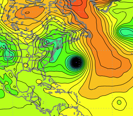
-
Yeah read about that ... It's a long way from sustainable practicum - but ... know what would be funny. The planet, having been 'straining' against the GW lean for so long, ... if breakthroughs and policies all at once alleviate the cause, ..rebound or repulse may over compensate. It's like "plausible Sci Fi" ... not impossible, that compensating natural forces cause the whplash effect. ... maybe a poor metaphor: you can't just cut off stage 4 alcoholic because detox AWS can be deadly
-
September Discussion Thread: Bring the frost; kill the bugs.
Typhoon Tip replied to moneypitmike's topic in New England
Someone ought to do a statistical comparison between wet summers and the ensuing winters - -
In what respect ... ? I just went to Tropical Tidbits and loaded up the operational ....clicked Prev 7 or 8 times and the QPF layout was fine and huge and axis of greatest essentially where it aligned - certainly not enough to be 'that' much of a distraction. I don't like the GFS model for other reasons... but, just trying to be fair.
-
It worked out flawlessly ... as it/posts were done in jest as snark and sarcasm ... for laughs. Two facets that routinely escape your comprehension skills as a patented, conflict oriented internet donkey honk.
-
Looks like the models did scary good with this thing... Not tropical Not extra tropical Something of an in-between. It had "too much" latent heat transported, and those convective sequences last night ...back building Jersey/NYC region ...where too cold, bright and expansive, with dark insidious cloud topped cores for typical convection over this region - even appeared to couch 'hot towers' ... sort of a smoking gun for something unusually tropic taking place at our latitude. Yet, there were frontal boundaries clearly in play ...no need to rehash all the evidences as to why/how. But, the super clustering of various products seemed to really work, as the blend(s) therein nailed the axis of heaviest rain where it appears to have verified at almost precision. We have brooks and streams around town here along Rt 2 in N-central Mass ...none are in flood that I have seen. Contrasting, the narrow axis of huge pummeling was very well handled in the short range by guidance; I recall commenting yesterday that there was a subtle trend therein to narrow that corridor along the southern zones. You know... some sort of hybrid meshed mess comes through with ( in theory ...) the most complex task by the modeling there can be ( for having collateral materialized physics going on...) and the models nail it ... But take it to the bank ...we're busting snow to rain , rain to snow and amounts all winter long!
-
-
You are … it expresses in SD extremeness
-
NAM has zero clouds low RH and light wind at 68-74 tomorrow afternoon. top 10 weather
-
I think it’s honing that convective band.
-
I dunno ... might wanna get this underway - For east of the Hudson rad keeps eating back. The heavier band extension into CT appears to modestly weaken. Probably just panic but ...heh, if this/these trends continue, may wanna change this thread title to 'Ghost of Any Impacts Thread' ...


