-
Posts
4,732 -
Joined
-
Last visited
Content Type
Profiles
Blogs
Forums
American Weather
Media Demo
Store
Gallery
Everything posted by Windspeed
-
Yes, might be a bit premature on a hurricane landfall. It's still possible but we need an eastern eyewall band/convection in the core of Fred to help mix down those flight level obs. There is a dry slot working into the eastern LLC right now. This may persist through landfall. There may be a few gusts near hurricane force in that eastern band outside the low level vort, but Fred is going to need to consolidate a real eastern eyewall before I am more confident in hurricane intensity.
-
Spring/Summer 2021 Medium/Long Range Forecast Discussion.
Windspeed replied to John1122's topic in Tennessee Valley
Sorry for just now responding. The GFS has been more aggressive with totals from Fred over the Ridge and Valley and western side of the Blue Ridge. The SPC/WPC has the highest totals on the eastern side into the W. Carolinas. Euro is more in line with that, however some of this likely depends on how far west Fred's mid-level circulation pivots around the high and how strong Fred becomes prior to landfall. The GFS has been stronger than forecast and also keeps the heavier totals further west. We do need the rain but obviously not too much too fast and I hope I didn't seem like I was "model hugging". Here are the highest totals forecasted for Fred as of 3AM. Below is the latest GFS totals through 96 hrs as presumably Fred should be out of the region.- 86 replies
-
- 1
-

-

Spring/Summer 2021 Medium/Long Range Forecast Discussion.
Windspeed replied to John1122's topic in Tennessee Valley
Yeah that's a wide swath of 4"+ totals for a large portion of the eastern valley and higher terrain. Most likely flooding is going to be an issue now.- 86 replies
-
- 1
-

-

Spring/Summer 2021 Medium/Long Range Forecast Discussion.
Windspeed replied to John1122's topic in Tennessee Valley
Update to to upcoming weekly totals per Sunday 12z GFS:- 86 replies
-
- 2
-

-
Remote sensing information is showing a lot of landslides and ground deformation along the mountains of the Tiburon Peninsula of Haiti since the passage of Fred and the 7.2 magnitude EQ that occurred there yesterday. Regardless of Grace's classification, its wave envelope is still likely to produce significant flash flooding over the same region as Fred. This is concerning to say the least. Hopefully they can get folks out of mudflow prone areas where roads may be damaged prior to Grace's passage in the coming days. Upper level divergence will remain favorable for strong convection and prolonged heavy rainfall.
-
Deep convection is beginning to wrap upshear, north of the LLC.
-

2021 Atlantic Hurricane season
Windspeed replied to StormchaserChuck!'s topic in Tropical Headquarters
You said you agreed with JB. At any rate, based on your climatological assessment, it is my interpretation that you are going to be very wrong about this season like you were the past four years. You keep relying on June through intraseasonal early August storm activity to proclaim what peak to second half of an Atlantic tropical season will or will not do. Furthermore you repeat yourself incessantly when there's not a system reaching hurricane status. We could have had a drinking game by now based on how many times you have mentioned phase 2 MJO in the active threads. Your evidence based on the long-range operational outputs when you make bold claims, among other things, opens yourself up to a lot of criticism. That subtropical region comment you just made was a little much, even for you. -

2021 Atlantic Hurricane season
Windspeed replied to StormchaserChuck!'s topic in Tropical Headquarters
This post makes no sense. 1) Where did JB elude to season state anywhere in that tweet? 2) What type of season is it exactly? 3) Why would you ignore any system with potential based on any given season anyway? -
No doubt Fred has a well-defined LLC per early visual this morning.
-
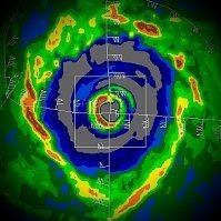
To say Grace is poorly organized is an understatement. Though radar doesn't tell the entire tale, the system is pretty much entirely within TJUA WSR-88D. So we are at least given a hint at what's under the hood. Whether nearby in the low levels or at a distance in the mid levels, there's just a piss-poor representation of a closed circulation regardless of satellite presentation. I really have no bearing on what will become of Grace. In this state it could organize and deepen with a wide variance of track path or do nothing but cause flooding concerns for Hispaniola.
-

Spring/Summer 2021 Medium/Long Range Forecast Discussion.
Windspeed replied to John1122's topic in Tennessee Valley
Potential heavy rain into next weekend through the Tennessee Valley thanks to redevelopment of TC Fred. Don't want too much too fast but some places sure need a prolonged soaker.- 86 replies
-
- 1
-

-
Flight engineer Nick Underwood giving explanation for their recent flight path through Grace:
-
That 5pm AST track is not so graceful...
-
To be fair, most Atlantic systems east of the Lesser Antilles struggle prior to the current climatological date. On top of that, both Fred and Elsa had significant interactions with the mountainous terrains of Hispaniola and Cuba besides the marginal atmospheric state. Fred has fared far worse than Elsa so far. Remains to be seen how Grace will evolve here in the short-term. But there really is a lot to be said about that August 20th date that Dr. William Gray harped about every season. Granted we do have earlybirds on occasion, but that is when the proverbial switch tends to flip on for the MDR.
-
12z GEFS ensembles trended west.
-
I really think that complex of convection (purple arrow) is merely a strong MCS that is not associated with the true low level vorticity that does appear to have some low level westerly flow on its south side (red arrow). That MCS will probably erode downstream. I am more interested in the subtle banding that appears to be forming near that true center. The steering flow should slow down some over night and perhaps this will allow Grace to organize further. As always, satellite and even radar can sometimes be a bit deceiving.
-
12z HWRF:
-
-
Looks like they clearly flew through the old wave axis there, whether that leads into the broader circulation or eroded old broad one, whichever. Guess we'll just have to be patient and see what the MLC is like showing up on radar and whether that is a vortex down to the surface.
-
-
The 12z HWRF just took a big swing left of previous runs and tracks Grace a good bit south of the Isle of Youth still on a due west track at hr 117.
-
Or... the system isn't even closed. lol. They'll investigate western region, I'm sure.
-
I think recon missed the center. Actually they flew on a heading through where hypothetically the broader center should have been located. Perhaps there is a low level vorticity maximum further west.
-
-
Radar has some suspicious banding that may be trying to consolidate a core. That feature is only barely coming unto view. This may still only be a mid level displaced circulation from the low level center however. So yes, reiterating recon's importance. But there is no doubt Grace looks improved over yesterday. See red X..

