

Windspeed
-
Posts
4,850 -
Joined
-
Last visited
Content Type
Profiles
Blogs
Forums
American Weather
Media Demo
Store
Gallery
Everything posted by Windspeed
-
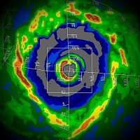
 Impressive large eye that continues to warm. Deep surrounding band of coldest CTs. If you'll notice the geometric pattern within the low-level clouds in the eye, most likely the result of multiple rotating mesovorticies currently riding around the eyewall. I'd imagine this is Cat 5 bound again.
 -
Fall 2026 Medium/Long Range Pattern Thread
Windspeed replied to John1122's topic in Tennessee Valley
The past few days have been glorious. -
Agreed. Huge backside feeder that is still attached and feeding into the eyewall versus being a closed off concentric feature. Champi is bombing. Very intense eyewall ongoing.
-
Again, they are so very lucky. Champi continues to intensify. Also, note the very intense meso in the northern eyewall at the end of this animation with the bright purple reflectivity. Amazing...
-
No doubt Champi is very intense at the moment. In the above radar, you can see the intense mesos rotating within the eye. The IR tells the rest below. Guam is so incredibly lucky this isn't barrelling due west at just a few ticks higher latitude.
-
Guam may come out of this very lucky. It looks as if the northern eyewall may only just graze or even miss the southern shoreline. The inner core winds will remain entirely offshore.
-
The Mexican shoreline is getting raked by Simon. However, Simon's small core is a frog's hair distance offshore to avoid weakening versus strengthening any further. It's a delicate balance that's preventing Category 5 intensity but not yet detrimental enough to induce weakening. Still, the abrupt change in elevation near the coast and such influence on inflow will still disrupt Simon and should begin to weaken it if the core parallels the coast any closer. Granted, that means very little with respect to flash flooding that is underway with moist low-level southerly fetch within the eastern circulation feeder bands and orgographic lift.
-
It seems like we always have to beat it into people's skulls during landfalls. It's the maximum sustained winds possible as an estimate over water for a reason. It's a marine storm before it is a land storm, and advisories have to account for what is occurring in real time over the ocean surface for any poor ships/souls that might find themselves in the worst scenario. But due to frictional convergence / drag, you will almost never see those sustained winds over land unless you have a super intense eyewall with embedded multiple mesos rotating around that overcome frictional forces with insane ground level velocities. As a general rule, the highest wind reports over land are always in gusts due to this process. You might get those highest sustained winds right on the immediate beach/shoreline perpendicular to the onshore motion of the inner edge of the eyewall, but the equipment would need to be in the right place at the right time and that is exceedingly difficult placement and timing to pull off. Interestingly, and as no surprise, the instrument anemometers that have been positioned in the right place and at the right time during past landfalls that recorded sustained winds near maximum have generally failed during that event. I also need to add that the reason most immediate advisory packages don't rapidly ramp down maximum sustained winds after landfall is twofold: 1) part of the eyewall or outer eyewall may still be over water, 2) any large estuaries even after landfall may still experience maximum winds. Once the entire circulation is inland, subsequent advisory packages tend to ramp down quickly.
-
Simon appears to be doing what most EPAC hurricanes have done this year. It's undergoing rapid intensification. A pinhole eye has formed in the direct center of the tiny CDO. This is a microcane for now and on it's way to becoming a major hurricane today. It will most likely grow in size over the weekend. It's tiny core will expand, and the pinehole eye should give way to a larger eye eventually.
-
-
4:00 AM CDT Fri Oct 09 Location: 26.4°N 88.0°W Moving: NNE at 15 mph Min pressure: 963 mb Max sustained: 110 mph
-
Satellite continues to improve, and we have a warming clear eye now. Category 3 is looking much more likely. If they don't pull the trigger in the 4AM CDT package, they probably will later with an intermediate advisory.
-
Best structure Isaias has had in its lifecycle so far. Perhaps a window here for some brief intensification prior to increasing shear today.
-
I am starting to lean into a major being a real possibility, but I still anticipate it getting hammered in the mid-levels prior to landfall. Wouldn't even be surprised if it got decapitated. 30+ kts of shear is still going to win the battle, regardless of the vector of motion and all other favorable factors. Keep in mind that some of the 500 hPa barbs of flow may be in excess of 50 kts by landfall. I would still be cautious of early onset RI being a sure thing as well. It may thread the needle, but you can clearly see assymmetry already in the cloud pattern, and the coldest tops are NE of the surface circulation. It may be slower to moderate intensification instead if it gets hampered by westerly flow. You can easily see this flow on satellite moving in quickly from Mexico. Again, RI is a possibility, but absolutely not certain.
-
Looks like we're going to have quite a battle of timing and walking thin ice with that shear axis. Might be a back and forth between 6 hr runs on the TC model suites today until they get a better feel for track motion, and if/when the mid-level shear begins encroaching. For example, the 18z HAFS suites kept intensity in check, preventing a major. The 00z suites kept the core on the edge and bombed Isaias into a strong major. The recent 06z runs are back to allowing encroachment in the mid-levels again, though it may still be reaching Category 3 / 960s prior to weakening. We'll have to see if the 12z suite swing back to flirting with the 940s and a more significant major.
-
Best track is now 35 kts and upgraded to TS Isaias for the next advisory package.
-
00z HAFS suites are significantly stronger versus 18z. Intensification is faster, with a major hurricane down into the 940s passing east of the mouth of the Mississippi River. Both still show disruption from increasing shear by landfall, but obviously, this would be troubling for surge impacts along the Mississippi, Alabama, and western Panhandle coastline.
-
Intense bursting of convection now over the NHC's 10PM CDT advisory position:
-
https://isotherm.rsmas.miami.edu/heat/weba/atlantic.php for updated TCHP maps. Sadly, many of the old NCEP and CPC sites are MIA these days for oceanic and atmospheric data.
-
The first runs of the HAFS suites since classification are not impressive, to say the least. The TC gets walloped around 70'ish hours out and becomes very assymetric with advected dry air doing its thing. Something to keep in mind. Is the window there for a strong hurricane? Sure. But the TC needs to come together rapidly over the next 48 hours.
-
Right now is the slowest motion we will see. The westerly steering flow in interaction with the mid-to-upper trough will push the TC towards the east and then begin to turn it poleward. At that point, it should be gaining forward motion into landfall.
-
The forecast track and storm motion keeps the center over relatively deep heat content. Obviously, shallow SSTs remain quite high and untapped due to limited frontal progression and miniscule TC activity so far this season. The system will not be a slow mover, so we must depend on the timing of development and changes in atmospheric conditions: How fast does the TC intensify versus how fast favorable atmospheric conditions deteriorate to hostile? The key limiting factors up to landfall are increasing mid-level shear and potential dry air encroachment to limit or weaken landfall intensity.
-
Having a closed surface circulation and its approximate location should give the TC models a better handle on environmental interaction. We'll have to see if there is RI potential prior to conditions becoming less favorable. I suppose there does exist the possibility of rapid intensification occurring, leading to some panic, only for the TC to rapidly weaken prior to landfall. It is an annoying forecast in that regard and subject to big changes quickly. It's tough to approximate exactly when strong mid-level shear will impede or disrupt a core, especially if the system intensifies faster than forecast. But no TC is going to be immune to 30+ kts of shear prior to landfall. Yet, before that shear escalates, the system will have very strong ventilation. Therefore, the ceiling is high through the first 72 hours. How close does the core get to the coast prior to shear obliterating it? Not like this would be the first time we've been psyched out by a hurricane in the GOM, of course.



