-
Posts
4,734 -
Joined
-
Last visited
Content Type
Profiles
Blogs
Forums
American Weather
Media Demo
Store
Gallery
Everything posted by Windspeed
-
Spring/Summer 2021 Medium/Long Range Forecast Discussion.
Windspeed replied to John1122's topic in Tennessee Valley
Nice article explaining how radar rates and dbz can be deceiving in tropical systems. https://radarlab.wordpress.com/2015/06/22/whats-so-special-about-tropical-rainfall/- 86 replies
-
- 2
-

-

-
000 WTNT42 KNHC 171452 TCDAT2 Tropical Storm Grace Discussion Number 17 NWS National Hurricane Center Miami FL AL072021 1100 AM EDT Tue Aug 17 2021 The cloud pattern of Grace is gradually becoming better organized on satellite images, but the system still lacks distinct banding features over the eastern semicircle. Cirrus-level outflow from the system appears to be well defined. Flight-level and SFMR-observed surface winds, as well as dropsonde measurements, support an intensity of 45 kt for this advisory. Not much change in intensity is likely through this afternoon while the circulation of Grace interacts with the island of Jamaica. Thereafter, since the cyclone will be over the very high heat content waters of the northwestern Caribbean Sea with modestly low vertical shear tonight and Wednesday, strengthening is anticipated. Grace will likely become a hurricane tomorrow and continue to intensify before moving over the Yucatan Peninsula. The interaction with that land mass is expected to temporarily interrupt strengthening, with some reintensification over the Bay of Campeche in 3-4 days. The official intensity forecast is near the model consensus for the first half of the forecast period, but below the consensus for the latter part of the period owing to the inherent uncertainties for that extended time frame. Grace continues to move just a little north of due west, or at about 280/13 kt. A well-defined 500 mb ridge should remain entrenched to the north of the tropical cyclone for the next several days. Therefore, a continued west to west-northwestward track is likely to continue for most, if not all, of the forecast period. The official forecast is close to the previous one through 72 hours and just slightly south of it at 4-5 days. This is very similar to the latest multi-model consensus prediction. Key Messages: 1. Heavy rainfall across Haiti, Cuba, Jamaica, the Cayman Islands, and the northern Yucatan Peninsula may lead to flash, urban, and small stream flooding, with the potential for mudslides highest in Haiti and Jamaica. 2. Tropical storm conditions are expected over portions of Jamaica today, and over the Cayman Islands later today and tonight. Tropical storm conditions are expected over portions of the southern coast of Cuba today in the warning area, spreading westward to possibly other portions of the southern coast of Cuba this evening through Wednesday morning. 3. There is an increasing risk of wind, rainfall, and storm surge impacts on the Yucatan Peninsula of Mexico Wednesday night and Thursday, and a Hurricane Warning will likely be needed for that area later today. FORECAST POSITIONS AND MAX WINDS INIT 17/1500Z 18.3N 76.8W 45 KT 50 MPH 12H 18/0000Z 18.8N 79.0W 55 KT 65 MPH 24H 18/1200Z 19.2N 82.2W 65 KT 75 MPH 36H 19/0000Z 19.7N 85.3W 70 KT 80 MPH 48H 19/1200Z 20.4N 88.3W 65 KT 75 MPH...INLAND 60H 20/0000Z 20.9N 91.3W 60 KT 70 MPH...OVER WATER 72H 20/1200Z 21.1N 94.0W 65 KT 75 MPH 96H 21/1200Z 21.5N 98.5W 65 KT 75 MPH...INLAND 120H 22/1200Z 21.5N 103.0W 30 KT 35 MPH...POST-TROP/INLAND $$ Forecaster Pasch
-
Grace is now forecasted to become a hurricane in the NW Caribbean prior to landfall along the Riviera Maya coastline, Yucatán.
-

TN valley heavy rain/flooding week of whenever
Windspeed replied to janetjanet998's topic in Tennessee Valley
Yeah I hope you've got a boat. Looks like Chattanooga area totals are going to exceed forecast. -

Spring/Summer 2021 Medium/Long Range Forecast Discussion.
Windspeed replied to John1122's topic in Tennessee Valley
A common trait of tropical system rainfall. It's steady moderate rain here at my location south of Bristol but the radar dbz echoes aren't really that impressive.- 86 replies
-
- 2
-

-

TN valley heavy rain/flooding week of whenever
Windspeed replied to janetjanet998's topic in Tennessee Valley
Latest HRRR.. -

TN valley heavy rain/flooding week of whenever
Windspeed replied to janetjanet998's topic in Tennessee Valley
Going to resurrect this thread for the Fred and frontal related heavy rains over the eastern Tennessee Valley this week and weekend. Looks like it's going to be a mess for some folks despite a much-needed soaker. -

Spring/Summer 2021 Medium/Long Range Forecast Discussion.
Windspeed replied to John1122's topic in Tennessee Valley
I-75 corridor is getting pummeled right now as coverage continues to increase. I-81 coverage is beginning to increase as well. Should we make a new thread specifically for a heavy rain event as to not clutter up the medium/long range too much going forward?- 86 replies
-
- 1
-

-
Land interactions have certainly not been kind to Grace. But things can change pretty fast if a core does get established. Obviously the thermodynamic potential is out the roof tomorrow if it can get going.
-
Last pass found some 55kt flight level winds on the north side of the reorganized LLC. This is just off the coast of Jamaica. Let's see if Grace finally starts developing a core now despite its close proximity traversing near-to the northern shoreline of Jamaica today.
-
RE: Upper level pattern over the next 72 hrs: Watch as the upper ridge over the EGOM pivots and slides WSW while another upper ridge develops and follows Grace over the WCARIB and Yucatán. I've seen worse patterns for WCARIB hurricanes, including a couple of majors there last season. But we shall see...
-
Not really seeing a pronounced upper level trough or low feature. There is an upper ridge/anticyclone over the eastern to southeastern GOM that could impart some northeasterly flow over Grace in the NW Caribbean, but it is forecast to retrograde WSW. It's not terribly strong shear though as Grace will be moving in a western vector of motion with easterly mid-level steering flow. I'm not sure it would be strong enough shear to prevent strengthening at least to lower-end hurricane status by Yucatán landfall. That is if Grace can finally get its act together upon leaving Jamaica, which remains to be seen.
-
-
Appears the LLC has reorganized off the NE coast of Jamaica where the spiral band on SSIMS had suggested.
-
I do like the hurricane potential this weekend when Henri turns north towards the gulf stream. If timed right, it will be between two upper troughs with good thermodynamic support. Should be sufficient ventilation for a stronger hurricane as it heads into the maritimes by early next week.
-
Yeah, SSMIS really shows that banding organization well. If not for Jamaica, I would expect a core to form relatively quickly with such a strong spiral band curving into that center. But Jamaica likely will have some success slowing down that process at least until Grace has cleared the island to the west.
-
Curved banding structure is getting established. All Grace requires now is development of core banding, which may be within progress. Some disruption with a close pass of Jamaica may occur today, but I now also think Grace will become a hurricane prior to Yucatán landfall on Thursday.
-
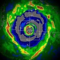
Linda's structure right now is legit weather porn. Annular large eye with a very thin-radius CDO.
-
[emoji102]
-
A significant amount of rainfall has been occurring over the Tiburon Peninsula of Haiti this evening. Mudflows are going to be an issue throughout Tuesday and Wednesday. Moreover, the organization of Grace is not degrading but improving significantly tonight. This is going to be problematic for Jamaica over the next few days as well.
-
That position and intensity is pretty long range. Anything is possible at this point. I would be reluctant to focus on modeled intensity until we have a better understanding of what Grace is after it clears its interaction with the Tiburon Peninsula.
-

Spring/Summer 2021 Medium/Long Range Forecast Discussion.
Windspeed replied to John1122's topic in Tennessee Valley
Latest from WPC...- 86 replies
-
Dennis is probably the most recent example of near-to path south of the Tiburon Peninsula that continued to intensify. Of course, Dennis was already a hurricane.
-
Just to jump off topic here, briefly, Josh was never in a reporting capacity for TWC. They reached out to him while he was on his regular chase schedule for several hurricanes. The WN gig was their decision to contract him for work and he took it. Fred was not a normal chase. Additionally, Josh now lives on the Gulf coast during hurricane season for this very reason. He has a particularly great skill set that can be advantageous for any particular network coverage. That being said, if there is an intense hurricane landfall, he's going to be in chase mode, not coverage mode. At any rate, no need to berate the man for getting paid. Speaking of...
-
As such over the past six hours, the vortex just can't seem hold onto convection long enough to close off a stable eyewall. One attempts to develop and then erodes. This is a telling sign that though shear is not too strong to prevent upshear convection within the vortex, it is still too strong to allow convection to not intermittently erode. Fred is running out of time here. Odds significantly decreasing this reaches minimal 'cane status. As is always typical with higher end Tropical Storms, heavy rain and flash flooding will be the main threat. But we could still see some strong gusts inland this evening.


