IWXwx
-
Posts
6,618 -
Joined
-
Last visited
About IWXwx

- Birthday 01/07/1958
Recent Profile Visitors
11,417 profile views


-
You catch smallies from the bank?
-
Don't worry. We have some Saharan dust heading our way. That may tide you over.
-
You're gonna miss IWX.
-
Sirens for Severe t-Storms warnings create siren fatigue and people begin to ignore them. Highly unrecommended. From a former EMA Director.
-
I thought that you got hammered a few weeks ago, while I was suffering one miss after another. In the meantime, we've had 5.66" in the past 30 days, completely wiping out our extreme drought. Amazing how different it can be in only 50 miles.
-
Turned ours on about 4 hours ago. After the clouds from the morning rain cleared, we shot up to 83 (predicted 77). We've hit the low 80's a couple of times, but without the dews.
-
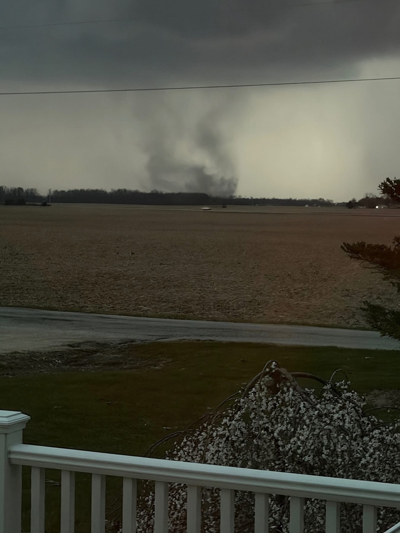
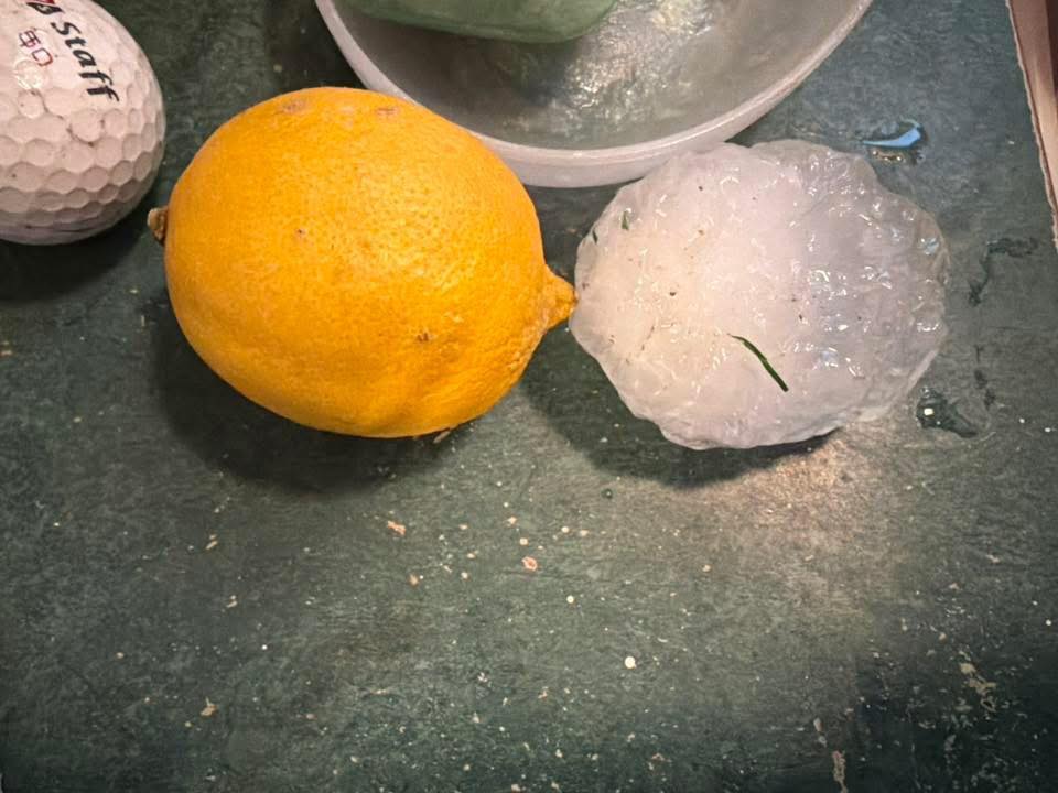
It looks like we did have a quick spinup yesterday evening in the extreme southern part of the county and adjoining county (Huntington and Wabash), from radar appeared to be a cell merger. I was one my way back from Ft. Wayne, so didn't have time to get that far south with the speed of the storm movement. I mentioned to the local Skywarn group that it should have been T-warned, but never was. One of the spotters got down there to collect some large hail off of the ground as it sped away. The Director who took my job after I retired is meeting the NWS survey team down there this morning. That was one part of the job that I miss is doing storm surveys.

-
I'm just biding my time right now. I will be in Ft. Wayne until 6-ish for my maintenance chemo. Will be keeping a close eye on radar so maybe I can get out of Dodge before the storms get here for a back yard chase, but will try to stay out from under any stones. Will have the wife with me who hates to chase, but she will be recruited if need be. lol
-
Although this month isn’t getting the notoriety of 2012, it’s been pretty warm around here, dating back to mid Feb. In fact, I was surprised by this Facebook post by IND: ”Indianapolis has so far exceeded 70 degrees on 8 days this year, starting with 71°F on 2/18, and led by 79°F on 3/6 and 78°F on 3/20. This tally is the 2nd-greatest on record through March 20th, behind 2012's record 9 days. The normal 71°F+ tally by 3/20 is only 2 days.” With a predicted high of 78 today, 81 tomorrow, and 74 on Thursday, 2026 will set a standard in Indiana for late winter/early spring warmth.
-
Wow!!! that's some amazing stuff right there. Good to hear from you. I was concerned, since you've been AWOL here all winter.
-
86 mph gust at KMIE. Multiple semis blown over on I 69 south of FWA.
-
I wondered why you haven't mentioned chasing when you've had several opportunities to fairly close by recently. I'm like you about the hordes of chasers. I remember when I could go on a chase in Indiana and be the only car out there. Jackstraw is seriously right about the other chasers being more dangerous than the storm itself. I will still do it if it's within an hour's drive though.
-
I would agree. The remnant outflow was clearly visible on satellite for a long time before the cell interacted with it. It appeared to move south for several miles and then became stationary.
-
Someone mentioned last night that they shut the sirens off. That is the typical procedure. Once a tornado warning is issued, they sound sound the sirens, usually for 2-3 minutes, depending on the jurisdiction, then shut down. Another misnomer is that they sound them when the threat has passed. The sirens will sometimes be sounded a second time if it's a long leashed warning, say 15 minutes or more before the tornado actually gets close to the siren's warning area. As someone who used to work on them, you don't want to hear that for 15-30 minutes if you live near the siren.