

Carvers Gap
-
Posts
17,458 -
Joined
-
Last visited
Content Type
Profiles
Blogs
Forums
American Weather
Media Demo
Store
Gallery
Everything posted by Carvers Gap
-
LOL. Let's hope that run of the Euro Weeklies is not correct.
-
That is gonna leave a mark. What to really watch for is if a SER connect with the WAR, and consequently sends a ton of warm surface air from the subtropics into the TPV. That has been the sign of a top to bottom split. The EPS has been close as has the GEPS. Cosgrove correctly points out that most splits result in the cold heading to Eurasia. However, just seems like modeling likes having cold on this side of the hemisphere in the LR. I can say this though, modeling is going to be a total mess. A strat split can actually trump a poor MJO phase. I do not think modeling is even close to sorting out the LR outside of the SSW which seems probable.
-
I haven’t looked at them today...However modeling does show a few shots of cold consistent with phase 7. Then, MJO site shows a cluster of models which try to loop the MJO back into 6 which is consistent with the warm-up late in the LR. So, model output seems to be consistent with that uncertainty as they bounce around. Interestingly, the warmth seems to be getting pushed back some. I still like the 10-20th for a ridge to roll through/form in the East.
-
Not uncommon during second year La Nina's I don't think. JB has been calling for a strat warm forever. He has to be right at some point? I have noticed when SSWs begin to appear, modeling goes absolutely haywire. Was my first thought when I saw modeling go warm, then cold, and now warm again. I don't think they are done bouncing around. I think at some point, if real, we will see a high latitude blocking signal appear on LR modeling. Past few years, the West has won the SSW lottery. Climo might favor the eastern part of NA if the split pushes cold onto our side of the hemisphere. That is another reason we want an early split. Wavelength pattern favors us early.
-
Yep, indeed the 12z GFS nearly or completely severs the SPV late in the run at 10, 30, and 50 mb. Now, normally I give it little credence at that range, BUT it has an uncanny ability to nail those events at range even if it misses nearly everything else. Huge implications down the road if that early season split occurs.
-
With that big high, is the GFS beginning to sense an SSW?
-
There is a 1065 hp in the Canadian Rockies around 324 on the 12z GFS run. Fantasy land for sure, but I generally have found that when the GFS starts to "sense" those big highs, it is a hint that cold may well press eastward after first pooling in the Rockies. Definitely some uncertainty with the MJO as modeling can't seem to decide whether to leave it in phase 7 or loop it back towards 6. But wow, some gigantic highs on the 12z GFS.
-
Bit of a suppressed storm track on the 12z suite of models.
-
The 12z operationals for the Euro, GFS, and CMC all show potential in the d8-10 range. This is an amplification that was missed by the GEFS if I remember correctly. Now obviously, at this range no model run is right or wrong. The 12z Euro has a 1-2 punch late in its run. Way out there, but something to consider.
-
May be worth beginning to consider Dec 5-10 as a potential window for the first accumulating snows for someone in the forum area.
-
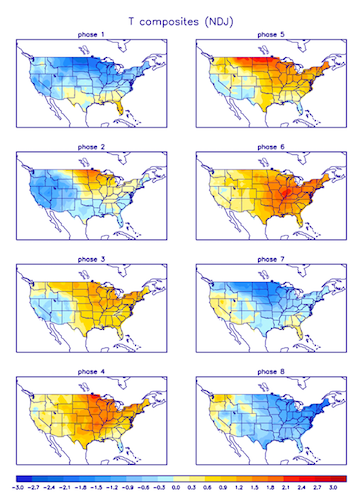
Today's MJO from the CPC shows some modeling which takes it into phase 7 after a bout with phase 6. Let's see if we can take a run through the cold phases. If that MJO look is legit, modeling should begin to reflect that. Lots of plates to juggle right now in regards to getting something out there that makes sense regarding December/early January ideas.
-
I like analogs, but they are fickle companions. Lot of ground to cover before I would be willing to mail it in this winter(especially since it hasn't started). There is always the risk of non-winters. Generally, strong El Nino's and strong La Nina's are notorious for those. The late 90s were terrible with the exception of a couple of monster snows. Lots of variables still to sort out right now as I am not sure the base winter pattern has shown itself yet. There are always good and bad exceptions to the rule. It is a good sign that November will likely end-up BN. I have generally found that record setting cold shows-up IMBY during weak La Ninas. It is often followed by a break for spring or an extended thaw. Of note, the GFS(the model that was warm for so long) is spitting out some 1040+ highs in early December. The 18z run was extreme in terms of trough amplification - single digits and low teens showing up between Dec 5-7 and highs below freezing IMBY. I like the GFS when it begins to hint at those types of events. It is definitely not always right nor is the timing always exacting....but, it does sometimes sniff out those types of events. 12z Euro had it as well. I suspect we will see those features come and go on modeling. If the frequency increases on modeling, it will have my attention.
-
Happy Thanksgiving, everyone! Welp, it looks like the Euro and GFS have sort of met in the middle. Interesting points....It is waaaay out there, but some hints at a major trough amplification over the east between d8-10. This time of year, trough amplifications have to be watched as the GOM could fuel sever and/or winter activity. Looks like modeling is beginning to converge on the time frame of Dec 10-20 as a time of warmth. This does not surprise me as much of November has been below normal, and we are due a break in the below normal pattern. Euro Weeklies, after the 20th go into a pattern where there are cold swings and warmth in equal doses. Again, would not surprise me to see some extreme temps in terms of cold this winter. Maybe the timeframe from Dec 20-Jan10 has some potential for that? But hey, let's not rule out the potential amplification in the 9-10 day timeframe. HUGE grains of salt!!!
-
18z GEFS was super warm. We better hope the EPS hangs on!!!!
-
Thanks for the great post! I think this winter will be potentially super similar to last winter. Base warm, but with some cold shots embedded - maybe severely cold at times due to the QBO flip from late summer. Right now, I am just super wary of model output. I think La Nina lends itself to cold which arrives abruptly and leaves abruptly. Total crapshoot on timing, but generally December has better odds. All of that is based on the ENSO state. Seems like the last few winters have had modeling show cold barreling into the East at d10-15 only to have favored areas in the northern Rockies get the lion's share. That may be what the EPS is indeed doing again. IDK. However, given that December "should" have some cold, have to think the actual solution is probably somewhere in between the Euro and American suites - warm interludes w/ AN heights with 3-4 day cold shots arriving regularly. In other words, the pattern is one where a southwest ridge pops and sends cold eastward. Once the trough in the east exits, the ridge rolls forward. So, maybe a blend of the two gets us to something which works? Best case is a full NA trough. Been a long time since we have seen that. Have a great Thanksgiving, man!
-
Indeed, late in the forecast time frame the MJO is shown on American modeling to swing into phase 7 which is cold for NDJ(source is CPC site). I read in the MA forum that DT had noticed the MJO beginning to move on the Australian site. So, I made a mental note to check the CPC site to see if there was similar movement. The GEFS for the past several runs is pulling the eastern ridge back into the southwest. The 5-day 500 anomaly (d10-15) on the 0z EPS stretches from Juneau to the west slopes of the Apps. That looks an awful lot like phase 7(even phase 8) of the NDJ MJO. GEPS has a different look. The GEFS is trending away from its solutions of the past several days. Just something to watch. Huge grains of salt as always.
-
GEFS at 6z has the stubborn ridge in the nation's mid-section. But we are again where the 6z GFS, 0z EPS, and 0z GEPS are showing a sharp cold shot during early December. Interestingly, the EPS/GEPS combo has almost all of the cold air in the northern hemisphere(in regards to departures) over North America. That may well be forcing the cold eastward regardless of the SER. Crazy look. Been a while since we have seen the major hemispheric cold pool on this side of the planet....no idea if that occurs. I can say this, if true, models likely don't have that ironed out yet.
-
Ensembles look quite a bit different this morning. Will take some time later and dig through them later. There is a full latitude trough showing up on the EPS now. The GEPS has flipped back to a good solution. Not sure I trust any solution at this point. Again, a lot of volatility in LR modeling. Just looking at this AM's suite, looks like something as moved the needle just a hair back into the cold camp to start December. Not sure what has changed, but they look a bit different than yesterday. The 6z GFS is not exactly warm, and even attempts to send a piece of the PV south late in fantasy land.
-
Thanks for the update. Always great information.
-
Yeah, I think Nina climatology wins in this regard....there should be a substantial cold shot at some point during December, and then again during late January. Agree that winter will be likely be base warm. Aren't most of them? The real wild card here is that some second year La Nina's tend to turn cold and hold that look. So, I am really wary of what I am seeing on LR modeling. Could just be a warm winter upcoming. Could be models are wrong in the d10+ which we saw repeatedly last winter, sometimes to our benefit and sometimes not. The back half of winter, as Jeff notes, should be warm. However, it seems that analogs have been squirrelly of late. If in doubt though, roll with the ENSO state. I still think our chances for winter are on the front end of the season. That said, this is what makes following wx so much fun and frustrating - predictability is no a given! I am definitely willing to sacrifice a cold start for cold/winter around Christmas. MJO is locked in the same 4-5-6 rotation that it has been for several seasons....I think things will improve once this La Nina is over and maybe a chance for an improved SST gradient which has been lacking during the past decade or so. If December is warm in totality, I am not sold the rest of winter will be warm. It seems like there are some second year La Nina's which have a decidedly cold Jan/Feb cluster. Maybe @John1122 would care to comment on that?
-

Fall 2021 Thread (September, October, November)
Carvers Gap replied to Carvers Gap's topic in Tennessee Valley
Looks like TRI will likely finish BN for November. Right now we are at -2.1 and likely to strengthen that departure. Will have to go back and look at which models actually got that right... Strong amplification this week. Maybe some moderation next week, and then uncertainty persists. I would urge caution(on way or the other) when viewing LR model output during November as verbatim. Right now, I think Cosgrove is on to something with his most recent FB thoughts. Basically, he says a warm start to December(2-3 weeks at least), but with the stage being set for a typical and possibly severe cold outbreak to end the month. I am leaning in that direction, but not quite there yet. Lots of understandable volatility in modeling right now. The GEFS in particular seems a bit blind to trough amplification in the East. Something to watch if it consistently misses those. -
Fall 2021 Thread (September, October, November)
Carvers Gap replied to Carvers Gap's topic in Tennessee Valley
Very persistent and somewhat conflicting features still showing in the LR....BN heights over Alaska and the SE/EC of the US. If taken verbatim, Alaskan cold would periodically break loose and head southeast under the persistent AN heights over Greenland, Davis Straits, or Hudson Bay. Warmer air would intrude between cold shots. Whether this can persist is another question altogether. I tend to think an Alaska vortex wins most of the time. However, we have discussed this on here many times...during the 70s and really early/mid 80s a cold Alaska was a good thing here. At some point, it was heading southeast. Was just a matter of time. That has not been the case during the past couple of decades in general. Right now the EPS, has handled the LR better IMHO. GEFS is playing catch-up as evidenced by the cold coming this week. -
Fall 2021 Thread (September, October, November)
Carvers Gap replied to Carvers Gap's topic in Tennessee Valley
Some fairly massive differences this morning in the overall North American pattern between the EPS/GEPS and GEFS. EPS/GEPS is a strong, early season shot of repetitive cold while the GEFS is a trough out West. This has been a persistent difference for a couple of days. I don't discount either camp on this. I see sound reasoning for both portrayals. Something to watch. Weeklies looked a little bit more back and forth to me vs a December cancel. Always a fight to get it to snow early IMBY, though recent years have bucked that trend. More of a shift from a net cold(with warm intrusions) to a net warm(cold intrusions) look to me. -
Fall 2021 Thread (September, October, November)
Carvers Gap replied to Carvers Gap's topic in Tennessee Valley
EPS and GEPS double down on a continuation of BN heights in the d10-15. GEFS now "toying" with the idea. Modeling is now beginning to show ridging along the western coast of North America. What we don't want to see is a strong ridge in the Aleutians IMHO. Not seeing that consistently, but it has shown up on a few operational models. I think the amplification next week is now highly likely. Could be 1-2 shots of winter like air masses. After that, that is the question mark. The MJO certainly seems to be an opposite signal of what the EPS is signaling. Though, as noted above, the EMON did show it moving out of warmer territory. IMHO, the MJO becomes really important as we get deeper into December. IO definitely has people skittish right now - as it should. -
Fall 2021 Thread (September, October, November)
Carvers Gap replied to Carvers Gap's topic in Tennessee Valley
The EMON(EMOM?), swings the MJO to colder phases late though. The EPS/GEPS are just about opposite with 500 heights after d10 when compared to the GEFS. Was kicking around with @tnweathernut on a sidebar if maybe the GEFS handles the IO a bit better? I probably lean towards the EPS, but that model has flat burned me in November in the past!!! Will be fun to watch.

