

Carvers Gap
-
Posts
17,461 -
Joined
-
Last visited
Content Type
Profiles
Blogs
Forums
American Weather
Media Demo
Store
Gallery
Everything posted by Carvers Gap
-
Indeed, overruling events began to show up yesterday at 18z and 0z. VERY concerned right now that we see something similar to last winter.
-
Interestingly, LR guidance(to quote someone from the MA) nailed the long wave pattern we are currently in. Sure, the details were lacking and details MATTER in weather. That said, I feel like the long wave pattern for January....if I had to make a call today...troughs are going to likely roll through and some cold ones at that during the first half of January. Could it LR guidance bust? Sure, we live in the subtropics, and there is a strong argument for warmth as well. We don't live in Minnesota or interior Maine or Montana where snow is the norm. Rain is the norm here. So, and to paraphrase what PSU said in the MA forum, we are looking for windows. The window during the next couple of days didn't work out, BUT the pattern did produce a coastal slp. Cold wasn't there. And then we arrive at timing...we just don't know at this range when referencing the 10-15 window. So to repeat, we know the pattern is base warm right now. My seasonal forecast is base warm which I put out(ideas and not a true forecast) in June. Individual months will likely be boom or bust from those ideas. That said, my January ideas of a warm month are in jeopardy. I think it will go AN, but in the same way it became apparent December was going to be warm, January kind of looks seasonal to me...and that will get the job done most years. So, LR guidance in reference to the long wave pattern looks decent, and modeling for that since early December has been pretty good. Let's see if it holds serve.......
-
If the CPC is correct, it will be available. Now, timing is another discussion completely. Bigger concern, again, is that systems producing precip are infrequent. That will make timing cold/precip much more difficult.
-
The Austrialian MJO looks great. Looks like maybe a seasonal Jan. Someone at CPC has to be smiling after that Jan map. Cause I bet they were sweating after that 12z suite yesterday!!!!
-
And precip is above normal with seasonal Jan temps. We take.
-
Euro Weeklies 30 day temps from Jan 3 to Feb2 are normal. Intrusions of cold and a SER in the mix of course! Nice run.
-
Compliments of the MA forum....I'm just gonna leave this right here for you all to interpret. This explains the last 24 hours pretty much.
-
Great run of the 12z GEFS and GEPS ensembles. Canadian was bitterly cold with -10 departures from normal at times. @Holston_River_Rambler, we need some GIFS. LOL.
-
12z GFS has single digits in NE TN in early January behind a very strong trough amplification. Starting to see some of those runs now. GEFS doesn't look too bad as well.
-
Interesting to see the 6z CFSv2 move back to a colder look after the first. Anyone know if there is another MJO source as the CPC is not updating for American modeling? Looks like a graphics glitch. I can always just look at it on modeling, but just too lazy to do so. The plot is much easier. Plus, you can see where each ensemble strand is.
-
No idea. @John1122 found the info. He had some great comments, so I will let him clarify. I would suspect that helps us early in Jan, and then flips to a hindrance.
-
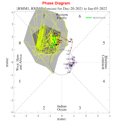
John had a good post earlier about phase 7.
-
What is showing up on modeling is a gradient winter storm track. It is WAY out there so please take with a grain of salt. It is likely that gradient is not in the right place. If modeling is just now catching the strength of the NAO, could be more suppressed. Also could trend north if the model is overplaying the NAO. Looks awfully familiar to last year.
-
Been up late at a veterinary hospital and up early! Things this AM look much better than 12z yesterday in regards to the LR pattern. Ensembles are workable. A lot of this hinges on which area of AN heights is stronger. Need both to weaken or the NAO to be stronger. Most importantly, need the big area of AN heights in the PAC to weaken or move closer to the coast. Those two scenarios bring the cold eastward.
-
The 0z GFS, and I have low confidence in any model right now due to huge swings, is basically showing what occurred last winter. The cold presses and multiple waves run it. That is the best run of the season so far. And with a block in place, that is the potential that is there...suppressed storm track with cold coming eastward in waves.
-
The 0z GFS is how one would expect that type of pattern to be...cold with multiple chances for ice/snow.
-
Honestly, that is super close to an long duration over running event. Not quite there yesterday, but a strung out front with ample precip. Night and day to earlier runs.
-
0z GFS is a vast improvement through 300. Snow(minimal but was a ridge earlier)threat for KY and SW VA on the 30th.
-
The 18z GEFS is how you would draw up a great winter wx pattern. NO IDEA if it stays there. Prob will change several times more. High in the GOA and building into Canada. NAO is textbook. There is some connection between the Alaskan and NAO block.
-
I use Pivotal, WxBell, and TT to name a few. I usually watch the models run on Wx Bell, because it is easier to watch trends. The 18z GEFS is a great winter weather pattern after 300. Flipped back from 6z/12z to 0z. Not often you see large scale features bouncing around that much over NA on an ensemble.
-
Not through with the run yet, but looks like the cold is going to get kicked eastward on the ensemble.
-
Models have no idea how to handle those two areas of blocking at this range. If the -NAO is stronger, the Pacific is likely weaker. Flip that around and the NAO is weaker. The 18z GEFS definitely accentuated the NAO this run, and temps are much cooler. Actually, the 18z would work really well. One thing that we have to consider is that there is some likely feedback over the West. I
-
I don't sweat temps(LOL) after d10. Pretty much just look at the trends at 500. Out to about 294, the -NAO is the dominant feature with the are of AN heights in the Pac being weakened. Hints of AN heights in Alaska which is a big change.
-
Thanks, it was your previous post I remember that from.....knew I had read that somewhere. Any thoughts on the models bouncing around? I do believe this year we see a repeat of November. Fall was warm during the first half and then the cold pattern of November slammed the door shut on that. Almost seems like that is repeating.
-
GEFS is still running. Looks like both blocking areas are less strong. We will see where that leads. Pac is substantially less strong. Honestly, modeling is just going to be nuts for a few days. I thought it would settle down once the typhoon dissipated. Nope.


