

Carvers Gap
-
Posts
17,401 -
Joined
-
Last visited
Content Type
Profiles
Blogs
Forums
American Weather
Media Demo
Store
Gallery
Everything posted by Carvers Gap
-
In NE TN, the heat wave has pretty much always looked bad on Saturday. That said, I think we may be seeing a pattern change where the heat shifts east and stays 3-4 weeks. I thought we might dodge the endless summer patterns of the past few years...looks locked in through the third week of September...that might be when the first cold shots arrive.
- 295 replies
-
- 3
-

-
- severe weather
- frosts
- (and 5 more)
-
Long term teleconnection winner for MBY in NE TN...AMO and it isn't close. Jeff had some great comments on the optimal accompanying teleconnections for that. When the AMO flipped during the late 80s, our winters changed over night. Maybe we still have 5-10 years before it flips back??? Seasonal teleconnections...MJO and then everything else. QBO, NAO and/or EPO, PDO(but moving up the list). I do think the MJO can trump most patterns. But what I really enjoy about all of this, that SSTs drive the boat in some form or fashion. That is a lesson that it took me a long time to learn. The MJO is very closely related to Nino/Nina status. When we have a La Nina, it is very tough to get convection over cold water at the dateline which is phase 8 of the MJO. When it is El Nino, convection near the dateline is more likely if we have a basin wide El Nino. But in all reality, seasonal forecasting is a true crapshoot. There are some strategies to get better outcomes (SSTs are a great option), but if you can hit the bullseye one out of every three winters...that is decent skill. By hitting the bullseye, I am talking longwave patterns. Snow is so random at this latitude. It is always amazing to me to think about those great, snowy winters...only to realize those winters would have been colossally terrible with the exception of a 10-14 day stretch. Those 10-14 day stretches of winter are nearly impossible to predict at this range. Also, optimal teleconnections differ quite surprisingly for eastern forum areas when compared to middle/western areas.
-
In weather, there are always counter examples for sure. And some winters, other things can over-ride the PDO such as the MJO, NAO, and just random things we don't think of (volcanic activity, AMO etc). I think lately, the PDO has been responsible for the trough going into the Mountain West regardless of other teleconnections. The negative phase really wants to pull that trough west.
-
Apple Wx app says 88 and rain. I am riding with it, because I don’t want to think about the other. LOL
- 295 replies
-
- 3
-

-
- severe weather
- frosts
- (and 5 more)
-
12z GFS/GEFS combo has backed off decently on temps. 12z Euro is HOT as is the EPS.
- 295 replies
-
- 1
-
-
- severe weather
- frosts
- (and 5 more)
-
There is one thing to never say to someone working in an ER. Don't say, "It sure looks quiet tonight." The Q word is something to never, ever say if indeed it is quiet. Maybe one other thing not to say, "It looks like fall is on modeling. The worst of summer is behind us." I am guilty as charged. This one is on me! As noted by John, there is an extreme heat wave showing on the GFS. The GFS tends to overcook things. What worries me? Modeling, ensembles and operationals across the board, are showing insanely warm air moving into our region later next week. It is still in the 7-10 day range, so there is room for some moderation(not really room for it to get worse...high end of extreme on modeling). We are talking 90F by 10AM on modeling w/ lows in the upper 70s to low 80s in even NE TN. Hoping that is going to be wrong. It looks temporary. Modeling has for sure been hinting at temporary heat later in the month...but as it comes into focus, it is far warmer than LR modeling had it. All-time highs would be at risk if modeling is even remotely accurate.
- 295 replies
-
- 2
-
-
- severe weather
- frosts
- (and 5 more)
-
The PDO is very important as sea temps in the eastern Pac correlate nicely with troughs or ridges in the West depending on phase. Sometimes, that index is the only one that matters. D'Aleo talked about it today. It is being stubborn in switching phases. I have seen great patterns completely muted by a PDO which is out of phase. East TN winters turned crappy around 2018...want to take a guess when the PDO flipped negative? Yup. Go find your favorite winter, and I bet most of them are weakly negative or positive. Strongly negative PDOs will park a trough in the West more times than not. During the past 6 months, I have really just about decided that it is probably the most important teleconnection for winters in E TN and maybe one of the least discussed. With very few exceptions, strongly -PDOs = bad outcomes(lack of stormy pattern). Somehow, it has to be connected to the QBO as the QBO mirror this quite nicely. https://www.ncei.noaa.gov/access/monitoring/pdo/ I do think the MJO is one teleconnection which might outweigh the PDO during winter. Again, and others have noted this, it all begins with SST in the Pac and IO. MJO looks decent this upcoming winter IMHO. PDO....it should start to rapidly ascend, but not sure it gets there by winter. Could be a close call. It "should" switch to positive with the expected El Nino. But again, look at the plot in the link...find your favorite winter if you live in E TN.
-
We are going to have to see that big ridge in the middle of the country breakdown before we see the first fall air masses slide into place. It is blocking cold air from moving eastward in the LR. I would look for tropical systems to begin to destabilize the North American pattern sooner than later, but it sure doesn't show that right now. Well, the CFSv2 always looks like the next ice age at the surfaces - always. So, if you need some feel good modeling, you can always turn to it.
- 295 replies
-
- 3
-
-
- severe weather
- frosts
- (and 5 more)
-
Yeah, of all the things to forecast seasonally....snowfall is the toughest and has very little skill. I often don’t include a lot of snowfall discussion in seasonal outlooks. The coastal areas adhere to pretty strong ENSO correlations...but this region is no slam dunk. I tend to like winters where the SST gradient is reset after La Niña. Snow in this forum are can be random at times. I do like the storm track clusters across seasonal modeling for the mountains...that would be one area where my confidence is slightly higher. Like Jeff says as well...there are some torch possibilities for all of us. Again, most of this by me is conjecture at this range with a heavy reliance on fickle seasonal models and SST trends.
-
Yeah, this wasn’t nearly as bad as a couple of weeks ago. Lots of lightning, but thankfully no wind. Looks like the storms re-intensified some once they crossed I-81. I was already looking at the backs of my eyelids by the time the storms reached the foothills. Super common here to have storms lose strength as the reach the city center if Kingsport and then re-fire once they hit Bristol. Winter snow squalls do something similar.
-
Several damage reports from Jonesborough just scanning social media. Carter Co was hit pretty hard as well. Lots of tree damage in Dennis Cove. Several school systems are closed today.
-
I am going to trend downward precip for middle and western areas. I got a bit carried away. Seasonal modeling does see less precip in those areas as the winter progresses.
-
I am just north of it. I can hear the thunder with it though.
-
I have managed to get simultaneously under two separate thunderstorm warnings and a tornado warning. Lots of lightning and Thunder.
-
This wx pattern is one which often favors E TN. I made no bones about it when it came to last winter's forecast for NE TN and SW VA- it was going to be sparse, especially towards the mountains. At this moment, I would literally flip last season's forecast for all regions of the forum area. "Right now" the Nino is depicted by seasonal modeling as shifting to a basin wide event by Jan. I think we start as east based and transition steadily to a basin wide event. The 90s were Nino predominantly = snow dome for Nashville. The 2000s have had many more La Ninas = often a good pattern for Nashville and points westward. SST forecasts are notoriously fickle - I have been burned more times than I can count at this range. Temps/Precip/snowfall: Dec: eastern forum areas: normal to above/above/below middle forum areas: normal to above/above/normal to below western forum areas: normal to above/above/normal to below Jan: eastern forum areas: starts above and moves to seasonal/above/seasonal middle forum areas: above/seasonal to below(edit)/below western forum areas: above/above/below Feb: eastern forum areas: BN to much BN / above / above middle forum areas: normal / seasonal to below(edit) / below western forum areas: normal /above / much below March: Yes, March during El Nino's eastern forum areas: BN / above / above middle forum areas: BN/ above / crap shoot western forum areas: BN/ above / crap shoot Overall Season (Dec-March): eastern forum areas: normal / above / normal to above middle forum areas: above / seasonal to slightly BN(edit) / below western forum areas: above / seasonal to slightly BN (edit) / below Over-reaching ideas: When it snows, the storms could be big. El Nino seasons are often not nickel and dime stuff. The primary pattern is coastal storms with secondary as inland runners. There are always some cutters - we live in the South! Cold sources will likely be an issue, but the storm track for E TN could potentially be good. As others have noted, east based El Ninos don't favor a good winter pattern for all but the most eastern sections of the forum areas. A super Nino which is east based is a bust for all regions. Basin wide(which I expect from mid to late winter) favors E TN and the NC mountains. I don't foresee week after week of snow on snow - unless you live in the mountains. What I do think we see are big storms which bring us to average - maybe even just one storm. The pattern should be active. The trick is getting the cold to get far enough south while the STJ is absolutely ripping. I think the MJO will favor trips into colder phases as plots 7-8-1 should have active convection. The PDO is the wildcard...to repeat...the PDO is the wildcard. To have a banner winter, we need it to flip from its phase last winter. Of note: Seasonal forecast is often woefully inaccurate. I am basing my forecast on the Pacific driving the pattern - ridge out West, mean trough in the East. Get that trough east of Hawaii(per the Euro seasonals), that is a money pattern. As always, it is important to remember that we live in a place where it wants to rain for about 48 weeks out of the year. In Wyoming it is rare to see rain during DJFM. Here, it is quite the opposite in the sub tropics. It wants to rain. But...there are times when we can coax a decent pattern from the chaos.
-
Had some hail in Knoxville this afternoon as well.
-
Our forum area is what he is referring to. We have dealt with 3 straight Nina summers which have been scorchers in this region. We probably have one more heat surge to deal with. The Upper South has not been near as hot as the GC states. It is super rare to have 70s as highs IMBY during August. I was working a couple of days ago mid-day and probably could have used a jacked as drizzle came down. In some cases, we are 20-25 degrees cooler than previous Augusts. All of that said....we aren't out of the woods quite yet. Unrelated to Blizzard's post, I was thinking today that the leaf season should be really good this year as we aren't in a drought and trees aren't stressed due to heat(at this point). If we can get a nice cold shot by mid-late September(just overnight temps), could see a really good leaf season. All of this rain should help.
- 295 replies
-
- 3
-
-

-
- severe weather
- frosts
- (and 5 more)
-
Was on the UTK campus when the deluge hit today. I am not sure I have ever seen that much water running down Lake Avenue(lived up to its name!).
-
One day of May during August is all bonus. LOL.
-
Feels like May outside......
-
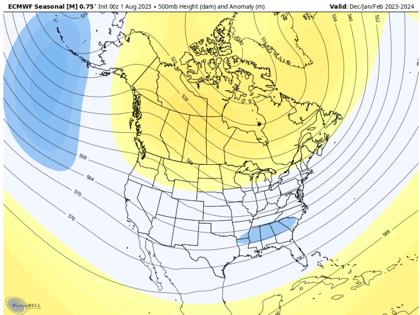
I'll drop this in here as well.. .
-

Fall/Winter Banter - Football, Basketball, Snowball?
Carvers Gap replied to John1122's topic in Tennessee Valley
Man, those are significant burdens just by themselves....and all at once, that takes some strength to carry(strength which you have). If there is anything that we can do to help, please let us know. I am the worst at having the right thing to say, but just know that you have been missed. -
78F in the afternoon of August 8th. Can you believe that? Is the worst of summer behind us? Might be. I can see one last push of heat to end the month and maybe begin Sept, but after that...average highs begin to drop quickly. So, even AN temps by mid-Sept are tolerable. Clock is ticking.
-
Fall/Winter Banter - Football, Basketball, Snowball?
Carvers Gap replied to John1122's topic in Tennessee Valley
@Holston_River_Rambler, paging the rambler. Anyone talked to Holston lately? Just checking on you, man. -
Tornado warning to the southwest of Johnson City.