jm1220
-
Posts
26,187 -
Joined
-
Last visited
Content Type
Profiles
Blogs
Forums
American Weather
Media Demo
Store
Gallery
Everything posted by jm1220
-
Lots of inlets and bays too that will funnel the surge. This is gonna be a bad one for a lot of people. Looks like people there are taking it seriously though and getting out.
-
Extremely symmetrical/well defined eye. Just about picture perfect satellite presentation and definitely primed to go. Fort Myers looking like it’s in a really tough spot. I guess the one hope this doesn’t bring hurt on a lot of people is it somehow keeps trending south past Naples. That whole Tampa to Ft Myers area has exploded in population as others have pointed out, so there’s really no “good” landfall area in that stretch, and it’s also very surge vulnerable especially with a larger storm like this.
-
Today’s LOL-flooding lake effect rain north of Syracuse. Can’t say I’ve seen flash flood warnings for those before or 4-6” of rain from lake effect streamers. Lakes must be really warm for that to happen.
- 1,529 replies
-
- 2
-

-
- hurricane
- tropical storm
- (and 1 more)
-
We had a drought for maybe 2 weeks up here lol. More like an average dry spell.
-
At this point it’s hard to say. The rainfall boundaries have kept setting up like this over northern NYC and northern LI. From time to time the sea breeze boundaries cause more rain to develop over central/northern LI but it’s been so excessive that it can’t be the overall story.
- 1,529 replies
-
- 1
-

-
- hurricane
- tropical storm
- (and 1 more)
-
Yep, looks like the rain is edging north again. It's just unbelievable how persistent this is over months now.
-
Rain starting up again. I have 1.3-1.5" already by radar estimate. And finally S Nassau getting in on some of the action.
- 1,529 replies
-
- 1
-
-
- hurricane
- tropical storm
- (and 1 more)
-
I don't think any hail here but it's an absolute gusher.
-
Downpour, frequent lightning. We'll see if any hail makes it here.
- 1,529 replies
-
- 1
-
-
- hurricane
- tropical storm
- (and 1 more)
-
Looks like a hail core around Albertson area headed toward Jericho.
-
About to get rocked here, loud thunder currently
-
Opal had the pinhole eye that essentially folded like a house of cards. I guess once it gets to that high category state it needs perfection especially when the core is that tiny. Anything goes wrong and it collapses. I'm sure the dry air near the continent helped too. This one does seem to be more at risk at having that 1990s-2000s Gulf half-a-cane outcome if the departing trough throws down too much dry air. But the Gulf is untouched this year by any hurricane so who knows how long this could sustain for in the N Gulf.
-
You live through something like that once then believe me, you never want to again. NYC area after Sandy was mostly pure hell for a month after especially where the surge hit. My town had no drinkable water for 10 days and no power for a month along with the huge surge damage. And Fiona was worse for these people.
-
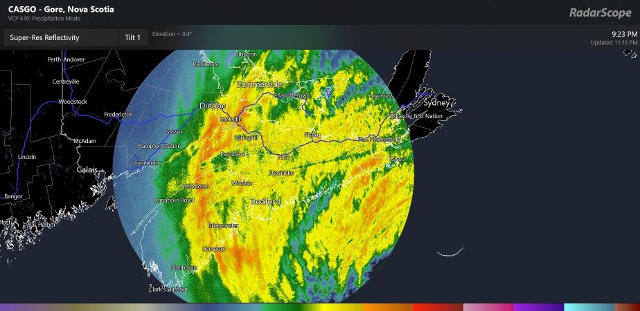
Wonder how much that sting Jet remains but I’m sure that means business. Sable Island gusted to 120mph on that jet?
-
Yep that's not an eyewall anymore, it's more like a frontal boundary now.
-
I'd bet where those small cells come onto land, that very strong winds are happening there. During Sandy those were where the really strong (80-90mph gusts) mixed down. And the sting jet behind the center would be another spot.
-
Where those “cells” are popping up to the right of the center will likely have the strongest winds.
-
NYC can definitely get hit by a major Hurricane in the right setup. 1938 could’ve hit 100 miles further west, Gloria could’ve been a real major if it wasn’t annihilated by dry air, etc. The 1893 Hog Island Hurricane may have been a major. We’re due for a stretch again like 1938-1960 where we had numerous strikes nearby.
- 1,529 replies
-
- 2
-
-
-
- hurricane
- tropical storm
- (and 1 more)
-
But I mean-it is post tropical. It doesn’t have a symmetric warm core CDO anymore for sure, and you can see for the last few hours the cold air stratocumulus wrapping into the storm. There’s also the classic baroclinic leaf growing out NW of the storm. Takes nothing away from its destruction and I think Environment Canada will treat “post tropical hurricanes” differently after this storm. Thank goodness it’s not headed directly into Halifax or just west.
-
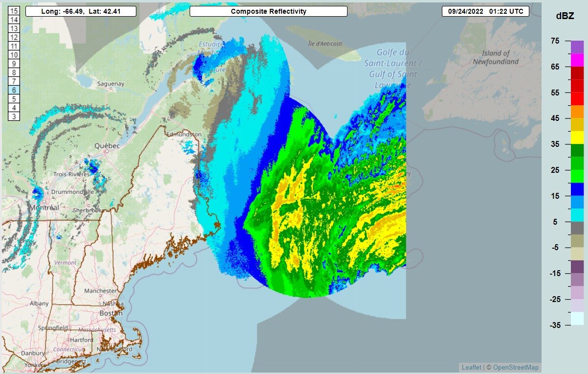
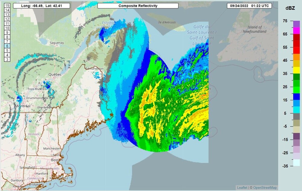
Same evolution as Sandy so pretty much the same result except a good bit worse because of the marine heatwave in the area and it being a month earlier. Judging by the radar a bit of west movement now? Sandy was 945mb at landfall, looks like those insane model runs in the 920s-930 will be right. Yikes.
-
Yep, once it happens it’ll be quick.
-
On the satellite you can see the beginning of the tug back to the left in the direction of the high clouds. They seem to be backing to the left somewhat already.
-
When the interaction happens it can be yanked left pretty quick. I remember how much speculation there was that Sandy would end up over eastern LI because it kept trucking NE, but it turned left almost on a dime when the trough dove in.
-
As it's transitioning it'll still have the calm center. The worst winds will likely happen a ways east of the center. It'll look something like a regular nor'easter when it comes ashore with all the steady rain west of the center but this obviously is incredibly worse.
-
After this storm they will, trust me. At the end of the day surge will be the biggest story from this. The fetch this will create is immense due to the expanding size and pre-existing intensity. Again thankfully it isn't a 100 mile or west track or that surge would be headed into Halifax and that would.... suck.