

Met1985
-
Posts
16,564 -
Joined
-
Last visited
Content Type
Profiles
Blogs
Forums
American Weather
Media Demo
Store
Gallery
Everything posted by Met1985
-

2025 Spring/Summer Mountain Thread
Met1985 replied to Maggie Valley Steve's topic in Southeastern States
Storms already firing in Haywood and down into Jackson County. I know home has already seen two storms this morning. -
No rain in Concord but this morning already feels freaking amazing compared to earlier this week. Current temp is a cool 75.
-
90 degrees here in Concord. Yeah you can cut the air in two today. Hopefully we get some pop up storms today.
-
2025 Spring/Summer Mountain Thread
Met1985 replied to Maggie Valley Steve's topic in Southeastern States
Looks like south central mountains are getting hit. NWS says im at 72 with a storm. -
97 here in Concord.
-
Yeah crazy pattern. This spring has been weird.
-
2025 Spring/Summer Mountain Thread
Met1985 replied to Maggie Valley Steve's topic in Southeastern States
Truth! -
And inner mountain west just had a foot of snow this past weekend.
-
2025 Spring/Summer Mountain Thread
Met1985 replied to Maggie Valley Steve's topic in Southeastern States
That place is a desert lol. -
2025 Spring/Summer Mountain Thread
Met1985 replied to Maggie Valley Steve's topic in Southeastern States
Yep looks like some big storms blowing up. So much for the heat and drought talk by some. This is run of the Mill stuff we are dealing with. Sent from my SM-G998U using Tapatalk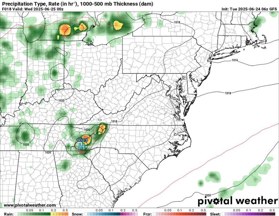
.thumb.jpg.9cc95a3a531350d83c2dc2c9815d2c62.jpg)
.thumb.jpg.d3df27dac437231bb04d232d07c79643.jpg)
-
2025 Spring/Summer Mountain Thread
Met1985 replied to Maggie Valley Steve's topic in Southeastern States
Yeah Thunderstorms are going to be roaring back to life in the mountains starting tomorrow through the weekend. -
85 this morning in Concord
-
Truck temp says it's 98 in Concord at the moment.
-
2025 Spring/Summer Mountain Thread
Met1985 replied to Maggie Valley Steve's topic in Southeastern States
Asheville airports normal is 84 and 63 currently. We will only be about 5 degrees above normal this week and we will be hitting right at normal for lows. Actually my current temp is 59. -
2025 Spring/Summer Mountain Thread
Met1985 replied to Maggie Valley Steve's topic in Southeastern States
Looks like this heat wave will be short lived. Better chances of storms by Thursday and temps cooling back down to the lower 80s by the weekend. Typical summer weather. -
2025 Spring/Summer Mountain Thread
Met1985 replied to Maggie Valley Steve's topic in Southeastern States
Today being the summer solstice marks the longest day of the year but also marching us towards Fall every single day. Also our days will be getting shorter so summer can suck it... -
2025 Spring/Summer Mountain Thread
Met1985 replied to Maggie Valley Steve's topic in Southeastern States
An awesome summer day today. My high today was 75 degrees. It's going to get warm but it's summer. Nothing new -
2025 Spring/Summer Mountain Thread
Met1985 replied to Maggie Valley Steve's topic in Southeastern States
Nice! We are getting hammered in Brevard currently. -
2025 Spring/Summer Mountain Thread
Met1985 replied to Maggie Valley Steve's topic in Southeastern States
Freaking amazing brother! -
2025 Spring/Summer Mountain Thread
Met1985 replied to Maggie Valley Steve's topic in Southeastern States
Speaking of we've been issued a severe Thunderstorm warning down here in Transylvania County. Severe Thunderstorm Warning for... North central Elbert County in northeastern Georgia... Central Hart County in northeastern Georgia... Transylvania County in western North Carolina... Henderson County in western North Carolina... Southwestern Polk County in western North Carolina... Greenville County in Upstate South Carolina... Anderson County in Upstate South Carolina... Pickens County in Upstate South Carolina... Northwestern Abbeville County in Upstate South Carolina... Oconee County in Upstate South Carolina... * Until 915 PM EDT. * At 812 PM EDT, severe thunderstorms were located along a line extending from 14 miles north of Walhalla to 5 miles west of Pickens to 9 miles northeast of Elberton, moving northeast at 35 mph. HAZARD...60 mph wind gusts. -
2025 Spring/Summer Mountain Thread
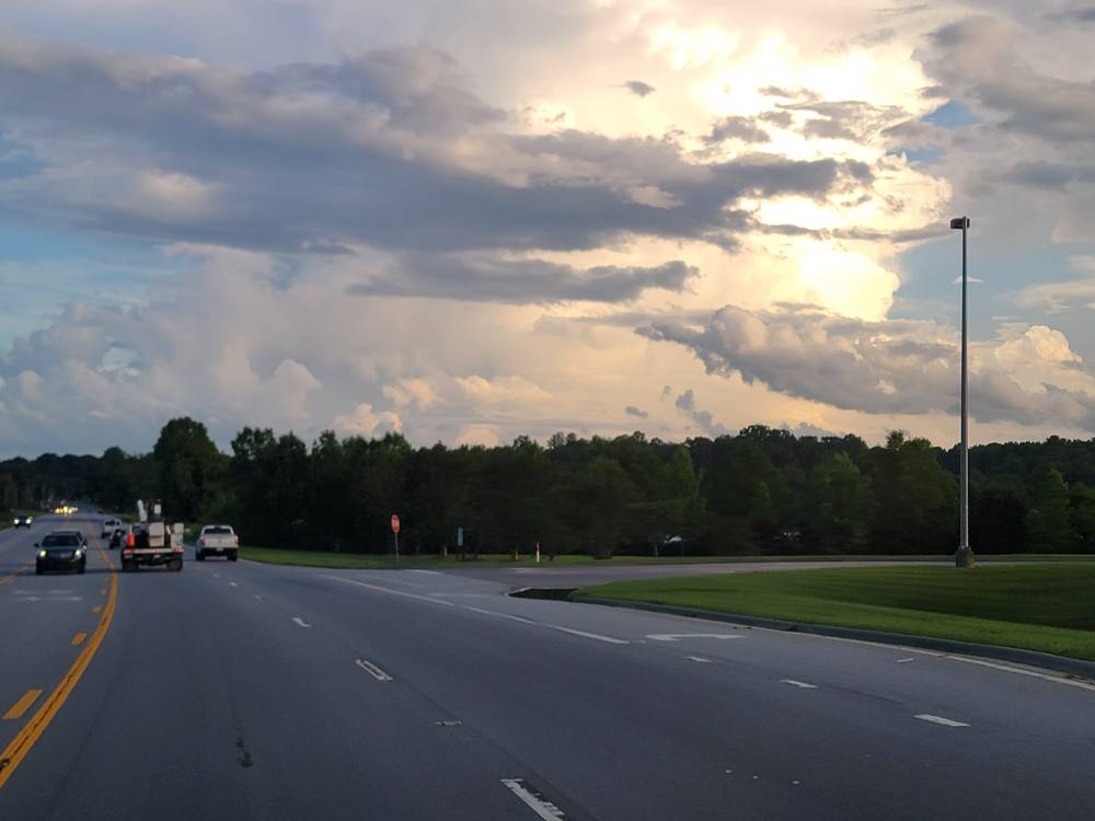
Met1985 replied to Maggie Valley Steve's topic in Southeastern States
I bet especially at your elevation. These clouds tops are beautiful. Big storms rolling in from SC. Im in Brevard tonight. -
2025 Spring/Summer Mountain Thread
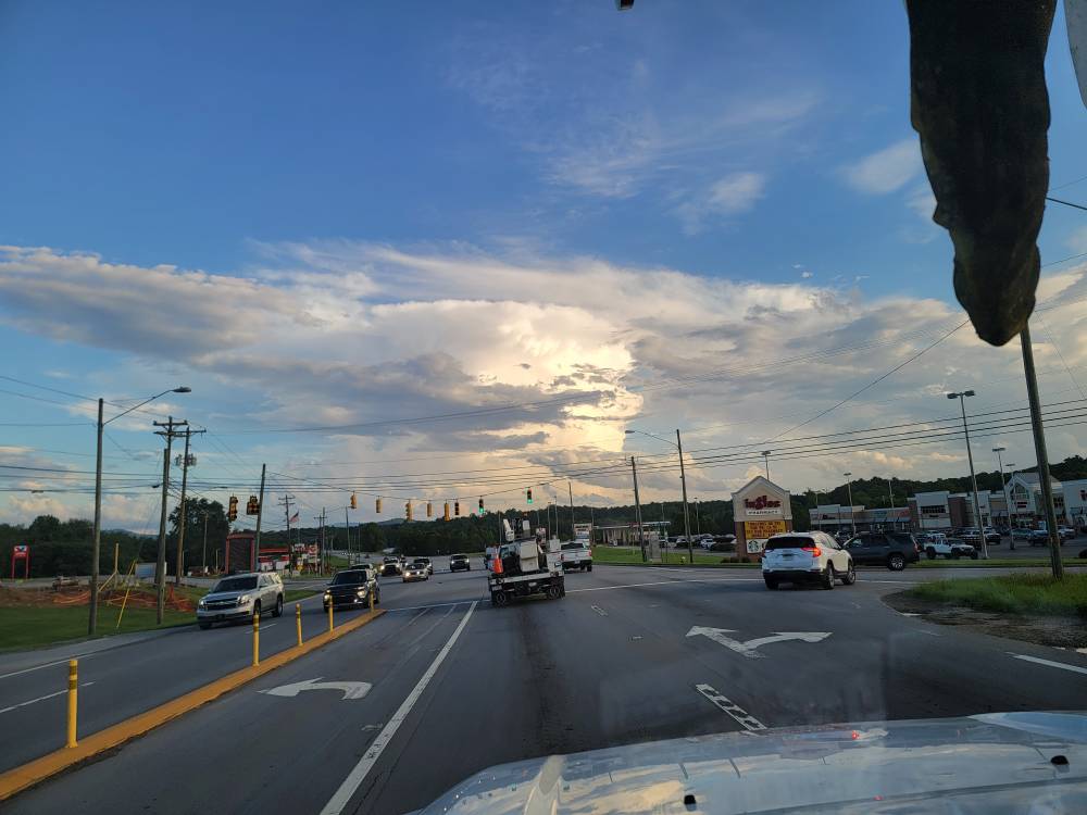
Met1985 replied to Maggie Valley Steve's topic in Southeastern States
Absolutely beautiful thunderstorm heads this evening. Sent from my SM-G998U using Tapatalk
-
2025 Spring/Summer Mountain Thread
Met1985 replied to Maggie Valley Steve's topic in Southeastern States
Beautiful sunrise this morning. Sent from my SM-G998U using Tapatalk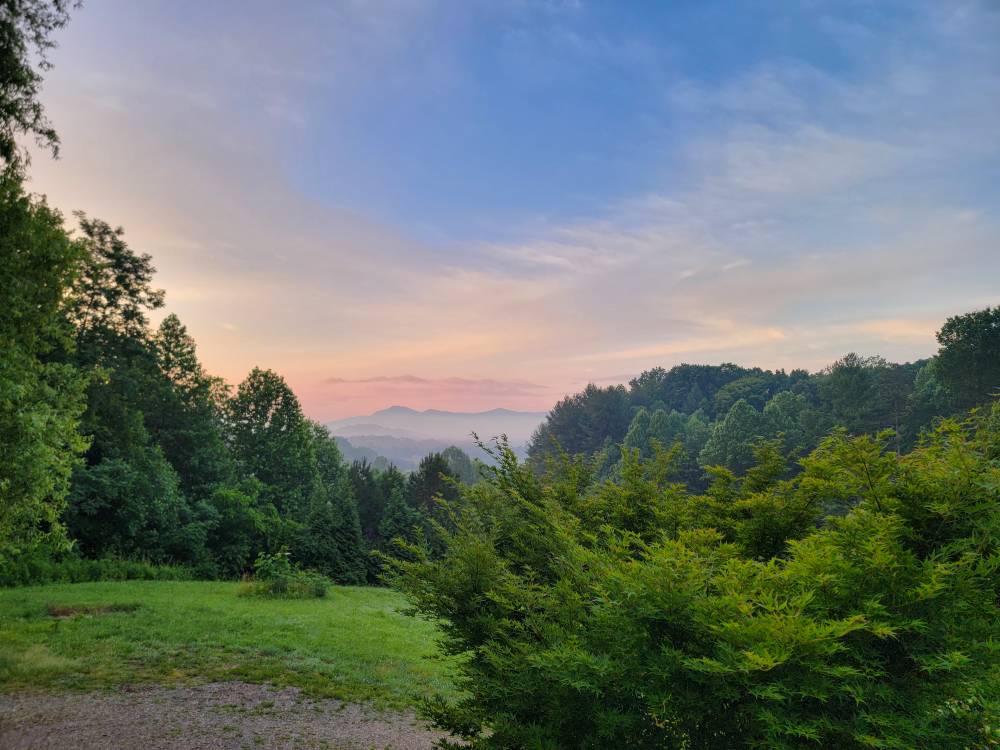
-
2025 Spring/Summer Mountain Thread
Met1985 replied to Maggie Valley Steve's topic in Southeastern States
I saw your post in the obs thread. Ywah this has been one wet spring. Especially this late in the season. -
2025 Spring/Summer Mountain Thread
Met1985 replied to Maggie Valley Steve's topic in Southeastern States
If your tired of the rain then buckle up because it looks like we are going to enter another very unsettled several days starting tomorrow evening through the weekend.


.jpg.41d22948f216c54a2eca987a83b08f3b.jpg)
.jpg.9d9054c21fbb1ec8f558f1c0f664e444.jpg)