-
Posts
2,559 -
Joined
-
Last visited
Content Type
Profiles
Blogs
Forums
American Weather
Media Demo
Store
Gallery
Everything posted by RogueWaves
-
Winter 2024-25 Medium/Long Range Discussion
RogueWaves replied to michsnowfreak's topic in Lakes/Ohio Valley
-
Half inch over here as well. The winds this evening are the worst I've seen in months. Lots of blowing across 127 and a snow devil thrown in for fun. Saw drifts in one open area about 4 foot or so. Today's dusting plus Monday's dumping that didn't pack down too tightly gave the winds something to work with up here. Could only imagine if we had these winds with some decent snow falling.
-
I thought your region just scored with Monday's system?
-
Come on! SE Ridge
-
I've noticed the seasonal total maps don't capture the small LES dustings that add up to a few inches in some seasons.
-
1) I've followed it for years and this is the first time I've seen it glitch horribly like that. Even the NOHRS map showed nothing here. Makes me wonder if the satellite indeed had an issue. 2) I have eyes on the ground for this region, so I'm not guessing as to whether its correct here or not, I can see plainly where its missing the mark.
-
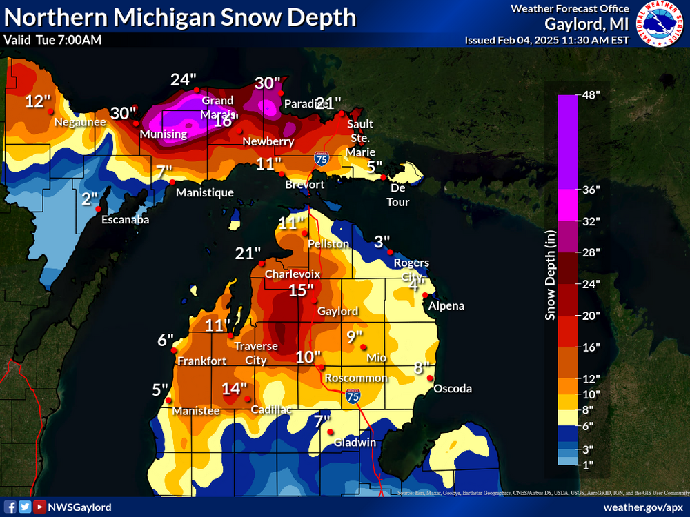
Almost as frustrating in a season where snow depth is at a premium is weeks of NWS offices map showing barely any snow OTG in yby when you've had a decent snow pack all the while. FINALLY after yesterday's decent hit, something snapped their satellite back to reality and I have a much more accurate map for Harrison
-
Mistake by the lake. Even in the snow dept. Feel bad for any winter enthusiasts living there.
-
-
-
Had 70% more than DTW but my biggest was only 2.5" lol. The contractor that does the supermarket parking lot across the road from here is fond of "chemical plowing" and with so many nuisance tiny snows, there are ZERO large piles you'd typically see in mid-winter. So far, its one of the strangest winters I can remember personally.
-
Were you expecting that much?? Sounds like it overperformed up there and the opposite down here.
-
Seen them all make bad calls this winter. I'd like more SN than Ice. Meet in the middle works for me.
-
Shoveled 0.8" off the driveway and took numerous measurements at 5-6" in the back/side yard. Both APX's and the NOHRS snow maps make it look like we have an inch or nothing (SMH). I posted elsewhere that I drove south yesterday to Midland and the snow drops off dramatically just 6-8 mi south of here.
-
0.8 fell here this morning. Cold dense upper teens mid-winter variety. This system looked better organized on recent model runs than what transpired in the end. 5-6" measured numerous places imby today.
-

Winter 2024-25 Medium/Long Range Discussion
RogueWaves replied to michsnowfreak's topic in Lakes/Ohio Valley
Funny post, but the EC actually doubled-down today, lol -
Howell magnet this winter I see. Really like that place and would've been glad to live there. The old west style shoot-out between railroads building there is pretty wild stuff.
-
I've had that same thought for a few weeks already, and the snow and cold down south just reinforced it. I remember 86-87 being like that in SEMI. Meanwhile, I've had 7 straight days of measurable snow totaling 5.9" and its 10F right now. Like in late Dec, we get our best snow cover leading into a torch - sigh.
-

Fall/Winter '24 Banter and Complaints Go Here
RogueWaves replied to IWXwx's topic in Lakes/Ohio Valley
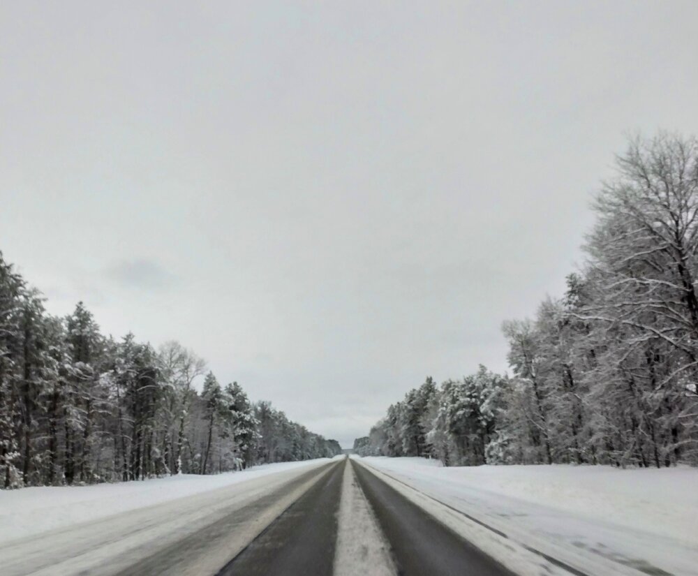
My complaint this morning was too much snow on the x-way. Roscommon hadn't touched S 127 so it was basically two tire ruts in the slow lane, and 4" in the passing lane. You're at the mercy of the slowest snail driver. -

Fall/Winter '24 Banter and Complaints Go Here
RogueWaves replied to IWXwx's topic in Lakes/Ohio Valley
Threading needles has even ceased - sad times -
This helping out no doubt Drifts were massive after work in near bliz conditions - worst since Dec's clipper delivered all those Squall Warnings.
-
5" in my grid for the expected clippers
-
Just measured 1.3" new snow from this evening. Had just cleared the driveway this afternoon from yesterday's hit. 1-2 inches in my forecast for next clipper Monday. That one actually has the look of doing better. Picked up a nice metal yard stick that can penetrate down through the crusty under covering making accurate depth measuring much easier. Knocking on the 30" door and exactly 50% of an avg season - we winter
-
-

Winter 2024-25 Medium/Long Range Discussion
RogueWaves replied to michsnowfreak's topic in Lakes/Ohio Valley
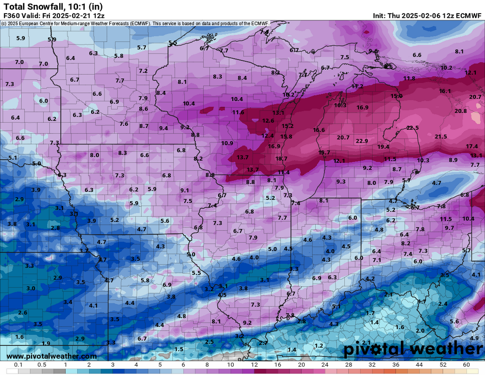
Looking more and more like a repeat of late Dec. We finally lost the cold NW flow and promptly got ice and rainers, then right back to cold NW flow.


