Big Jims Videos
-
Posts
3,124 -
Joined
-
Last visited
Content Type
Profiles
Blogs
Forums
American Weather
Media Demo
Store
Gallery
Everything posted by Big Jims Videos
-
Not expecting anything of significance at the beaches today. Maybe some gusty winds toward the afternoon.
- 527 replies
-
- 1
-

-
- flash flooding
- river flooding
- (and 2 more)
-
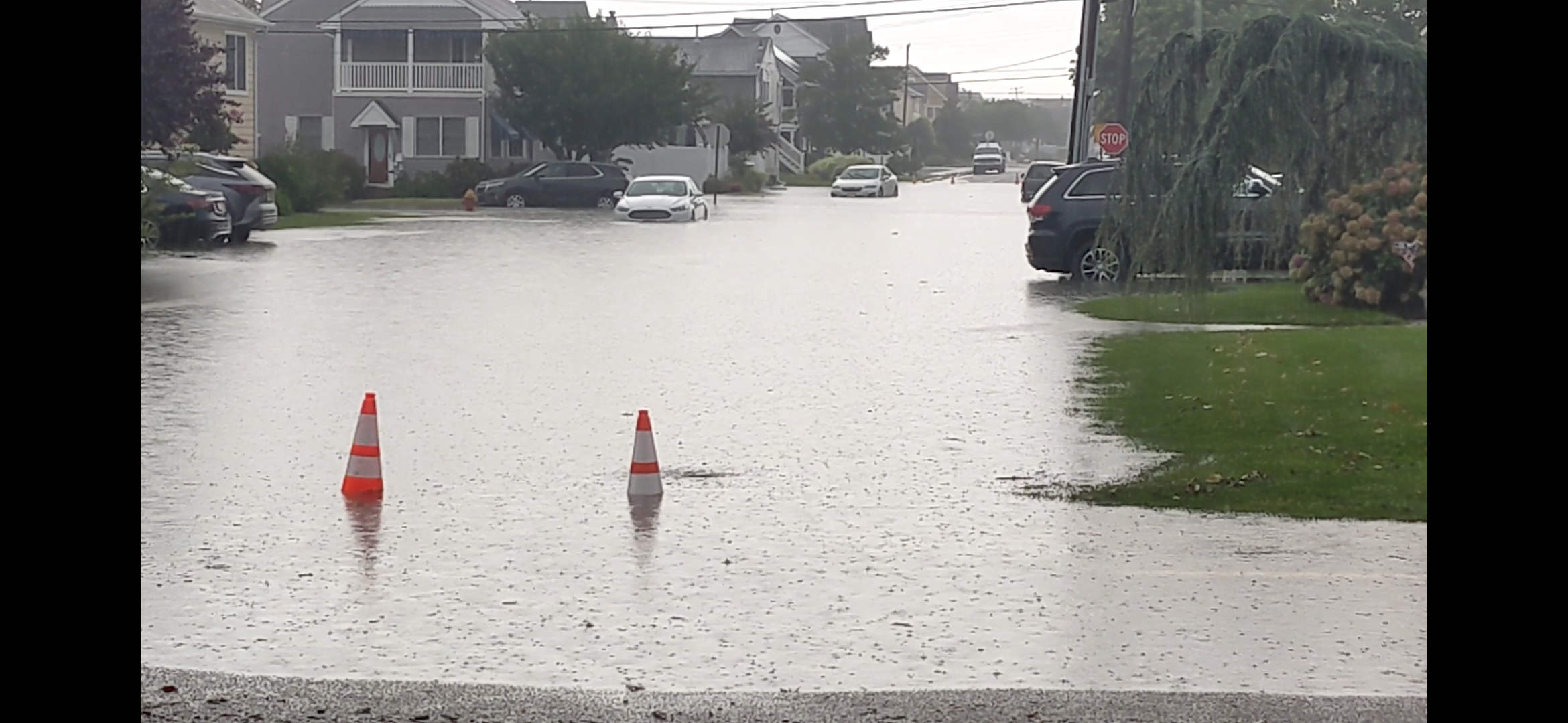
We flood. Point Pleasant Beach. Pretty much inaccessible at this point.


- 527 replies
-
- 3
-
-
- flash flooding
- river flooding
- (and 2 more)
-
At a meeting in Freehold today. More of the same. Heat index 105, air 92. Absolutely oppressive outside.
-
Very glad this thread was started to follow along without having to wade through the disaster that is the tropical threads. Can a mod jump in and help out over there please? Thanks! Also growing concerned for tomorrow along 195 corridor.
- 527 replies
-
- 3
-
-

-
- flash flooding
- river flooding
- (and 2 more)
-
Feels hotter than yesterday here in central NJ. Absolute misery outside - in Toms River by the courthouse now.
-
Repeatedly hot and dry along the 195 corridor. Lawns are brown/crispy here in Central NJ.
-
looks like it will be an Open the Windows At Night weekend. Finally.
-
This is annoying on so many levels. Gives everyone who works in media a bad name.
-
Just got back from Trenton/Robbinsville. Absolutely brutal again with index values nearing 105-110.
-
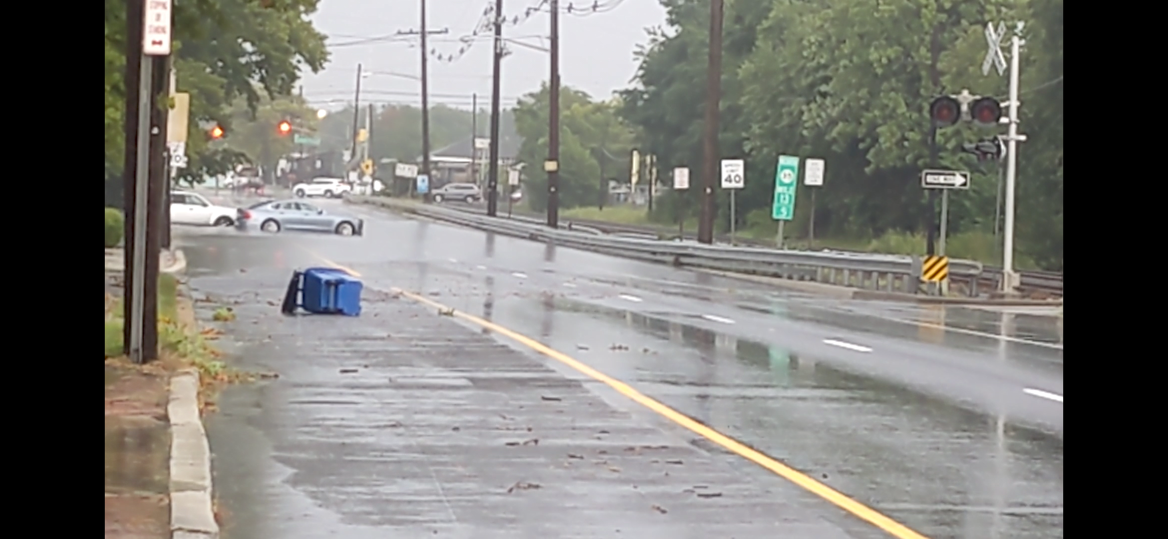
Just got absolutely pounded in Point Pleasant Beach with wicked lightning and flooding. Some minor property wind damage (fence blew down) at a neighbor's yard.
-
My cousin from NJ is in Montego Bay stuck while on vacation. She says no power but getting breezy. Nothing to note so far. Messenger_creation_21369813-2038-4540-9e75-30fb2924fee4~2.mp4
-
I'm down by the beach where we had morning showers dewpoints are approaching 80, haven't felt this muggy outside since maybe September 2022
-
Nasty storm just knocked out our power in Point Pleasant Beach with round two already lighting up the sky to the west.
-
West winds and southeast winds cause upwelling here along NJ east facing beaches. What we need is light or no wind or northeast wind (which brings rough conditions) to warm up the water again.
-
The ocean yesterday at parts of the Jersey Shore was 58 degrees. Hopefully we can get a wind shift.
-
Brush fire on the Parkway south of Toms River. The grass is getting dryer.
-
Let's see how much of that activity is actually left by the time it reaches the beach communities.
-
Memorial Day Weekend 2021 disagrees with you. 50 degrees 3 to 4 inches of rain - complete and total washout.
- 1,603 replies
-
- 4
-
-
- spring
- cool temps
- (and 3 more)
-
Yesterday I was actually able to sit outside for a few hours under blue skies and warm temperatures, only the third time this year on a day I wasn't working.
- 1,603 replies
-
- 1
-
-
- spring
- cool temps
- (and 3 more)
-
25/12/4
-
Putting together a story for tonight on if we get rain this weekend it will be the 12th consecutive one - going back to March 2nd. Absolutely miserable out there. Whoever enjoys this, I have to agree with Liberty Bell on this topic, is not normal.
- 1,603 replies
-
- 3
-
-
- spring
- cool temps
- (and 3 more)
-
Tell that to the folks in Mullica Hill, NJ. My aunt and cousin moved to Wichita suburbs last year because "we needed a change." And I doubt you have no interest in severe weather on a weather forum lol. We all do. It's human nature. Do we want to see it happen to us? No. But we are interested in it.
- 1,603 replies
-
- 2
-

-
-
- spring
- cool temps
- (and 3 more)
-
Severe Weather 5-6 through 5-9-24
Big Jims Videos replied to cheese007's topic in Central/Western States
Following this today from back east. I have close family who just moved to outside of Topeka from the Jersey Shore and they're kinda freaked out by the local hype. Hopefully they're just north of the major impact threats there. -
8 hours from Plattsburgh to Point Pleasant Beach in a drive that usually takes 5. Worth every minute.
-
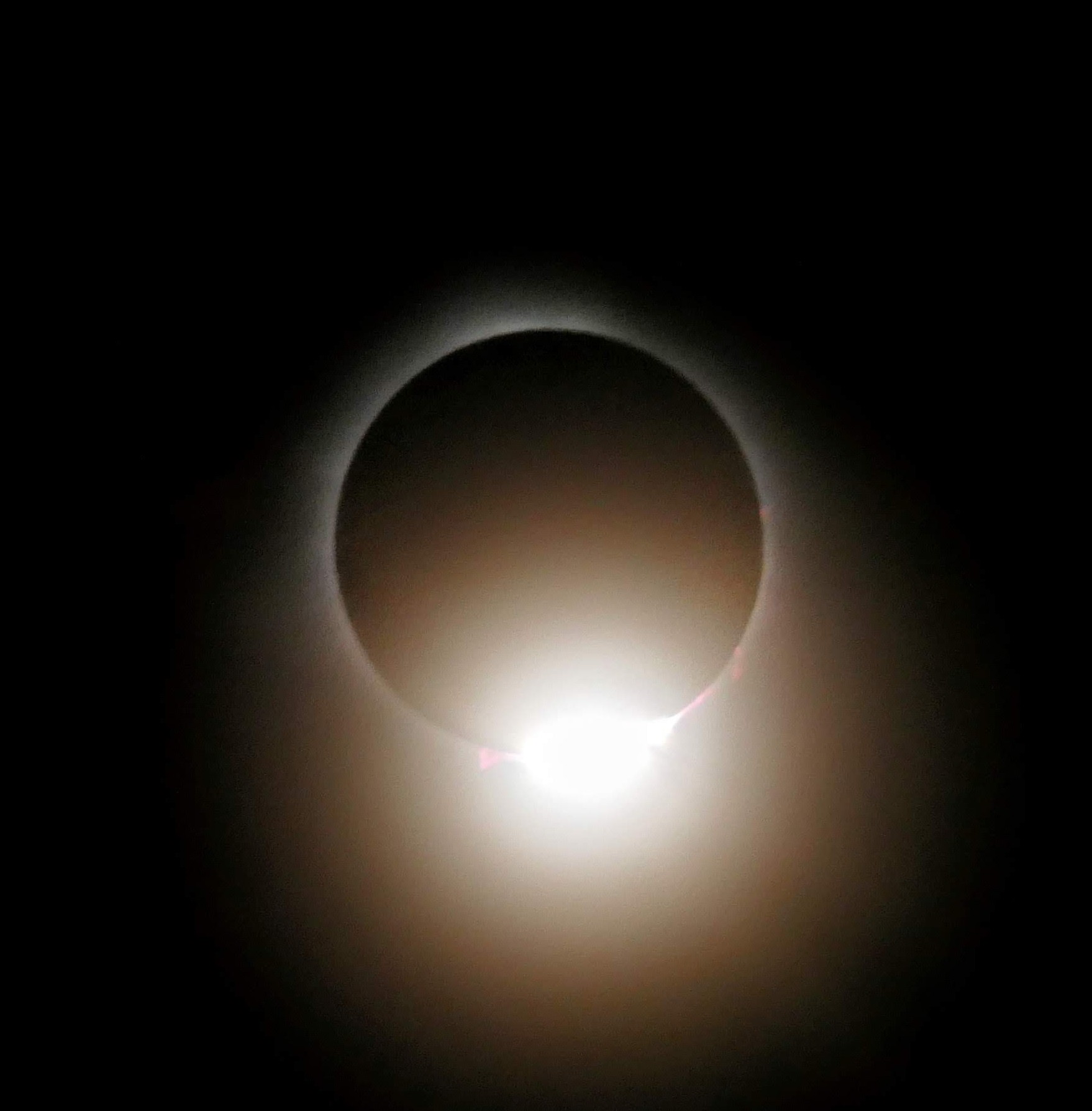
Totality in Plattsburgh. The few high clouds had zero effect of the eclipse comparing it to 2017 in South Carolina. Saw both diamond ring phases and we were treated to Baily's Beads throughout totality. It's tough to see here