

Big Jims Videos
-
Posts
3,123 -
Joined
-
Last visited
Content Type
Profiles
Blogs
Forums
American Weather
Media Demo
Store
Gallery
Everything posted by Big Jims Videos
-
Snowfall NYC subforum Jan 6 and OBS if needed
Big Jims Videos replied to wdrag's topic in New York City Metro
Icon with a much slower exit as some Atlantic moisture lingers over Jersey. Interesting solution. -
Then you read on to see the hyped forecast post is sponsored by Big Al's Travel Deals and Snow Blowers. So not only are they playing off hype mongering, but they're also profiting off of telling others not to do this, then doing it.
-
It's the hypocrisy of the social media weather fan pages that crack me up. They're all "don't post hour 300 maps bc so much can change" and then they post it and say *this is the image circulating around Facebook etc. I'm posting it to give you the truth about it." Yet they're posting it for clicks and are jealous of the pages that do it first.
-
we didn't get nearly as much at my place as they did down south - LBI down to AC jackpotted in that - I did get to stand in it on the AC boardwalk all morning which made up for the loss at home.
-
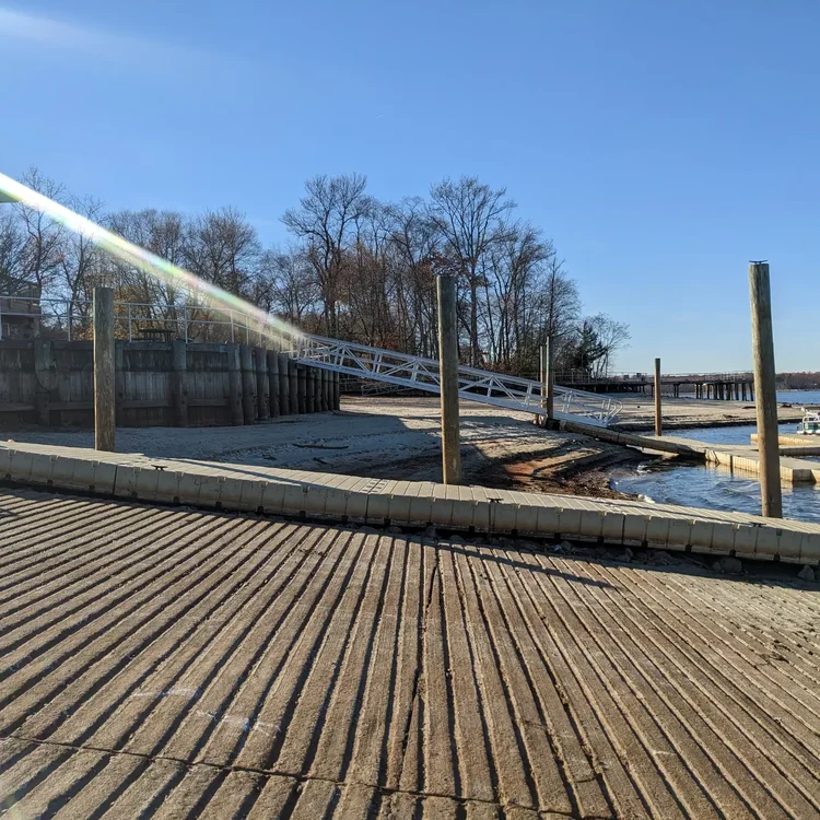
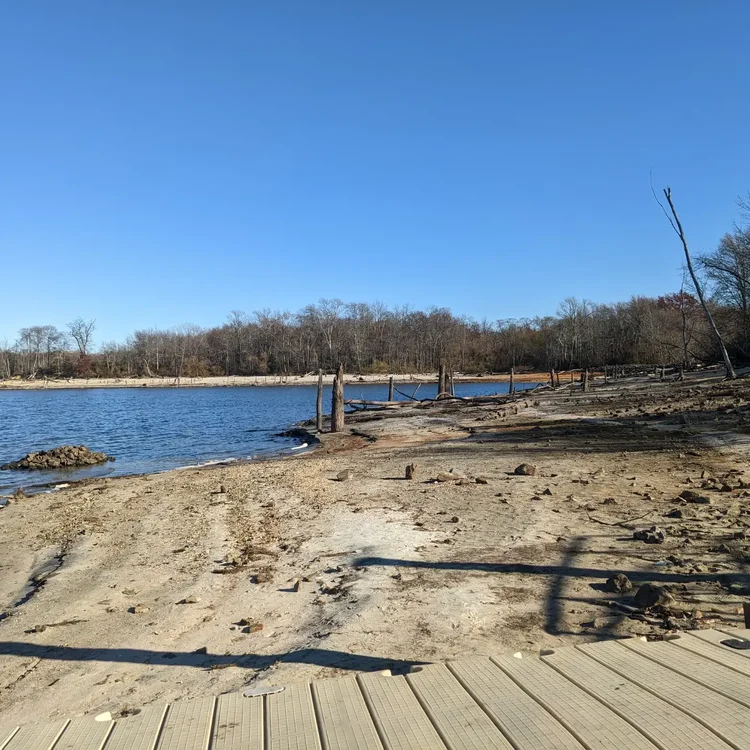
haven't had a decent storm at my place along the beach since January 2018 when we got 22 inches and 5 hours of blizzard conditions - west of the parkway amounts dropped off significantly. We failed to get an inch the last two winters.
-
First frost this morning at the beach. One of the latest I can remember. Ever.
-
Lightning here in Ocean County
-
Manasquan reservoir now sitting just under 52% capacity
-
DROUGHT WARNING coming to NJ statewide tomorrow - governor will likely announce late morning.
-
you missed nothing except New Jersey is on fire.
-
.1 at the beaches. More fire risk this week.
-
November is on average one of the drier months. We'll see what happens.
-
Cranberry farmers are taking a serious hit - especially if we don't get rain in November - this is my piece from yesterday. I love visiting these farms - the visuals are stunning. https://newjersey.news12.com/farmer-weeks-without-rain-is-impacting-new-jerseys-cranberry-harvest
-
Spent the day at a Pinelands cranberry farm - these folks REALLY need water as they're right in the middle of the harvest.
-
Really concerned Thursday for fire spread. The military base fire still burning at Ft Dix looks like a mushroom cloud and visible all the way from the beach bridges today.
-
Here's my piece on the fire risk and drought conditions from yesterday https://newjersey.news12.com/fire-officials-ongoing-droughts-cause-risk-of-wildfires-in-new-jersey
-
Heading to the NJ forest service tomorrow to speak with our NJ FFS officers on the late season fire dangers - It's a busy season for state parks for camping this time of year and there are many restrictions now in place with open fires. If you know anyone heading out camping or hiking, let them know the risk is unusually high for October. We've had a series of fires down in Burlington County this week.
-
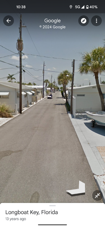
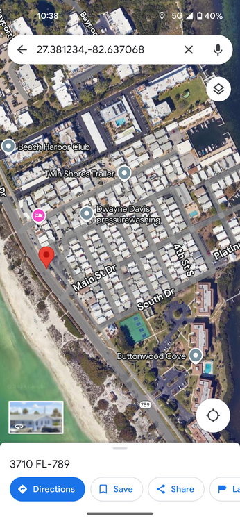
A viewer here in NJ texted me a photo of her second home on Longboat Key today. She was worried what would become of it bc they shut the gas and electric off at noon today so she lost her live feed. It resembled one of the cottages on Barnegat Bay Island that was swept away during the S storm we dare mention in Brick Twp back in 2012. No stilts, nothing. I told her it's gonna be gone. I was just down there in February and the amount of development miles inland is mind boggling. We're watching probably the first or second costliest us hurricane ever and it's all just a wait and see. The photos below show the location. It's smack dab in the middle of Longboat. They all lost the protective dunes during Helene. It's sickening what's about to unfold.
-
12z GFS gives us ZERO precip through the run lol
-
Beautiful and dry outside. Laying out and grilling today. It's like part of the September we lost out on
-
We haven't turned on the heat or AC since before Labor Day weekend. Amazing stretch of weather here.
- 1,154 replies
-
- 4
-

-
- tropics
- heavy rainfall
- (and 3 more)
-
Down down yellow and brown. All the leaves are falling down. Driving around coastal NJ it's really really really dry.
-
Here ya go! https://newjersey.news12.com/cheers-new-jersey-wineries-poised-to-have-great-harvest-due-to-drier-weather-this-year
- 1,154 replies
-
- 6
-
-

-
- tropics
- heavy rainfall
- (and 3 more)
-
Working on a story today about how this dry stretch of weather and cool nights are leading to probably the best grape harvest for NJ wineries in a decade. Definitely California type weather here.
- 1,154 replies
-
- 11
-
-
-
- tropics
- heavy rainfall
- (and 3 more)
-
Not expecting anything of significance at the beaches today. Maybe some gusty winds toward the afternoon.
- 527 replies
-
- 1
-
-
- flash flooding
- river flooding
- (and 2 more)


