Allsnow
-
Posts
26,462 -
Joined
-
Last visited
Content Type
Profiles
Blogs
Forums
American Weather
Media Demo
Store
Gallery
Everything posted by Allsnow
-
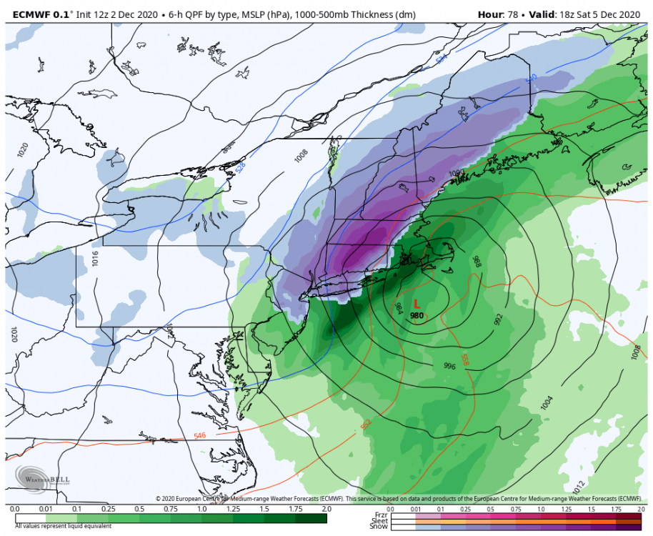
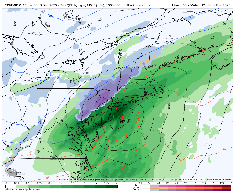
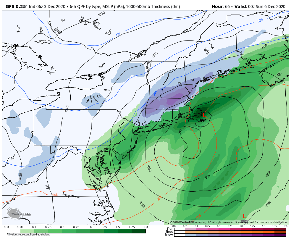
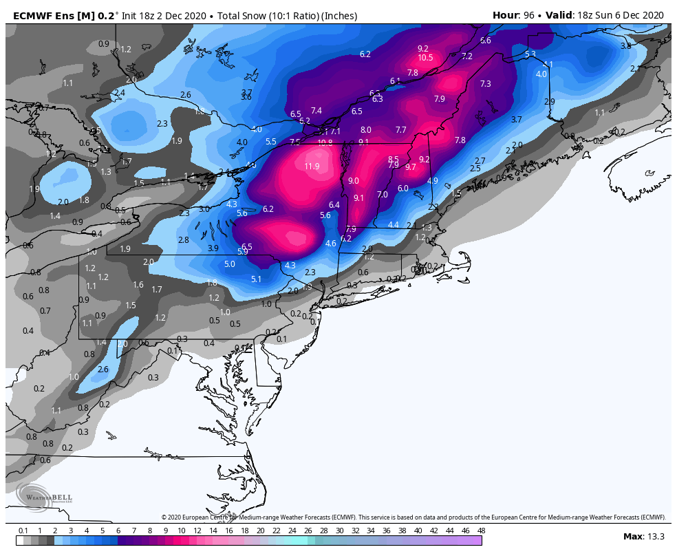
If it goes ballistic just east of sne, LI could get into some CCB action.
-
@bluewave any input? Is this from the ridge off maine moving north?
- 373 replies
-
- 1
-

-
- heavy rain
- wind event
- (and 2 more)
-
All we are blocking with this set up is pac puke. Basically killing the snow potential
-

December 2020 General Discussions & Observations Thread
Allsnow replied to bluewave's topic in New York City Metro
The ensembles did a good job of predicting the ridge in west and trough in the east this weekend. It’s just small details that we won’t know until closer in. This weekend we have a nice 50/50 Feature that wasn’t their earlier. -
Dec 5/6th major coastal/ west Atlantic cyclogenesis ...?
Allsnow replied to Typhoon Tip's topic in New England
-
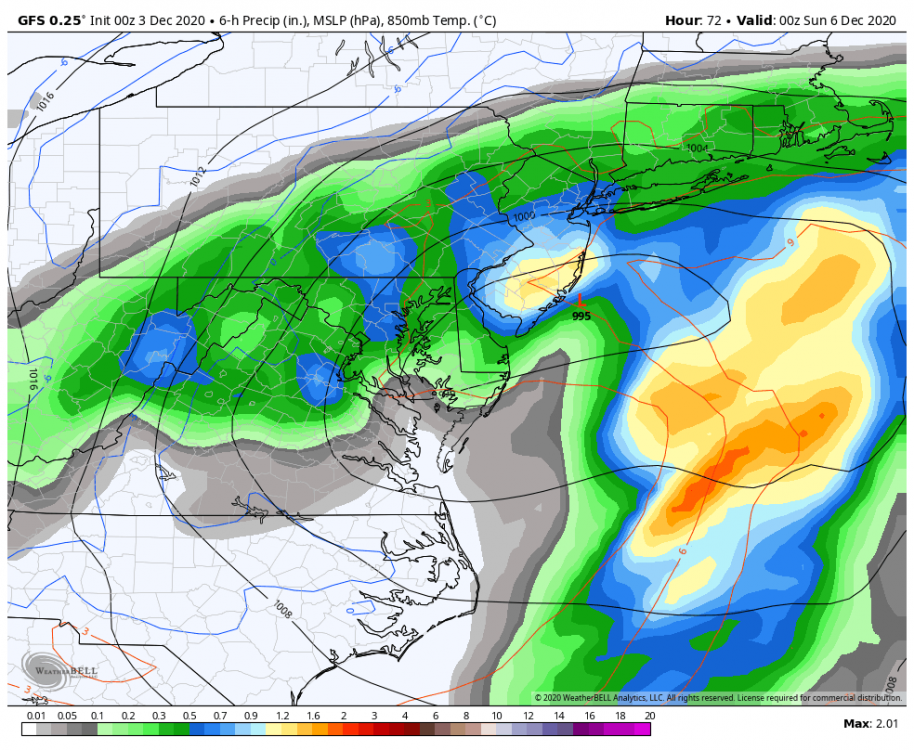
One of the reasons this storm is trending snowier for interior areas is the 50/50 feature that was not expected earlier. Instead of a ridge east of main it’s north of that area. The only reason this isn’t snow for the entire area is because the pna ridge is to flat. This is just another example of having bad luck in a small window of opportunity

-
Dec 5/6th major coastal/ west Atlantic cyclogenesis ...?
Allsnow replied to Typhoon Tip's topic in New England
Young people speaking their minds -
Dec 5/6th major coastal/ west Atlantic cyclogenesis ...?
Allsnow replied to Typhoon Tip's topic in New England

-
Classic snow track but just to early in the season.

- 373 replies
-
- 1
-
-
- heavy rain
- wind event
- (and 2 more)
-
Dec 5/6th major coastal/ west Atlantic cyclogenesis ...?
Allsnow replied to Typhoon Tip's topic in New England

-
-
Dec 5/6th major coastal/ west Atlantic cyclogenesis ...?
Allsnow replied to Typhoon Tip's topic in New England
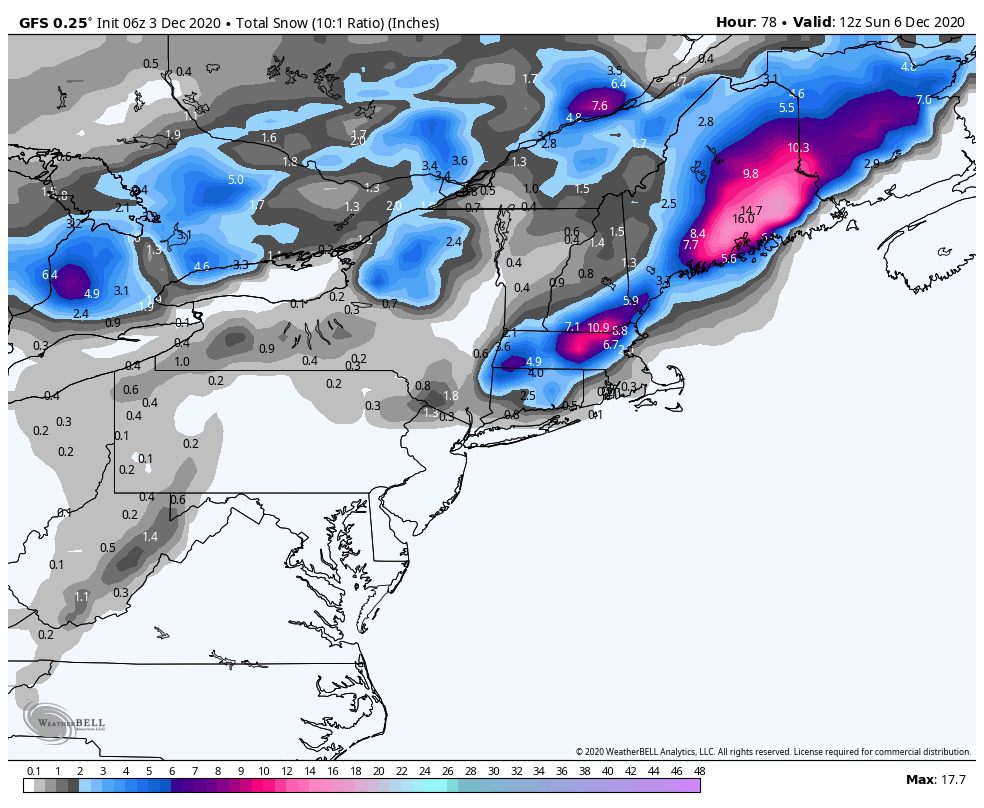
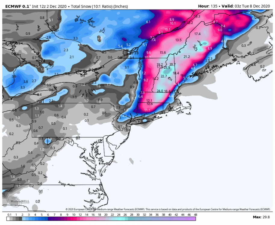
Snow mean pretty high on the eps. Most of the idv are hits for northeast Pa north into NNE/Upstate NY
-
Hopefully more storms like this as we get deeper into the winter
- 373 replies
-
- 1
-
-
- heavy rain
- wind event
- (and 2 more)
-
December 2020 General Discussions & Observations Thread
Allsnow replied to bluewave's topic in New York City Metro
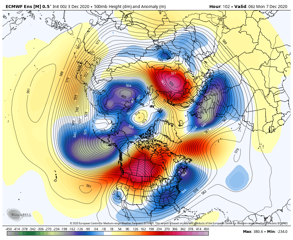
Keeping the vortex weak is important because it allows us a mechanism to get cold without the help of the mjo. If the mjo (which I expect this winter) remains in unfavorable phases it is very important the vortex stay weak. Last winter strong mjo and vortex was a death sentence. Im not referring to a SSW, just a weak enough vortex for strat hits. -
December 2020 General Discussions & Observations Thread
Allsnow replied to bluewave's topic in New York City Metro
-
December 2020 General Discussions & Observations Thread
Allsnow replied to bluewave's topic in New York City Metro
I hope all is well @DT_WXRISK. Great to hear from you. -
December 2020 General Discussions & Observations Thread
Allsnow replied to bluewave's topic in New York City Metro
Some really nice tweets from Simon Lee today about the vortex. The second half of December will be the key to how the rest of winter ends up. In 2019 we had some Weakening of the vortex (cold November and early December) then it went crazy at the end of the month. This was basically the nail in the coffin last winter. It’s very important not to see it gain strength at the end of December. -
This is turning into a classic early winter Nor’easter. Perfect track for snow just not cold enough near the coast
- 373 replies
-
- 2
-
-
- heavy rain
- wind event
- (and 2 more)
-
Dec 5/6th major coastal/ west Atlantic cyclogenesis ...?
Allsnow replied to Typhoon Tip's topic in New England
The idv eps members had a good amount slamming western sne into NNE -
The idv eps members had a good amount slamming western sne and upstate ny
-
Agree. It’s definitely not the January 2014 euro anymore. It’s still the model I would want on my side inside 72 hours. Over the pass few years it has become very erratic.
-
December 2020 General Discussions & Observations Thread
Allsnow replied to bluewave's topic in New York City Metro
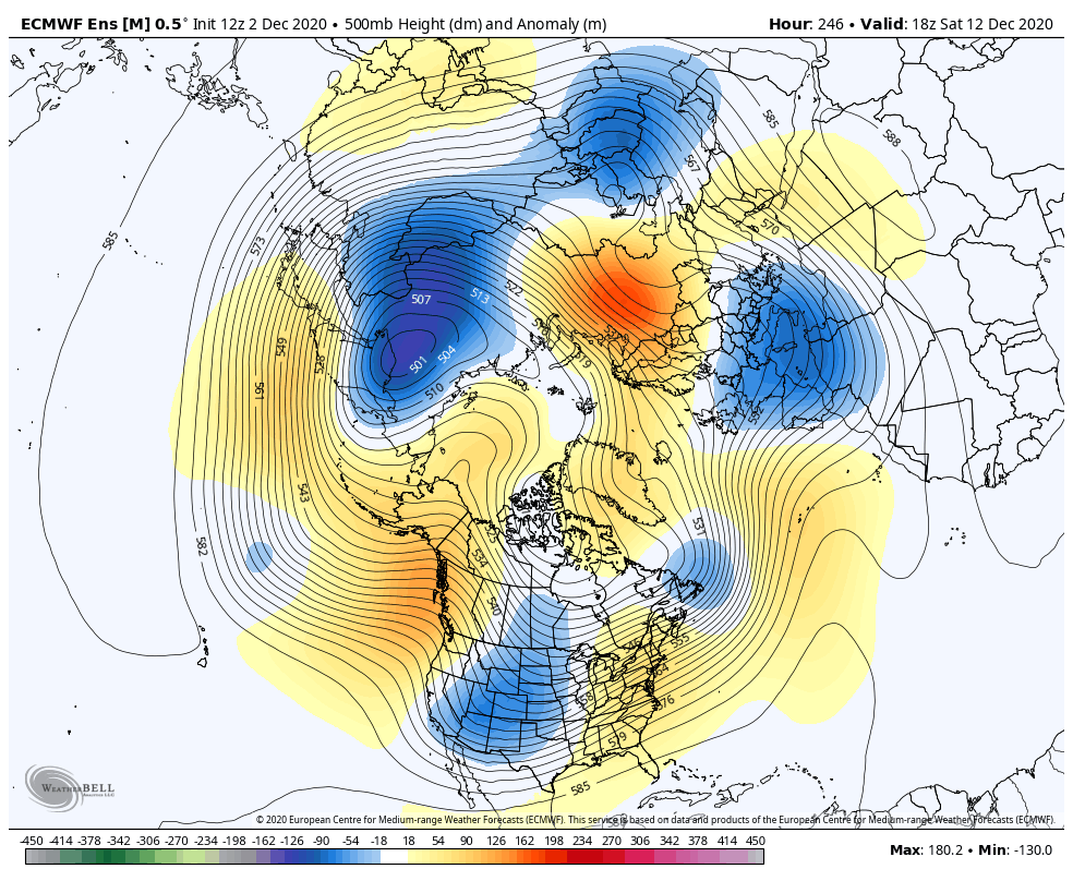
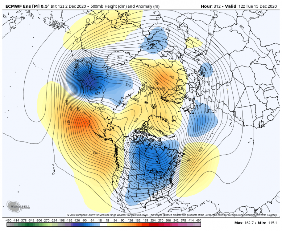
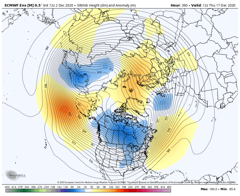
As the pac reshuffles we are probably going to warm next weekend. The eps went towards the gefs today with dumping energy into the west. It doesn’t break off a piece into the trough in the east. IMO the 11th into the 20th will be our best shot for snow. We will get a cold dump into the east because of the wave 1 hit on the strat. We will loose the Aleutian low so this will allow lower hgts into Canada.
-
December 2020 General Discussions & Observations Thread
Allsnow replied to bluewave's topic in New York City Metro
Interesting battle going on in the 6-10 day. GEFS want to torch us and eps/geps reinforce the artic air -
- 373 replies
-
- 1
-
-
- heavy rain
- wind event
- (and 2 more)
-