Allsnow
-
Posts
26,462 -
Joined
-
Last visited
Content Type
Profiles
Blogs
Forums
American Weather
Media Demo
Store
Gallery
Everything posted by Allsnow
-
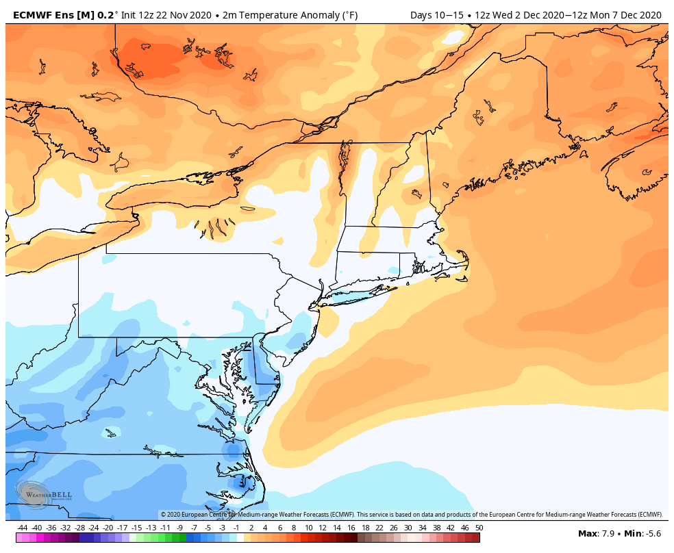
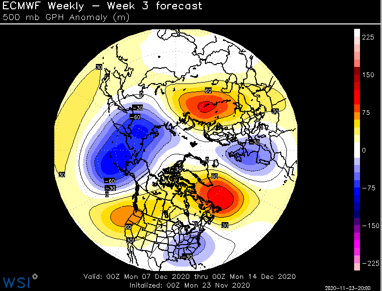
Yeah, looks like we start to cool Canada at the end of the run. That’s a pretty abrupt change on the weeklies for the first half of December. Last Friday it pretty much a Niña pattern for the month of December
-
-
I think initially it will be a issue but hope is changes around mid month. Remember Canada’s above avg is below here as we get deeper into December
-
Good. Hopefully this means it will weaken for the second half of the winter. Last winter it was real weak at this time and gain strength at the end of December
-

November 2020 General Discussions & Observations Thread
Allsnow replied to Rtd208's topic in New York City Metro
Weeklies look great for the first half of December -
Weeklies looks real interesting for the start of December into mid month. +pna/-nao
-
November 2020 General Discussions & Observations Thread
Allsnow replied to Rtd208's topic in New York City Metro
12z eps is fire for snow potential to start December -
Furnace the phucker
-
November 2020 General Discussions & Observations Thread
Allsnow replied to Rtd208's topic in New York City Metro
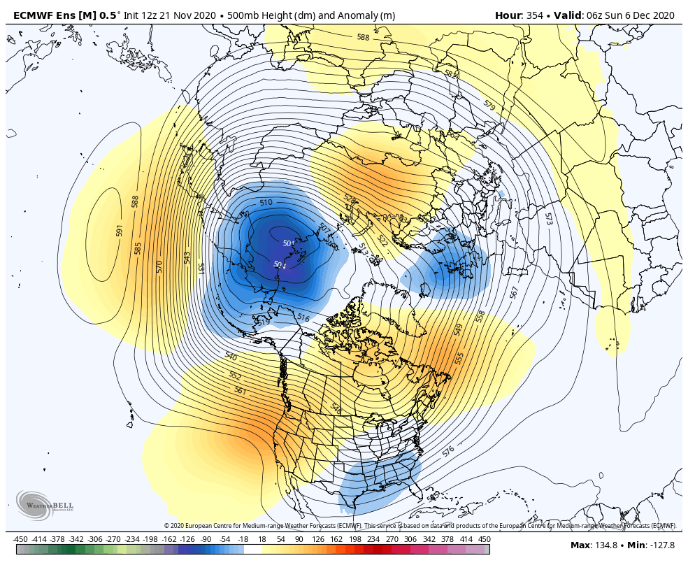
Yeah, big PNA rise in the west should produce a sizable storm. Looks like we will have a block to the north for it as well. I would watch that trailing wave after the cutter for some potential winter weather around the 4/5th -
November 2020 General Discussions & Observations Thread
Allsnow replied to Rtd208's topic in New York City Metro
We are a h5 look away from a ideal storm track. It’s all about capitalizing on are chances. We haven’t had a good setup in the last two years. We don’t need a strong niño to get a snowstorm again -
November 2020 General Discussions & Observations Thread
Allsnow replied to Rtd208's topic in New York City Metro
With the -enao the cold shot gets trapped underneath the block and just rots over us.
-
November 2020 General Discussions & Observations Thread
Allsnow replied to Rtd208's topic in New York City Metro
I agree. But it should come with a decent cold shot afterwards. The majority of the ensemble guidance keeps the +pna for the first half of December. With that look probably favor a Great Lakes snowstorm around the 30th-1st -
November 2020 General Discussions & Observations Thread
Allsnow replied to Rtd208's topic in New York City Metro
Big time storm signal in the east to start December.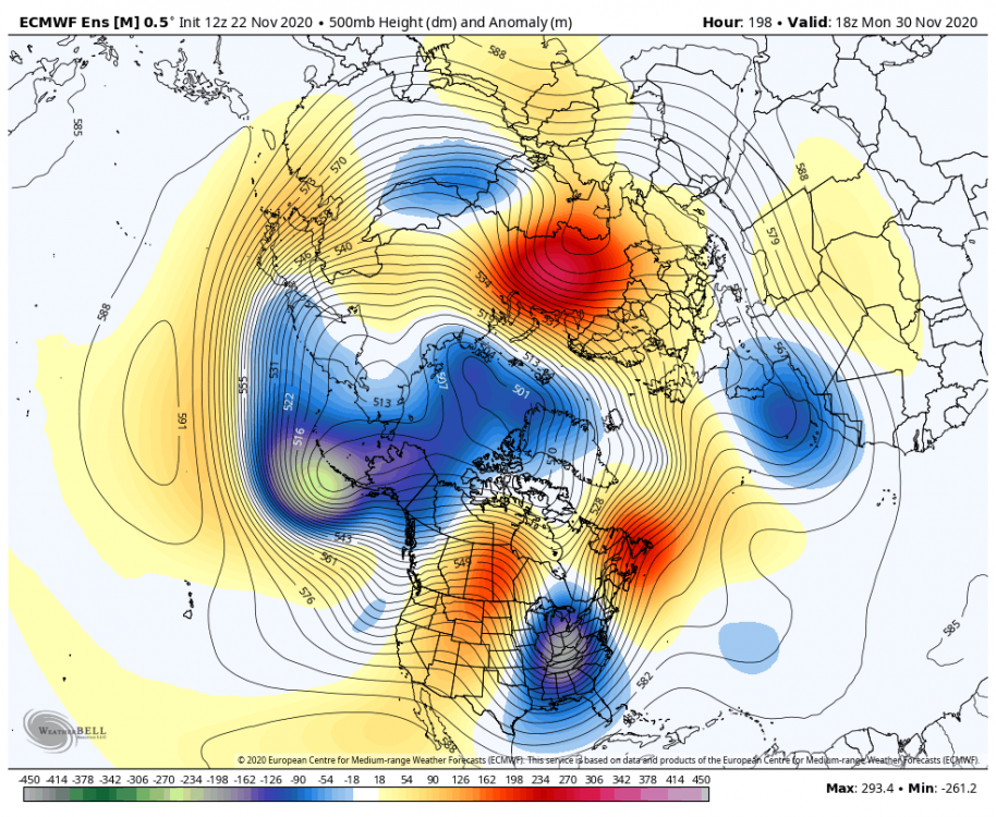
-
November 2020 General Discussions & Observations Thread
Allsnow replied to Rtd208's topic in New York City Metro
Im more referring to the winter as a whole. The last two winters whatever pattern set up at the end of December has dominated throughout the winter. This year seems reversed so far, with a warm November and early start to December. Now do we get a reverse in the second half of the month? The PV is very strong currently, this time last year it was weak and on the verge of a ssw. At the end of December 2018 the Pv took off and pretty much closed the shades on any snow potential. -
As you said going to take a few weeks to flush that airmass out of Canada. Even with the pna the flow is still from B.C. And not poleward, so we will need the help of mid/late December climo.
-
November 2020 General Discussions & Observations Thread
Allsnow replied to Rtd208's topic in New York City Metro
One way to look at this warm November is it’s the exact opposite of the last two. Whatever pattern has set up in the 2nd half of December has dominated the winter. -
November 2020 General Discussions & Observations Thread
Allsnow replied to Rtd208's topic in New York City Metro
I don’t think December 2010 is walking through the door but I feel optimistic for some snow in December. 1. the Pv isn’t going to sit in Ak 2. The pna willbe positive with the potential for some blocking 3. Once into mid December the above normal temps in Canada are below normal here. -
November 2020 General Discussions & Observations Thread
Allsnow replied to Rtd208's topic in New York City Metro

-
Definitely more trending towards the GEFS today
-
November 2020 General Discussions & Observations Thread
Allsnow replied to Rtd208's topic in New York City Metro
Looks like a cold shot to start December after whatever storm goes by to end November -
November 2020 General Discussions & Observations Thread
Allsnow replied to Rtd208's topic in New York City Metro
That’s all I’m really alluding to. Yes, as you said we had a tiny ridge for those months but the flow was split still kind of zonal at h5. -
November 2020 General Discussions & Observations Thread
Allsnow replied to Rtd208's topic in New York City Metro
This is why I think 11/12 is a bad analog. We are not getting a typical Niña response and the PV might weaken for the second half of the winter. -
November 2020 General Discussions & Observations Thread
Allsnow replied to Rtd208's topic in New York City Metro
That flow was still basically from Seattle or southern BC off a flat ridge. Not exactly a ideal pna rise for us. -
November 2020 General Discussions & Observations Thread
Allsnow replied to Rtd208's topic in New York City Metro
That map doesn’t look like a +pna to me. It’s tough to tell with the hgt lines but doesn’t look like it. I don’t see any downstream trough in the east. Unless you’re talking about some garbage hgt rise in the west. I don’t recall +pna in December 18 or January 2019. We had a dateline ridge with a -pna. I remember we had blocking in early December that produced a snowstorm north/west. January 2019 we had recorded breaking warmth with a southeast ridge and -pna combo. March 2018 we had a snowy weekend with a -pna/-epo combo. -
November 2020 General Discussions & Observations Thread
Allsnow replied to Rtd208's topic in New York City Metro
I might be in the minority but I feel the cutter/hugger track the last few years is more of a cause of the -pna then ENSO state