Allsnow
-
Posts
26,462 -
Joined
-
Last visited
Content Type
Profiles
Blogs
Forums
American Weather
Media Demo
Store
Gallery
Everything posted by Allsnow
-
You’re definitely correct. It’s starting the fade the Aleutian low as hgts back into Ak. That could be good (see GEFS geps) or its a bit muted like the eps. Just need to see if it goes further west into the Aleutians which would be standard Niña. This might be a response from the mjo getting into p5/6
-

December 2020 General Discussions & Observations Thread
Allsnow replied to bluewave's topic in New York City Metro
Could make the end of December and January colder if it continues into the colder phases. -
December 2020 General Discussions & Observations Thread
Allsnow replied to bluewave's topic in New York City Metro
-
December 2020 General Discussions & Observations Thread
Allsnow replied to bluewave's topic in New York City Metro
Drool worthy look to start December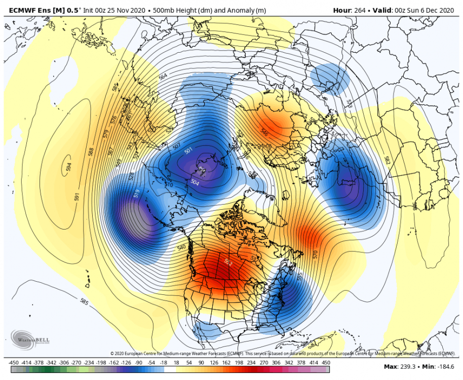
-
December 2020 General Discussions & Observations Thread
Allsnow replied to bluewave's topic in New York City Metro
The first one off the pna spike will definitely go west of us. After the 1 week of December I believe are chances of a snowstorm will be higher. The one around the 5/6th is our first chance. -
December 2020 General Discussions & Observations Thread
Allsnow replied to bluewave's topic in New York City Metro
-
December 2020 General Discussions & Observations Thread
Allsnow replied to bluewave's topic in New York City Metro
-
Yeah. Definitely. Ventrice thinks it might be from a Siberian ssw?
-
December 2020 General Discussions & Observations Thread
Allsnow replied to bluewave's topic in New York City Metro
-
December 2020 General Discussions & Observations Thread
Allsnow replied to bluewave's topic in New York City Metro
-
-
-
Crazy. It only took two years of waiting. What is causing this look? Warm pool off the west coast? Mjo in cod?
-
@Isotherm what do you think is causing this niño response? Mjo with weak convection in P7? Or the warm pool off the west coast? Aleutian low/++pna/-nao is textbook niño December
-

-
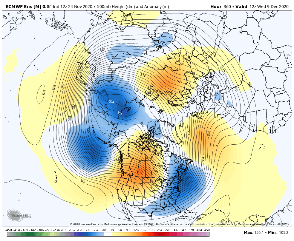
Just keeps getting better.
-
Wow.
-
Eps doing the same
-
November 2020 General Discussions & Observations Thread
Allsnow replied to Rtd208's topic in New York City Metro
Some real potential for the first half of December to produce snow in this pattern. Hopefully it works out.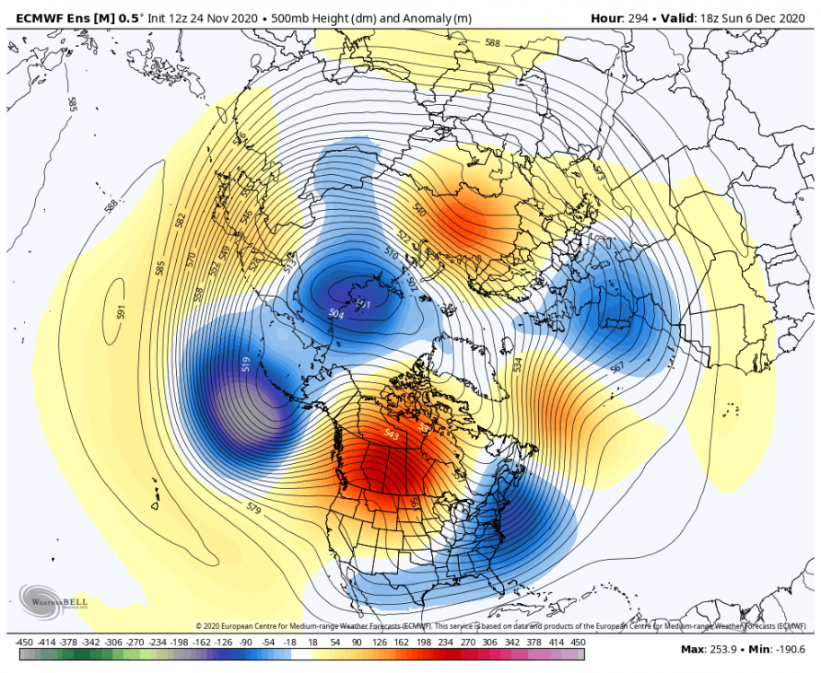
-
November 2020 General Discussions & Observations Thread
Allsnow replied to Rtd208's topic in New York City Metro
It will help cool eastern Canada closer to normal if it goes poleward. +3 for Canada is plenty cold for snow for us in this pattern. Good to see that southeast ridge Niña look is not coming for December -
November 2020 General Discussions & Observations Thread
Allsnow replied to Rtd208's topic in New York City Metro
-
November 2020 General Discussions & Observations Thread
Allsnow replied to Rtd208's topic in New York City Metro
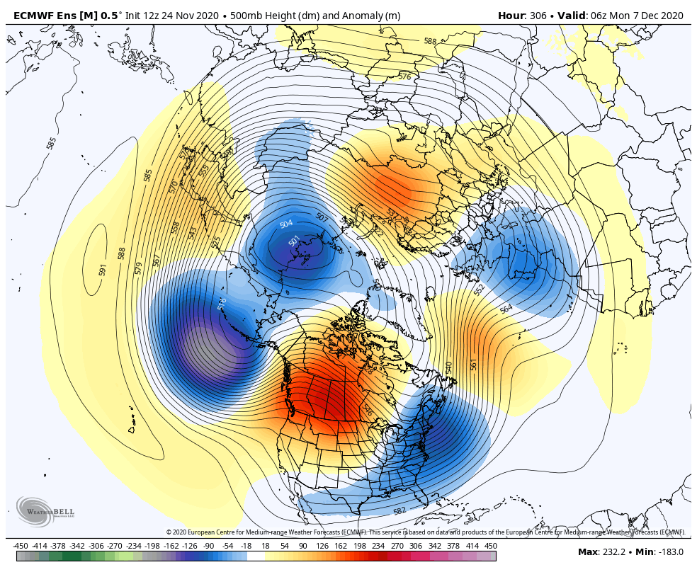
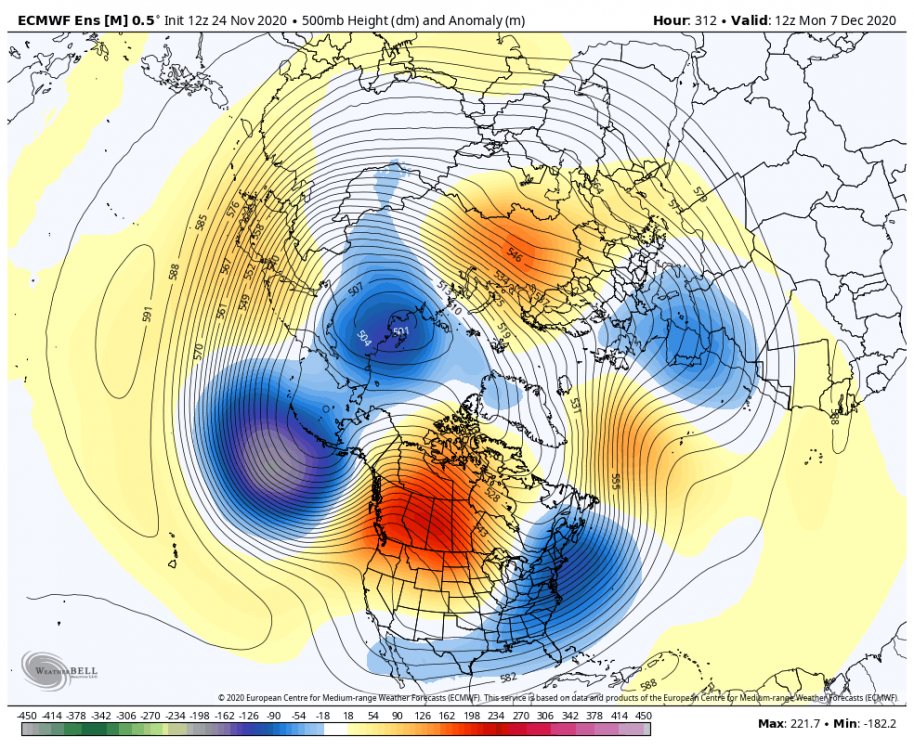
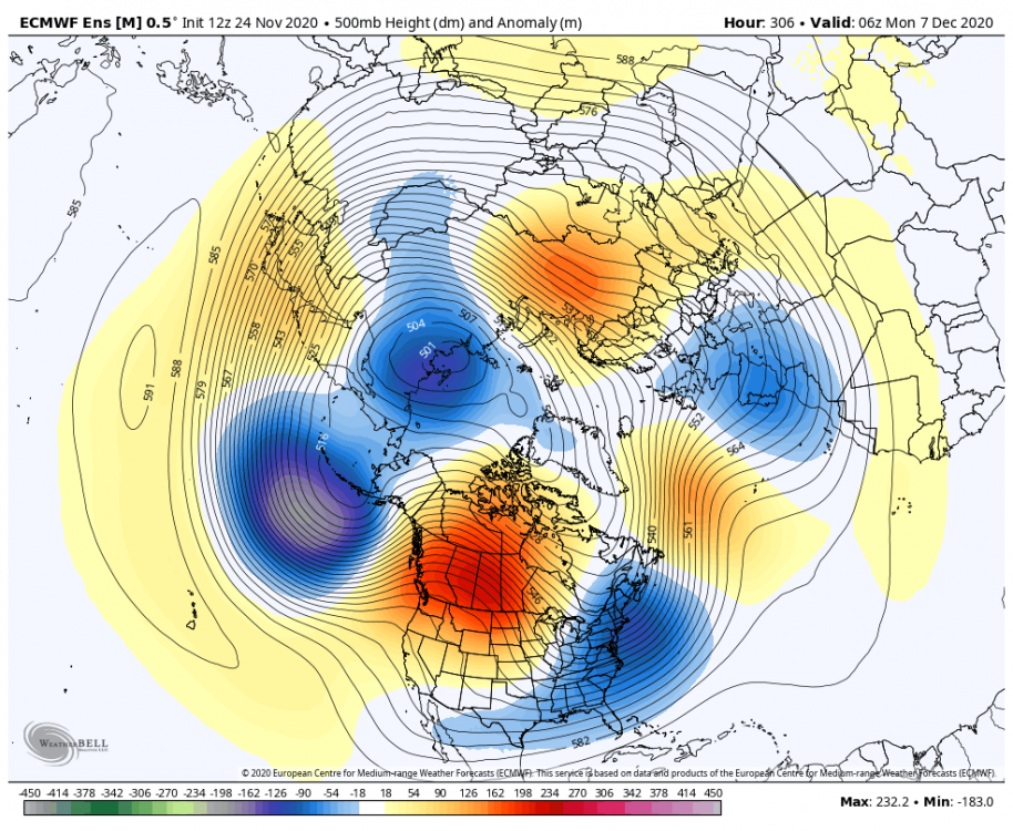
Lots of pac influence with the +pna and lower hgts near Ack. We have a niño pattern to start December with a Aleutian low/+pna/-nao. We will be trapping a meh airmass under the block. It looks like after the 5th the ridge goes more poleward. -
November 2020 General Discussions & Observations Thread
Allsnow replied to Rtd208's topic in New York City Metro
The last week of November was never supposed to be cold. Too much pac influence from the lower hgts in Ak. It’s after the 1st when we start seeing a +pna with -nao to suppress the southeast ridge -
November 2020 General Discussions & Observations Thread
Allsnow replied to Rtd208's topic in New York City Metro