wdrag
-
Posts
5,603 -
Joined
-
Last visited
7 Followers


About wdrag

Recent Profile Visitors
22,832 profile views


.thumb.jpeg.f5c6ba9d911ec96b3b124f8606aee58e.jpeg)


-
Wantage NJ (this part) in nw NJ... 0.6". Have seen at least a 2" report in Bushkill Township, PA. Might be my last report on this one.
-
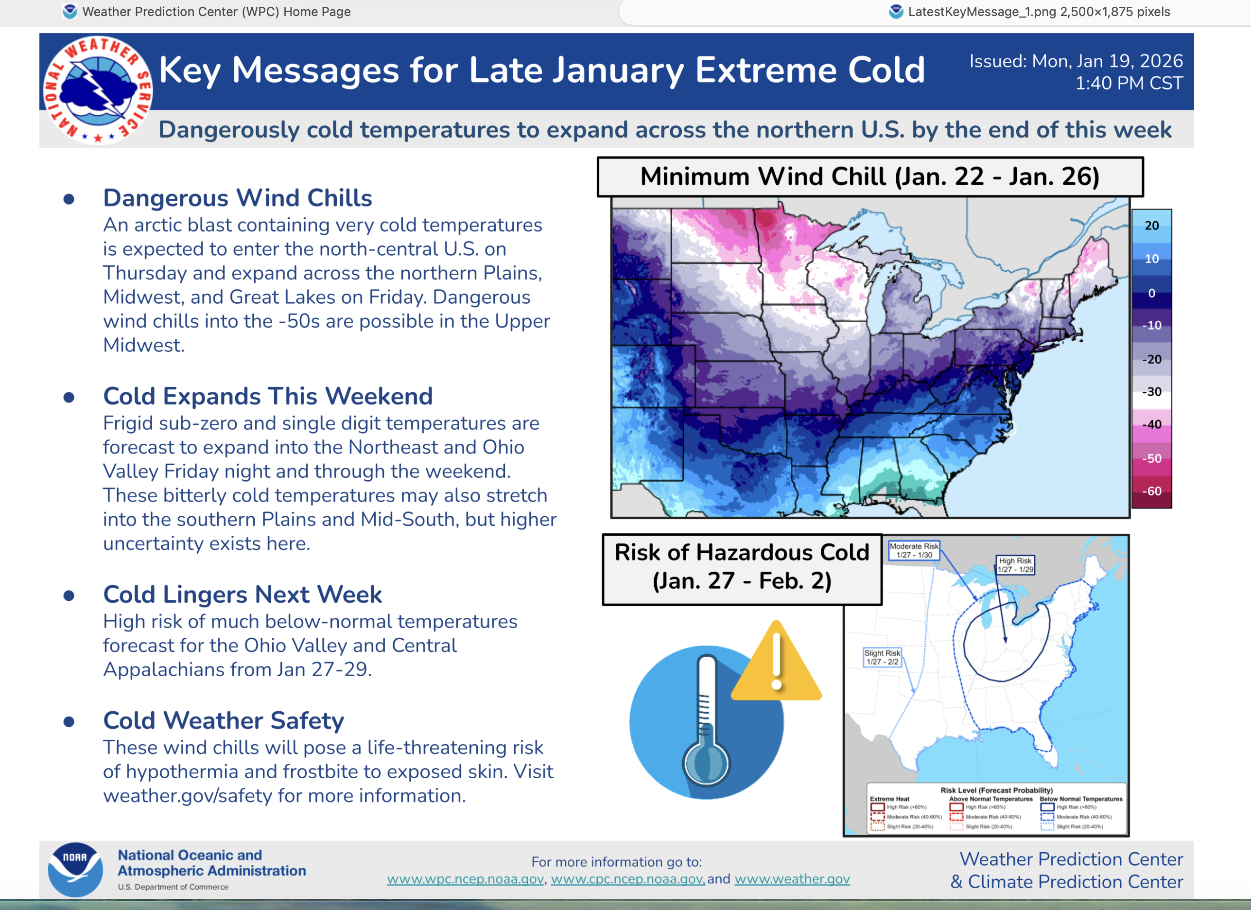
Pattern is cold with staunch 5H blocking ne Canada and snowcover preserving the cold for another 3 weeks, I think. How much snow? Maybe not much til after 2/10, but tracking multitude of northern stream vorts will determine til then. After 1/9, appears there is broad WAA (5H height rises) central USA progressing east, overrunning a pretty decent cold dome here. Am aware CP did not drop below 10 this morning... and so far 9 for the season.
-
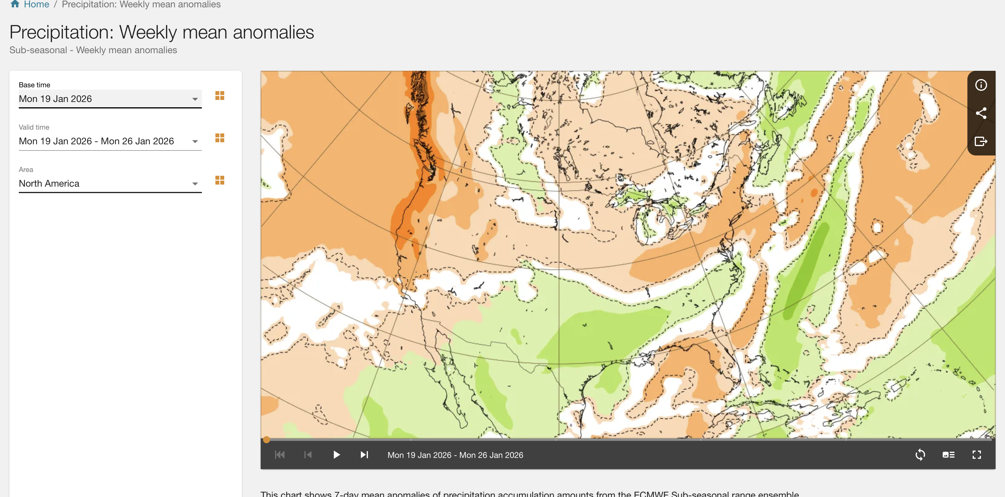
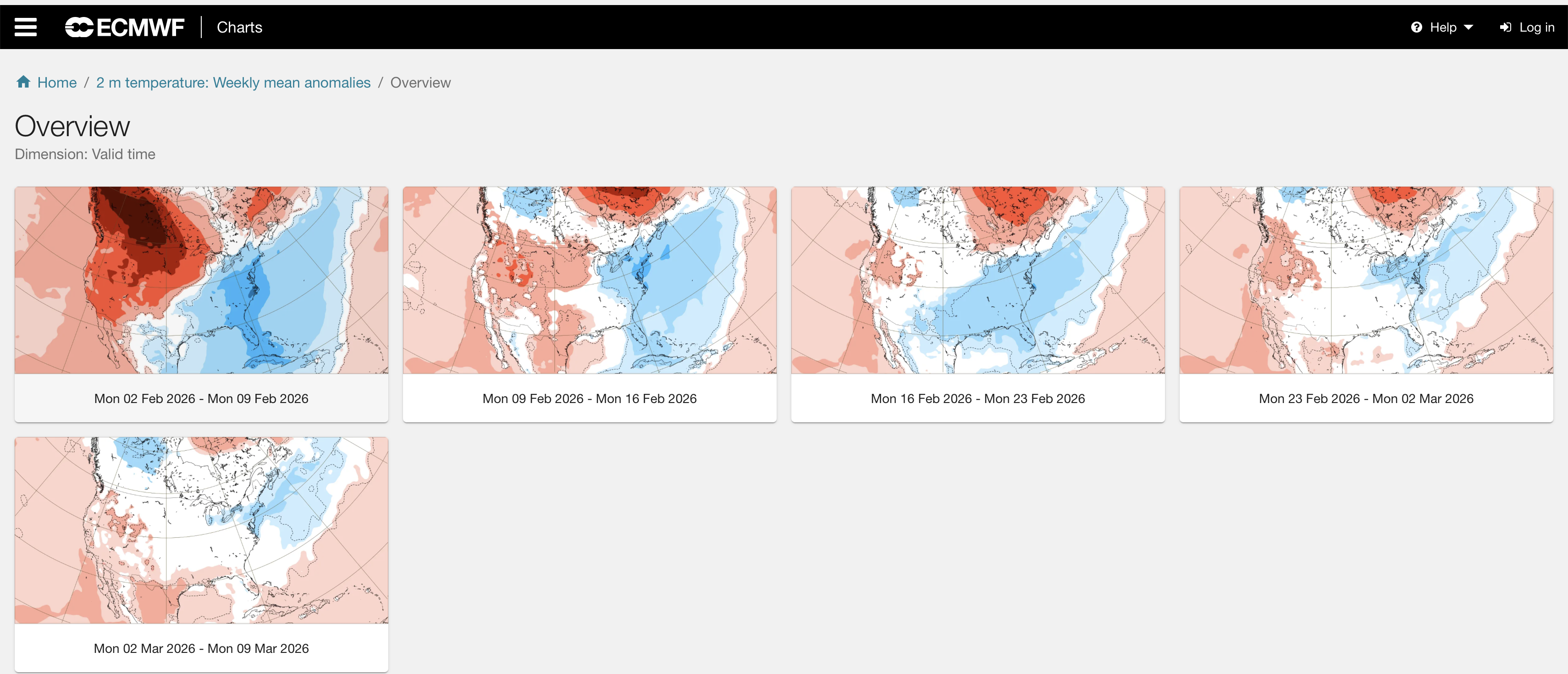
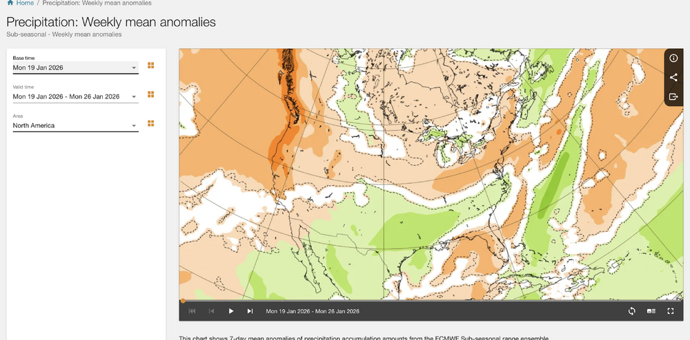
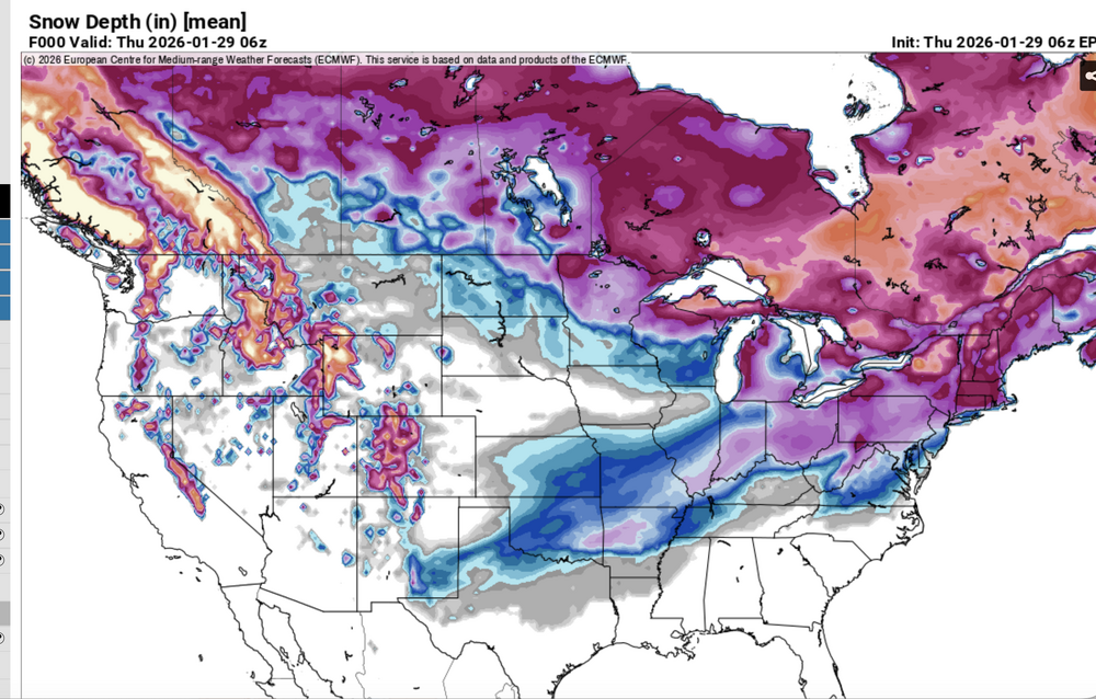
A few notes: ECMWF sub seasonal ensembles via ecmwf.int. imo tend to be too dry here in the northeast and deny the shorter range global ensemble expectations. Be alert for that. Huge error this past weekend - see attached ecmwf.int prediction the 19th, and you know what happened! Also fwiw: via ECMWF.int. Week 3-4, 2m temp departures, I suspect are related to snow cover... see the repeated weekly prediction of colder than normal-here ne USA and OH Valley, and where the snow depth is this morning (and the southern boundary likely to be close to that 16 days - Valentines Day) from now. GFS MOS (MEX). I have no access ecmwf mos. GFS MOS is missing too warm on nighttime lows NYC CP... this I think will be a factor on getting much colder than morning MEX MINS this weekend as the BL wind tends to go northernly---easier access CP. I still try for 2-3F above zero. This also portends the power of the weekend storm. Occasionally prior to these huge northeast snowstorms, it sets up with MB T cold prior to, like this past weekend, and what I think is likely this weekend (excepting unknown nw fringe of snowfall). If you read Weather Wise (Ludlum et al) issues for the big snowstorms including Kennedy Inaugural Jan 1961... big time cold prior to.

-
Wantage NJ 16.5 YTD 40.3 The 40" report is near our entire seasonal normal.
-
Wantage NJ 10.5" 230PM. much 1/4S+ small flake snow the past few hours...densely packed, drifting occurring. temp still 4.5F
-
ALSO, AI modeling basic benefit is for patterns... the global's are for physics higher res etc.
-
Wantage NJ 1110AM. 6" powder. drifting snow has b begun. 4.5F
-
Don, I think we will see our coldest (60% non-stat based) NYC CP temp since 2019 of 1 or 2 above between Wed-Sat. Your odds? I am seeing MOS and 2M temps missing too warm on mins NYC. I use GFS/EC 2M blend for the countryside low, but typically those models dont handle the urban very well. In this case, now that we have so much fresh snow on the ground... it should be relatively easy to get down to near zero in the city on one of these nights. Noting MOS errors significantly too warm for the city the past two mornings. Your stats-impressions on this possibility?
-
Wantage NJ: 1" 650AM 1/25/26. SB 440AM. beautiful powder 5F. may be my last report for awhile.
-
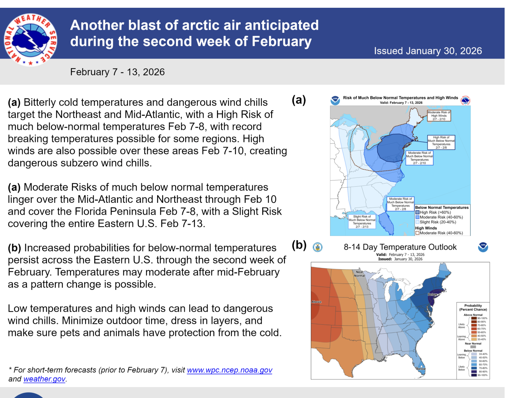
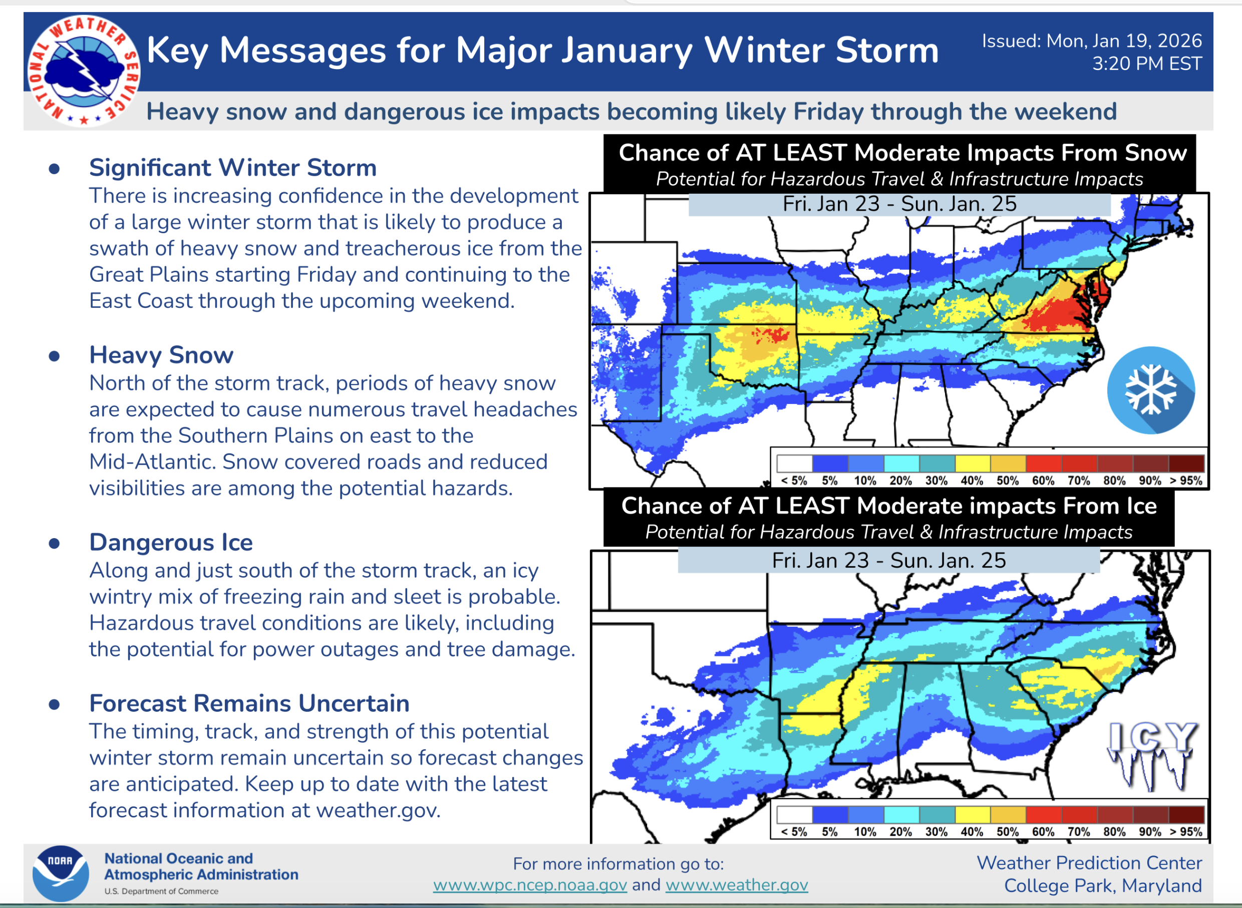
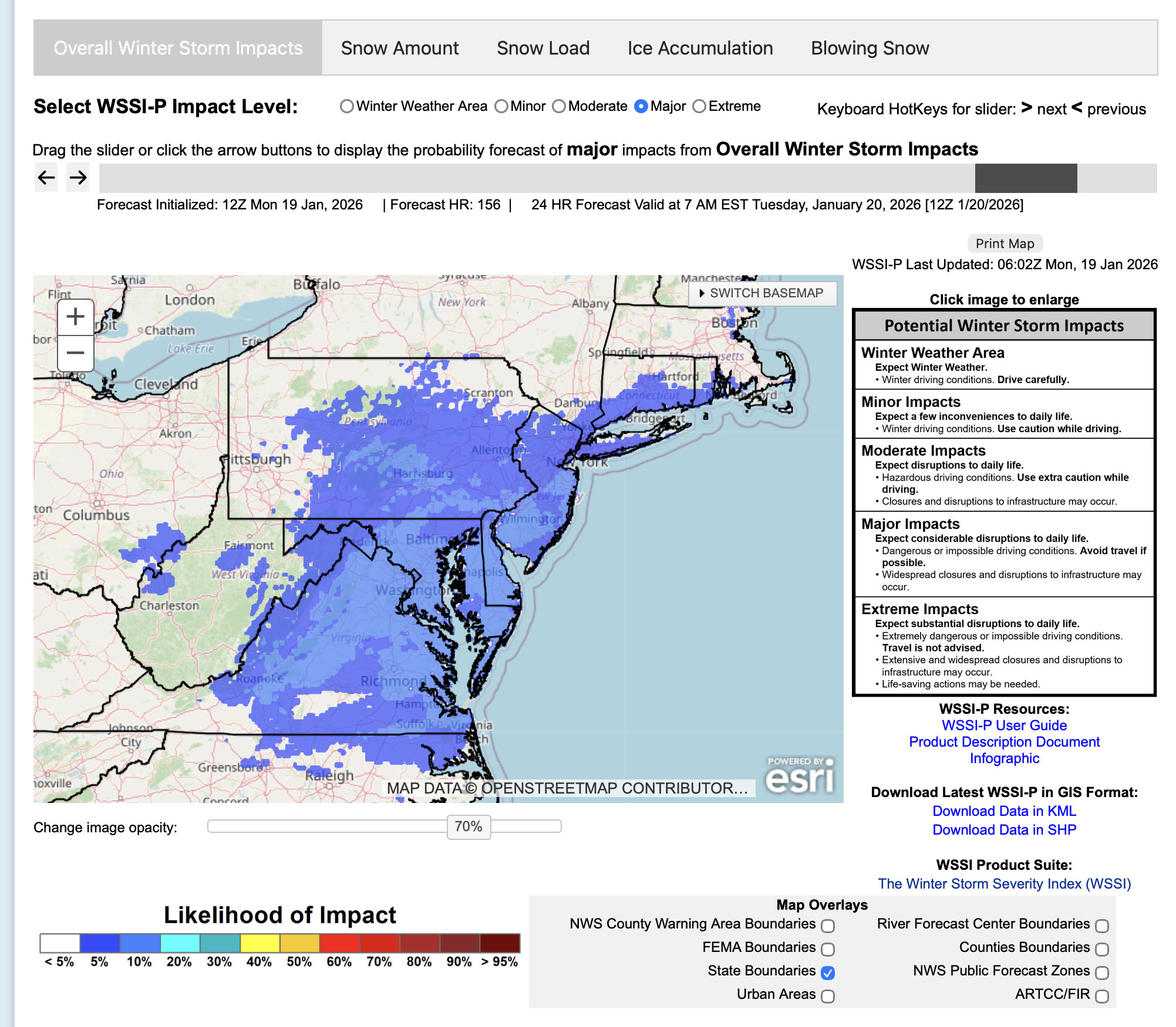
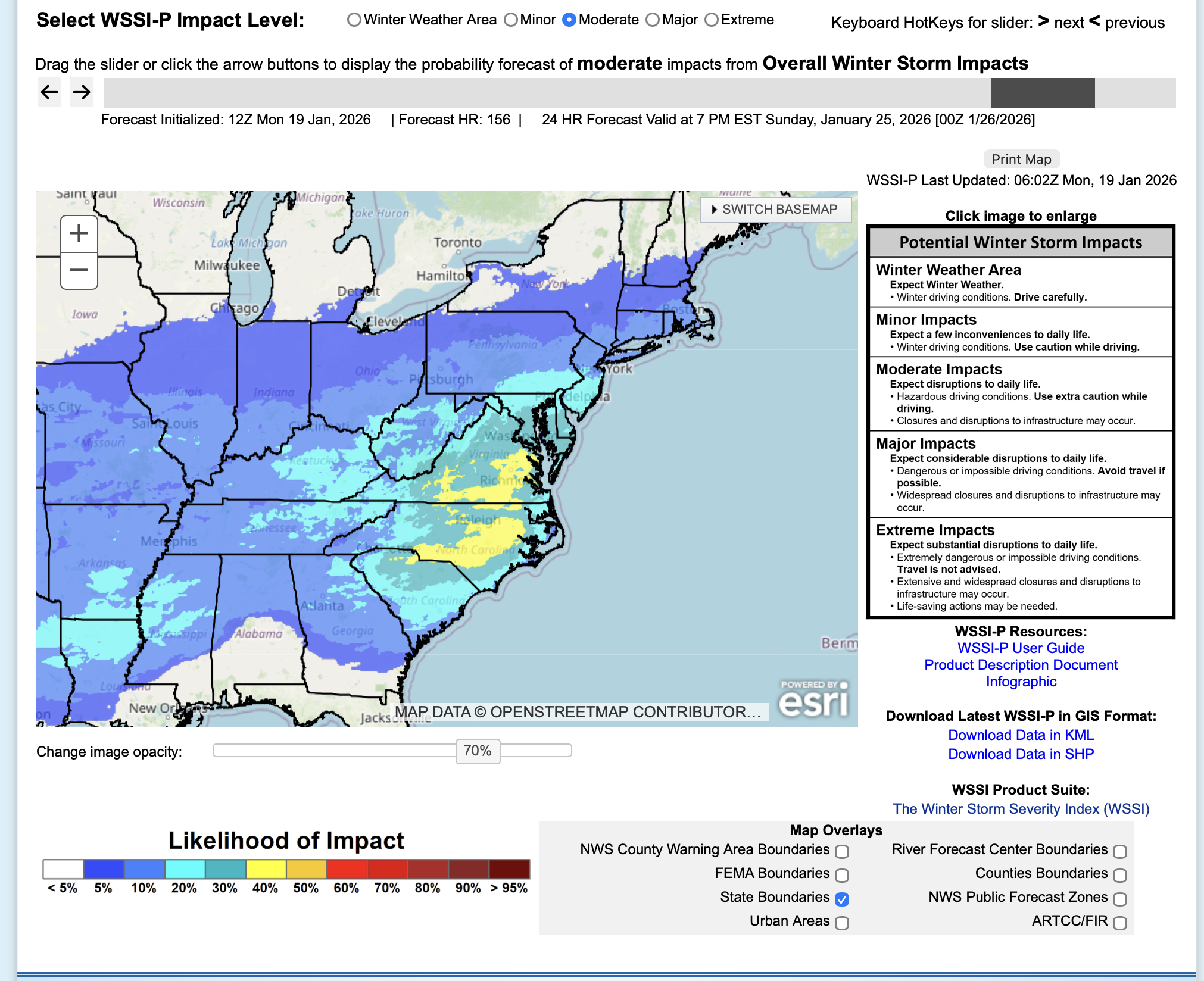
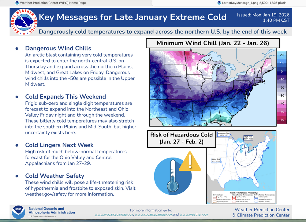
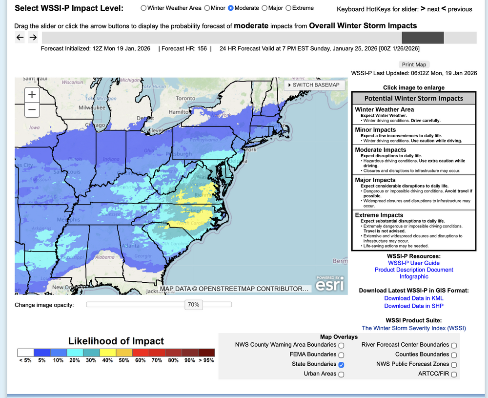
From WPC this afternoon... COLD and Winter Storm. Thread started and glad you took the bull by the horns. All yours: click attached for the WPC take. MY only concern is the ECMWF weekly ensembles are forecasting below average qpf for this period. However it did for this past weekend and we got 2-9" in the NYC subforum with qpf 1/4-3/4 inch, drier than the weekly normal but snow. This weekly qpf forecast adjusts daily and is not excellent. Not sure if its got the AI ensemble ingested into ecmwf.int. No matter--- right now we're on the fringe... fringe can have large errors either way. Once we get to D5 on AI, then we should have a little better idea. The modeled WSSI keeps low prob major here LI south. Suggest monitoring the WSSI-P trends...it's what WPC is using now. Right now it's maxing south.

-
Didn't give up on AMWX... I still lurk and will toss out something once in a while but can't lead the threads...just too much at home including a FB weather group that feeds a bunch of friends-acquaintences and work colleagues from ATL-Old Forge NY. Couldn't stay out in front of it on threads for AMWX without stressing a bit. Takes time to generate a decent pice of info, including researching the models, patterns etc. Plenty of very good thread met leaders here - glad you're getting it done! Think plowable snows. This is a very good WINTER like I used to remember. Lots of daily snowscapes, less grass.
-
PLEASE USE with caution--- others here prior to this have already spoken, but there is hope here for a pretty good powder snowstorm next weekend... very cold air in advance... depends on the confluence zone at 5H (for now imo think we' re on the north edge of 4+ NYC) AI's through 06z/19 cycles are north of the following probabilistic for this coming weekend: Think (just my opinion) it only a matter of a day or so that the NWS WPC advertises a probable major winter storm in the eastern-southern USA. Since our recent AI communication w Bluewave and others prior flagging me on AI better performance... not always best but needs stronger weighting consideration, even in its relative modeling infancy. The MAPS below are self explanatory for this coming weekend. One is MAJOR impact... VERY-VERY low probs right now PA/NJ/LI. The other is moderate (max prob axis south of Mason-Dixon).. and this is 5-6 day in advance. Enjoy your snow cover... and coming imo, possible infrastructure impact coldest air-- since Jan 19?

-
Wantage NJ, last report this evening and close to the end. 3.1" at 8P.
-
Wantage in far nw NJ at 7PM 2.8" rural roads are getting covered again as the temp drops to 27.9. Light snow in progress.