

donsutherland1
-
Posts
23,987 -
Joined
Content Type
Profiles
Blogs
Forums
American Weather
Media Demo
Store
Gallery
Everything posted by donsutherland1
-
Showers are likely tomorrow into Thursday. An additional round of showers and thundershowers is possible on Saturday. Cooler than normal temperatures will prevail through the week. Meanwhile daily record and possible monthly record heat could develop for Friday and Saturday in such cities as Redding and Sacramento. June looks to be warmer than normal on the CFSv2. However, just as had been the case for May, the AI guidance is notably cooler than the conventional models. The ENSO Region 1+2 anomaly was +0.2°C and the Region 3.4 anomaly was -0.2°C for the week centered around May 21. For the past six weeks, the ENSO Region 1+2 anomaly has averaged +0.08°C and the ENSO Region 3.4 anomaly has averaged -0.08°C. Neutral ENSO conditions will likely continue through at least mid summer. Early indications are that summer 2025 will be warmer than normal in the New York City and Philadelphia areas. The potential exists for a much warmer than normal summer (more than 1° above normal). The SOI was +29.36 today. The preliminary Arctic Oscillation (AO) was +2.171 today. Based on sensitivity analysis applied to the latest guidance, there is an implied near 74% probability that New York City will have a cooler than normal May (1991-2020 normal). May will likely finish with a mean temperature near 62.7° (0.5° below normal).
-
Tomorrow will be fair and warm, but some showers are possible Wednesday night and Thursday. Cooler than normal temperatures will prevail through the week. Meanwhile daily record and possible monthly record heat could develop for Friday and Saturday in such cities as Redding and Sacramento. The ENSO Region 1+2 anomaly was 0.0°C and the Region 3.4 anomaly was +0.1°C for the week centered around May 7. For the past six weeks, the ENSO Region 1+2 anomaly has averaged +0.55°C and the ENSO Region 3.4 anomaly has averaged -0.07°C. Neutral ENSO conditions will likely continue through at least mid summer. Early indications are that summer 2025 will be warmer than normal in the New York City and Philadelphia areas. The potential exists for a much warmer than normal summer (more than 1° above normal). The SOI was +23.46 today. The preliminary Arctic Oscillation (AO) was +1.910 today. Based on sensitivity analysis applied to the latest guidance, there is an implied near 71% probability that New York City will have a cooler than normal May (1991-2020 normal). May will likely finish with a mean temperature near 62.7° (0.5° below normal).
-
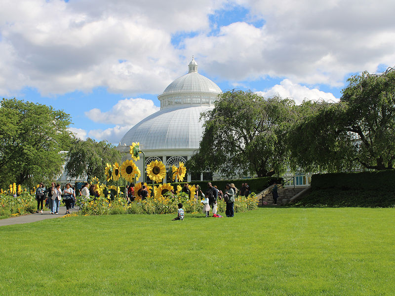
It runs through October 26th.
-
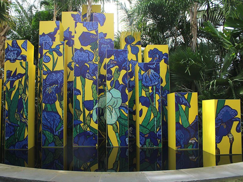
The temperature rose into the lower and middle 60s this afternoon making for a great start to the New York Botanical Garden's "Van Gogh's Flowers" show.


-
It will be partly sunny and even milder tomorrow. Temperatures will top out in the upper 60s. Readings will warm further into the lower 70s on Memorial Day. Nevertheless, temperatures will remain somewhat cooler than normal. The below normal temperatures will likely persist into the middle of next week. However,it could turn noticeably warmer during the closing days of the month or opening of June. The ENSO Region 1+2 anomaly was 0.0°C and the Region 3.4 anomaly was +0.1°C for the week centered around May 7. For the past six weeks, the ENSO Region 1+2 anomaly has averaged +0.55°C and the ENSO Region 3.4 anomaly has averaged -0.07°C. Neutral ENSO conditions will likely continue through at least mid summer. Early indications are that summer 2025 will be warmer than normal in the New York City and Philadelphia areas. The potential exists for a much warmer than normal summer (more than 1° above normal). The SOI was +23.38 today. The preliminary Arctic Oscillation (AO) was +1.533 today. Based on sensitivity analysis applied to the latest guidance, there is an implied near 56% probability that New York City will have a cooler than normal May (1991-2020 normal). May will likely finish with a mean temperature near 63.0° (0.2° below normal).
-
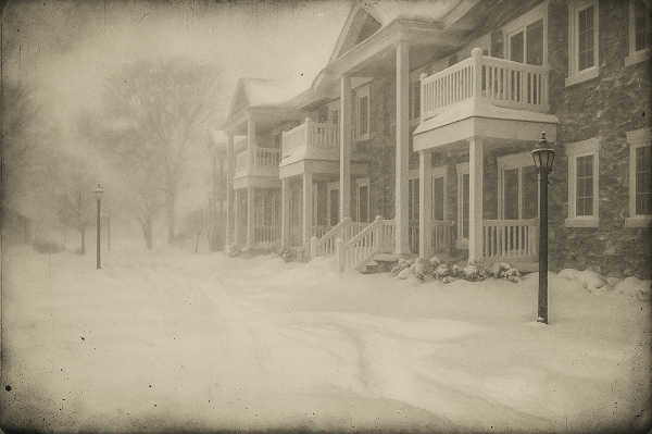
Something to ponder after a third consecutive winter with dismally low snowfall in New York City: Long after winters fade into dreary rain and the wettest of snow that melts on contact with the ground, a daguerreotype might offer the strongest symbol of winters past. Tarnished at the edges, but intact, it will provide a more powerful and permanent testament to the last great snowfall than any faded photo or digital image. Winter's final cold and snowy breath will be preserved for the duration of humanity's existence. In that single image, the passage of time will offer a timeless memory of what winters once were. Daguerreotype-style image recreated from a photo taken at Patchogue, NY during a blizzard on January 29, 2022. Fortunately, for the foreseeable future, such a nightmare does not appear likely in the New York City area and its surrounding suburbs. Even as average seasonal snowfall totals will likely decline as winters warm, there will continue to be occasionally snowy winters and periodic big snowstorms.
-
New York City has had five consecutive days with lows of 49° or below after May 20th for the first time since 1992. The last time New York City had five consecutive such days was May 24-28, 1992.
-
Clouds finally yielded to brilliant sunshine this afternoon. A partly to mostly sunny Memorial Day weekend lies ahead. The temperature will gradually warm from the lower 60s tomorrow, upper 60s on Sunday to near or just above 70° on Memorial Day. Nevertheless, temperatures will remain somewhat cooler than normal. The below normal temperatures will likely persist into the middle of next week. However,it could turn noticeably warmer during the closing days of the month or opening of June. The ENSO Region 1+2 anomaly was 0.0°C and the Region 3.4 anomaly was +0.1°C for the week centered around May 7. For the past six weeks, the ENSO Region 1+2 anomaly has averaged +0.55°C and the ENSO Region 3.4 anomaly has averaged -0.07°C. Neutral ENSO conditions will likely continue through at least mid summer. Early indications are that summer 2025 will be warmer than normal in the New York City and Philadelphia areas. The potential exists for a much warmer than normal summer (more than 1° above normal). The SOI was +6.68 today. The preliminary Arctic Oscillation (AO) was +0.962 today. Based on sensitivity analysis applied to the latest guidance, there is an implied near 52% probability that New York City will have a cooler than normal May (1991-2020 normal). May will likely finish with a mean temperature near 63.1° (0.1° below normal).
-
Through 5 pm, Bridgeport, Islip, New York City-Central Park, New York City-LaGuardia Airport, and Newark are in line to set new record low maximum temperatures for May 22. JFK Airport is in line to tie its record. After an unseasonably cool start, temperatures will top out in upper 50s and lower 60s tomorrow in the New York City area. There could also be some scattered showers. A partly to mostly sunny Memorial Day weekend will then follow. The below normal temperatures could persist into early next week. However,it could turn noticeably warmer during the closing days of the month or opening of June. The ENSO Region 1+2 anomaly was 0.0°C and the Region 3.4 anomaly was +0.1°C for the week centered around May 7. For the past six weeks, the ENSO Region 1+2 anomaly has averaged +0.55°C and the ENSO Region 3.4 anomaly has averaged -0.07°C. Neutral ENSO conditions will likely continue through at least mid summer. Early indications are that summer 2025 will be warmer than normal in the New York City and Philadelphia areas. The potential exists for a much warmer than normal summer (more than 1° above normal). The SOI was -8.71 today. The preliminary Arctic Oscillation (AO) was +0.091 today. Based on sensitivity analysis applied to the latest guidance, there is an implied near 62% probability that New York City will have a cooler than normal May (1991-2020 normal). May will likely finish with a mean temperature near 63.0° (0.2° below normal).
-
Tonight and tomorrow will be rainy and exceptionally cool for this time of year. A storm total 0.50"-1.50" rainfall is likely into Friday morning. Temperatures will top out in the lower to middle 50s in New York City tomorrow. Tomorrow's record low maximum temperature is 54° from 1894. That mark could be challenged. The below normal temperatures could persist into early next week. However,it could turn noticeably warmer during the closing days of the month or opening of June. Showers could persist into Friday. It is likely that New York City will see the mercury dip below 50° on Thursday night and Friday morning. The ENSO Region 1+2 anomaly was 0.0°C and the Region 3.4 anomaly was +0.1°C for the week centered around May 7. For the past six weeks, the ENSO Region 1+2 anomaly has averaged +0.55°C and the ENSO Region 3.4 anomaly has averaged -0.07°C. Neutral ENSO conditions will likely continue through at least mid summer. Early indications are that summer 2025 will be warmer than normal in the New York City and Philadelphia areas. The potential exists for a much warmer than normal summer (more than 1° above normal). The SOI was -3.58 today. The preliminary Arctic Oscillation (AO) was -0.328 today. Based on sensitivity analysis applied to the latest guidance, there is an implied near 50% probability that New York City will have a warmer than normal May (1991-2020 normal). May will likely finish with a mean temperature near 63.2° (normal).
-
70s and possibly 80s look realistic. Earlier runs with low and mid-90s on the GFS are likely overdone.
-
It was. The dramatic shift reveals the limits of the guidance beyond 10-14 days. Dramatic changes can and do occur. This time around, at least for the NYC area, the AI estimate will blow the modeling out of the water.
-
I think there’s pretty good agreement about upper 70s/low 80s to end May or start June. The GFS appears to be greatly overdone with the heat.
-
Thanks to its warm start, May will wind up near normal to perhaps slightly below normal.
-
An extended period of cool weather is now underway. This morning, the temperature slipped to 49° in Central Park. That was New York City's coolest temperature this month. The below normal temperatures could persist into early next week. A general 0.50"-1.50" rainfall is likely tomorrow into Thursday. A gusty wind will likely accompany the rainfall. Showers could persist into Friday. There is a chance that New York City could see the mercury dip below 50° Thursday or Friday. The ENSO Region 1+2 anomaly was 0.0°C and the Region 3.4 anomaly was +0.1°C for the week centered around May 7. For the past six weeks, the ENSO Region 1+2 anomaly has averaged +0.55°C and the ENSO Region 3.4 anomaly has averaged -0.07°C. Neutral ENSO conditions will likely continue through at least mid summer. Early indications are that summer 2025 will be warmer than normal in the New York City and Philadelphia areas. The potential exists for a much warmer than normal summer (more than 1° above normal). The SOI was +0.09 today. The preliminary Arctic Oscillation (AO) was -0.511 today. Based on sensitivity analysis applied to the latest guidance, there is an implied near 53% probability that New York City will have a cooler than normal May (1991-2020 normal). May will likely finish with a mean temperature near 63.1° (0.1° below normal).
-
Congratulations on your upcoming wedding.
-
Occasional Thoughts on Climate Change
donsutherland1 replied to donsutherland1's topic in Climate Change
The promise of fusion is real. It will supplant much of conventional power, when realized. I'm referring solely to carbon capture. The actual CO2 captured is tiny. Moving to clean energy, including nuclear fusion, will make a much larger contribution than carbon capture will. Investment should be focused on promising technologies such as nuclear fusion, not carbon capture. Climate projections should be based on realistic assumptions not fictional ones that assume carbon capture. -
Tomorrow will see temperatures top out in the upper 60s as clouds increase. It will turn noticeably cooler for the remainder of the week. The below normal temperatures could persist into early next week. A general 0.50"-1.50" rainfall is likely Wednesday into Thursday. A gusty wind will likely accompany the rainfall. Showers could persist into Friday. There is a chance that New York City could see the mercury dip below 50° for the first time this month Thursday or Friday. The ENSO Region 1+2 anomaly was 0.0°C and the Region 3.4 anomaly was +0.1°C for the week centered around May 7. For the past six weeks, the ENSO Region 1+2 anomaly has averaged +0.55°C and the ENSO Region 3.4 anomaly has averaged -0.07°C. Neutral ENSO conditions will likely continue through at least mid summer. Early indications are that summer 2025 will be warmer than normal in the New York City and Philadelphia areas. The potential exists for a much warmer than normal summer (more than 1° above normal). The SOI was -0.44 yesterday. The preliminary Arctic Oscillation (AO) was -0.435 today. Based on sensitivity analysis applied to the latest guidance, there is an implied near 50% probability that New York City will have a warmer than normal May (1991-2020 normal). May will likely finish with a mean temperature near 63.2° (near normal).
-
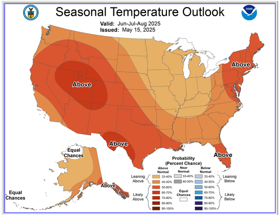
For reference, CPC's May 15th outlook is still favoring a warmer summer.
-
I was referring to the monthly and seasonal forecasts. Next two weeks is the close of spring.
-
So far, it’s looking good, especially Sunday and Monday.
-
Occasional Thoughts on Climate Change
donsutherland1 replied to donsutherland1's topic in Climate Change
I am not surprised. Carbon capture remains a gimmick. It offers a false promise to divert society's attention from the need to cut fossil fuel consumption. No serious analysis or agreement should incorporate carbon capture into future projections. -
Tomorrow and Tuesday will be somewhat cooler but still pleasant days. However, it will turn noticeably cooler Tuesday night. Once it turns cooler, an extended period of below normal temperatures is likely. A moderate to significant rainfall is likely Wednesday into Thursday. A gusty wind will likely accompany the rainfall. Showers could persist into Friday. The ENSO Region 1+2 anomaly was 0.0°C and the Region 3.4 anomaly was +0.1°C for the week centered around May 7. For the past six weeks, the ENSO Region 1+2 anomaly has averaged +0.55°C and the ENSO Region 3.4 anomaly has averaged -0.07°C. Neutral ENSO conditions will likely continue through at least mid summer. Early indications are that summer 2025 will be warmer than normal in the New York City and Philadelphia areas. The potential exists for a much warmer than normal summer (more than 1° above normal). The SOI was +7.83 yesterday. The preliminary Arctic Oscillation (AO) was -0.290 today. Based on sensitivity analysis applied to the latest guidance, there is an implied near 50% probability that New York City will have a warmer than normal May (1991-2020 normal). May will likely finish with a mean temperature near 63.2° (near normal).
-
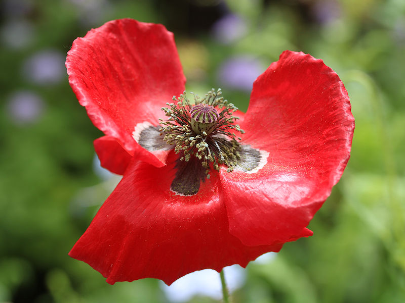
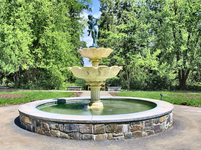
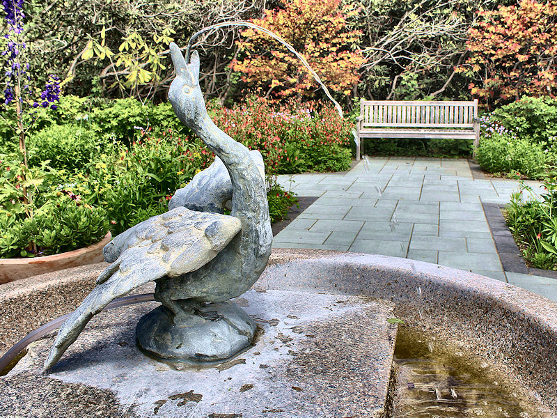
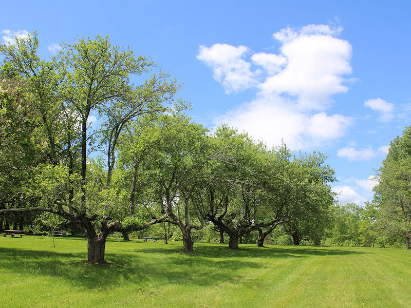
This afternoon is gorgeous with a refreshing breeze and temperatures in the low 70s. A few photos from Katonah:
-
Tomorrow and Monday will be somewhat cooler but still pleasant days. By midweek, it will turn noticeably cooler. Once it turns cooler, an extended period of below normal temperatures is possible. The ENSO Region 1+2 anomaly was 0.0°C and the Region 3.4 anomaly was +0.1°C for the week centered around May 7. For the past six weeks, the ENSO Region 1+2 anomaly has averaged +0.55°C and the ENSO Region 3.4 anomaly has averaged -0.07°C. Neutral ENSO conditions will likely continue through at least mid summer. Early indications are that summer 2025 will be warmer than normal in the New York City and Philadelphia areas. The potential exists for a much warmer than normal summer (more than 1° above normal). The SOI was +6.38 yesterday. The preliminary Arctic Oscillation (AO) was -0.234 today. Based on sensitivity analysis applied to the latest guidance, there is an implied near 52% probability that New York City will have a warmer than normal May (1991-2020 normal). May will likely finish with a mean temperature near 63.5° (0.3° above normal).

