Vol Man
-
Posts
243 -
Joined
-
Last visited
About Vol Man

-
Spring/Summer 2026 Pattern Discussion Thread
Vol Man replied to Carvers Gap's topic in Tennessee Valley
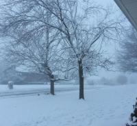
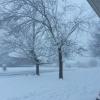
We have had a nice, steady snow since mid afternoon on the east side of Kingsport...nice little March surprise. Didn't stick at all for quite a while, but have a nice dusting now.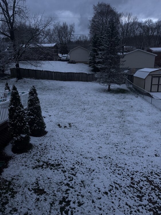
-
Jan 30th-February 1st 2026 Arctic Blast/ULL Snow OBS Thread.
Vol Man replied to John1122's topic in Tennessee Valley
Hard to believe it's coming another solid shower...really, hardest snow since early this morning! -
Jan 30th-February 1st 2026 Arctic Blast/ULL Snow OBS Thread.
Vol Man replied to John1122's topic in Tennessee Valley
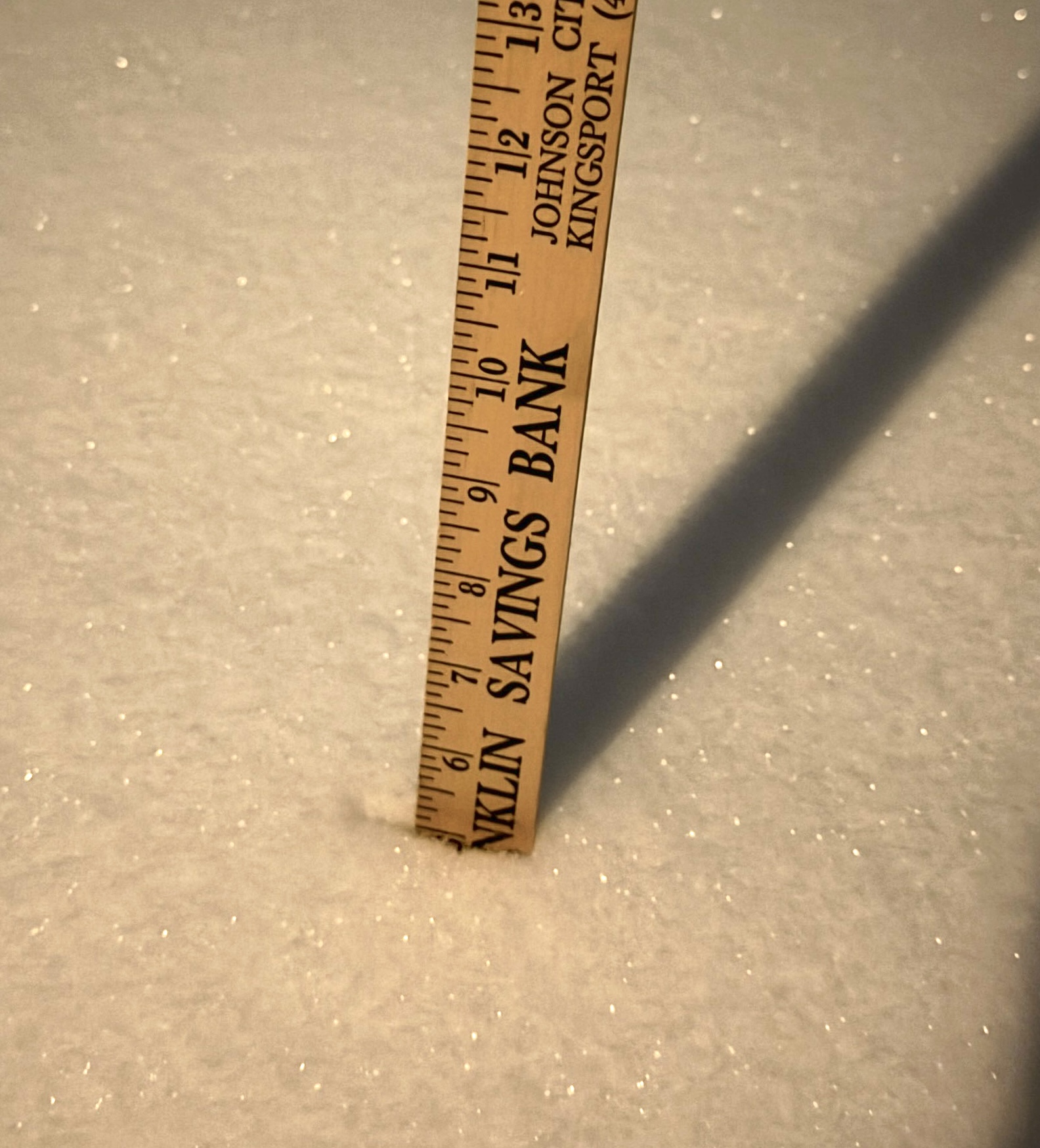
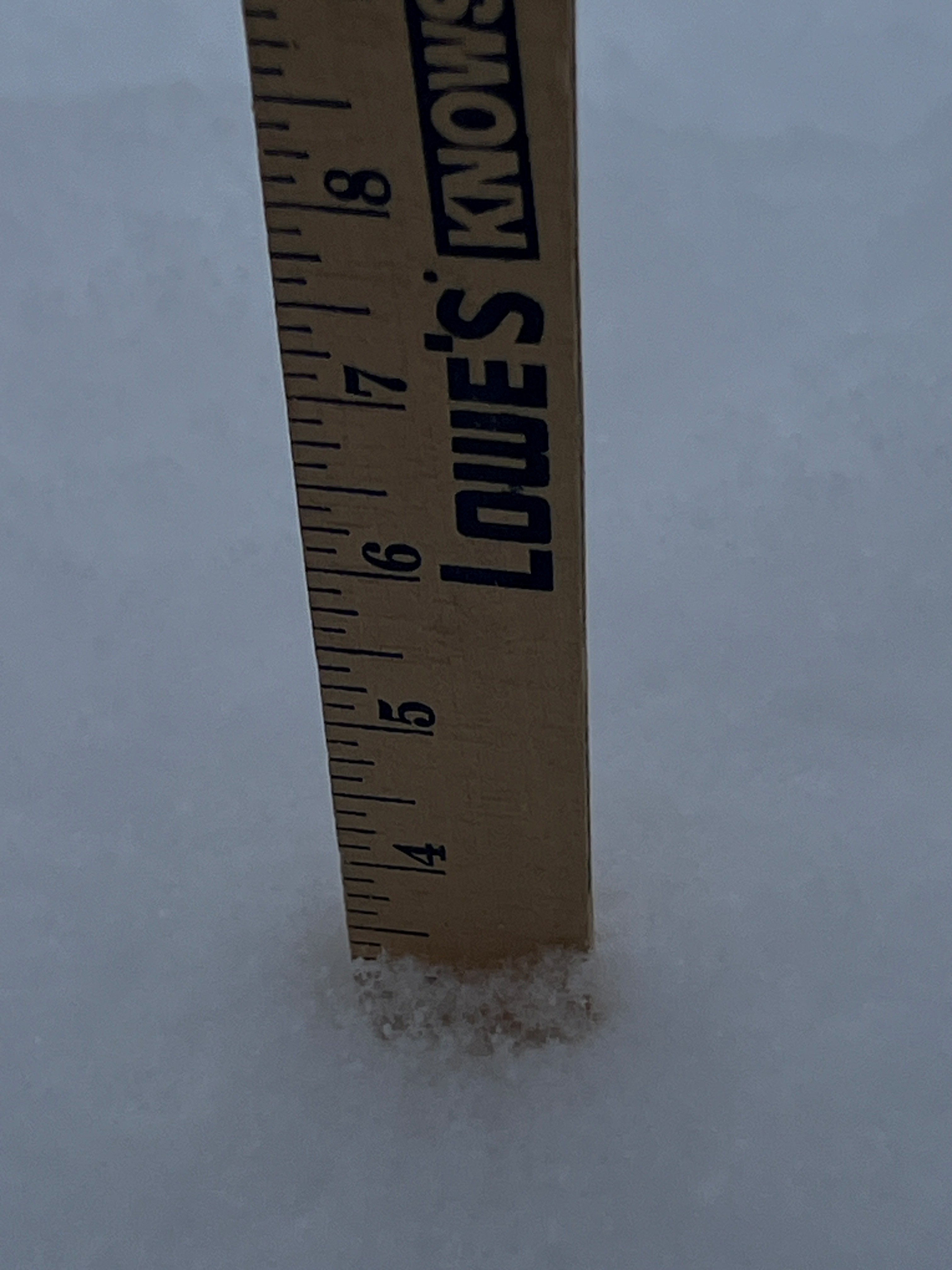
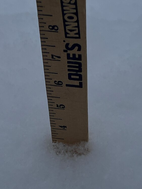
I believe Carver lives on the west side of town. I'm on the east side and had about 6" an hour ago
-
Jan 30th-February 1st 2026 Arctic Blast/ULL Snow OBS Thread.
Vol Man replied to John1122's topic in Tennessee Valley
Looks like 5" between Kingsport and Blountville
-
I do remember the horrible ice storm that hit Knoxville my senior year at UT...1982...and I believe it was early February. Also, seem to remember it was bad in Kingsport too. It was quite the sight to see Cumberland Avenue become an ice rink.
-
December 11th - 12th clipper potential
Vol Man replied to Holston_River_Rambler's topic in Tennessee Valley
Wow...getting some pretty good flakes in East Kingsport right now! -
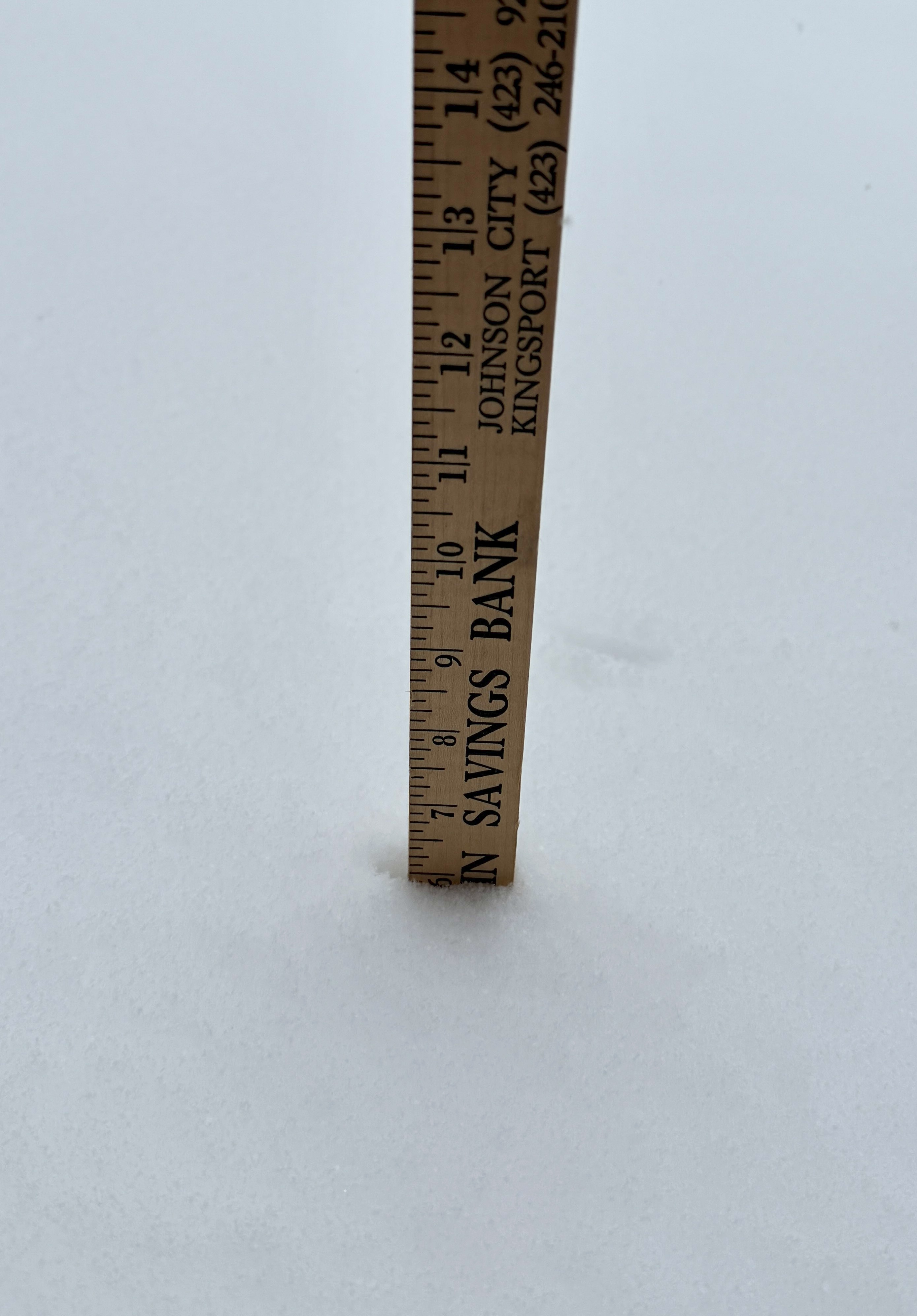
Wow, what a surprise... a little over 3" since about 4:30 this morning.
-
Finally got a little decent snow out of this event in Kingsport.
-
Fall/Winter Banter - Football, Basketball, Snowball?
Vol Man replied to John1122's topic in Tennessee Valley
@Mr Bob and @PowellVolz Thank you for getting my email issue corrected! I appreciate it very much!!! -
Fall/Winter Banter - Football, Basketball, Snowball?
Vol Man replied to John1122's topic in Tennessee Valley
So, I saw this posted from Archives of Kingsport Facebook page. Winter of 1936 saw two huge snows just a few weeks apart, early February and mid March! Here are the newspaper copies they posted for those two events. Interesting references to some incredible snow totals around the area, and to the issue of phone lines still working. Also some pictures in their post. archives of the city of kingsport - Search Results | Facebook -
January 15th-17th 2024 Arctic Blast/Snow Event
Vol Man replied to John1122's topic in Tennessee Valley
Definitely the hardest snow of the day...right at 4" east of Kingsport. Lots of melting today with the temps, as Carver described. Thanks to everyone for the great analysis and reports, especially the folks in north Knoxville area. My son now lives just off Tazewell Pike, so those reports were very helpful! -
January 15th-17th 2024 Arctic Blast/Snow Event
Vol Man replied to John1122's topic in Tennessee Valley
Nice writeup by MRX .LONG TERM... (Sunday night through next Saturday) Issued at 330 PM EST Sat Jan 13 2024 Key Messages: 1. Probability for an accumulating snow Monday into Tuesday is increasing. See Winter Storm Watch for additional details. Uncertainty regarding high temperatures especially in the southeastern part of Tennessee. 2. Very cold temperatures in the wake of the potential snow. Single digit temperatures and near or subzero wind chill possible Wednesday morning. 3. Additional wintry system possible Thursday night into Friday, details highly uncertain. Discussion: Still on track for a significant winter storm for Eastern Tennessee and southwest Virginia. A 140 knot jet aloft will develop ahead of the upper trough dipping out of Canada. Closer to the surface low level convergence and strengthening isentropic lift will provide for a corridor of snow to develop. Expect snowfall to develop over eastern Tennessee Monday morning, with exact timing still a little unknown. Despite continued waffling in deterministic runs on exact track of the snow Monday into Tuesday, ensemble probabilities are increasing for not only accumulating snowfall, but several inches of snowfall. NBM probabilities and some guidance suggest localized higher amounts of snow, but there are some caveats. Biggest concern outside of exact track of the heaviest snow is temperatures on Monday. Guidance has a bifurcated solution set, with a multitude of members showing near or subfreezing temperatures as daytime highs, but some members, including the NAM, show temperatures getting above freezing on Monday in the southeastern portions of Tennessee. That could spell spoiler, at least in the southernmost counties and lower elevations of the foothills where those warmer temperatures reside. The northern portions of Tennessee and Virginia are likely to remain below freezing, allowing for quick accumulations. Beyond the snow, we`re in for a spell of absolutely frigid temperatures. Euro and GFS ensembles are keying on high probabilities of single digit temperatures Wednesday morning, with the best chances for temperatures 20 to 30 degrees below normal values in line with where the ensembles have snow accumulations. It is quite possible for many locations that once we slip below freezing Sunday evening, we will not get back above freezing until Thursday afternoon. After that we have another shortwave trough accompanied by a much larger upper trough digging into the Ohio River valley Thursday night into Friday that will bring with it another chance of wintry weather. Once the whole upper trough swings through, that will potentially bring another shot of significant cold to the region. Ensembles have very low probabilities of valley snow, but near 50% chance for an accumulating snow in the mountains, which is pretty good signal for the high elevations at the day 6 range. && -
Fall/Winter Banter - Football, Basketball, Snowball?
Vol Man replied to John1122's topic in Tennessee Valley
Sweet ride, Powell! -
First snowflakes of the year! And strong winds too....at least we got some flakes before Christmas!
-
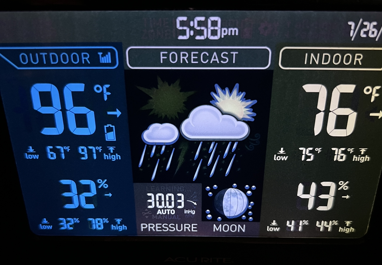
I agree Carver...hottest day so far in Kingsport I believe. Been sitting on 96 here for the last hour or two.

- 295 replies
-
- 3
-

-

-
- severe weather
- frosts
- (and 5 more)