jaxjagman
-
Posts
9,156 -
Joined
-
Last visited
Content Type
Profiles
Blogs
Forums
American Weather
Media Demo
Store
Gallery
Everything posted by jaxjagman
-
Definite looks better than the last couple days.
-
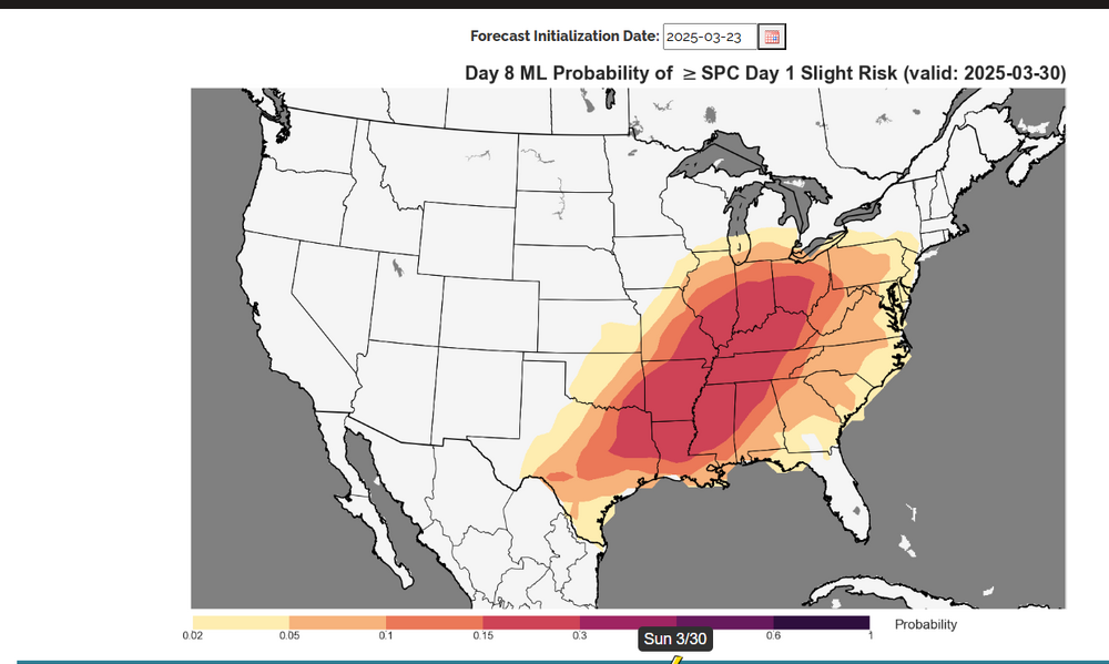
You can get that here if you dont have it or anyone else,that dont https://apps.nssl.noaa.gov/s2s-severe/index.html
-
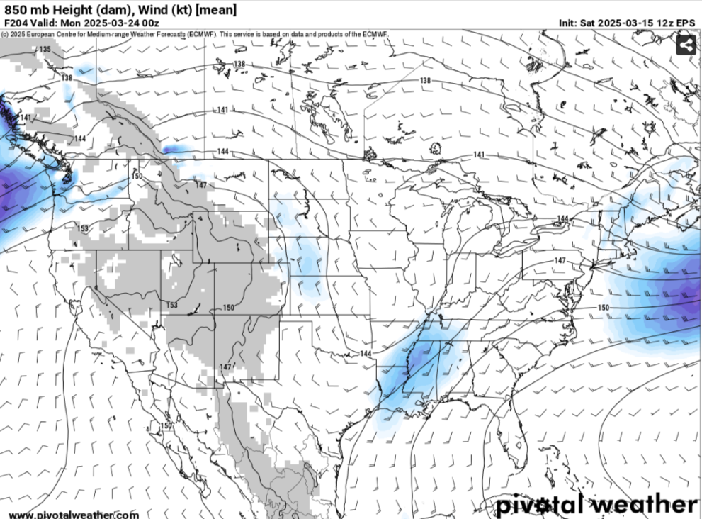
That big block into the Bearing Sea in a few days with no strong blocking into the Hudson Bay should give us a decent severe chance into next weekend.Today there is a trough going into the Yellow Sea with height rises into east China and the Sea of Japan.Think we should see the strongest-PNA we've seen in months upcoming.
-
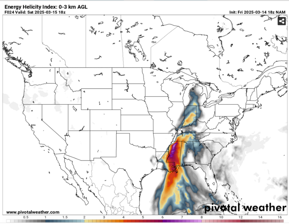
SPC extended the slight risk into Mid Tn,latest RAP/ HRRR now shows DP'S getting into the lower 60's with plenty of instability,looks mostly wind/hail but i wouldnt be surprised to see a tor warned cell or two into the early evening,i'm hoping for a good light show either way
-
I dunno,we will see but by the latest models i really think the severe risk will be more further east than whats showing right now and it could also be hydro problem for someone right now just as well,but its still far out The MJO is fixing to have the next several days destructive interference more than likely it seems from Kelvin and Rossby waves in the upcoming days,it seemingly should go into the COD and into the WH more faster than being shown by some RMMM'S

.thumb.png.344f61f1fd53213260d4c35a659a5158.png)
-
That ridge building into the Bearing Sea/Aleutians by all the models by mid next week will get us into a active pattern towards the end of March for several days.I believe the focus point should be towards the Hudson/Greenland.In general when height rises into the Hudson and into the Bearing Sea this should be ridging along the 4-corners and not into the S/plains
-

Fall/Winter Banter - Football, Basketball, Snowball?
jaxjagman replied to John1122's topic in Tennessee Valley
My pick to win the big dance this year is the Gators.Those guys are playing awesome as of late.I'd like to say Auburn,but i think they look tired now from playing all these Quad1 teams which in my mind has been insane. I'd be shocked still if Auburn isnt a one seed.JMHO -
Still looks like we have a severe threat upcoming and possibly some BN temps for a few days after.Thats a big trough in East Asia going through all the way to Taiwan the next couple days,probably more indictive of the MJO into the I0/Maritime during this period. If the JMA is anywhere right the MJO is going to move fast into the WH in a couple weeks,still looks like at this point as we get into well part of April it could be quite interesting as long as the signal stays strong,which is nothing guaranteed at this point
-
https://www.star.nesdis.noaa.gov/goes/meso_band.php?sat=G16&lat=34N&lon=90W&band=FED13&length=30
-
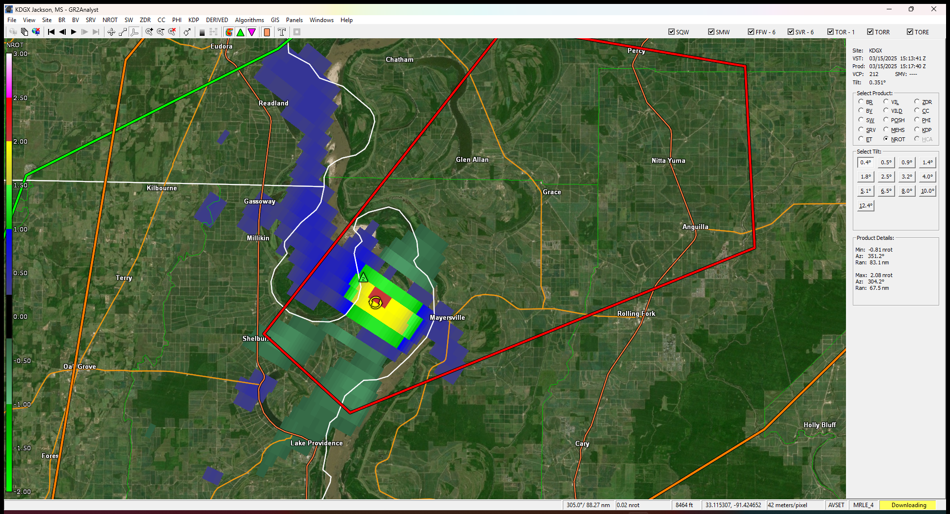
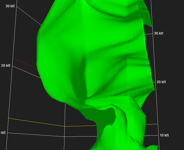
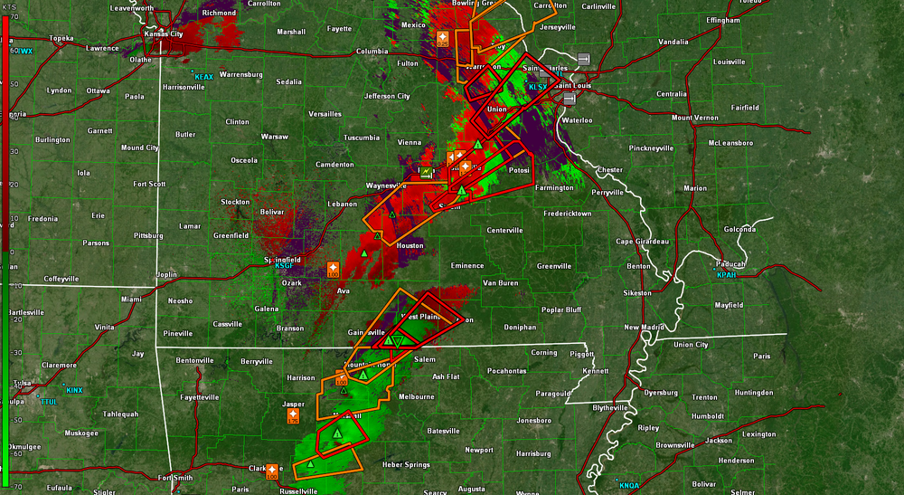
these cell are booking it in MS
-
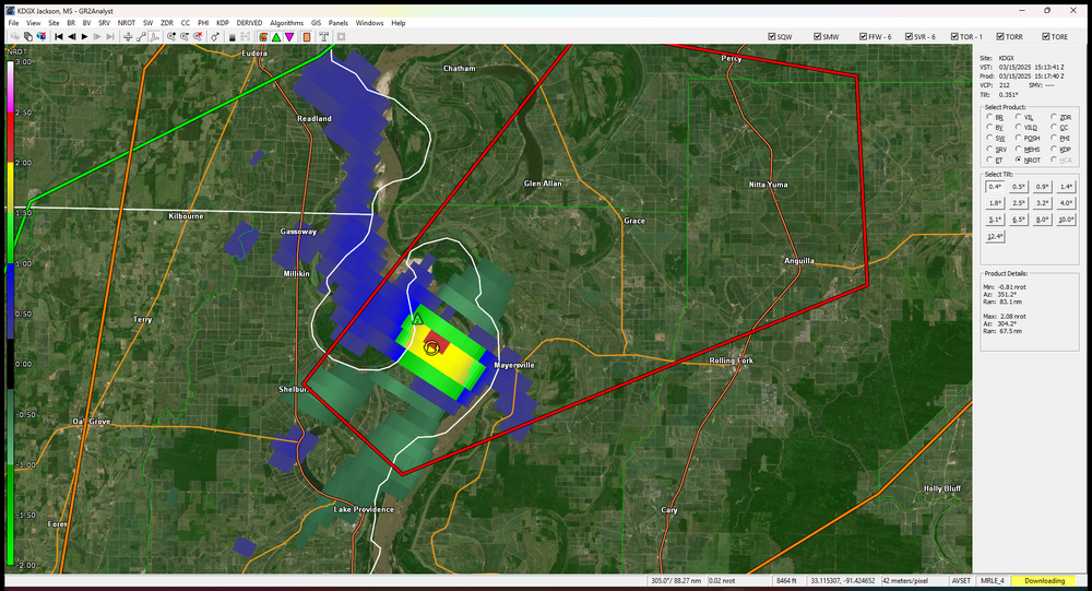
Tornado headed towards Morgan City
-
Yeah to bad its not at night,would be a awesome light show
-
Starting to recycle maybe
-
PDS now
-
Safe bet
-
Yeah and the sad parts its just starting,wait until tomorrow
-
-
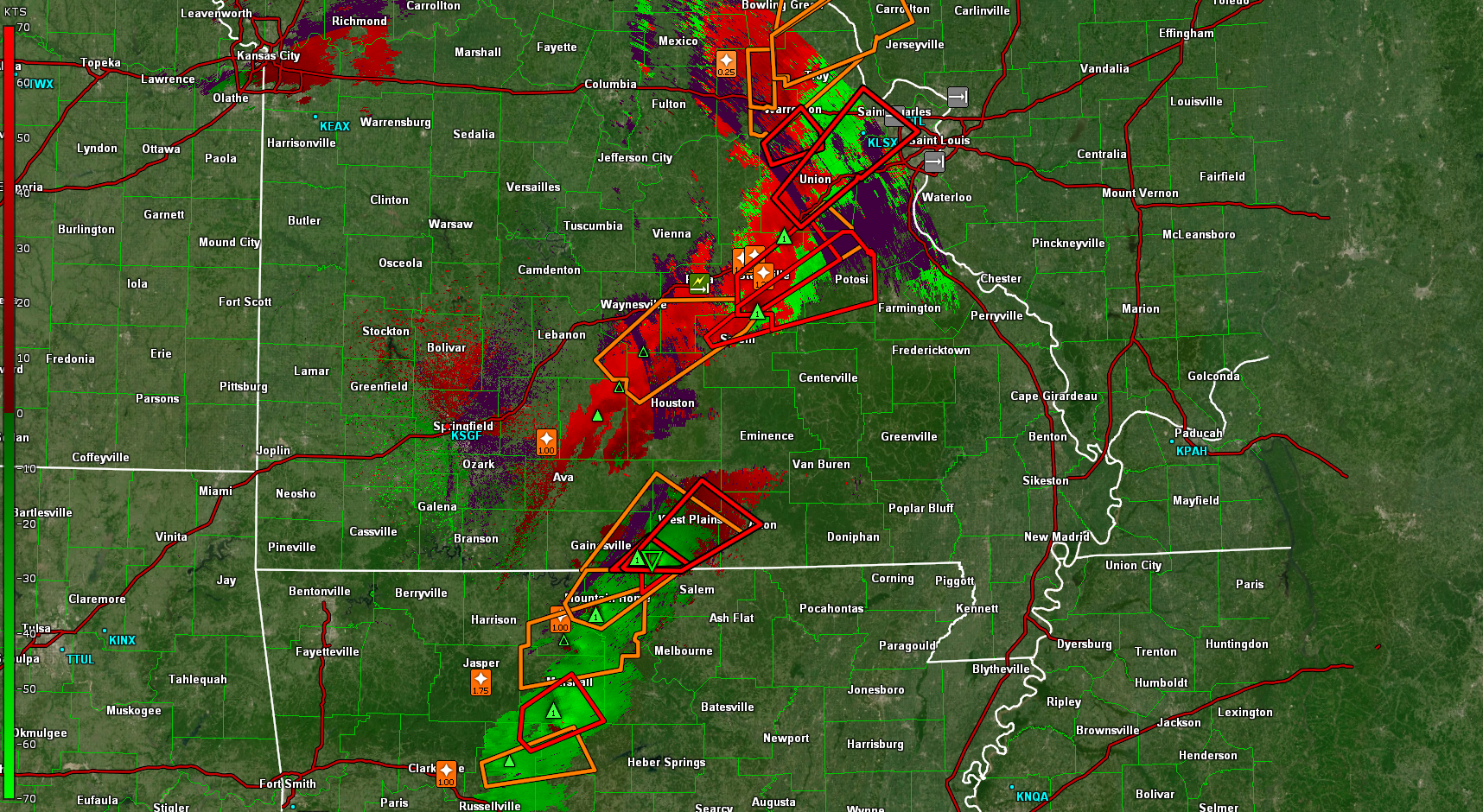
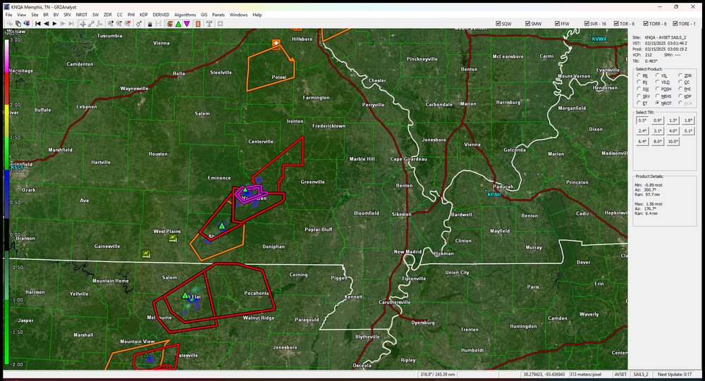
Tor emergency in MO,Carter CO
-
Yes,these are all broken cell super cells which should mature the next couple hrs
-
Oh its such a mesmerizing road,but there is so many few exits,its really dangerous in severe weather,i really love going through there any other time
-
Franklin Co is getting hit hard in MO,already had one tor and another is fixing to hit,2.75"hail marker
-
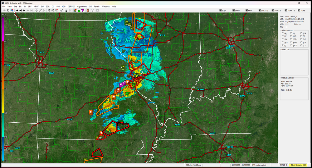
Cranking up
-
Yeah dont go down the Natchez to get to Jackson..lol..That could be the road of no return during severe
-
If the NAM is anywhere right,you might be chasing in your back yard,stay safe bro


.png.edd7e57dc32ba3e1ea04b479175ce84c.png)