jaxjagman
-
Posts
9,156 -
Joined
-
Last visited
Content Type
Profiles
Blogs
Forums
American Weather
Media Demo
Store
Gallery
Everything posted by jaxjagman
-
Euro has a boundary lifting though the Tn Valley around next weekend,if it right then would be also a line of severe storms possible with DP'S 60+all the way up into the lower OV
-
Good for the east,we've at least gotten moisture here recently South Drought Summary Temperatures were cooler than normal for the region this week with most areas 5-10 degrees below normal. It was mostly a dry week throughout the region with only areas of southern Texas recording above-normal precipitation. Some areas are pushing 60 or more days without any significant precipitation in portions of Oklahoma and Texas, but as it is climatologically the driest time of the year for some of these areas, drought degradation has been slow. Changes this week included an expansion of abnormally dry conditions over extreme northwest Arkansas and central Texas. Moderate drought also expanded over portions of central Texas due to reports of crop losses due to lack of soil moisture in the region. Extreme drought expanded along the Big Bend of Texas where hydrological indicators are supporting the expansion. Some improvements to the severe and extreme drought were made in middle Tennessee, but abnormally dry conditions were expanded in the southwest portion of the state.
-
Yeah but where has it been this year,i agree with you more study
-
Be totally shocked if we get anywhere near 80 through mid month,it should be a wet pattern into TN
-
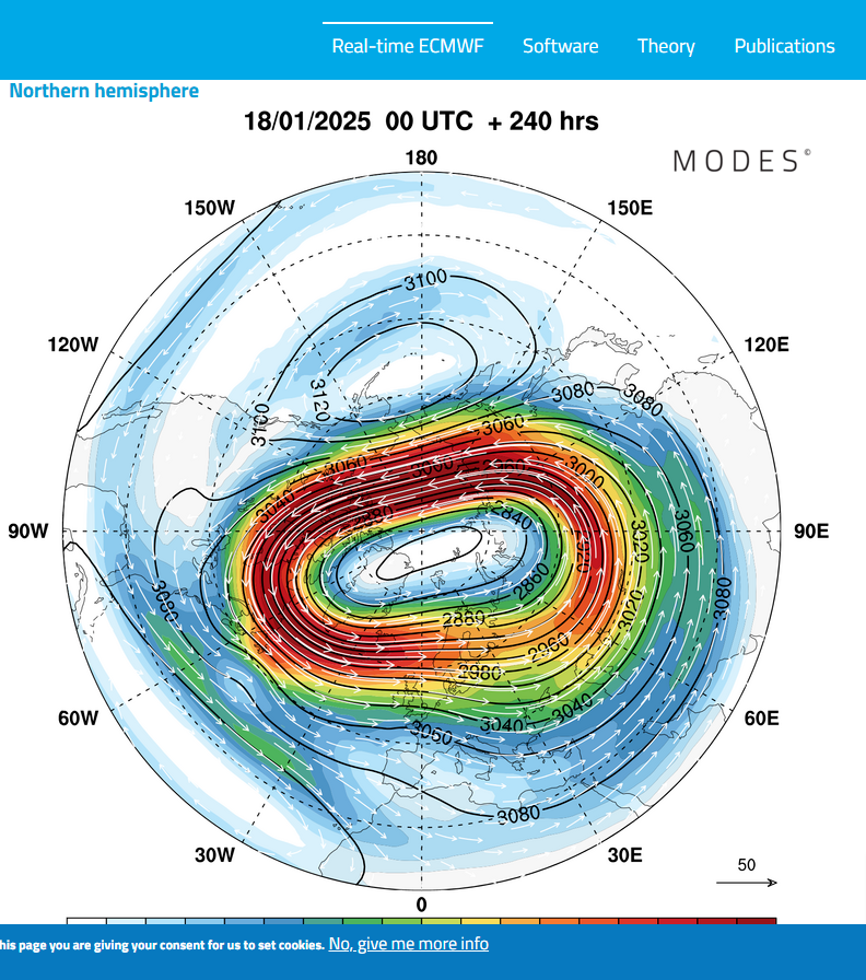
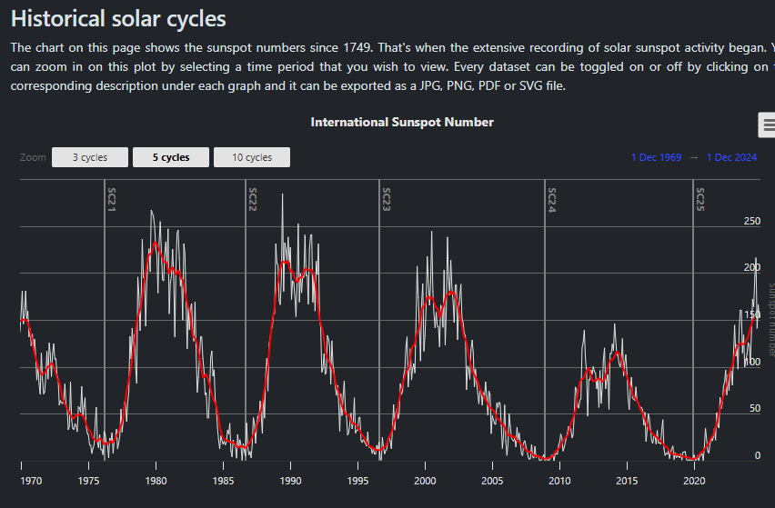
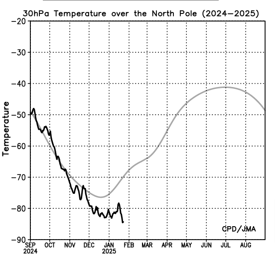
I'd like to understand more about the solar cycles and why people even try and incorporate them into seasonal forecast.In 1996 we had back then one of the strongest PV's on record only to get surpassed by the 2020,this year the PV has been relentlessly strong even without a solar min.I'm just using 30hPa as reference what JMA shows
-
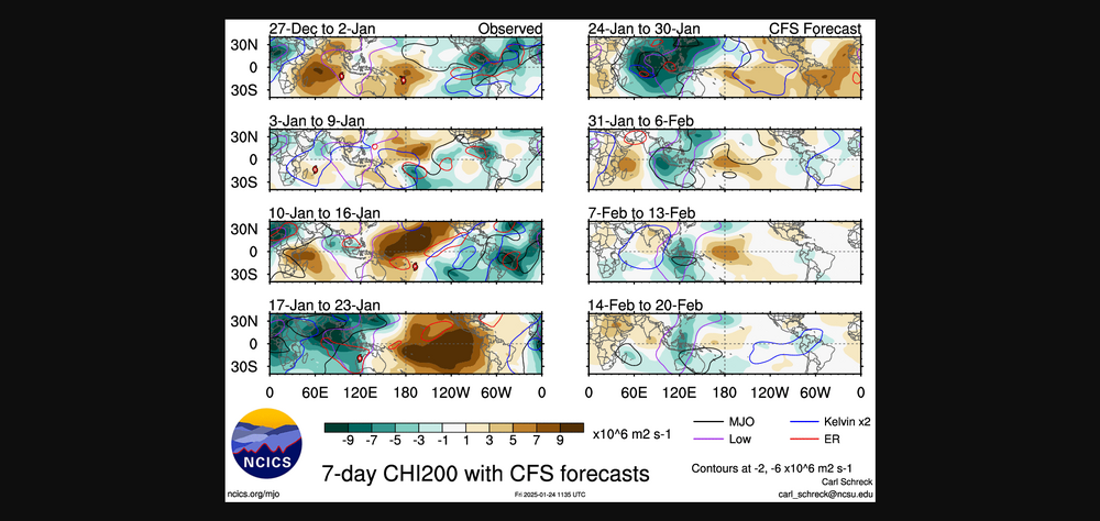
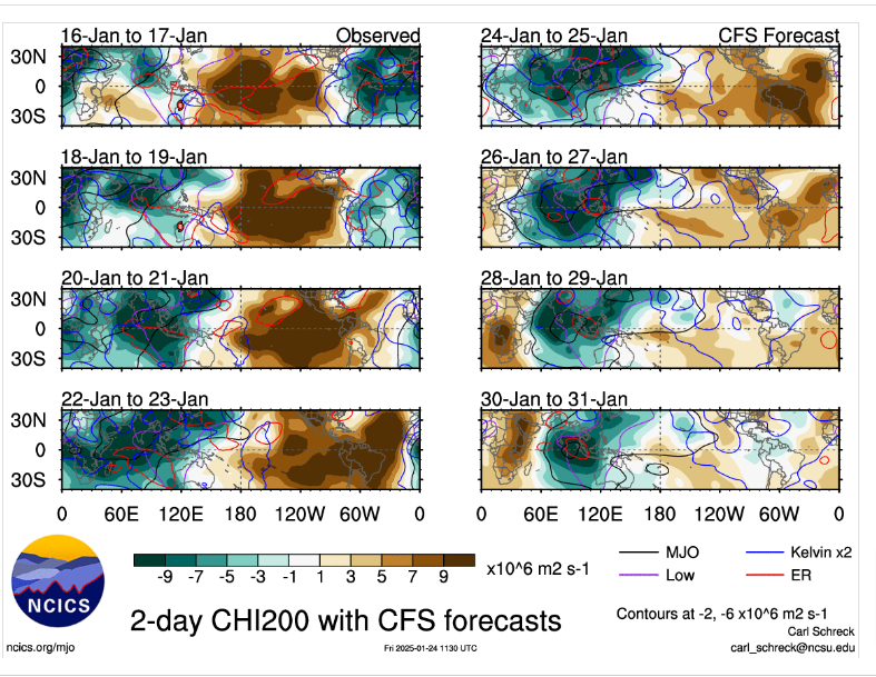
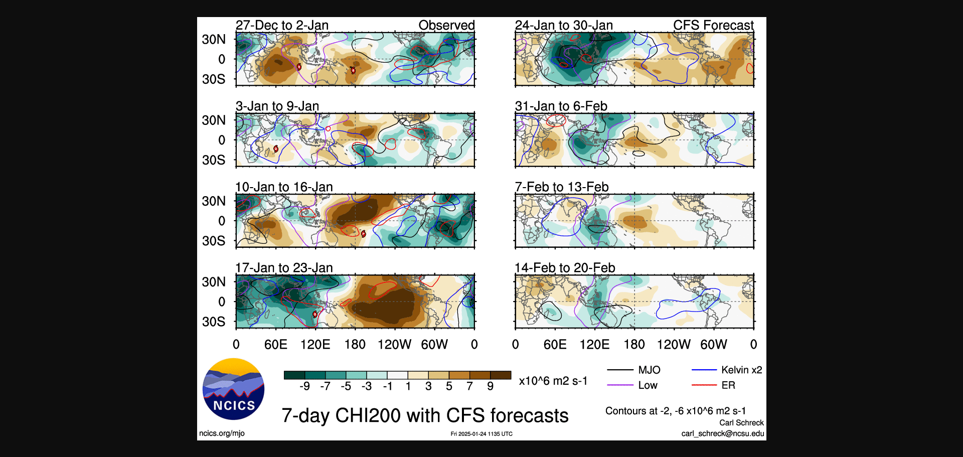
Dunno,its a waiting game.CFS totally rocked the other models into the extended period last cycle,it showed what was going to happen into the IO while the other extended models wanted to kill the MJO off to fast
-
See what happens the next few days into the IO.RW AND KW can cause chaos into the IO and cause constructive interference with the MJO signal where it could be further along,but every model i see is showing the the MJO will start to weaken the next couple days
-
https://www.brproud.com/video/wvla-anvato-2/adstXlnjeoDNm4YE
-
Resembles the 2014 storm https://www.weather.gov/mob/2014_Ice
-
https://www.nature.com/articles/s41612-022-00263-5 Try this one,not sure its what you want.Some of my links ive had for many years,some were deleted and now some are behind a pay wall now.Jeff might be able to help you out more
-
I have more papers buried in my bookmarks, but this might be what you are looking for? https://journals.ametsoc.org/view/journals/mwre/144/2/mwr-d-15-0289.1.xml
-
 Last just came through here,mostly partly cloudy now,yall still have few hours
- 207 replies
-
- 3
-

-
- obs
- light snow
- (and 2 more)
-
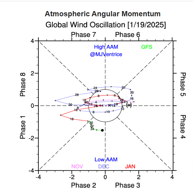
Shoot i wouldnt rule out you guys getting some strong storms upcoming,AAM seems fairly coupled with the MJO,if this were certainly a month or two later you'd probably have alot more confidence
-
You guys to the east of us should have a few more hours,the back side of us is fixing to end but virga has mostly taken over,so good luck
-
Sorry to hear this.God speed recovery,my prayers are with you.
- 207 replies
-
- 3
-
-

-
- obs
- light snow
- (and 2 more)
-
Could be,some people still think its more like the 94-95,i at one time thought the same,but but Yellow Sea to off of the West Pac off of Japan the SST'S were very cold compared to this year.Its kinda ironic tho even tho last year was in a NINO was the warmest ever SST'S in a NINO,this year is even warmer with a NINA,i dunno,we'll see
-
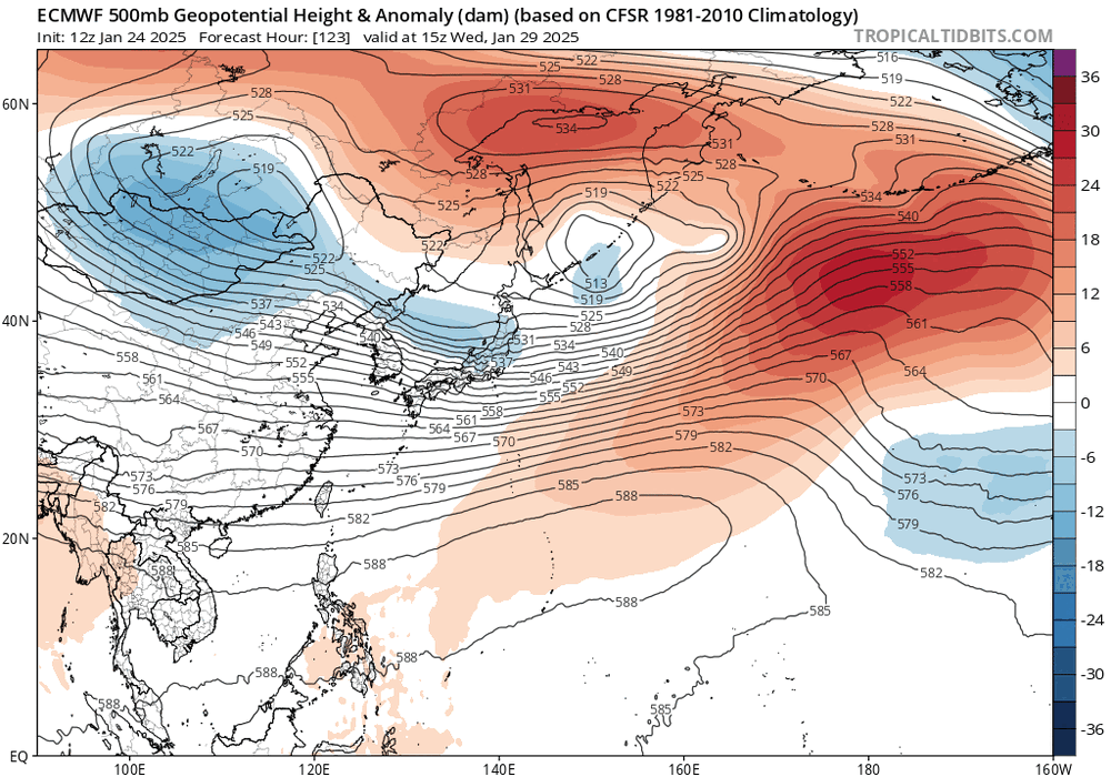
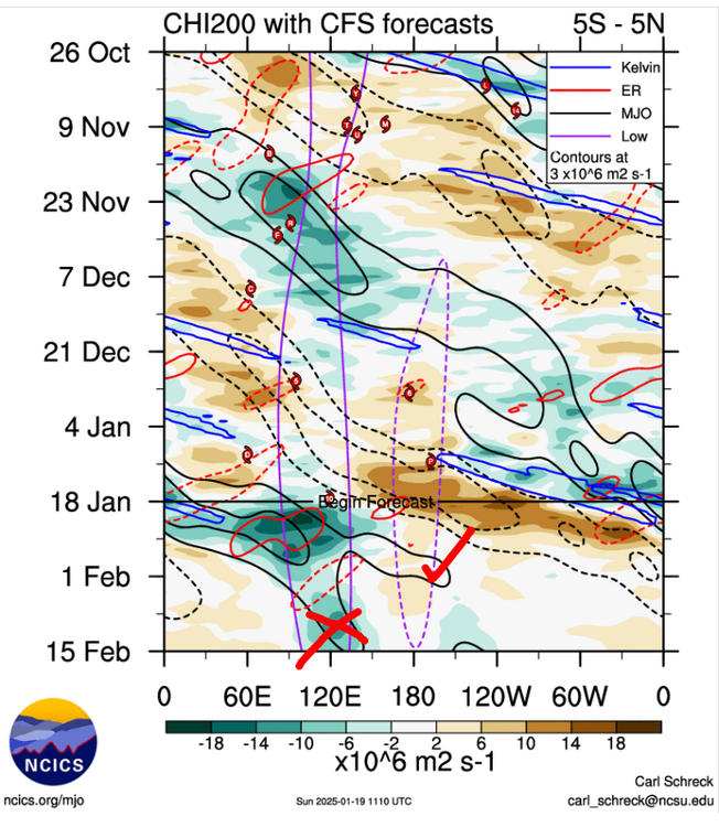
Think we can moderate some into the first week of Feb.some people say the MJO is gloom and doom when it gets into phase 3,its really not,see all the height falls into east China and the Koreas,IMHO thats not is not a warm look,we've seen this pattern since late fall into winter this year and it continues
.thumb.gif.c890deb7215e94c41372933f9e48afbc.gif)
-
Why couldnt you?Think the MJO becomes murky right now where it actually could go in later days,probably any model could be right ATM into the extended period.I was looking at the CFS and it shows two camps in the upcoming days,,believe it should be more advanced.Seems to me the IO will play games with the signal from the Rossby wave trains and Kelvin,thats just my thoughts,no forecast and i certainly could be wrong
-
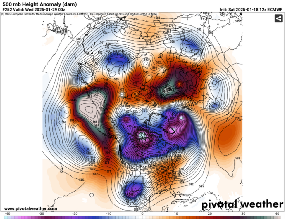
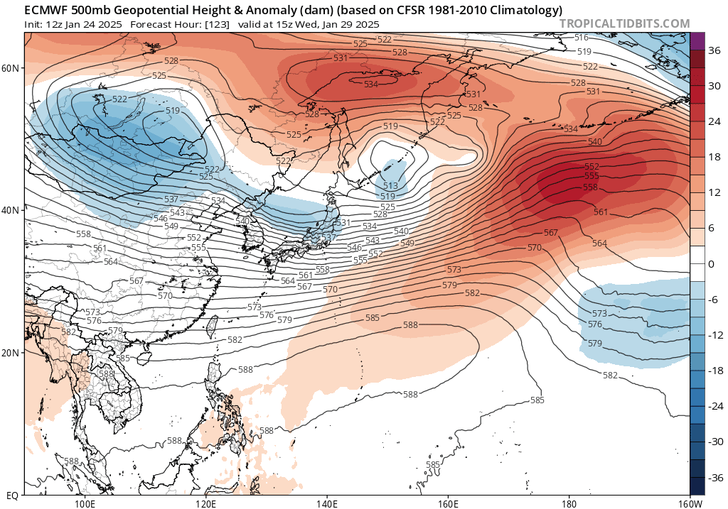
Euro is trying to kill my cold thinking towards the end of the month.Siberian ridge and heights pumped up into the AK,Bering Sea would be a more ridge in the east,hopefully this changes
-
Should be one of the past several years we seen the PV so strong.More warming today per JMA,but the PV is still strong and by 10days on the Euro it looks more just tilted.Soon as the MJO gets out of the Maritime it should get sling shot back to the pole

-
Not really,they only cover severe during prime time.But this is the classic for them still to this day
-
Alot of people move in those parts the same as Florida to escape the cold in winter,guess that will backfire on them this year..lol

.gif.f1ec276942a0ea541a8e1ba3c5387c89.gif)