Terpeast
-
Posts
6,687 -
Joined
-
Last visited
Content Type
Profiles
Blogs
Forums
American Weather
Media Demo
Store
Gallery
Everything posted by Terpeast
-
I'm on the south side of that band, and I've picked up about the same amount. Even added more since my last measurement.
-
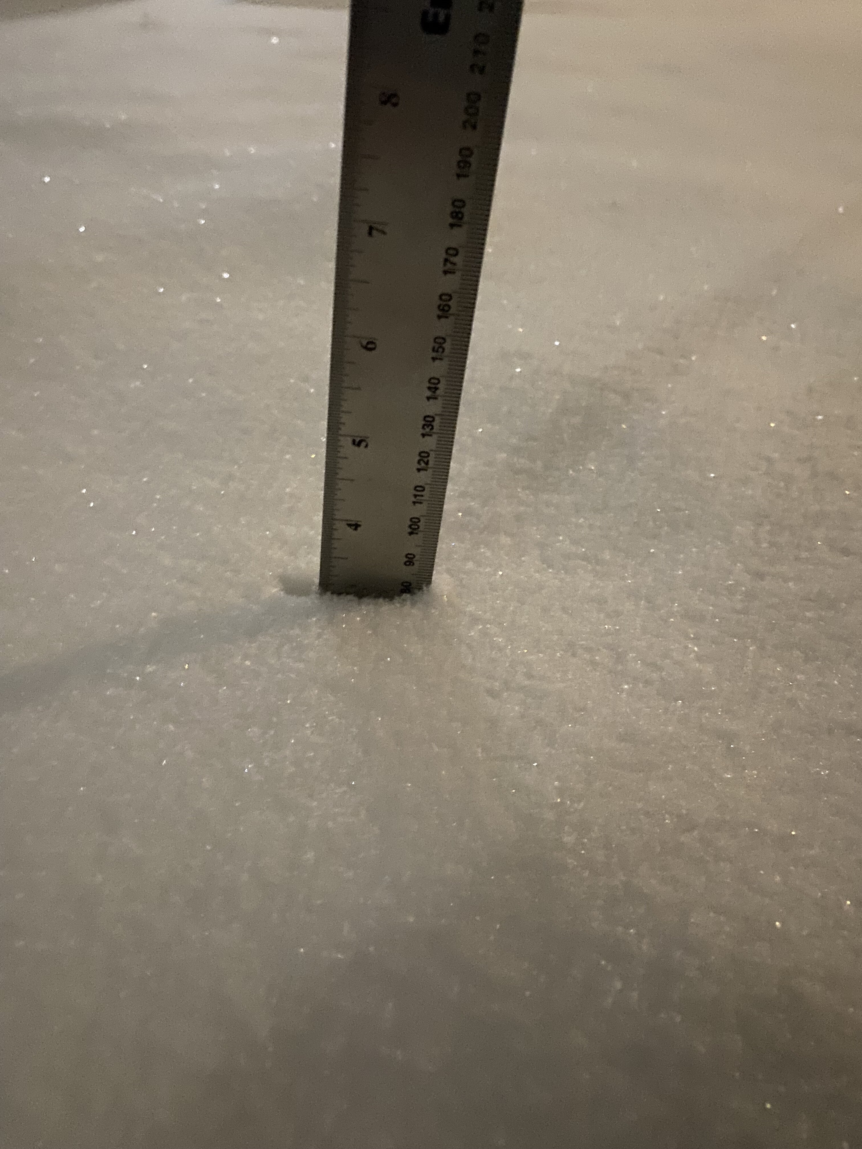
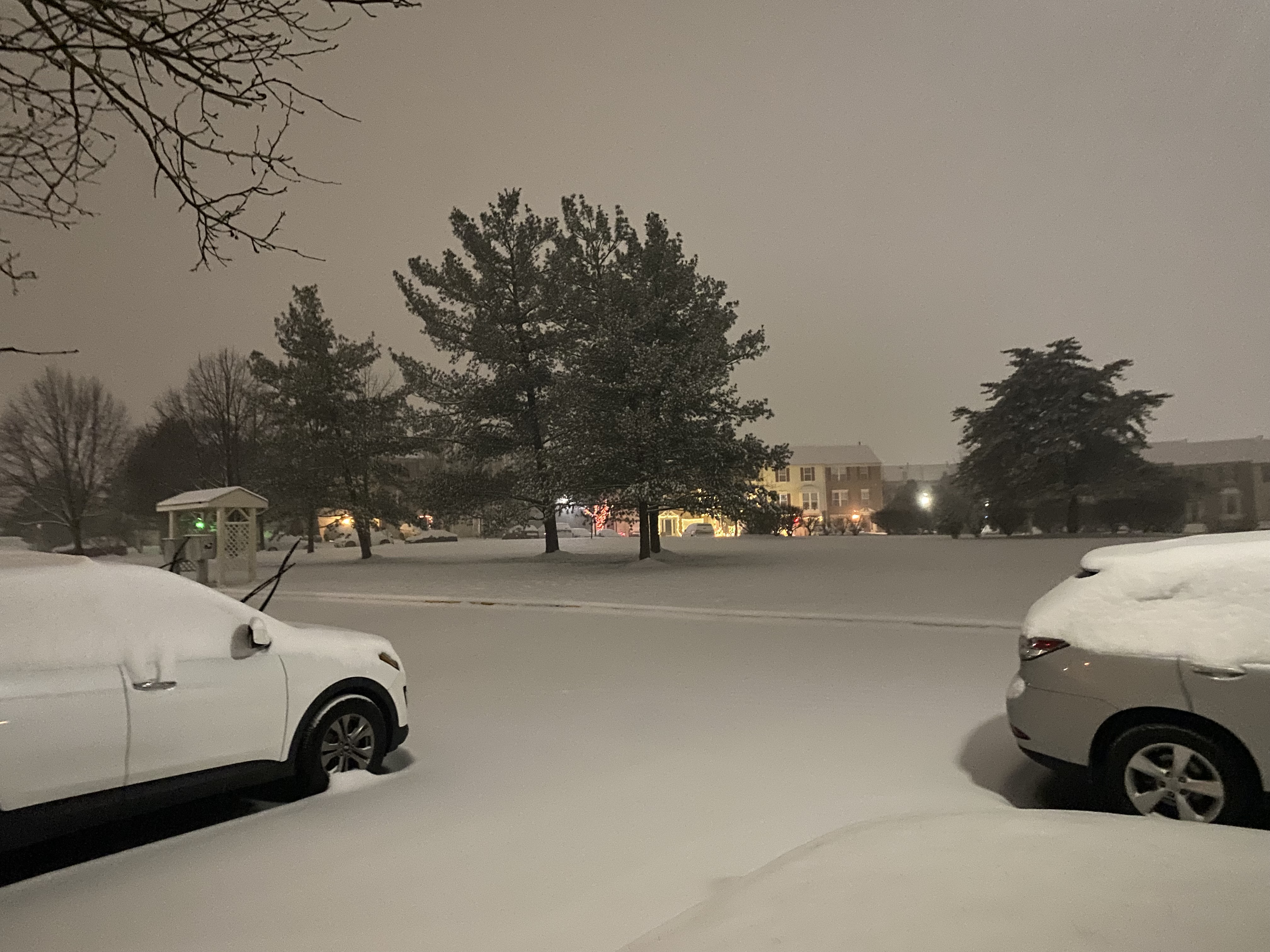
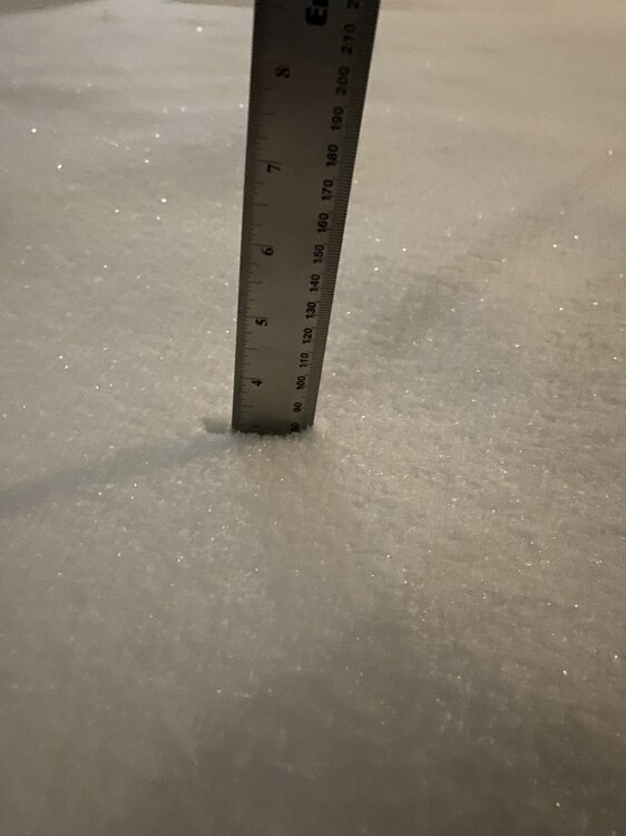
Just measured fresh snow after shoveling my sidewalk - 0.7", which takes me to 5.5" so far
-
Maybe... JUST maybe I can reach 8" if this ULL overperforms. I'm at or close to 5.5" with that band over me. I think 7" total is more realistic.
-
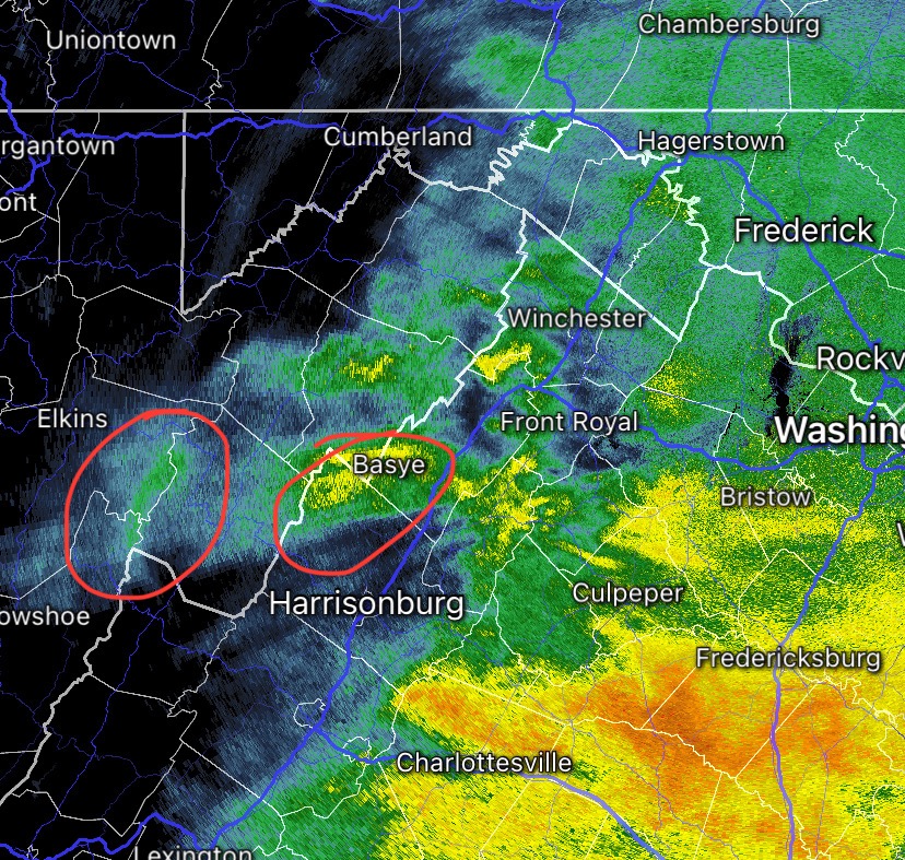
plowed streets and shoveled sidewalks getting covered again This band looks stationary, maybe?
-
this band over ashburn should push me to 5" total for warning criteria (compaction notwithstanding)
-
Mod snow, nice dendrites
-
thats not the ULL round, though. switching back to snow as this band arrives on my doorstep
-
Good trend by the GEFS the last few runs. Will have to see if Euro/EPS follows. It did better the current event than the GFS as far as pinpointing the max snowfall stripe south of us imho
-
Yeah, I've compacted down to 4" of cement. Odd thing is when I first went out with my kid, we couldn't make a snowball that held its shape. After some fzdz, I sent her back inside (she was cold) and did some shoveling. With 4" OTG after some sleet and fzdz, it felt more like shoveling 7 or 8 inches. Or maybe I'm just getting old
-
Light snow with decent flakes, finally
-
For those of you still getting heavy snowfall, congrats. This is yours! My compacted 4"+ makes for a beautiful winter wonderland, and currently getting snizzle which isn't adding to my accums. Hopefully the ULL pass gets me another inch or two.
-
Back to light snow!
-
You’re to the east and going by radar your rates are still good. But soon they will lighten up and flip to IP maybe fzdz even i don’t think that will last, though. When the ULL passes over, we all flip back to snow
-
4.8” at 7 am it’s sleeting though rn
-
About to go jebwalking, will take my 7 am measurement
-
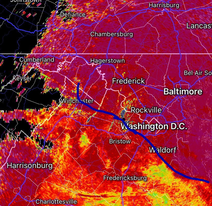
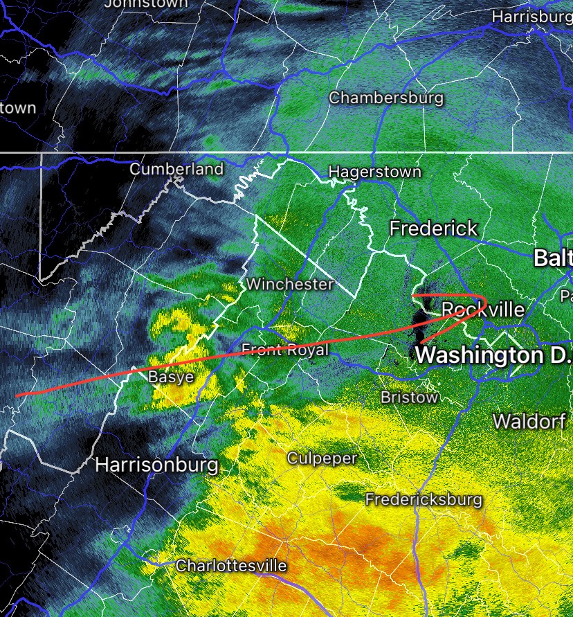
Here’s where a i think the mix line is
-
Rimed snow + sleet at the moment
-
6am measurement in ashburn: 4.2” (1.1” in the last hour) just now bigger flakes coming down after rates faltered a bit with subsidence between bands. Main band trying to push north into my area.
-
Confirmed. I’m a couple hours ahead of you as per radar, and this is a beat down here. After a slow start, I’m catching up you’l get even heavier rates than I’m getting here, probably
-
25/23 SN+ under some yellows, heavy snow bigger flakes. Not fatties, but can see them without any light
-
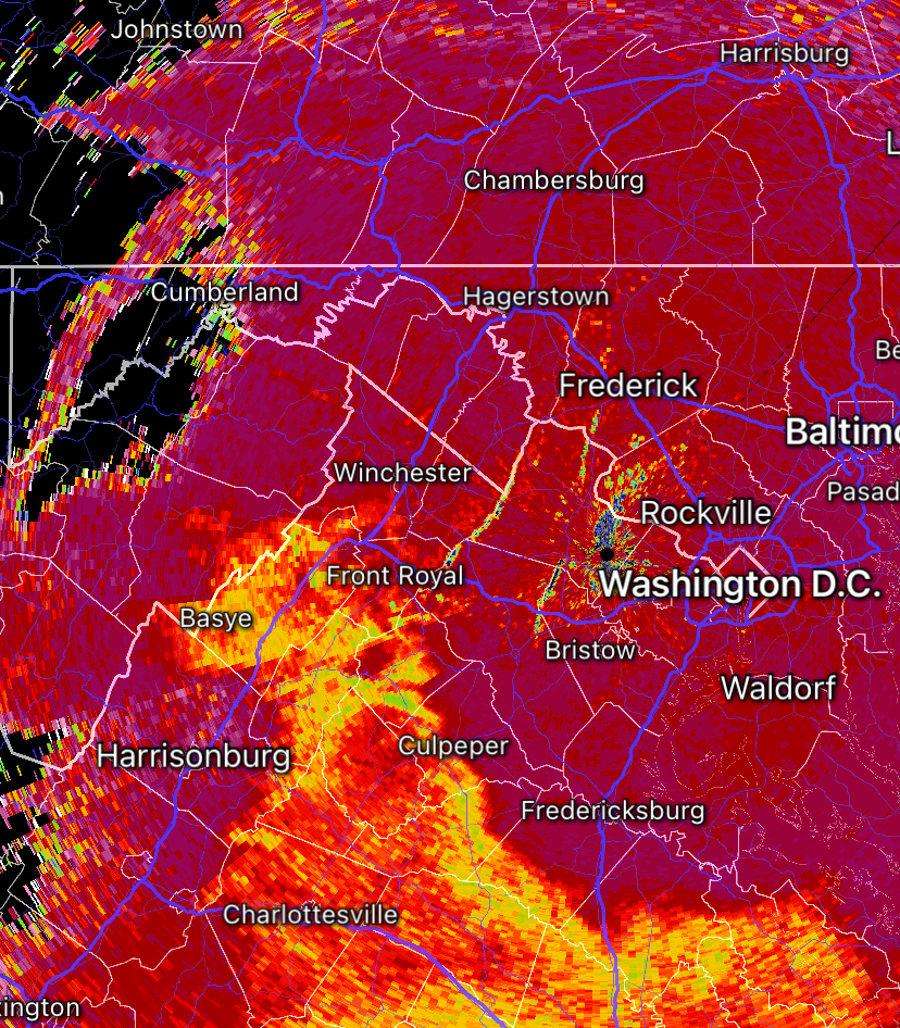
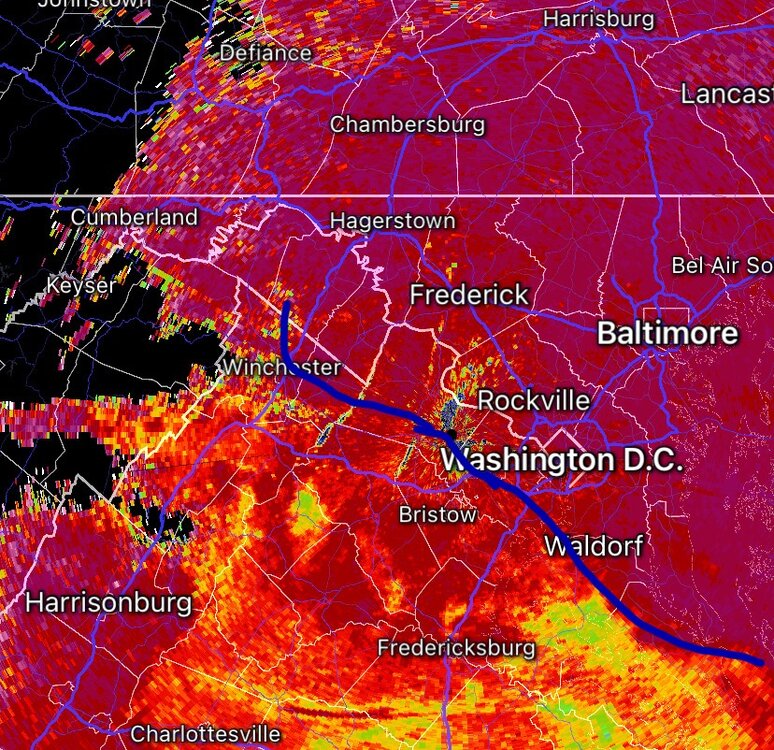
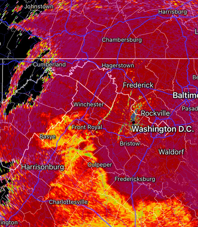
more backbuilding, some additional yellows on the way Strong frontgen with mixing and riming in brighter correlation coefficents below (we won’t mix, this will become heavy snow by the time it gets here)

-
3.1” at 5 am, snowing at a rate of 1.3”/hr

-
bit of back building in WV at the start of my red line

-
Heavy snow. 25/23. Best rates of the night
-
Nope. Wasn’t me