Terpeast
-
Posts
6,687 -
Joined
-
Last visited
Content Type
Profiles
Blogs
Forums
American Weather
Media Demo
Store
Gallery
Everything posted by Terpeast
-
Snowpack holding on strong despite the sun and temp pushing 40
-
I wonder if that would actually push the pna ridge further east so instead of a west-central trough, it’ll be situated closer to the east.
-
CMC/GEPS still has a cold bias, but it’s still verifying better than the GFS.
-
I don’t know about 60s, but I imagine making a run at 50 wouldn’t be too difficult without the pack
-
If we’re calling 39 a mini torch, you know it’s been pretty cold for a long duration.
-
Low of 27, bit warm compared to other places
-
Especially considering this winter was, on paper, supposed to be a ratter. I know you were skeptical, and that was a good call on your part. I initially thought ratter, but when I checked the analogs and adjusted for recent climate, I was like “hmm, maybe not as bad as we think it’s going to be.” It’s in the thread title of my outlook
-
Safe to say this one overperformed DC N&W and underperformed S & E
-
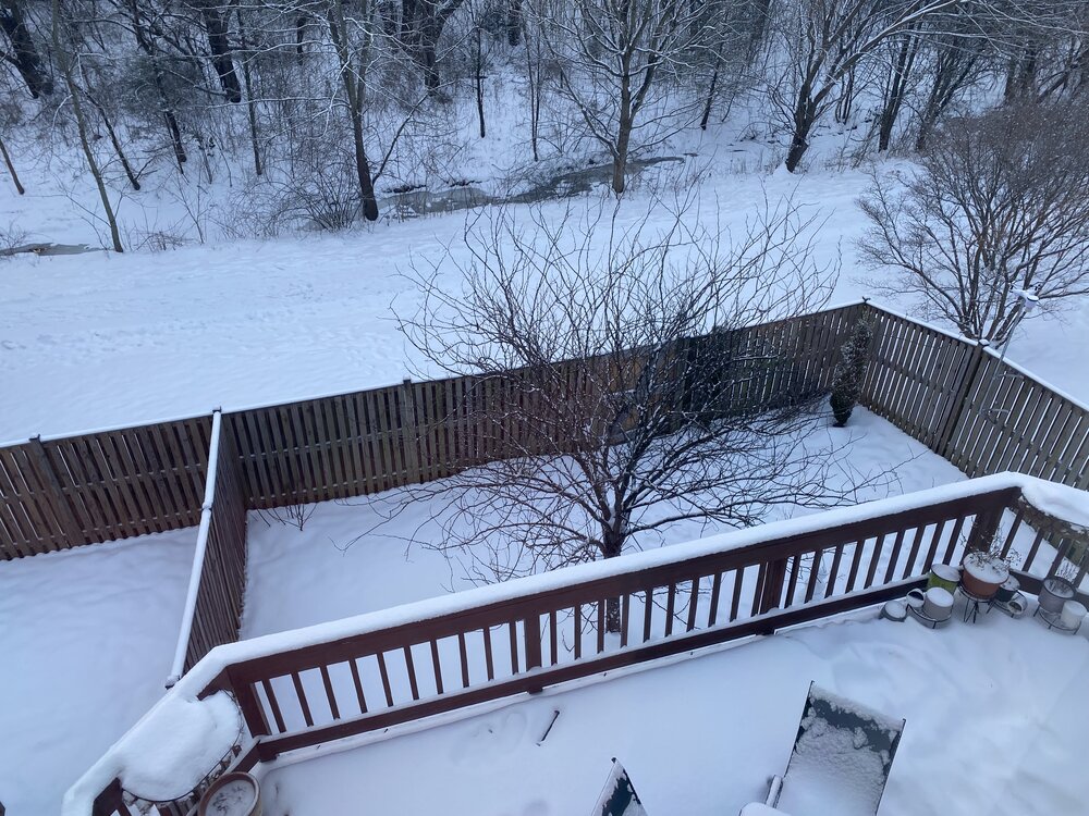
12/24: 0.1” 1/3: 0.3” 1/6: 7.6” 1/11: 1.3” Season total: 9.3”
-
-
Just measured 1.3” in Ashburn. Everything white again. Winter wonderland
-
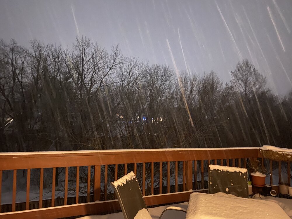
Rates starting to lighten, but still dumping good. Getting close to an inch… i think I get there. going to bed now, gn all. Enjoy! Anything we get after this round is house money to me
-
-
Visibility just dropped way down. If this holds for another 30 min, I get the inch
-
Looks like 0.7” so far
-
Bigger flakes mixing in
-
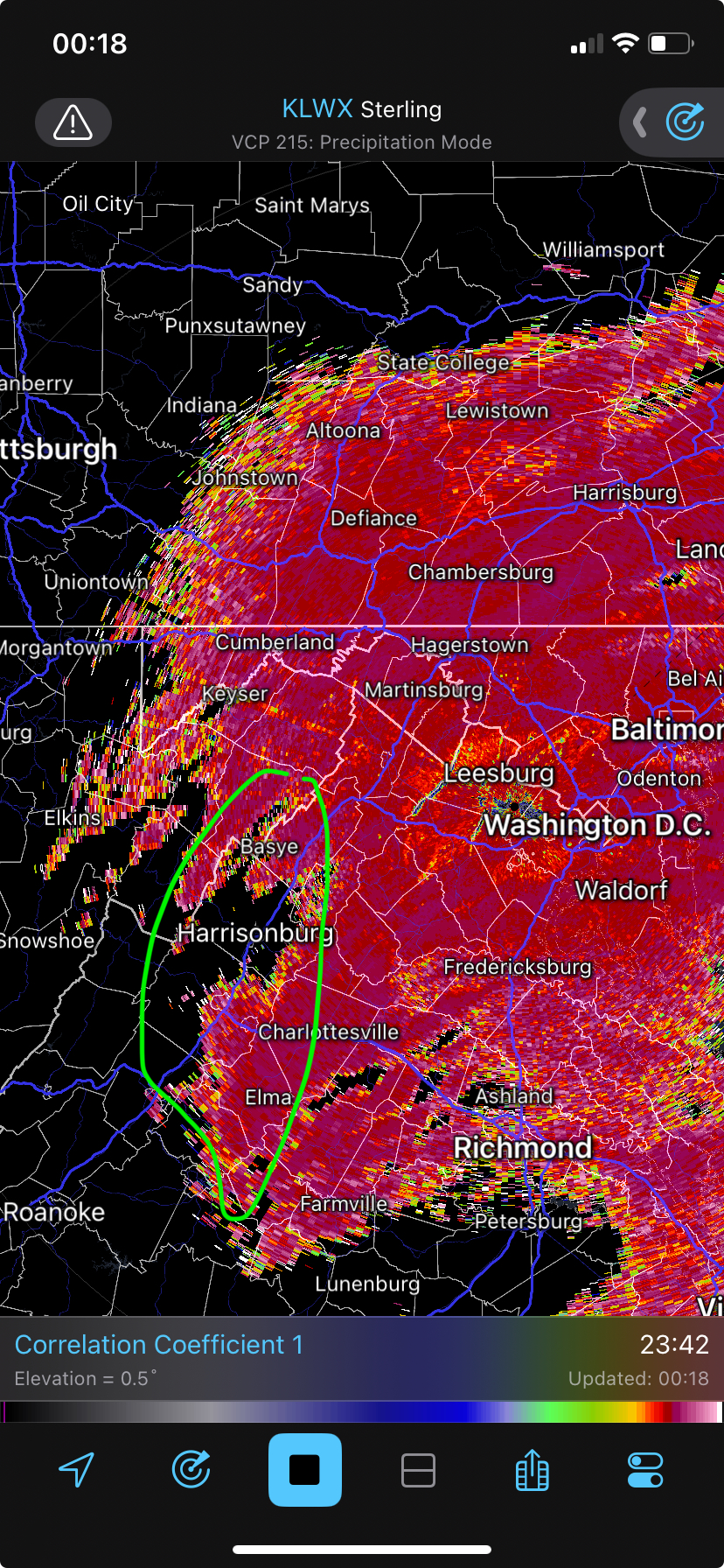
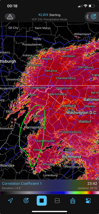
Some stuff is backfilling where I circled, but I think it will be light and showery stuff. I prob won‘t stay up for it
-
Same, if this band holds together, I think 1” is reasonable
-
Looks like a band is trying to set up along PWC, loudoun, montgomery, and howard counties. Will be interesting to see how long it lasts before the cut off
-
Dumping under this yellow
-
Eyeballing maybe 1/4” so far. Still coming down good. 27/23
-
Ripping
-
Mod snow, some dendrites
-
Better rates now. Starting to whiten everything back up
-
Light snow started again. Instant stickage. Streets about to cave