Terpeast
-
Posts
6,687 -
Joined
-
Last visited
Content Type
Profiles
Blogs
Forums
American Weather
Media Demo
Store
Gallery
Everything posted by Terpeast
-
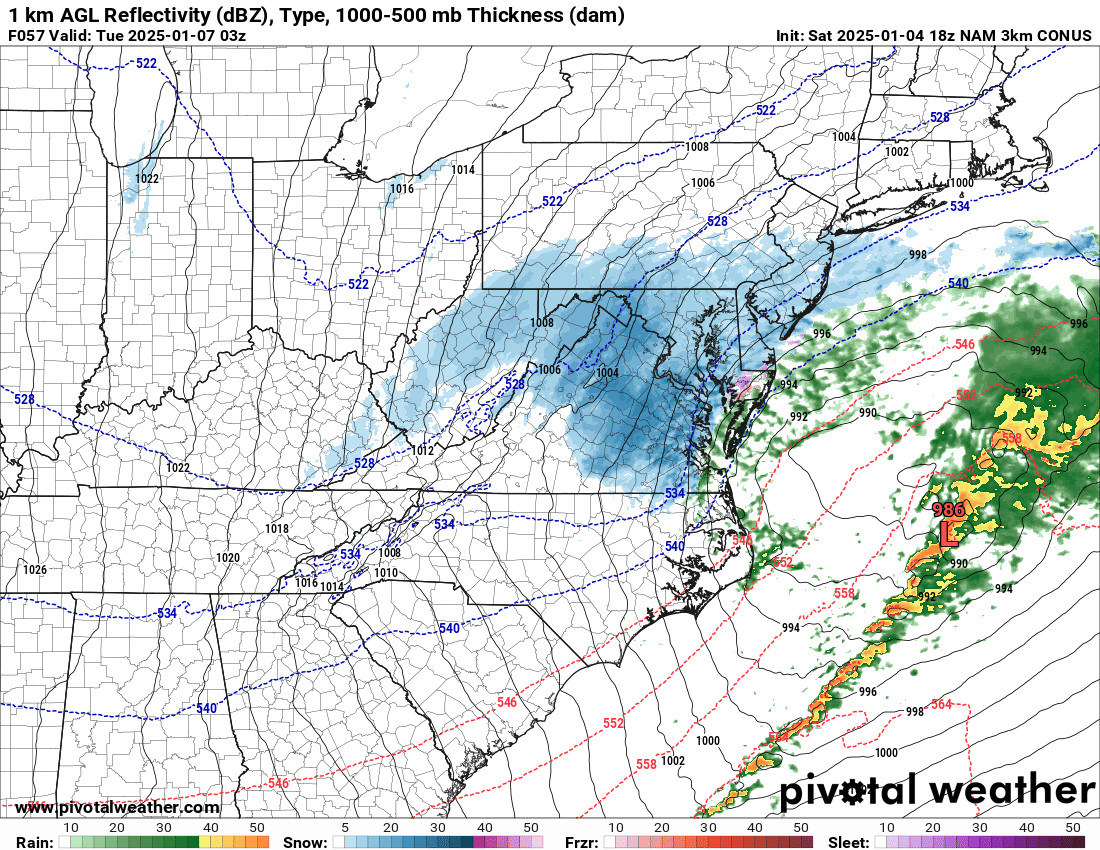
HRRR shows quite the thump. Hopefully its thermals are correct and I turn out to be too conservative DC south
-
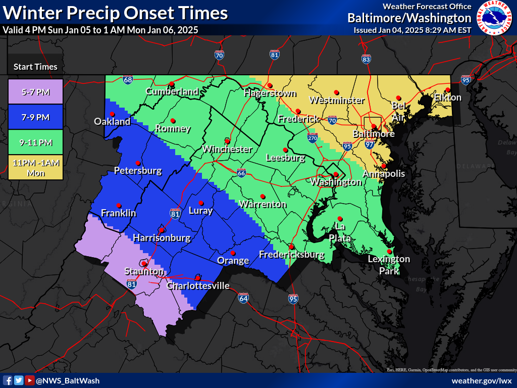
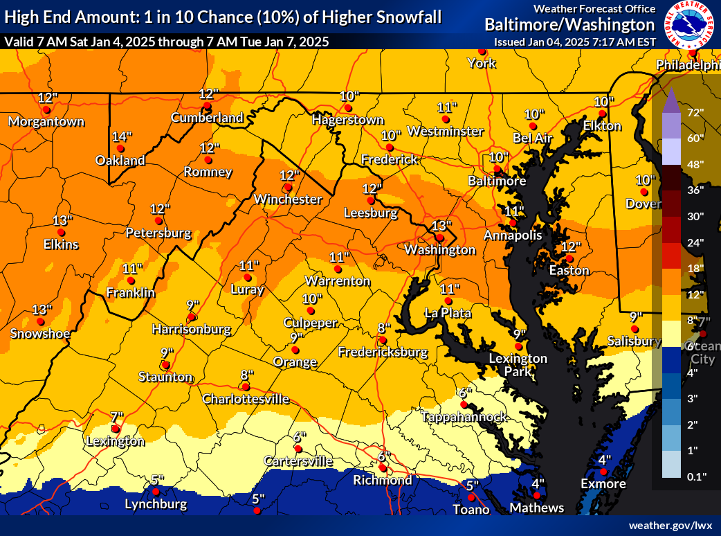
First call: I’m in favor of the northern group of models and not really buying into the foot plus snows around EZF, nor am I buying the weird “dry slot” in the WAA portion of the storm. Even though confluence is very strong and we have a cold antecedent airmass, this is a very dynamic system with a powerful 70kt low level jet. We’ll see dual banding with 850 and 700 fgen, with the former along i-66 (give or take) and the latter between i-70 and the M/D line. Mix line likely to reach DC, and sleet/fzdz may even occur as far north as i-70 WHEN rates lighten up (heavier rates will be snow). Greatest uncertainty is whether a coastal gets going in time for us to get an extra few inches. In my first call, I say it will. My snowfall forecast (east of blue ridge): South of CHO - EZF - La Plata line: 1-3” heavy mix Delmarva South of Salisbury: 3-5” Delmarva North of Salisbury: 5-10”++ EZF north to I-66: 3-6” mix Between I-66 and I-70: 5-10” with some sleet/fzdz Between I-70 and M/D line: 6-12” all snow I reserve my right to make a final call when I see the need to make changes. P.S. Beltway DC metro? 4-7” with some mix
-
And there it is. Models are converging
-
Didn’t even get half an inch, and there is still some patchy snow otg. It’s cold. 27 now, wind chill 14
-
I’m thinking GFS is trying to find a compromise. This might be it
-
According to LWX WSW, it looks like they are banking on a warm nose up to and along i-66 and maybe a bit north of that. Still calling for 5-9” locally up to 12”
-
I expect that 18z and 0z runs tonight will start converging onto a final solution (more or less).
-
You could very well be right! I almost did not add the 36 hrs to 24-36 hrs. Really best inside of 24 hours
-
24-36 hours or less
-
I know it’s out of range, but this is beautiful

-
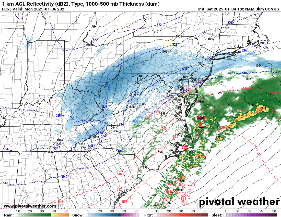
NAM 3k also bringing wrap around snow

-
Yeah I also think with strong frontogenesis and high DGZ rates, it’ll overcome any thin warm nose and keep it heavy snow with some riming. But as soon as those rates let up, it’s going to be sleet or freezing drizzle as with a dry slot. I don’t think we lose any real accums with it, maybe an inch if that. And the snowpack will be tougher.
-
3k says we don’t flip at all
-
Strong 850 frontogenesis across NoVA but warm nose over the potomac river, so it’s sleet verbatim (12k version, haven’t looked at 3k) Edit: changes back to snow next panel
-
This one gets rid of the weird dry slot at 12z
-
Confluence about the same. Closed low is stronger, but heights in front are a bit lower.
-
NAM is about 30-40 miles south baaed on H5 vort. Doesn’t sound like much, but could make a big difference in qpf and thermals
-
Nice CAD if the thermals are accurate
-
For the VA part, I hope its me haha But probably winchester and lottesville
-
FYI


-
I think the euro and ukie are underestimating the dual banding, with one on the north side with good ratios, fully believe that band drops over 6”. If the gfs and euro were to split the difference, that north band will be across north-central MD
-
That was yesterday’s run. But good to compare
-
Sfc low farther south, but not sure what it showed last run
-
Low of 27
-
Ignoring the numbers and only looking at the max stripe - I would tick that a bit north maybe by about 20 miles but all should do well.