Terpeast
-
Posts
6,687 -
Joined
-
Last visited
Content Type
Profiles
Blogs
Forums
American Weather
Media Demo
Store
Gallery
Everything posted by Terpeast
-
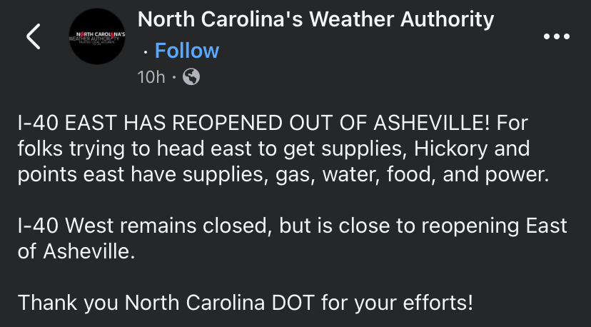
I-40 eastbound out of Asheville reopened last night per NC Weather Authority’s facebook post.
-
Agreed. I’m actually experimenting with AI and machine learning to enable this sort of pattern recognition and use that to predict where the main features are going to be on a seasonal time scale.
-
Notice it happened more frequently before the monster -pdo/-enso background state after 2015. Since that year, it only happened once. So i’m not sure if this pattern will hold this time. If it does, I think its random chance, like flipping a coin and getting tails 5x in a row and then getting heads on the 6th try. But if we DO get a cold February, I’m willing to eat my words and concede that you’re onto something.
-
3.63” on the month. The only day we got a lot of rain was 1.56” on the 26th, the rest was nickel and dime stuff of 0.05-0.25” even though we haven’t seen the sun in almost two weeks.
-
Yeah, we basically have nothing else going for us (anyone south of 40n east of the apps). If the MJO flops this month like the euro is saying, we have a fairly high probability of looking at another stinker of a winter like 2022-23 barring a rogue fluke. If the MJO pops OTOH, it’ll be a good test of the relationship that bluewave has sniffed out and hopefully we’ll get at least a few weeks of a decent wintry period.
-
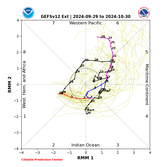
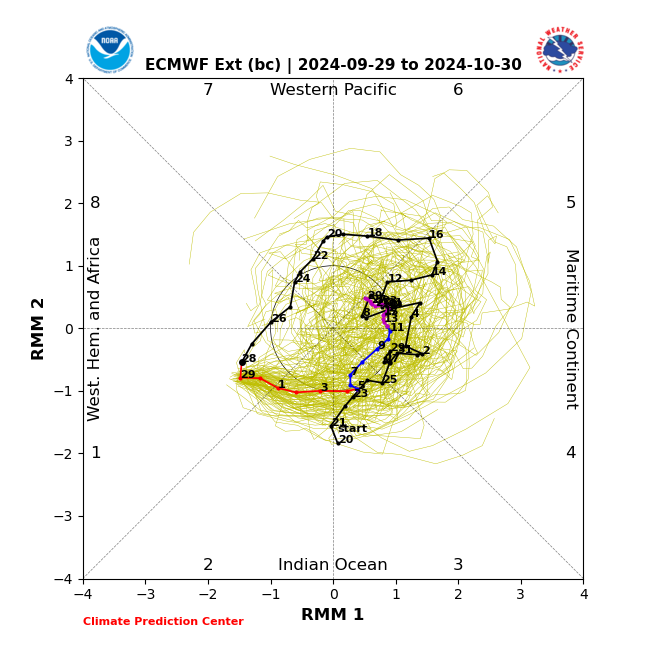
Worth noting most models take the MJO into 4-6 for October, but differ in strength. GFS ens goes record strong especially in the second half of the month, while Euro ens keeps it weak or COD.
-
Haven’t seen any up this way, but noticed a few stink bugs. That’s new because I hadn’t seen them last year or the year before.
-
Musta been gnarly
-
Hurricane Helene: Remnants Impact to Mid-Atlantic
Terpeast replied to WxUSAF's topic in Mid Atlantic
Going by radar, Helene appears to have made a jog east moreso than the nhc forecast track. Maybe nothing, maybe something -
Except for the storm surge in the immediate coast. But other than that, I agree
-
1.56” overnight
-
Looking ominous, especially that 12+ storm surge and high flood risk in the southern apps. Stay safe @WxWatcher007
-
For what it's worth, all ensembles (gfs, eps, cmc) point to October 2021 as a top analog in the 6-10/11-15 day forecasts at least in yesterday's 12z run. We'll see if this holds though, as bluewave said this is a volatile pattern especially in terms of the polar domain.
-
Good link, but what you said in bolded implies that low arctic ice is causing multityear ninas. That’s not what the paper is saying at all - if anything, they’re showing evidence that points to the other way around, multiyear ninas causing lower sea ice by changing the mid-lat circulation via forcing. Be careful with interpreting your sources. edit: I had it flipped in the first sentence. Now corrected
-
That plot makes more sense, thanks. It’s as though the 1950s was more like the 1990s, both being pretty warm decades. But now, we have way overshot both.
-
Its amazing how warm the 1950s were there, or at least depicted in the graph just before that gap. I wonder about the accuracy and/or warm bias (if any) for those records taken then. If accurate, wonder what drove the warmth then and there.
-
Makes sense if a -nao october is going to happen, unless the SE ridge links up with it. In which case the cold might not make it that far east. But up towards the great lakes, the likelihood is much higher.
-
Remnants of PTC8: Drought Denting Rain Event
Terpeast replied to Weather Will's topic in Mid Atlantic
Only added 0.07” since my last morning report -
Remnants of PTC8: Drought Denting Rain Event
Terpeast replied to Weather Will's topic in Mid Atlantic
Event total 0.97 so far -
Well, we thought a cold and active february was a lock even the last week of jan this year. Models were showing it for months. Then it slipped away at the last minute. You never know.
-
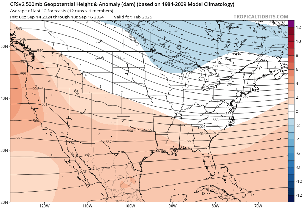
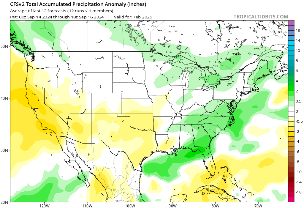
For a week in a row, CFS has shows February, not December to be the best winter month. Skeptical because it goes against the nina grain and what we’ve seen in the last several winters. Precip pattern shows a coastal track, too. Not particularly putting any weight on this, just not much more than a “hmm” moment.
-
Good. Still in a hole precip wise on the year.
-
Curious if the colder Feb is a reflection of a weaker Nina or cold neutral, as opposed to a stronger event?
-
With that record-breaking 500mb low over CA, one might think that a scenario with a stronger ridge over Canada would be more likely. But we shall see. I have no idea what will happen
-
Agree it is a statistical fluke. We had that Dec 2009 blizzard as well. In a -enso -pdo year like this, we need to score in that window to get something we wouldn’t look back on as a ratter.