Terpeast
-
Posts
6,687 -
Joined
-
Last visited
Content Type
Profiles
Blogs
Forums
American Weather
Media Demo
Store
Gallery
Everything posted by Terpeast
-
Yep. We will get ours one day, and when we do, some existing snowfall records will get absolutely pancaked. Not this winter probably.
-
Let’s save this for late Dec or Jan, mm aight?
-
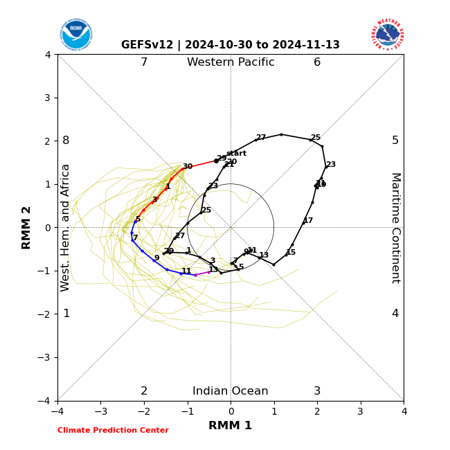
This may not even qualify as a nina if ONI stays weak, even though MEI/RONI are already in nina territory. both Nov and Dec look torchy, and I don’t see any decent chances for wintry weather in the MA until late Dec and thereafter.
-
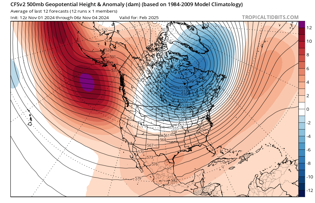
Just some fun speculation… maybe Feb will be the cold month this time? Not the first time CFS hinted this


-
Where did you get those? Links?
-
Got enough rain to wet the ground a bit. Was surprised. Don’t think it amounted too that much, though
-
Makes sense because the MJO will be back in the warm phases by then. It’s late Dec onward that I’m watching for.
-
82 imby
-
With the marine heat wave off Japan, strong negative PDO, high solar with westerly QBO, and a very warm Atlantic, and a weaker La Nina (stronger is actually better for us) it’s hard to think of any other forcing mechanism that can temporarily shake things up.
-
May get a temporary reprieve from the SE ridge mid-late month, then another pass back through mjo 4-6 late nov through mid Dec. On the plus side, it could possibly set us up for an interesting late Dec/early Jan period when the MJO completes its 4-6 pass.
-
SE ridge to continue for at least 1, probably 2 weeks. EPS shows pretty much the same. Better for it to happen now and November than later?


-
Has Ji ever canceled winter this early in October?
-
Got down to 32
-
Low of 36
-
Either way, we should do another pass through 4-6 in December, before we take aim at the colder phases late Dec through mid-Jan, give or take a week or so. That will be the window of opportunity I’m watching for the MA. The initial pass through 8-1-2 (weak or not) might yield some results for great lakes through interior NE, but just seasonal cool weather for the MA.
-
Crazy how long of a stretch without seeing a single cloud in the sky. Not even cirrus
-
I’ve gotten bit well into November in DC. I think December is when mosquito activity dies down unless Thanksgiving gets cold.
-
It actually has. I found a 16-18% increase in annual precip at IAD since 1962. But the variance is probably also increasing.
-
I think periods of heavy rainfall and periods of drought are only going to get more extreme. Longer droughts, and more severe flooding when it does rain. by the way, I got to 82 today.
-
Absolutely. As long as it is within the range of outcomes, I would be nervous if I lived there.
-
I hope it is wrong. NC does not need this
-
Reasonable, my timing is a bit different from yours, but overall agreed
-
Have to see how this plays out, but could be the winter weather’s version of an “october surprise”
-
Didn’t quite make it to 80 today. High 78.6. probably hit 80 tomorrow
-
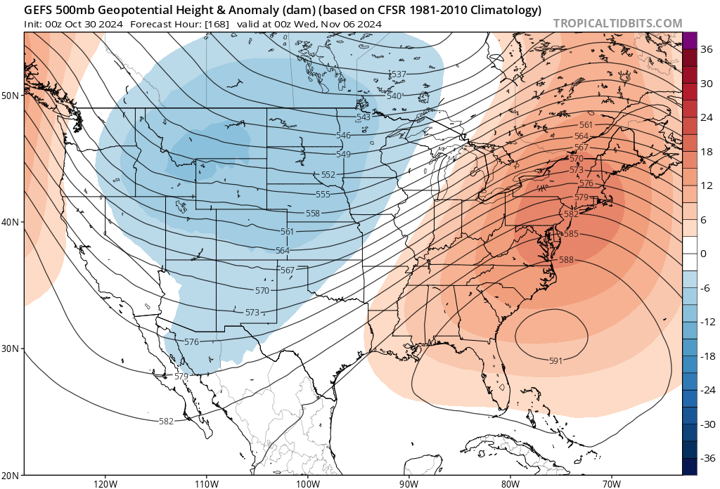
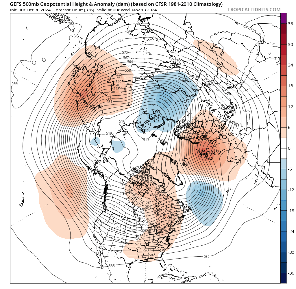
Even when looking at the control run, it still doesn't look right. I think it's something that's gone a bit haywire. As far as whether or not it's intentional, I'm not going there. I'll just use other maps.