goldsborosnow
-
Posts
484 -
Joined
-
Last visited
Content Type
Profiles
Blogs
Forums
American Weather
Media Demo
Store
Gallery
Everything posted by goldsborosnow
-
Only .11" in my back yard in Pikeville. We were missed to the north and the south by three or four different storms.
-

Weather References and Newbie Information
goldsborosnow replied to burgertime's topic in Southeastern States
Question for the group. The attached image is from the 0z NAM3K last night and it was showing snow in the circled area which is south of the 540 line on the map. The image was valid for hour 10 of the model run. Is it possible to receive snow between the 540 and the 546 line like the image shows, or would it be strictly rain?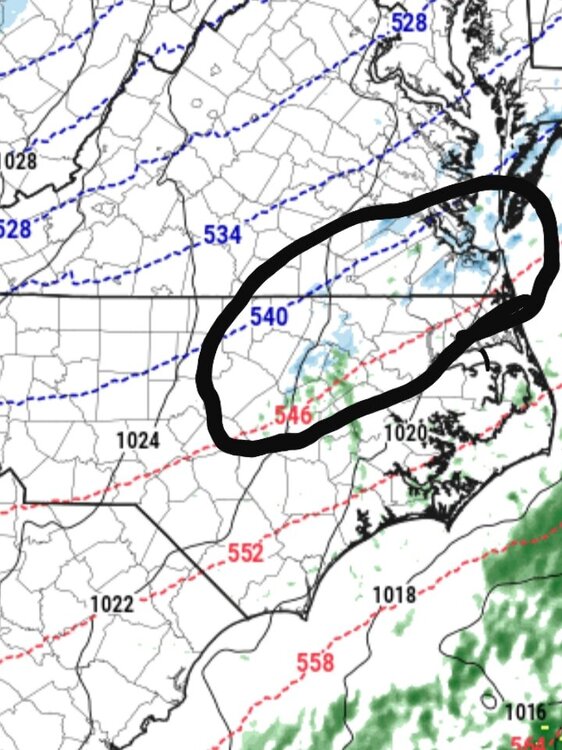
-
3.5" for Pikeville on top of 1/4" of sleet.
-
January 20-22 “bring the mojo” winter storm threat
goldsborosnow replied to lilj4425's topic in Southeastern States
Just need Joe Buck for the play by play/call. -
1.70 inches liquid equivalent in Pikeville after .10" of ice accrual this morning.
-
General Severe Weather Discussion
goldsborosnow replied to nwohweather's topic in Southeastern States
It could be an interesting weather day in the southeast tomorrow and in Eastern North Carolina tomorrow night.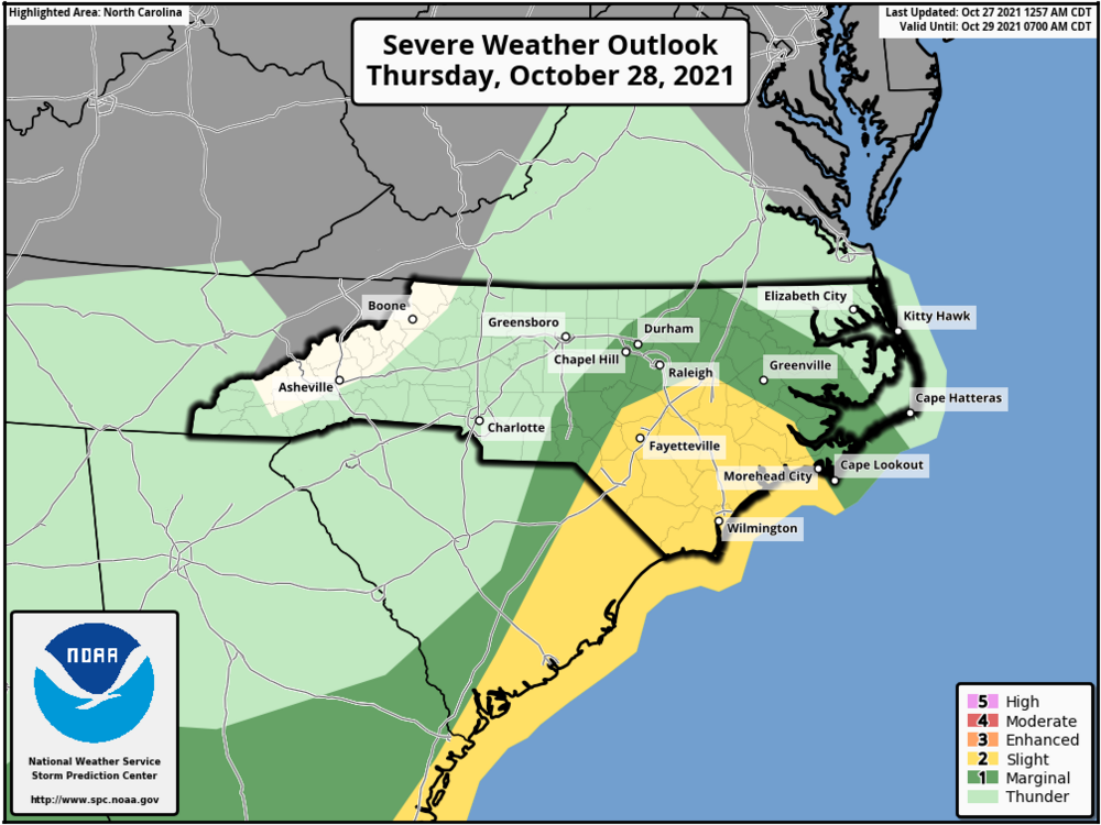
-
0.78" of rain in Pikeville NC. It was nice to have clean air and no dust when I walked outside this morning.
-
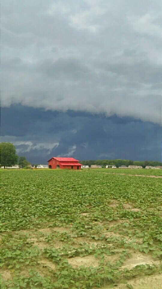
Yeah, several rounds of thunderstorms went through Wilson County, one of which was severe. It was pretty much the only game in town though.
-
3.14 inches of rain in Pikeville NC overnight with several roads flooded around the Princeton area of Johnston County.
-
1.43" in Pikeville NC yesterday. 6.45" so far this month.
-
1.99" in Pikeville yesterday for a two day total of 5.01".
-
3.02" of rain in the last 24 hours in Pikeville NC.
-
1.20" in Pikeville during the last 24 hours. The cool, cloudy weather is keeping things damp too.
-
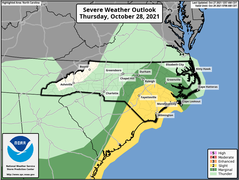
A Slight Risk has been added to the Coast with a Marginal Risk extended inland to Raleigh.
-
We are seeing a rain/sleet mix in Goldsboro NC.
-
1.66" of rain in Pikeville overnight for a three day total of 3.19".
-
1.13 inches of rain in Pikeville yesterday and overnight.
-
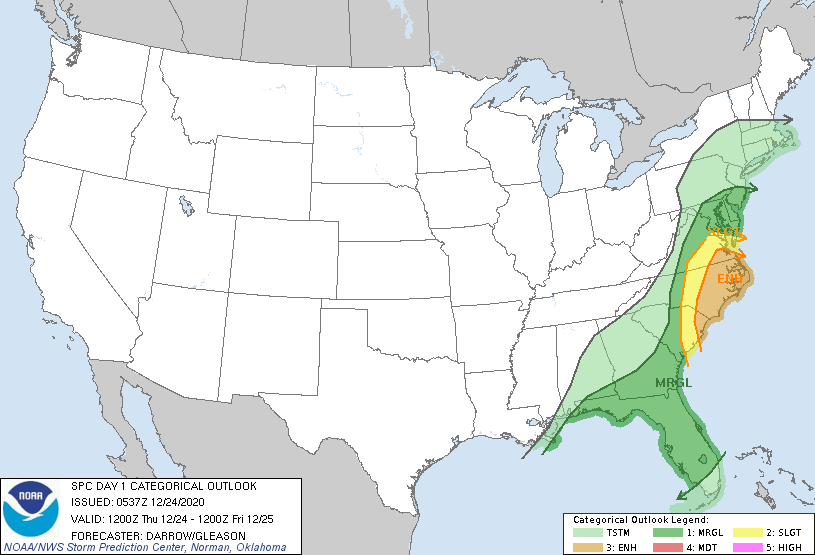
The new day one outlook from the SPC maintains the enhanced risk for Eastern North Carolina. The discussion mentions the potential for supercells during the afternoon followed by a squall line later in the evening.
-
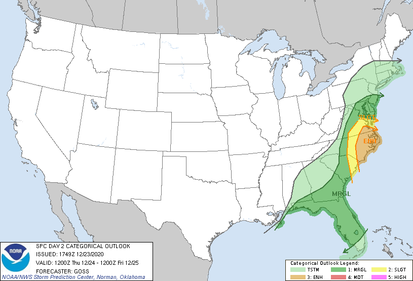
The SPC has upgraded to an Enhanced Risk for Eastern North Carolina now. They seem to like the idea of supercell development in the warm sector ahead of the main line in addition to QLCS spinnups with in that line.
-
How about a day three slight risk for Eastern North Carolina on Christmas Eve?
-
Is there a way to tell how much ACE the regular names were responsible for vs how much the Greek names were responsible for?
-
11/12 Heavy Rain/Flooding Event
goldsborosnow replied to NorthHillsWx's topic in Southeastern States
5.56 inches in Pikeville NC with quite a few flooded roads. My parents in Tarboro had 10.5 inches for the two day storm total. -
It just passed by the Wayne/Johnston County line. The temperature dropped 9 degrees over about a five mile distance. 72-63 degrees.
-
Tornados count relationship to hurricanes in NC
goldsborosnow replied to downeastnc's topic in Southeastern States
It gets more interesting the more you think about it. Unfortunately, we have to wait until next year to add to the sample size. -
Tornados count relationship to hurricanes in NC
goldsborosnow replied to downeastnc's topic in Southeastern States
So there were at least 15 tornadoes between the February and April severe weather events plus there were likely a few more scattered throughout the year and we've already had a hurricane make landfall in Eastern NC.