
goldsborosnow
-
Posts
484 -
Joined
-
Last visited
Content Type
Profiles
Blogs
Forums
American Weather
Media Demo
Store
Gallery
Everything posted by goldsborosnow
-
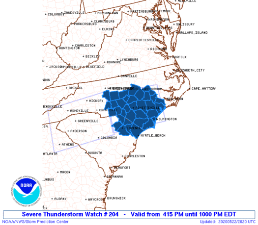
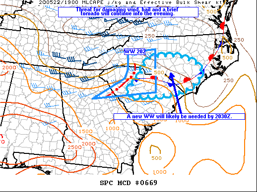
The Severe Thunderstorm Watch has been extended eastward until 10pm.
-
SPC is about to extend the watch further east.
-
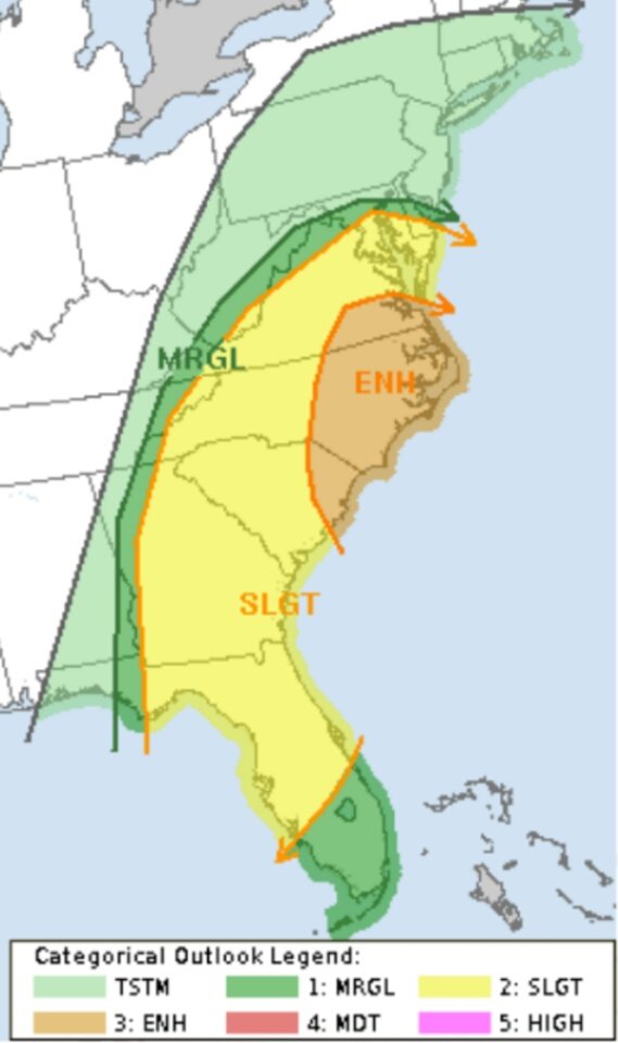
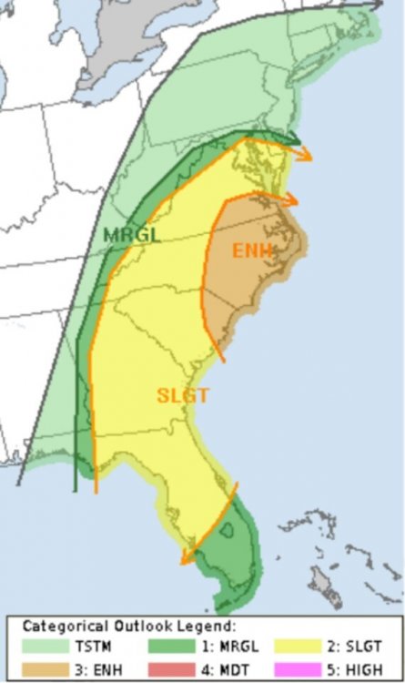
A Slight Risk is up for a good portion of the Carolinas and Northeastern Georgia.
.thumb.png.256c30dfcda818088395405fbf6162b1.png)
-
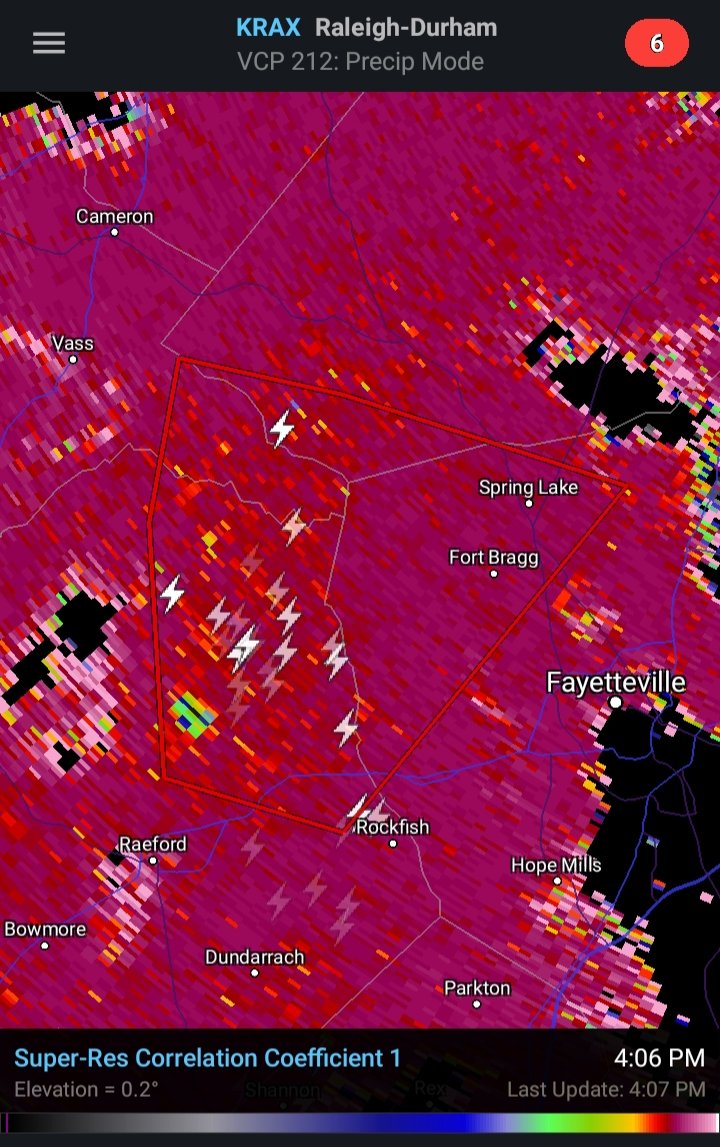
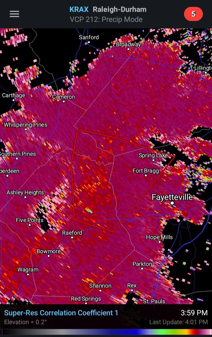
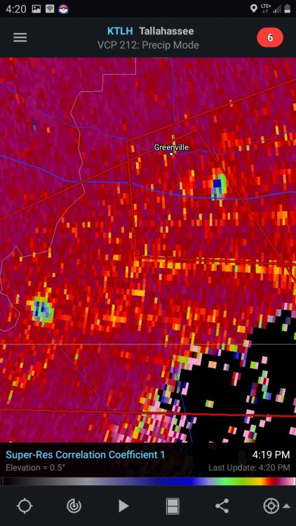
The CC Drop is still there, but the velocity doesn't look impressive.

-
Debris signature?

-
I enjoy their commentary on the severe weather. Theres lots of knowledge being dispensed in that thread.
-
This is NOT a valid image, but I am trying to figure out where this type of warning/watch product is generated or produced? Is it some type of app, or is it something sent out by NWS? I've seen these products posted on Americanwx before, so I was hoping someone on here cold tell me how to get or produce these graphics. Thanks in advance for any help.
-
CC drop with both cells
-
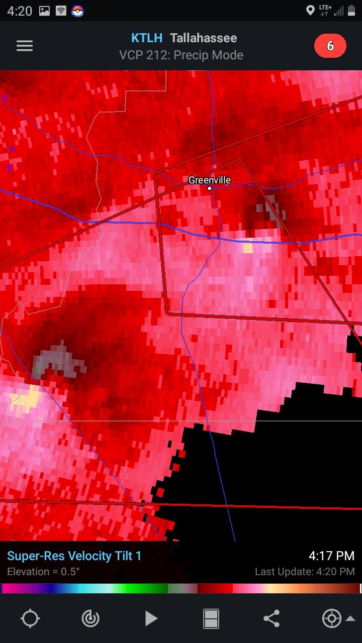
Two tornadoes on the ground at the same time east of Tallahassee.

-
If yall get a chance and are interested, check out my group on Facebook called "Whats up with the Sky NC". I started it back in December with a goal of having a place to share interesting or unusual(manmade or natural) events in the sky. Clouds, rockets, solar and lunar events, ISS crossings, sunrises, sunsets, etc are all welcome. Check it out and ask to join if you're interested and just because it says NC doesn't mean it's limited to only people in North Carolina. If you decide to join, feel free to invite others. The more, the merrier!
-
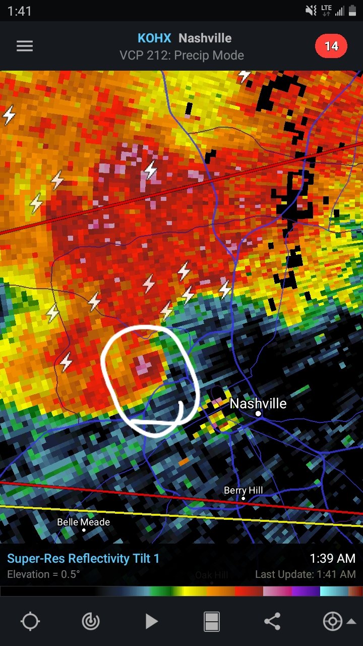
Debris Ball near Nashville TN.

-
2.5 Inches in Pikeville NC with mostly wet roads this morning. The bridges are icy with quite a few traffic accidents.
-
The same thing here in Goldsboro with Dish Network.
-
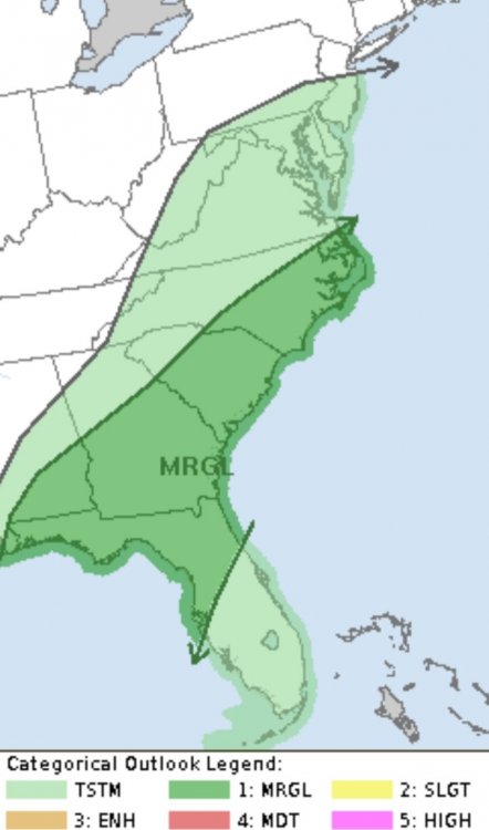
A large Slight Risk area up for the Southeastern US.
-
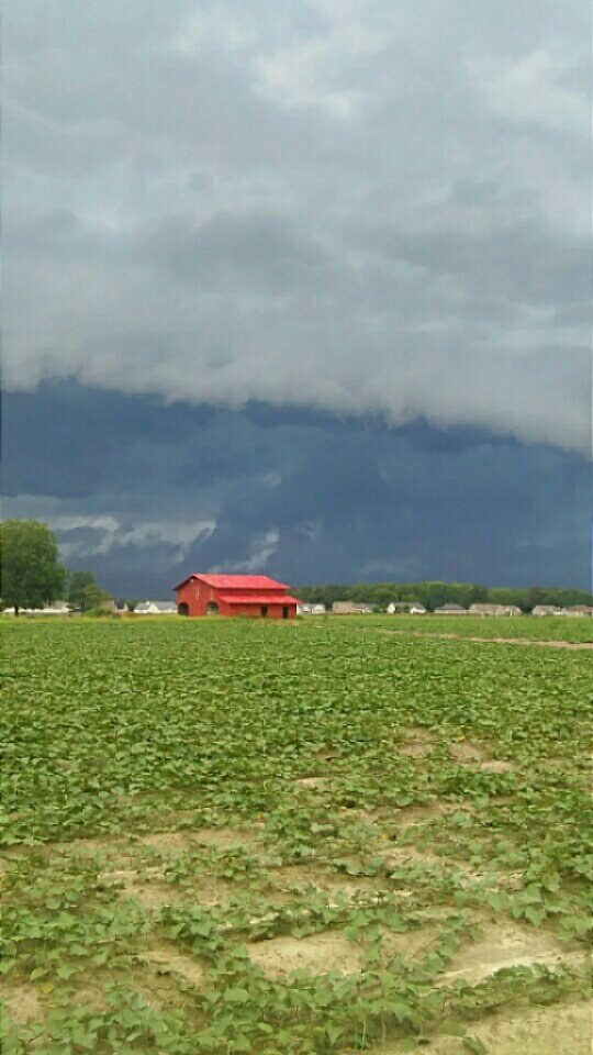
Lot of tree damage in Southern Wayne County from this storm. Trees and minor structure damage being reported. The roof of a school was damaged in Sampson County.
-
Marginal Risk up for parts of the area tomorrow.
-
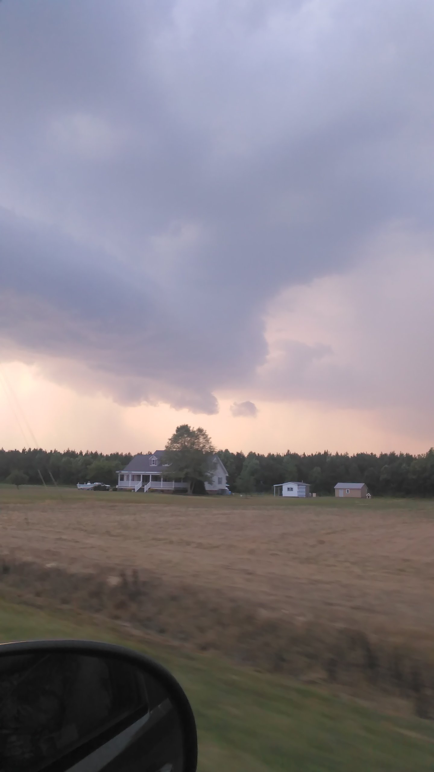
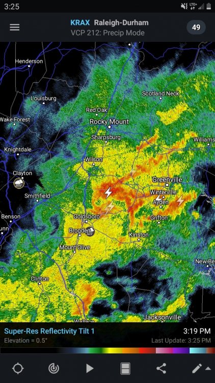
Here's how it looked in Pikeville earlier as the severe thunderstorm moved into Wilson County. This storm was tornado warned when it was in Johnston County.
-
45% Damaging wind probabilities with this update.
-
This looks ominous for Eastern NC. The NAM3k seems to like the bowing segment idea.
-
Large slight risk area for tomorrow.
-
This was the storm I encountered on Highway 264 just east of Washington last Thursday. It produced at least quarter sized hail with a few pieces close to golf ball sized.
-
1:30pm SPC update: ...Carolinas to the Middle Atlantic region... Southern-stream shortwave trough will deamplify as it becomes absorbed within the base of an amplifying northern-stream trough and move off the Atlantic Seaboard early Friday. The northern-stream trough will continue through the Carolinas and Middle Atlantic region during the day accompanied by a cold front. Modest low-level moisture with dewpoints in the upper 50s to lower 60s F will advect through the warm sector along a 50 kt low-level jet. This in conjunction with some cloud breaks will destabilize the boundary layer with MLCAPE from 500-1000 J/kg possible. Some thunderstorms may be ongoing along the NC coast early Friday in association with the leading shortwave trough. Farther upstream, storms are expected to intensify along and ahead of the cold front as the boundary layer destabilizes from VA into NC and possibly as far south as SC. Strengthening mid-upper wind profiles accompanying the northern-stream shortwave trough will support 40-45 kt effective bulk shear supportive of embedded organized structures with storms developing within the evolving squall line and some supercells with any storms developing ahead of the line. Damaging wind appears to be the main threat, but isolated tornadoes are also possible. Severe threat should end by early evening as the cold front moves offshore.
-
. Marginal Risk for Eastern NC, VA, SC, and Central Florida tomorrow afternoon.
-
The SPC has an enhanced risk for Eastern North Carolina on Friday.
-
SPC went with a much larger slight risk area with the 2:00am update.

.png.4d0ed630d7c2fdab8726ba4f1c6abc57.png)