Dark Star
-
Posts
1,731 -
Joined
-
Last visited
Content Type
Profiles
Blogs
Forums
American Weather
Media Demo
Store
Gallery
Everything posted by Dark Star
-
The town of Cranford NJ still had huge leaf piles plowed into the snow. Hopefully this doesn't cause more flooding than usual...
-
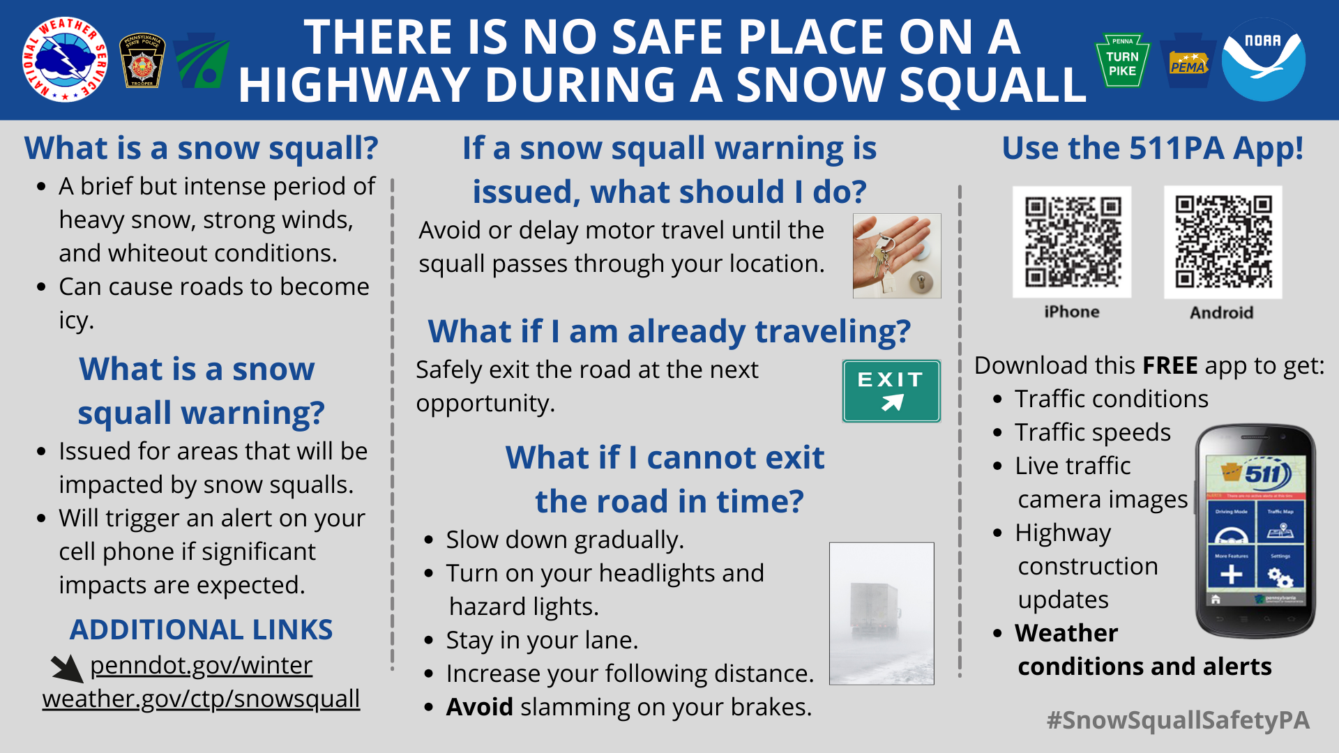
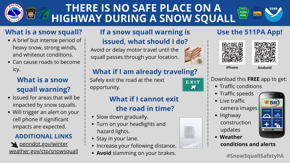
So, snow squall warnings have been in effect since 2023. I don't recall any issued for 20 miles around NYC. I would hate to see any issued for this particular area. While we have seen squalls laying a quick coating, I would be bold enough to say it would be nothing like what the warning was intended for, for severe squalls coming off the lakes. However, it seems these things are relative. To me, an actual snow squall creates true whiteout conditions, where you can't see 10 car lengths ahead of you, and/or snows a few inches in a matter of minutes. NYC immediate metro will probably never see one of these. The ferocity almost always wanes as it passes the Appalachians and then the Watchungs. Areas like White Plains or NW Jersey may have seen something like that. Peopel will rationalize, "well if it warns people of an impending light squall, people will be better prepared and perhaps avoid traveling at that time", then it is okay to issue the warning, no matter how minimal it is. I just don't want to see it issued here. Most of us have never experienced TRUE whiteout conditions. I couldn't imagine not being able to see my hand outstretched in front of me because of snow. - Crochety Old Fart -
-
Looks like it's making its way here anyway, just saw some flurries...
-
Cloudy here, but looks like they dry up as it moves east?
-
Models picked up on this storm many days out. I wonder which was the first and/or most accurate model to sniff this out?
-

Moderate snowfall 12/14/2025 WWA up for most of the area
Dark Star replied to WeatherGeek2025's topic in New York City Metro
Looks like 5.5" is the final tally for Garwood NJ.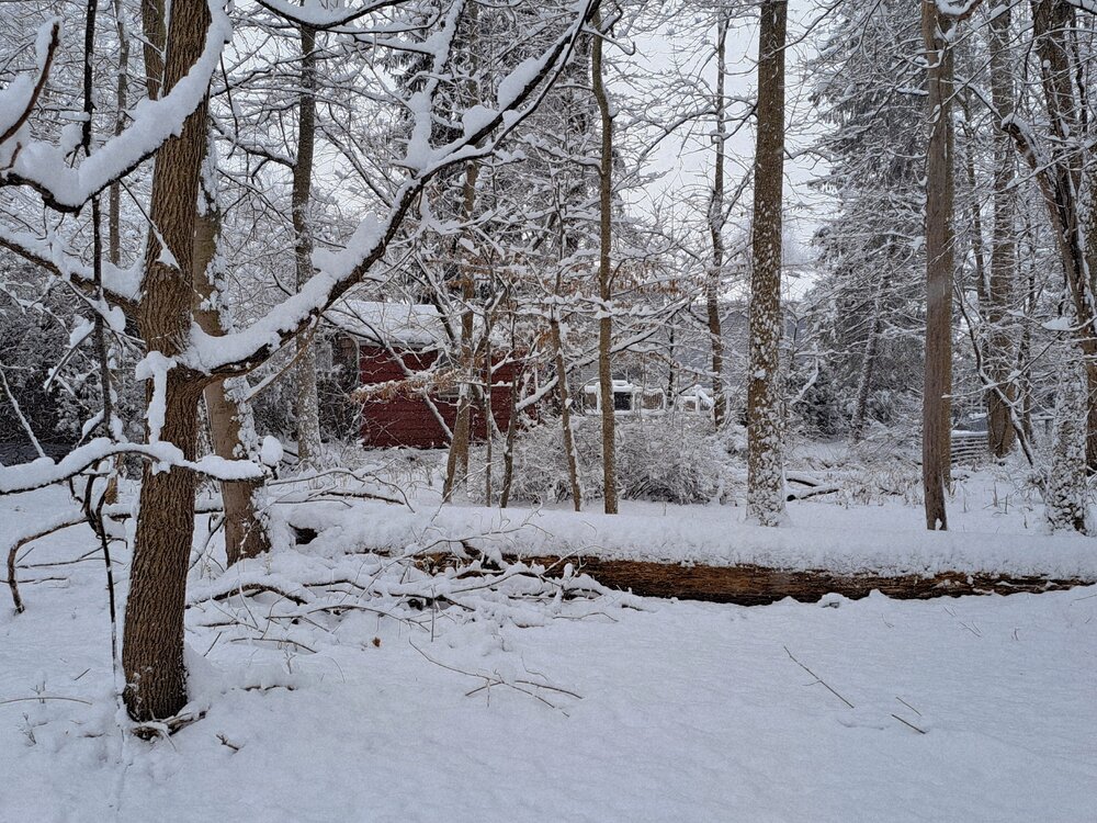
-
It didn't stick to the streets here in suburban Union county NJ, either, right away. It was too warm out at the beginning...
-
4.5" here in Garwood (central Union County NJ), so far. Very delighted.
-
Moderate snowfall 12/14/2025 WWA up for most of the area
Dark Star replied to WeatherGeek2025's topic in New York City Metro
Great to hear. I have no idea what effect next week's' warming trend will have on that thickness? -
Moderate snowfall 12/14/2025 WWA up for most of the area
Dark Star replied to WeatherGeek2025's topic in New York City Metro
Actually there was a break in the radar with main batch about 40 miles still to the west? -
While I am witnessing the urbanization of suburbia (central Union County, NJ) I am still under the impression that the temperature increases are more due to the effects from the GulfStream/Labrador current. It has been discussed here in the past.
-
Eventually, it becomes too warm to sustain the "normal" snowfall for the NYC metro area. While the global temperature has increased around 1.2 degrees over the last 100 years or so, our region has seen higher increases in temperature, presumably because of the slowing down of the Gulf stream/Labrador current, maybe as much as 4 to 5 degrees warmer? NYC has always threaded the rain snow line. With warmer temperature, it eventually will not matter what the storm track is...

-
Sounds like there is one continuos supply of cold air, and not cutoff from any one region?
-
Forget the crystal ball. You can make a hat out of the aluminum foil wrap in your drawer...
-
The treatment process doesn't remove chlorides, etc. Your best source of water is from underground aquifers, in which the soils, rocks and minerals work as a natural filtration system. Unless of course a toxic waste site has leached into it, or somebody's septic system leaked...
-
Storm drains here in central Union County leads to streams, which lead to the Rahway River, where United Water Rahway treats the water for potable H2O...
-
That white protruding from PA in western Jersey isn't snow cover, is it?
-
Thanks, I think...
-
To reiterate, there was zero snow on any paved surfaces Saturday morning. They were wet from the MELTED snow. Temps were above freezing when they salted, and would have naturally dried with sun all day and temps over 40 degrees. The only thing the salt did was get in dog's paws, go down the storm drains to give a shock load to the aquatic flora and fauna, increase salt content in drinking water sources, and get underneath your vehichle to initiate corrosion.
-
Some say it's liability. Bulldinkies. it's all about looking like you are doing something. Somehow, I don't think road salt and chemicals have gotten any cheaper. I remember some winters when they would run out...
-
As I live and breathe, I did not buy into this post. Woke up to about 0.1" of the white stuff.
-
So many late 70's cutters. Even in Coal Country in NE Pennsylvania, saw many a New Year's Eve storm start out as snow, but eventually change over to a plain rain...
-
Actually, I'll take the sugar coating from early this morning. No snow on the streets, but that didnt stop the Garwood DPW from salting. While the Garwood DPW always does a great job plowing, they HAVE to stop salting, unless absolutely necessary...
-
I never did learn how to read these things...
-
Flurries, perhaps mixed with graupel here in central Union County NJ...