Dark Star
-
Posts
1,731 -
Joined
-
Last visited
Content Type
Profiles
Blogs
Forums
American Weather
Media Demo
Store
Gallery
Everything posted by Dark Star
-
Meteorologist by education. I worked two summers at a now defunct weather forecasting office and one year in an engineering firm. My claim to fame was filling in at CBS NYC for 2 weeks. I told Steve Deshler that it looks like an Easter snow storm, perhpas about a foot of the white stuff. Irv Gikofsky, aka Mr. G., commented that it was impossible. Sure enough, we got about 14" of snow.
- 289 replies
-
- 2
-

-

-
- severe
- mountain snow
- (and 1 more)
-
Just moved here from NJ. Nice cool morning here in Hamblen County Tennessee!
- 289 replies
-
- 3
-
-
- severe
- mountain snow
- (and 1 more)
-
Saw it at 92 here...
-
Some Memorial Day weekends are hot, others are cold...
-
So is the cold pool off our coast a result of this past seasonably cold winter, of more of a stronger Labrador current? Or perhaps upwelling?
-
My dog ran in the closet. Thought she was crazy...
-
It has been windy the last 5-7 years.
-
Gotta love 1874...
-
A light intermittent spritz between 1 PM and 4 pm is not going to cut it...
-
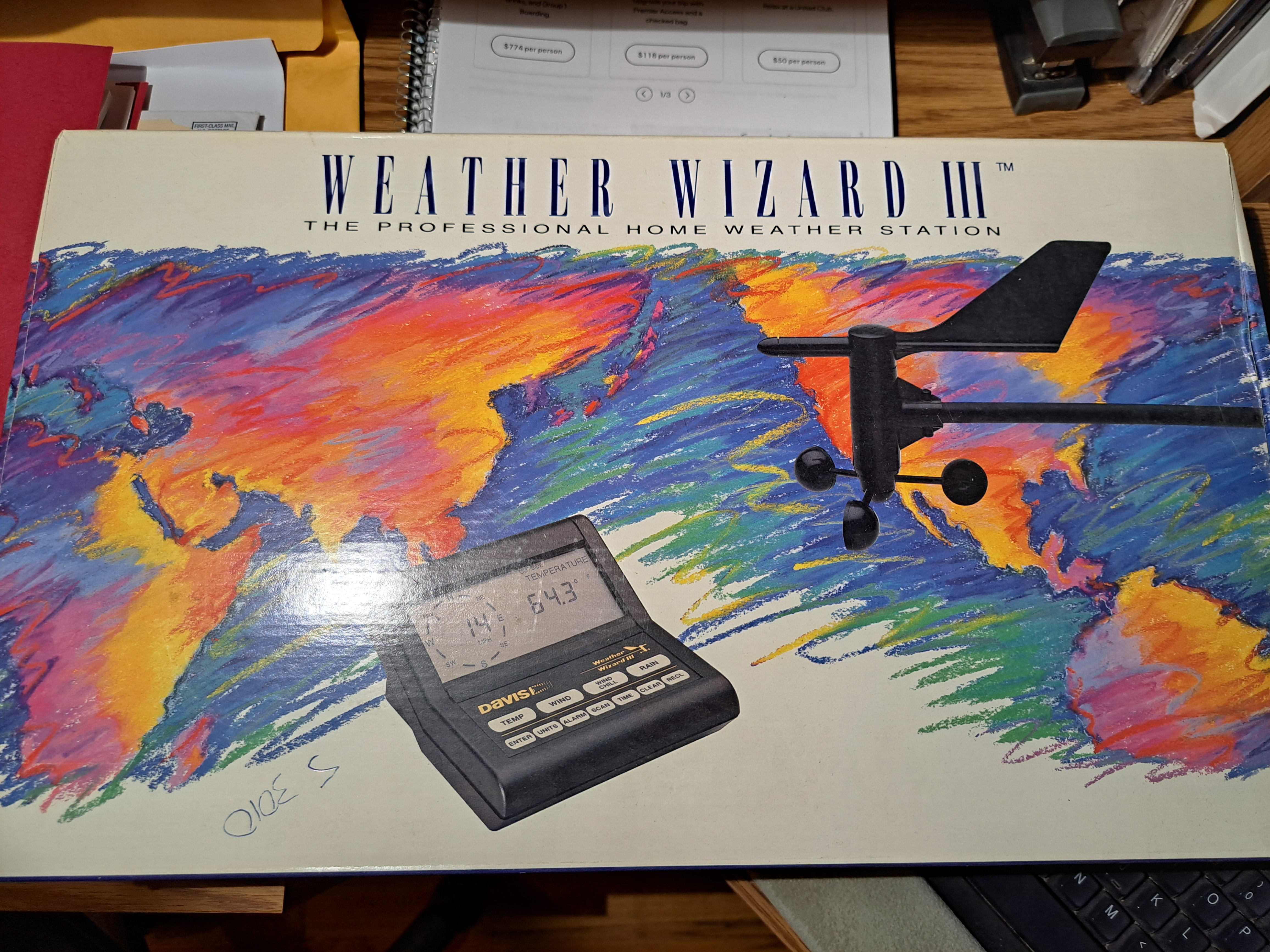
FREE Weather Wizard III. I dont know if this is allowable within the regulations of this site. If not, many pardons. I wish to give away an unused Weather Wizard III as my moving away gift to anyone on the forum. Older technology, so maybe it can just be used for parts? I prefer not to ship. I live in Garwood NJ 07027. Never Used!!!

-
Beautiful sitting on my back deck from 1130AM on, once the breeze died down...
- 970 replies
-
- 1
-
-
- april showers bring may..
- rain
- (and 2 more)
-
They really need locusts...
- 970 replies
-
- 1
-

-
- april showers bring may..
- rain
- (and 2 more)
-
Of course they were calling for snow last week...
- 970 replies
-
- 1
-
-
- april showers bring may..
- rain
- (and 2 more)
-
Too many people have figured out that life's events happen too frequently for people to remember erroneous bad predictions or bombastic lies...
-
Science uses tree rings, ice core samples, sedimentary rock, etc. to determine temperatures from past years...
-

-
It's over...
-
Cloudy, windy and cool along Barnegat Bay, NJ this morning...
-
woke up to some powdered sugar on some surfaces this morning...
-
Hard to believe this is illustrating a recent storm. High totals were between 30" and 40". With the snow, consistently up to the shoulders (consistently), this would mean a five foot depth?
-
I didn't expect a real winter, not with that Pacific jet out there...
-

-
It would be, if it weren't so windy...
-

Rain/Thunder and Anafrontal Snow
Dark Star replied to WeatherGeek2025's topic in New York City Metro
Snow stopped, getting brighter... -
Rain/Thunder and Anafrontal Snow
Dark Star replied to WeatherGeek2025's topic in New York City Metro
Flurrying in Garwood NJ (Central Union county)