SnoSki14
-
Posts
16,208 -
Joined
-
Last visited
Content Type
Profiles
Blogs
Forums
American Weather
Media Demo
Store
Gallery
Everything posted by SnoSki14
-
Disagree. Down here we've had two minor snow events within the last week whereas we had 0 before then. Temperatures are also averaging near or slightly below normal whereas in Jan/Feb it was +8/5
-
I think our best bet is wave one. The setup looks more favorable and there's some cold air draining south due to high near lakes.
-
Do you think a more amped up wave 1 would lead to a less phased storm for 2. GFS suggests it would
-
Not giving up on wave 1 down here. Things aren't that far off from something decent
-
There's a first time for everything
-
GFS was really close to something big.
-
This is probably true but wave 1 could muck things up so we don't get either.
-
Yes it's very picturesque this morning. Would normally be a nice end of season event instead it's the 2nd biggest snowfall at a whopping inch or so.
-
Yeah you're not going to get a winter savior in mid March. When things are bad they usually stay bad. Every day that a threat is delayed makes it that much more unlikely to occur. Time is running out.
-
The clock is ticking even in SNE and models are all over the place.
-
I doubt any of them work out to be honest. It feels like we're just chasing our own tail at this point.
-
Same but I'll laugh if we pull this off.
-
Given the Euro solution we can probably rule out a cutter.
-
It sneaked into my forum
-
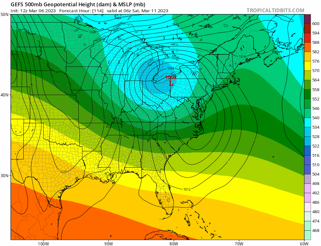
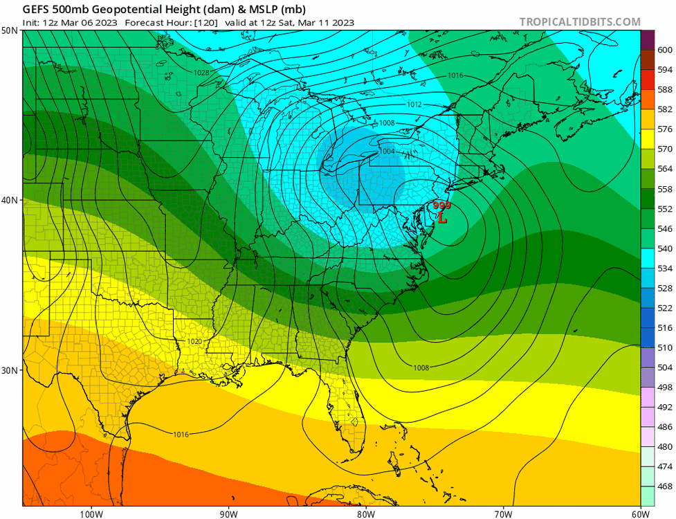
The SE tracks have some merit due to the confluence up north. If this really digs then I could see a secondary transfer off the Delmarva with it skirting more ENE. That's what the GEFS show
-
It's still a hugger. Need that primary to dig further south. Not a bad look right now though Additionally the more it digs due to a stronger Rockies ridge the stronger the secondary response will be. That's what we need in March to get big snows.

-
2" would be my biggest storm of the season. I only got 1.5" with the last one. Current HRRR has 2-4" over the area. Clear meso banding showing up on some of the models. Maybe a surprise positive bust for some
-
And that's what models are showing. It would be a dynamic coastal storm as some ensembles show.
-
Looks like GFS/CMC both moved in a favorable direction Need that Rockies ridge to keep trending
-
You need a dynamic storm + favorable track after March 10. It also helps if it falls at night if you want stickage but that's mostly for lighter rates. It is what it is
-
Just read Don's analysis regarding how rare a mid March snowfall is especially after a historically low snow winter. The no snow option in mid March will win 95% of the time
-
You really need ridges to spike behind the shortwave as they move east so they can dig and transfer. Others you just get deamplifying waves that give you light rain. It's easier to do now with shortening wavelengths but it's still a challenge. West coast trough is okay for March
-
I'm very close to it and within range. We won't know where the band sets up until it starts.
-
Here comes the Nam
-
I completely agree. We're in nape season where it can be in the 50s or even 60s one day and snowing heavily the next.