

SnoSki14
-
Posts
16,208 -
Joined
-
Last visited
Content Type
Profiles
Blogs
Forums
American Weather
Media Demo
Store
Gallery
Everything posted by SnoSki14
-
Inland runner though. That result wouldn't surprise me.
-
You got burned dozens of times and still think that's nonsense? In this winter that's the default position
-
The biggest difference is there's cold air around. If we had antecedent cold today then we would've seen a few inches on the front end.
-
Nah in this winter it's go big or go home. Either give me a monster storm or don't give me anything. I don't need an advisory event in mid March that melts the next day.
-
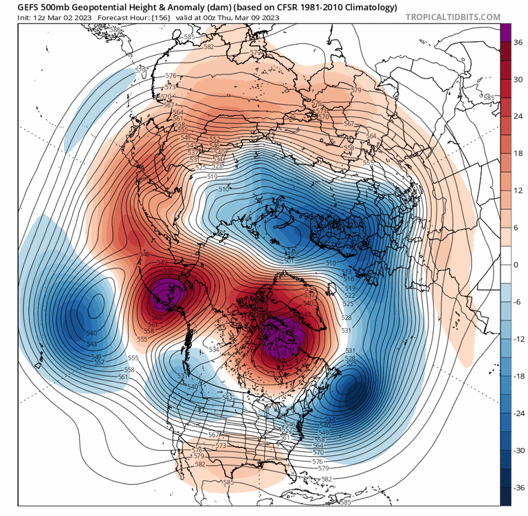
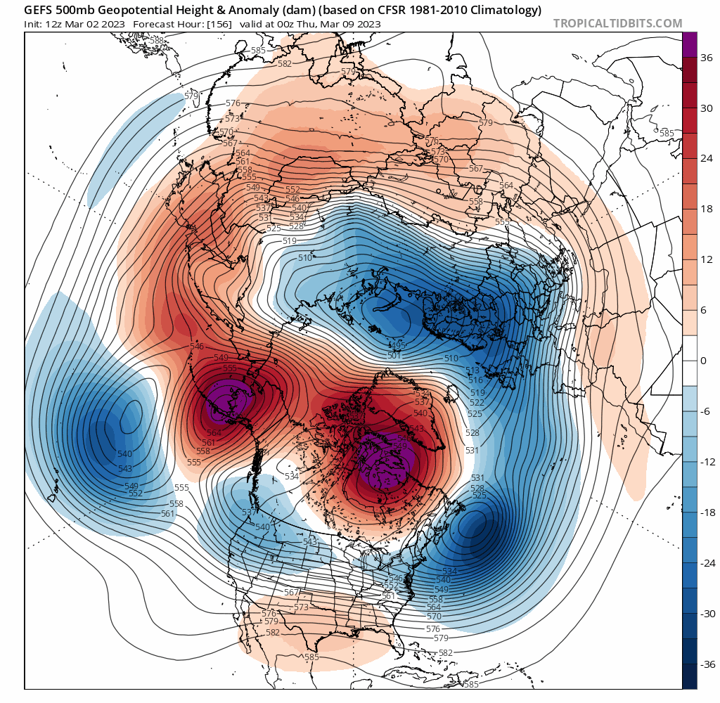
There's going to be a monster storm somewhere. You don't often see a low 90s pressure mean on the EPS 9 days out All the ingredients are there for sure. This is aa good as it gets for a major storm signal in March. The biggest downside is climo. We missed out on big totals in 2018 because things didn't get cold enough.
-
I do think it's less likely than normal but if we get a big phased storm then it's on the table. This plot gives me some hope though. I haven't seen an MJO 8 this amped in a long time.
.png.d1b45022112ea83e2d0775818ad7e727.png)
-
In all honesty that's what's probably gonna happen. We can't have nice things this winter.
-
I'm gonna lose it if it's another inland runner
-
Starting March 7-8 after that clipper system is when things get interesting. That's also when the MJO gets into phase 8 at a high amplitude, AO tanks and PNA starts rising
-
Models going ham with the fantasy storms. How about a blizzard from GA to the Northeast

-
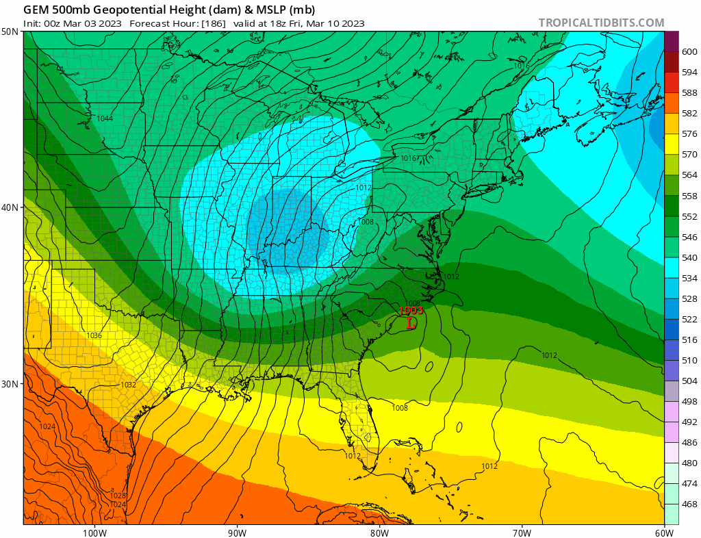
Suppression remains my biggest concern. A big sprawling 50/50 could be too much for us if positioned wrong. The somewhat -PNA does help in this regard to an extent It honestly wouldn't surprise me if places in the Mid-Atlantic 2-3x our seasonal totals.
-
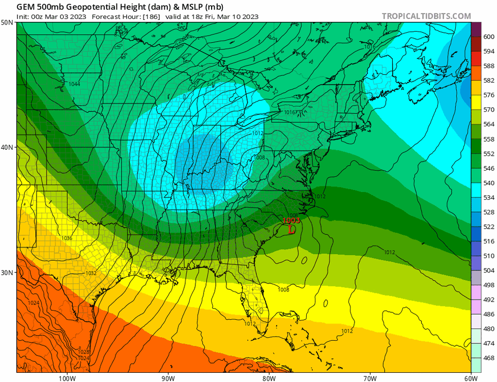
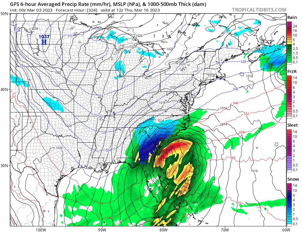
Likely colder than shown. Looks like DC/Baltimore gets the brunt this time. It's just one solution though GFS hints at that time frame as well
-
Big solutions beginning to show up.
-
01/02 will still rank #1 This March is on track to be much colder and snowier than that year
-
Just give me one coastal storm and none of this cutter/swfe nonsense Would be nice not having to worry about precip type
-
If it were any other winter I would take this look to the bank. Best GEFS I've seen yet.
-
GFS starting to get a clue with more ridging out west and troughing in the east GEFS follows. Not delayed either but moving up in time
.thumb.gif.d0010d6701f38128f2c0139c625e4466.gif)
-
Yes that's pretty important. You don't need a +PNA you just need a less negative one. The March 10-20 period is still in play My guess is models will continue to trend more favorably as the MJO gets into phase 8.
-
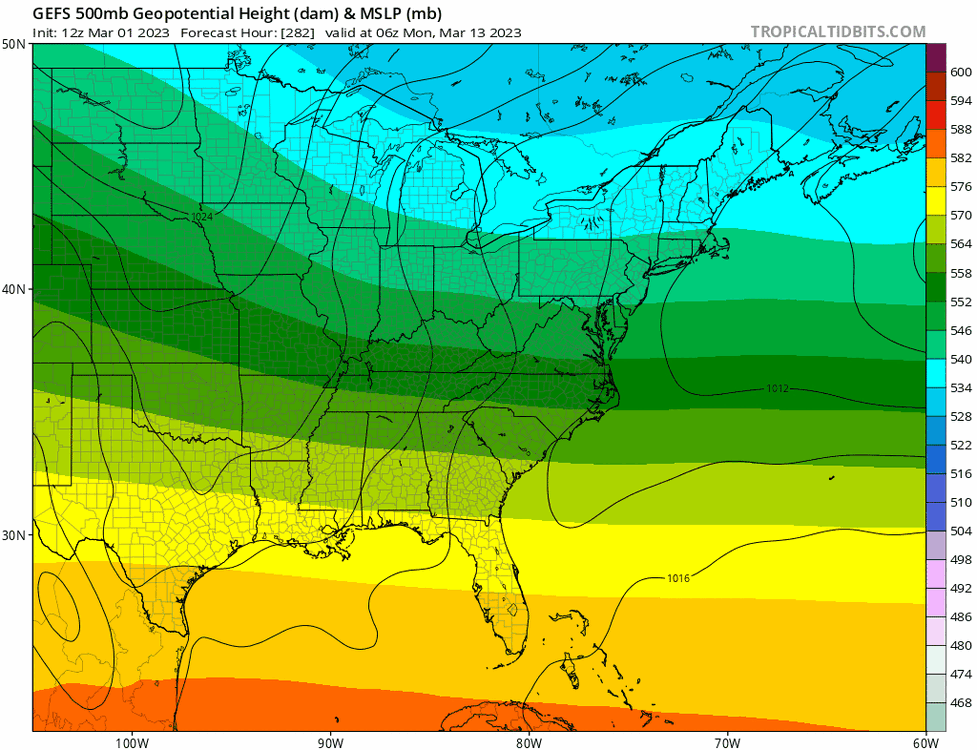
Ridge out west + gulf low + big 50/50 under a decaying NAO. That's a recipe for a monster event if it played out as shown.
-
This winter moreso than others my mind already goes to the worst solution. Based on winter trends alone I'd give an edge to the GFS however the ensembles paint a very different picture. March will definitely be below normal, which sucks, but if it's going to be chilly then at least give me a snow event or two. Nothing worse than a cold, dry or cold/rainy miserable March.
-
Now if that cuts then I'm giving up on ever getting another snowstorm.
-
GEFS with a much optimistic forecast than the OP. Signal is there but slightly delayed.
-
Agree with Allsnow, great calls all winter and was one of the few that dismissed the "favorable" December pattern when even Forky was on board.
-
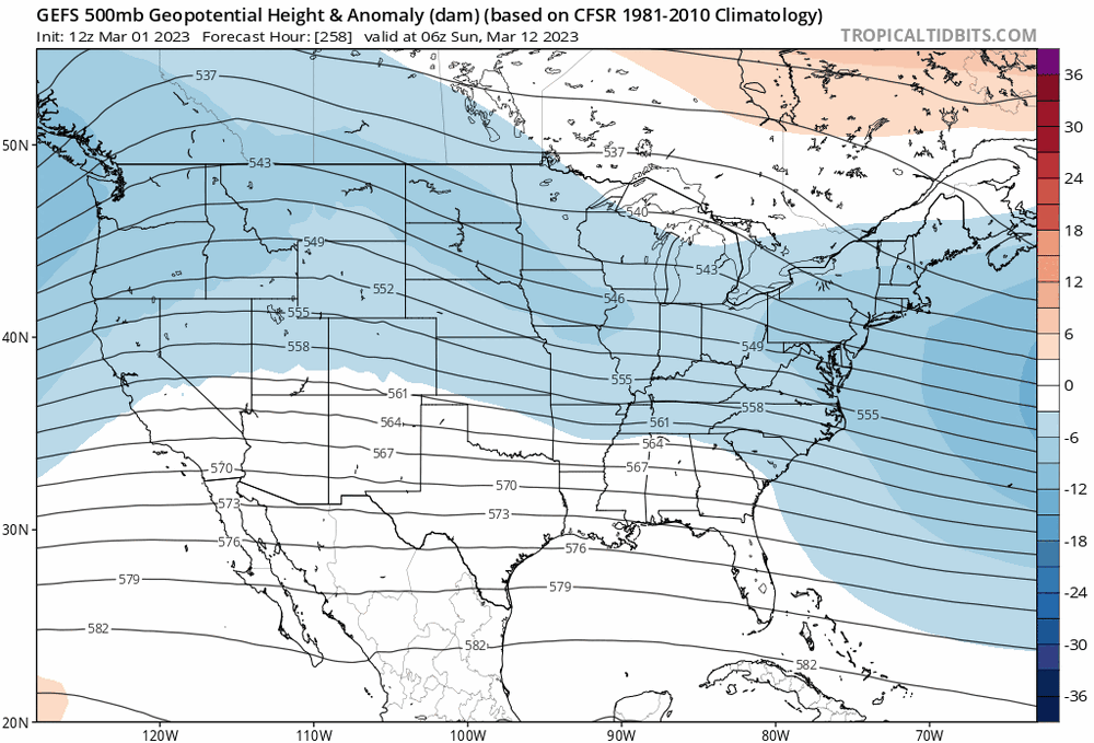
Lack of consolidated block & 50/50. Heights are high and low where they need to be but it's strung out. That's a problem given how the Pacific side looks. If the Pacific were a little better then this could work. It'll be good enough for C/NNE with some front end frozen further south.
-
I do think March 10-20 has the best potential to produce a significant snow event so far this winter. Better than December. I'll give it a 10% chance of producing a forum wide KU storm (10"+) a 25% chance of warning level snows (6-10") and 50% chance at another advisory event (2-5").


.gif.5fa4738be4c742b9c10aa733f1aa7d01.gif)


