Northof78
-
Posts
578 -
Joined
-
Last visited
Content Type
Profiles
Blogs
Forums
American Weather
Media Demo
Store
Gallery
Everything posted by Northof78
-
7.0" storm total, Millburn, NJ Essex County
-
What is your location?
-
Actually now that I looked at the PHL reporting observations as well, basically everyone in NJ will be in the 5" - 8" range north of AC to Highpoint.
-
7.0" of snow on the ground with light snow/flurries still falling and storm total in S/W Essex County, huge overperformer! Biggest storm since 2021 here and can't remember the last 2X outperformer. Beautiful outside, and love December snows pre-Christmas... Looks like Somerset, Hunterdon, N/W Middlesex, W Essex, W Union, Passaic, Warren, Morris, C/N Bergen, and Sussex will all end up with 5" - 8"...
-
6.3" in S/W Essex County with light/moderate snow continuing...2X overperformer...gorgeous outside
-
4.5” OTG and coming down nicely (moderate pace), looks like bonus area was N/W of originally thought. Look to end between 5” - 6”. Looks beautiful outside with everything pasted in deep white.
-
Moderate snowfall 12/14/2025 WWA up for most of the area
Northof78 replied to WeatherGeek2025's topic in New York City Metro
2"-4" from 287 E and Rt. 78 S. -
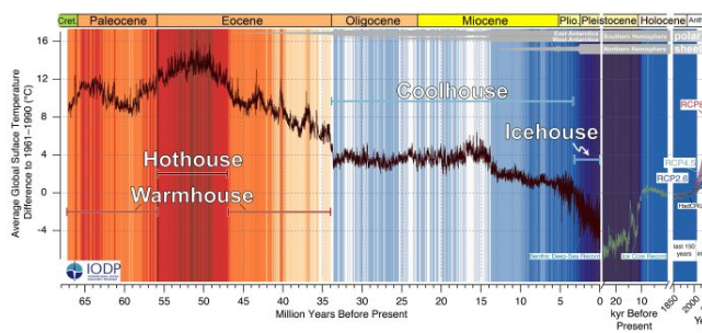
We are currently in a very cold area of Earth History....Enjoy it, no matter what the Earth should mean revert to warmer temperatures after coming out of the ice age/abnormally cold period, but we are still well below long term averages.
-
We got to close this thread...all this for nothing, flurries, or a dusting...
-
GFS continues a stormy and cold pattern through the entire period.
-
As it should, historically (looking back over 100,000's of years) we are currently in roughly the 80th percentile of cold vs. warm (80% of the time the world was warmer than current). Over periods of time it should normally warm off these levels and the ice caps should melt, if the past repeats itself, does man have a meaningful impact to the natural course of the warming (if there is a statistically signifcant one), no way we can say with certainty.
-
Looks like chance of a very minor to 1" - 2" snowfall this Sunday with upper lever low and some coastal presence
-
NAM back to a 3-6"....need other models to come on board now @ 12z to give much credence
-
Gfs now cold through entire run...
-
I would phrase the NAM as 'snow showers likely'
-
Very interesting, thanks, yes only small shortfalls, and you had to go back 45 - 55 years to find 2 examples, shows you how rare this outcome is!
-
Hey ORH, what are up to this weekend so far, it seems from roughly the M/D line south snowfall is above normal, while from M/D through SNE (maybe CNE) remains below normal?
-
GFS was in a league of its own (along with EAI), never showing a blockbuster storm, and the flattest by a wide margin over all others through the entire period.
-
I wonder if there ever has been a winter in recent times that has been below or @ normal temperatures in each of the winter months (D,J,F) and also in the aggregate for the entire time period, where we have also seen below average snowfall. I cannot think of one. It used to be if you could predict overall temperature anomaly of the winter you would predict snowfall as well....not this one
-
One out of 2 perfect tracks isn't bad...although probably would prefer a little cold air
-
GFS did very well also, where it was always much flatter than other guidance and I dont think every showed a monster, maybe it had one run with a moderate storm.
-
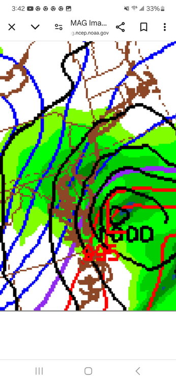
84 Hour NAM, we are So BACK
-
Bernie Ray just came out and said upper low further east than last few days, and will be MA storm, maybe a few inches here...the 28th 1-3"/nuisance storm of the season
-
Hillsborough always speaks the truth
-
Still got a primary hint in WV, that probably ends well