Northof78
-
Posts
574 -
Joined
-
Last visited
Content Type
Profiles
Blogs
Forums
American Weather
Media Demo
Store
Gallery
Everything posted by Northof78
-
100% light wet snow here now, no accumulation
-
Mostly a light wet snow here now
-
Drizzle/light rain for now
-
Obs thread started
-
-
I need Kuchera of NAM stat…
-
Almost all of NJ except NW border counties under a Blizzard Warning...not sure I have seen that so expansive before...
-
Your welcome board for the free money
-
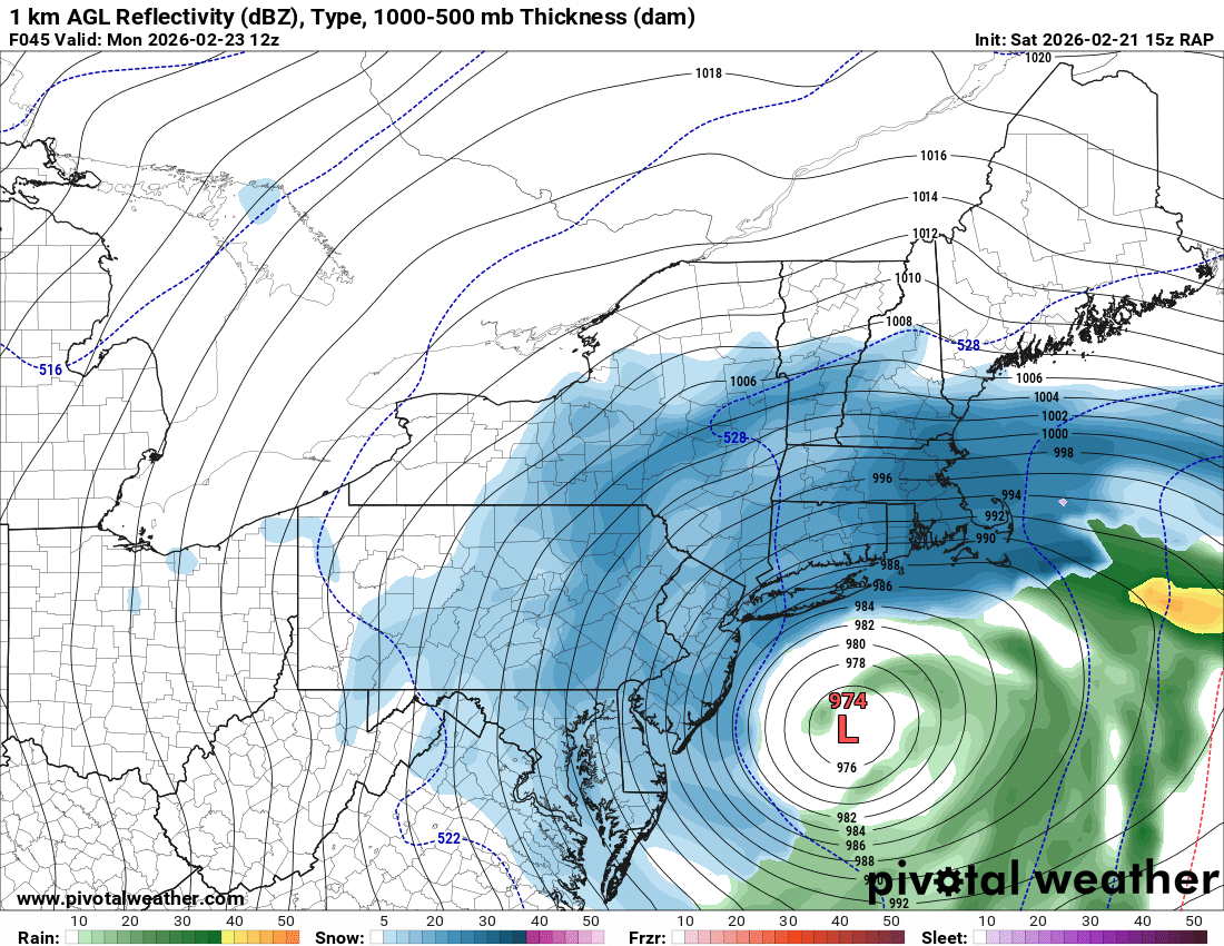
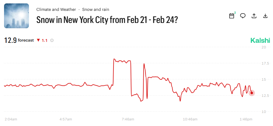
Betting markets have 12.9" as the over/under for CPK, newly opened contract...might be worth taking the over for a little arbitrage on this one...
-
The relief I feel from making it into the blizzard warning is palatable...
-
Winter Storm Warnings up all the way to Hunter in Catskills now
-
Euro running yet?
-
I think Monmouth (maybe N Ocean) good to go, but south of there not sure on temps, ratios, and axis
-
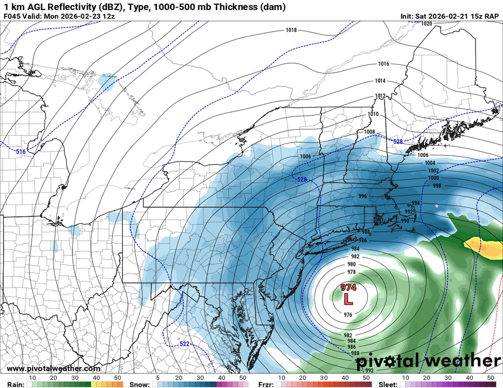
After seeing much of 12z guidance I think I95 and just N/W might do the best (along with C/W LI), your starting to get 12" amounts 100 miles north of us...
-
One at a time...
-
Spoken like an intelligent and prudent Hillsboroughian....
-
It did, very nice improvement, essentially in line with GFS now
-
Increadible....NAM/GFS/S Range/NBM all have PHL, ABE, ORH, to near ALB getting 10" - 15"+ now....way west of previous...I think I-95 ends up being bonus give or take 25 miles
-
I think you hit 12"
-
There are forecasts for as little as 6 - 12" for W NJ, S NY State, chances are most of these areas are getting 15" - 25", NAM/GFS/Short Rnage/NBM have near 20" to Harrisburg and Albany...they got to up quick
-
My local NWS forecast already has 3” - 7” for Sunday/Sunday night…
-
48….start time is Sunday 6am - 9am
-
Unless it comes way west...
-
1.1" from storm here, 30.6" for season (officially above normal), and today marks 1 month of straight snow cover. Not bad...
-
Looks to be 1” to 1.5” new, will measure soon…