vortex95
-
Posts
2,211 -
Joined
Content Type
Profiles
Blogs
Forums
American Weather
Media Demo
Store
Gallery
Everything posted by vortex95
-
Augdewst 2026: Summer's Last Stand
vortex95 replied to Prismshine Productions's topic in New England
You do realize this is a tropical air mass. If you are looking for big tstms/svr, you should know better! -
Correction. Not Key West 7/24/26, It is actually this: Corrotoman River in Mollusk, Lancaster County VA 7/4/22 Thank to @Rhino16 for pointing this out. https://x.com/deZabedrosky/status/2081401272578531578 Note that in order to listen to the audio and full size a video on X, you have to login now. About as classic "true" waterspout as you can get. Thin tall tube, slow moving, no rain, LTG, or wall cloud present, just TCU. Notice that after the base vortex moves over the dock, it re-emerges more intense and focused. This happens sometimes for spouts when the first come ashore. The rapid increase in friction can strengthen the base temporarily .
- 2,604 replies
-
- 1
-

-
- severe
- thunderstorms
- (and 7 more)
-
Augdewst 2026: Summer's Last Stand
vortex95 replied to Prismshine Productions's topic in New England
Correction. Not Key West 7/24/26, It is actually this: Corrotoman River in Mollusk, Lancaster County VA 7/4/22 https://x.com/deZabedrosky/status/2081401272578531578 That's @weatherwiz on the dock letting the the vortex come over him! Note that in order to listen to the audio and full size a video on X, you have to login now. About as classic "true" waterspout as you can get. Thin tall tube, slow moving, no rain, LTG, or wall cloud present, just TCU. Notice that after the base vortex moves over the dock, it re-emerges more intense and focused. This happens sometimes for spouts when the first come ashore. The rapid increase in friction can strengthen the base temporarily . -
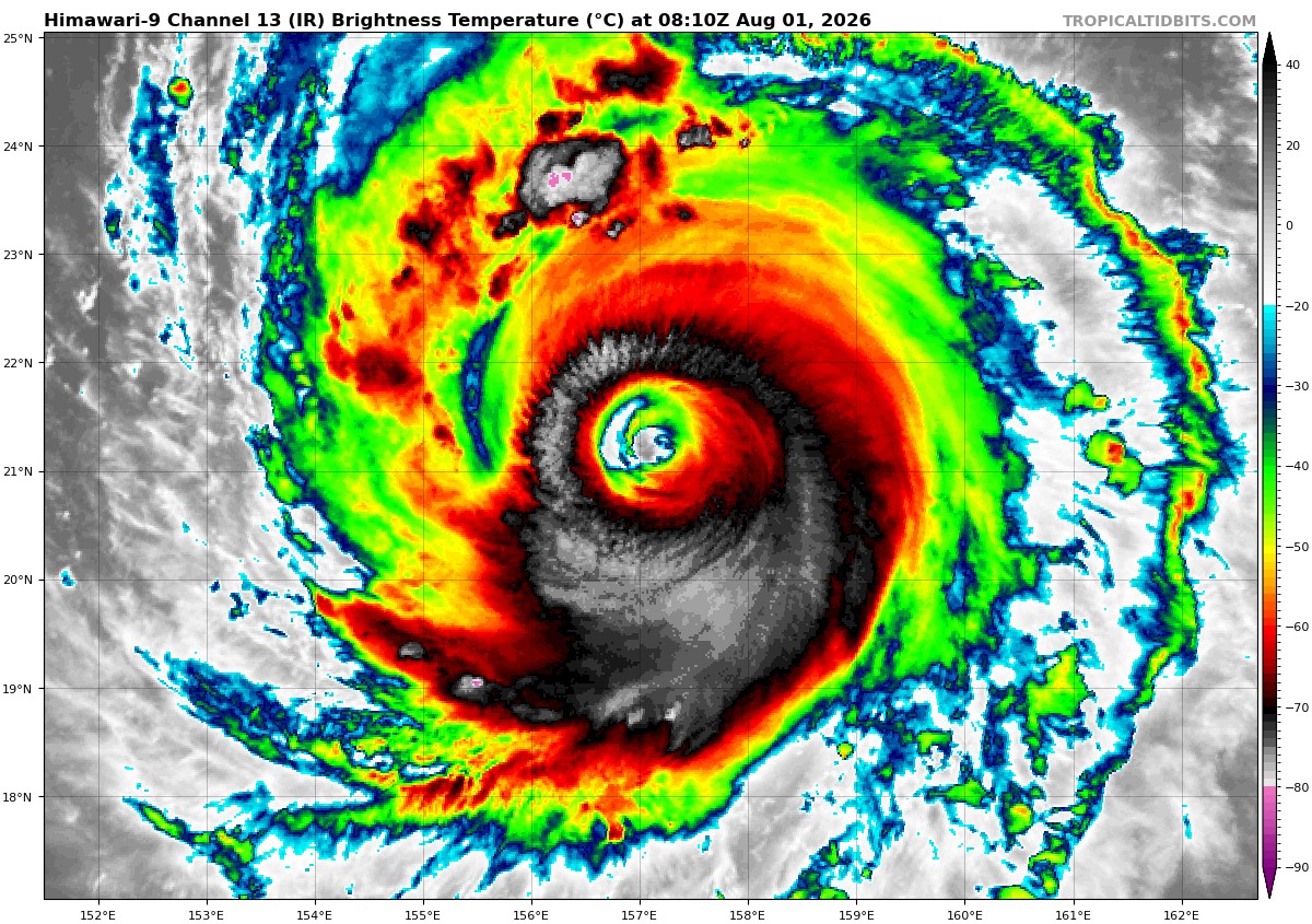
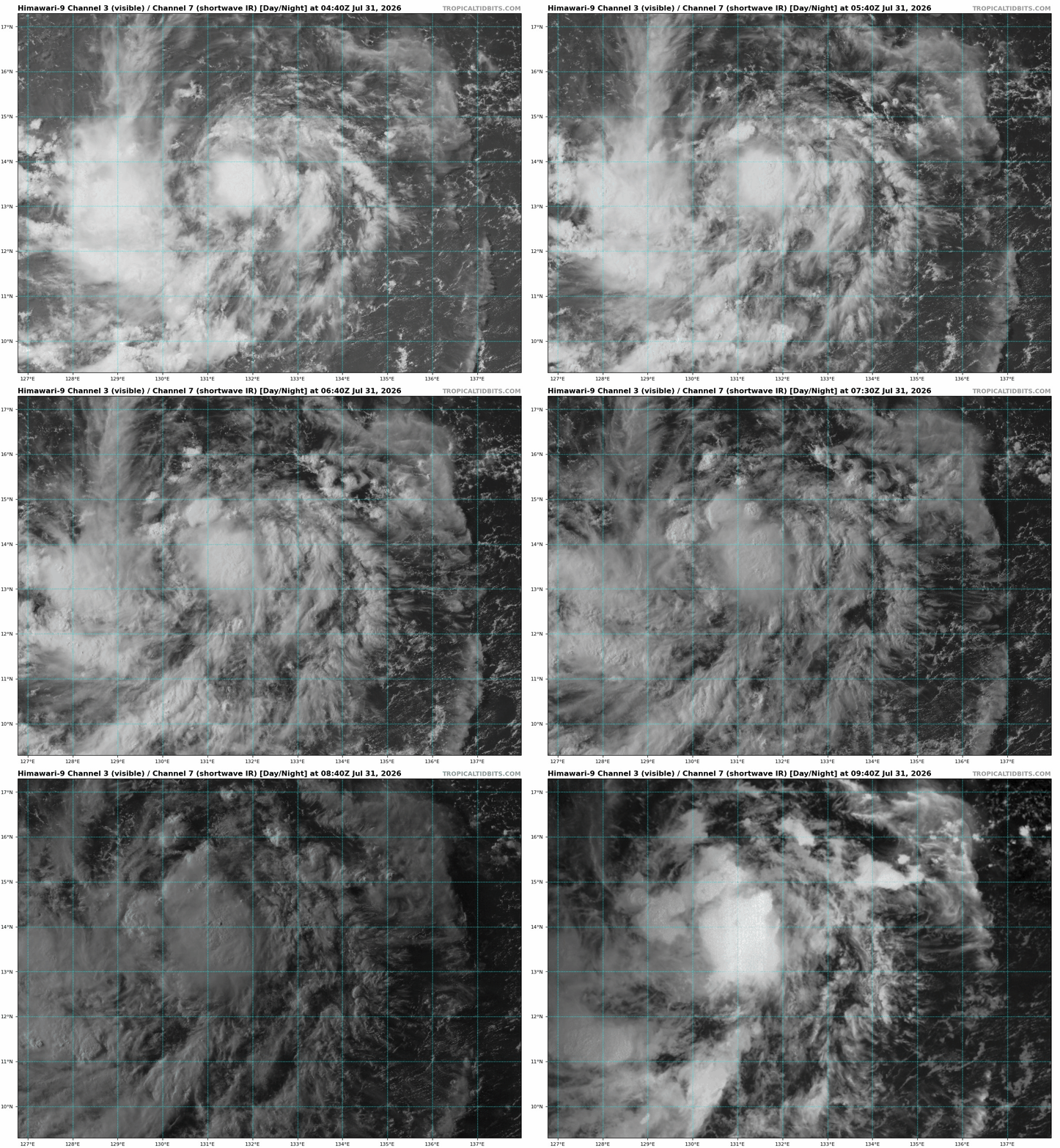
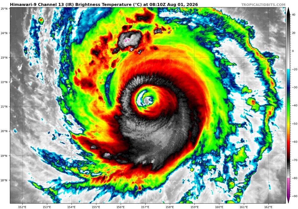
Dolphin appears to be en route to a very large eye. Inner eyewall is quite thin on W side. Not sure if drier air has got entrained into the W quad of the system or it is artifact of the next ERC. Either way, a lot of time still for this TC to evolve further, and no reason to think it will not end up being a "donut!"
-
Augdewst 2026: Summer's Last Stand
vortex95 replied to Prismshine Productions's topic in New England
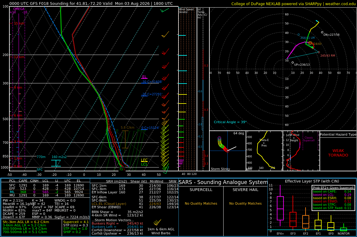
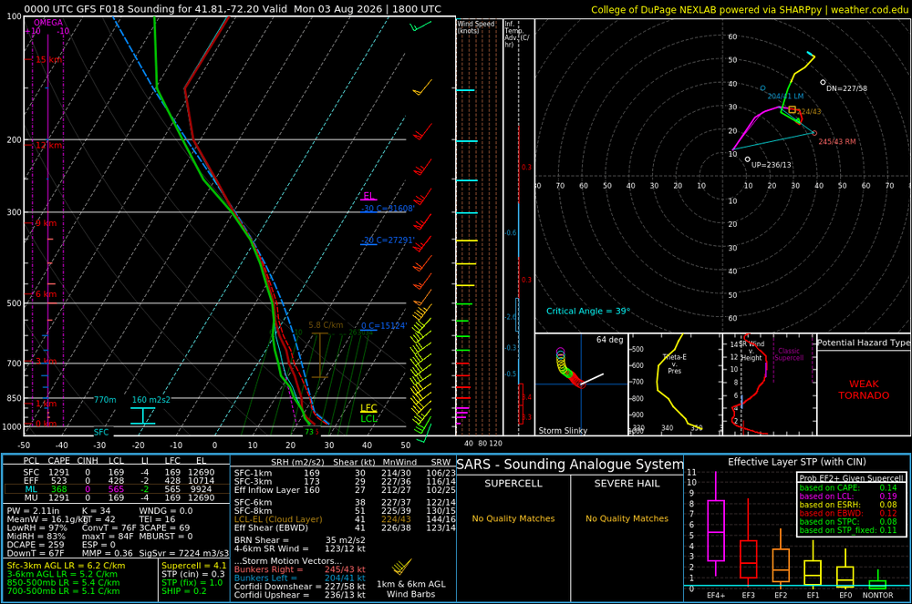
PT time for @weatherwiz b/c 2% spinner risk for CT now! I can see that. Even though winds are unidirectional sfc-aloft, they are quite strong at 925 and 850. 30-50 kt W to E from central CT to ern MA. Anything over 30 kt means spinner business. 30 -50 kt at 850 as well. Attached is GFS sounding for ern CT at 18z. 38 kt 0-6 km shear is enoughs for supercell and 30 kt 0-1 km shear is excellent for spinner potential. HRRR shows large areas of 0-3 km CAPE 100+ so there is your low-level stretching. Classic tropical tor set up where best winds, relatively speaking, are at low-levels.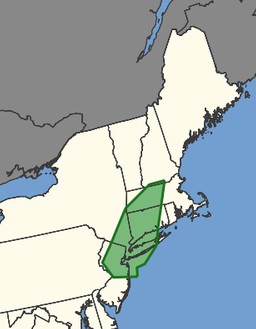
-
Augdewst 2026: Summer's Last Stand
vortex95 replied to Prismshine Productions's topic in New England
-
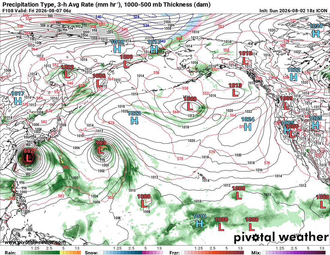
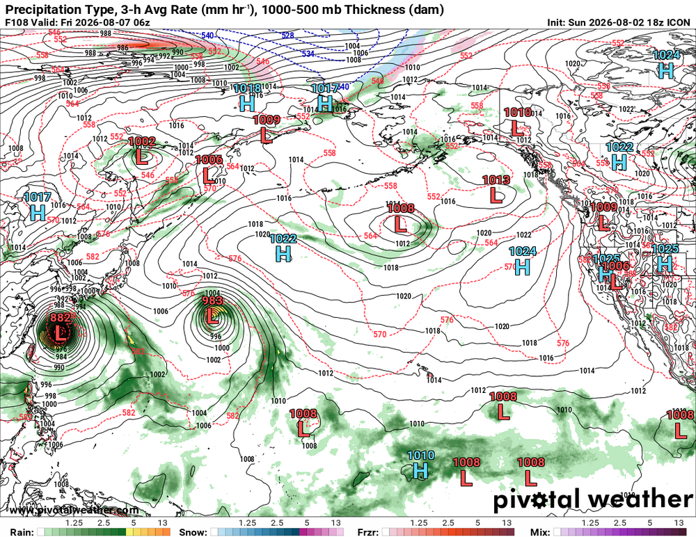
One thing for future reference. We have so many models now to chose from, and recently I had been looking at the ICON model. I've been watching it for the past several days, and it has a clear high bias for TC intensity in Dolphin's case. It tends to initialize the storm too low pressure and intensify it to the 880s once near China. That doesn't make much sense given how Dolphin keeps expanding from ERCs and its large eye already. And also it continues to gain latitude. Empirical observations over time show that TCs almost never regain their former intense "glory" after their initial first intense peak (often w/ a pinhole eye). So keep the ICON in mind for this b/c you know how some will pick the model that shows the absolute worst, and run w/ that! I still would like to see how the ICON handles long-tracked systems in other basins.
-
What were some of the bigger totals you have heard? I had one person tell me 3" in Chevy Chase.
-
2026 Atlantic Hurricane Season
vortex95 replied to Stormchaserchuck1's topic in Tropical Headquarters
One thing that has been consistent, Well-defined circuation at 700/500 w/ a pool of high PWATs, so that may eventually add to rainfall up and down the E Coast.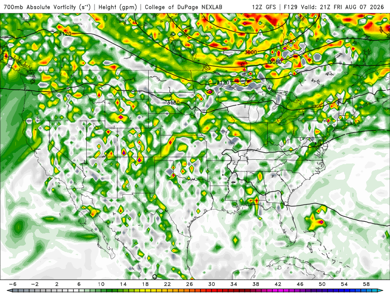
-
Augdewst 2026: Summer's Last Stand
vortex95 replied to Prismshine Productions's topic in New England
HRRR and RRFS are in good agreement swaths up to 4" both SNE and NNE. Given how local media really leaned into drought conditions, this should silence them, EXCEPT BOS prop is still -8.45" for the yea (2" too low from the snow LEQ issues), while PVD/PWM are less than -3" and ORH/much of central and western new England are AOA Y-T-D! And the HRRR/RRFS seem to screw BOS again for sig rain. Gonna be a microdrought area soon! But no real impact since draining downstream and reservoirs to the W are filling up. Local drought is not the same as widespread drought. And short-term drought everywhere is not an issue now, it just long-term drought for deficits. I'm sure everyone's gardens large and small are doing just fine after the wet July, as one example! -
Tropical sounding. Lapse rates all below 5.5 C/km, but that's ok b/c the deep layer high dew points make up for it, and just a small amount of heating sets things off. That's why the convective temp is so low, as noted. K-index 38 and PWAT 2.16", so there is your juice! 0-6 km shear 31 kt so close to support supercells. Low-level turning on the hodograph not bad either.
- 2,604 replies
-
- 3
-
-
- severe
- thunderstorms
- (and 7 more)
-
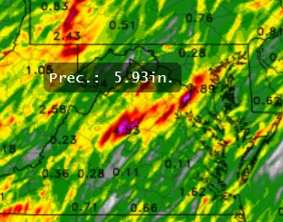
Looks pretty good for gully-washer tstms Sunday. GFS/ECMWF show PWATs over 2" (max 2.5") for the entire region. SW to NE training a good bet in some areas w/ the HRRR showing a 5.93" max just SW of DC. RRFS is similar to the HRRR. just not as high w/ the QPF maxes, but the point is the atmosphere is primed to big rains. A full-latitude, positively-titled trough to our W w/ broad SW flow over us should easily support some big QPF. Showers/sct tstms already in wrn VA and it all slowly moves E during the day, continuing into early Mon AM. Svr risk is marginal. Some supercell structures could be supported for short times. 01/18z ECMWF gives SHRA/TSRA every day through Thu. Nothing stands out for sig svr, just persistent, moist SW cyclonic flow, so lots of tstm activity.
- 2,604 replies
-
- 1
-
-
- severe
- thunderstorms
- (and 7 more)
-
Augdewst 2026: Summer's Last Stand
vortex95 replied to Prismshine Productions's topic in New England
Let's flood out wrn CT again! 00z HRRR.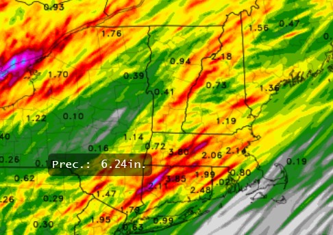
-
Augdewst 2026: Summer's Last Stand
vortex95 replied to Prismshine Productions's topic in New England
It doesn't! Imagine that! -
Augdewst 2026: Summer's Last Stand
vortex95 replied to Prismshine Productions's topic in New England
You have to ask yourself, "why wouldn't the air dry out AM to PM on a sunny day? " "Thankfully" for what? Diurnal temp range the the sun coming up??? Was the AM moisture causing "problems? Fluff post (the X link)! -
Augdewst 2026: Summer's Last Stand
vortex95 replied to Prismshine Productions's topic in New England
-
Augdewst 2026: Summer's Last Stand
vortex95 replied to Prismshine Productions's topic in New England
I still think it is funny that some local TV media will fcst highs something like 77-84, and call it "hot." Gotta push that heat all the time! -
Augdewst 2026: Summer's Last Stand
vortex95 replied to Prismshine Productions's topic in New England
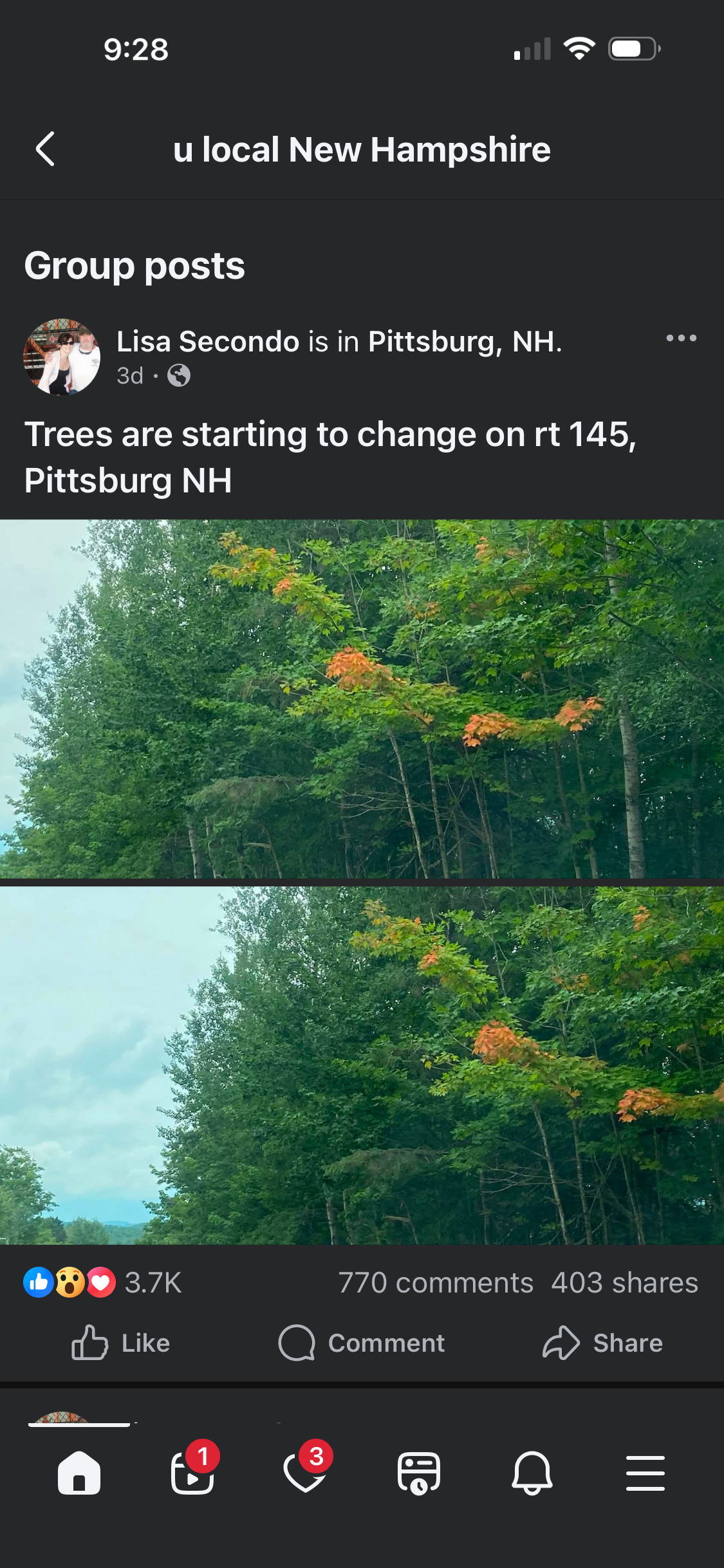
@CoastalWx all excited w/ the leaves changing already I bet! Now it is just the "540 thickness line watch" for first time!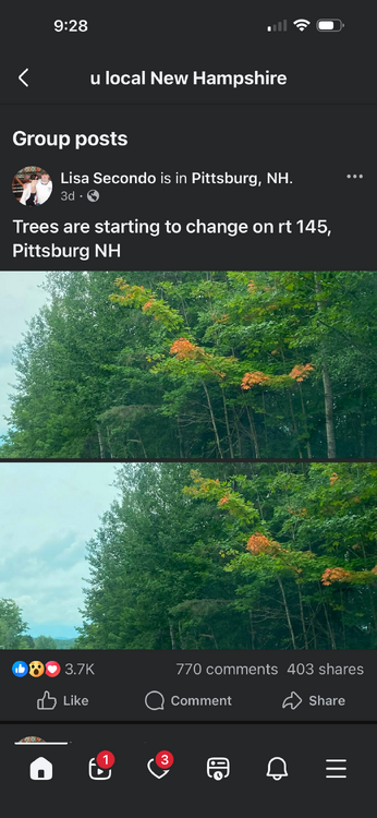
-
It has at least 6 days before landfall. so a lot of time to form a giant eye.
-
Synthetic Aperture Radar (SAR) products that give very detailed surface wind profiles for TCs. Click on the storm you want and then "profile plots" for the max winds in each quadrant and RMW text output, among other things. https://www.star.nesdis.noaa.gov/socd/mecb/sar/sarwinds_tropical.php
-
Looks like Dolphin is ready to form a huge eye. Several hours ago, I got about 20 nm for a eye diameter. Based on what I see on EIR now, the new larger eye is going be be close to 60 nm!
-
Yes, higher OHC means what can form and intensify has better potential. However, one thing I have learned is that there is lot more to it, and it is surprising/counterintuitive at times. This underscores what I say a lot, you can't think of the global system in a 1-2-3 linear manner. Human nature is conditioned though for this, as in correlation = causation in a very basic sense! Look at this BAMS paper concerning EPAC and WPAC TC intensification rates. You'd think the WPAC would be "better" for everything concerning TCs b/c it is the most active region on the globe, but that is not true. noaa_54129_DS1.pdf
-
When you see a ton of blue dots for svr winds reports in an area that first day and no red dots for tors, always go back and check the SPC reports for that day for several days after the event. Sometimes lots of red dots show up from post-storm surveys. In the SEUS for big winter/spring QLCS events w/ many winds reports. I've seen more than a dozen tors show up eventually as post-storm surveys are done.
-
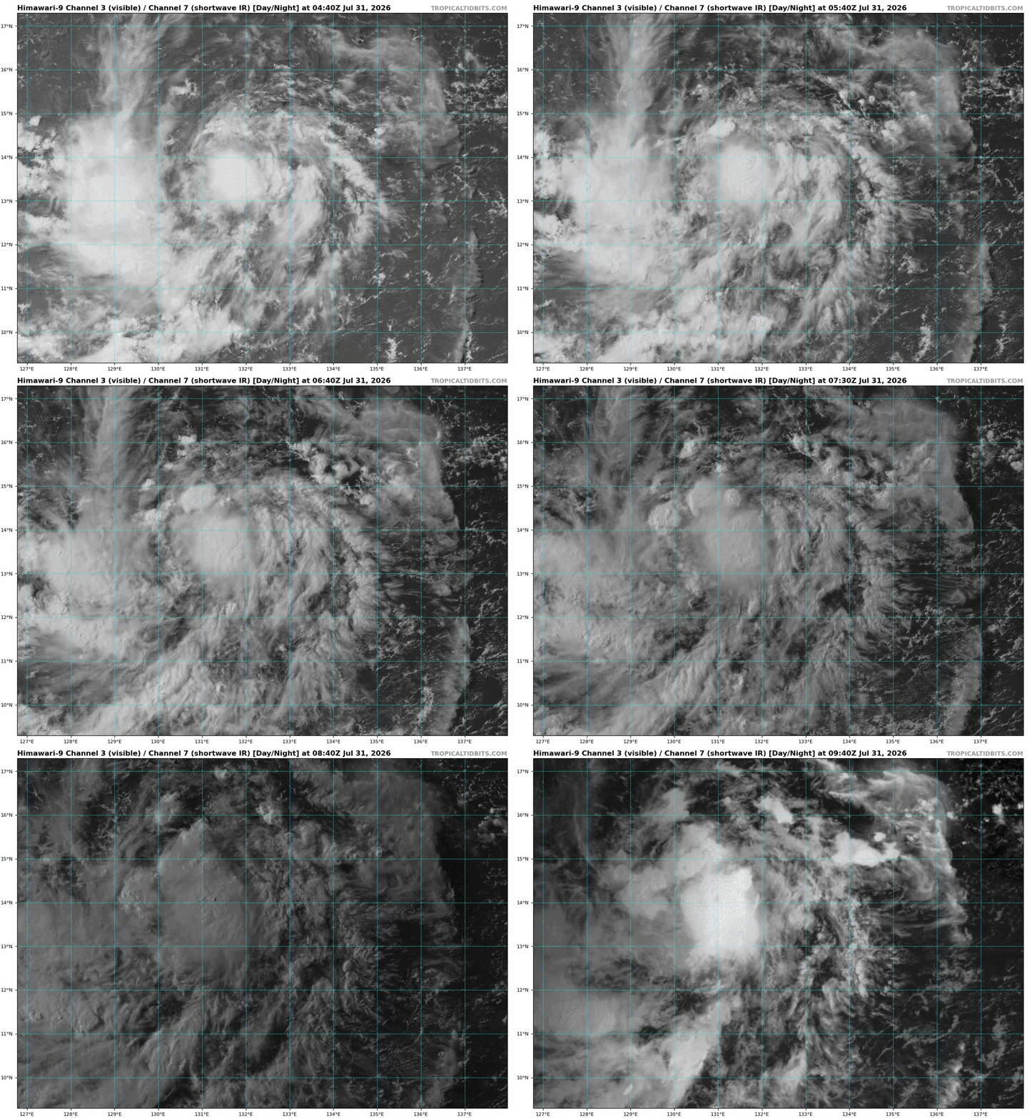
94W E of the Philippines is clearly a TD, if not a min TS. LLCC is well-defined and core convection is persistent. JTWC does not even acknowledge it as "low" for a chance of development, probably b/c the models don't do anything w/ it, but so what? It is what is in the here and now, and so what if it exists only for a short time as a TC?
-
SAL is another big factor, esp. in recent years. 2024, the SAL was dominant in the MDR. The 700 and 500 temp anomalies were impressive, and that why the heart of the season was squashed and why we did not get the fcst "2005 redux" in 2024. I recall seeing 0 C at 500 in part of the MDR in Aug-Sep 2024, and this was w/ no ridging present. It is not often you get 0 C at 500. In the core of a Cat 1 hurr or higher and under the hottest continental ridges. So to have 0 C at 500 just "there" w/ nothing atypical synoptically, you want to take about "extreme?" The SAL was so strong in 2024, it extended to the EPAC and that suppressed things big time initially, resulting in the latest first NS in the EPAC since reliable satellite records (1970). In 2025, what stood out was the African dust outbreaks. They usually peak in June and wane in July, but they went on into Sep, again knocking down MDR formation big time. 2025 was unique b/c all the major hurricanes except Melissa peaked and got intense outside the deep tropics. So what happened in just the last two seasons in the ATLC were non-trivial as to suppression of TC activity, and something that needs to researched more and included in the discussion. It is esp. important b/c of all the TC basins in the world, the ATLC is the most variable.