MN Transplant
-
Posts
17,811 -
Joined
-
Last visited
Content Type
Profiles
Blogs
Forums
American Weather
Media Demo
Store
Gallery
Everything posted by MN Transplant
-
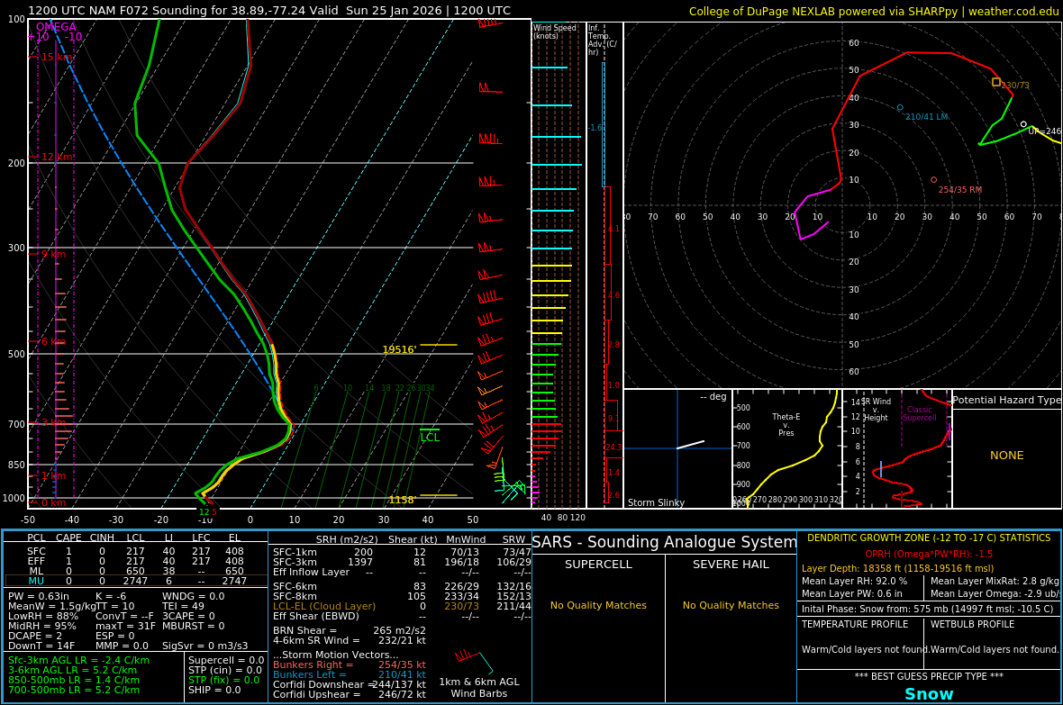
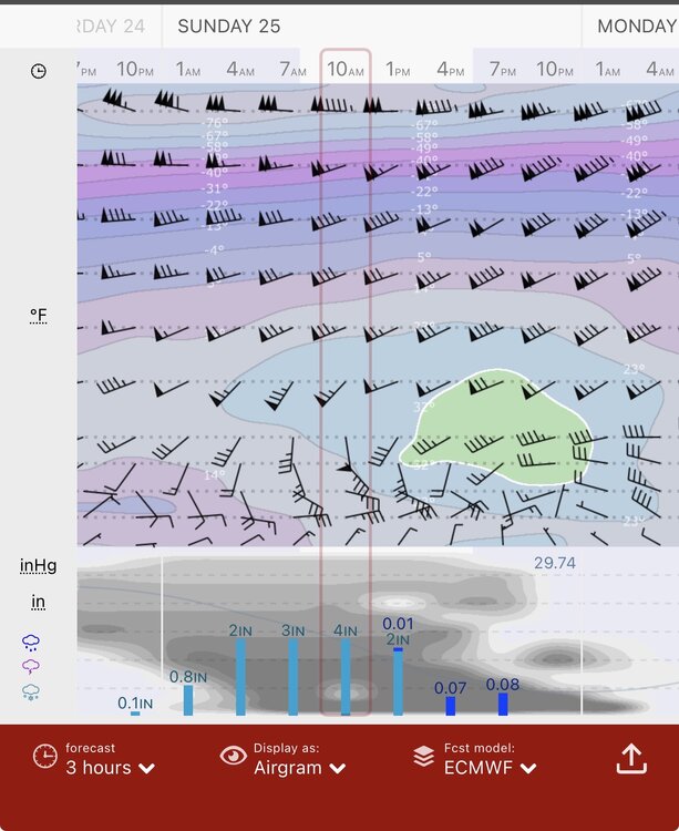
12z sounding is clean at DCA. Warmest is about -5C
-
I'm going to post the Correlation Coefficient to annoy @mattie g
-
Yeah, interesting that it happened again in a year where we had a cold December leading into January.
-
January 24-26: Miracle or Mirage JV/Banter Thread!
MN Transplant replied to SnowenOutThere's topic in Mid Atlantic
There is a real chance that many of us get more precipitation as sleet than snow, and that sucks. -
Sunday morning 7am per the NAM at DCA
-
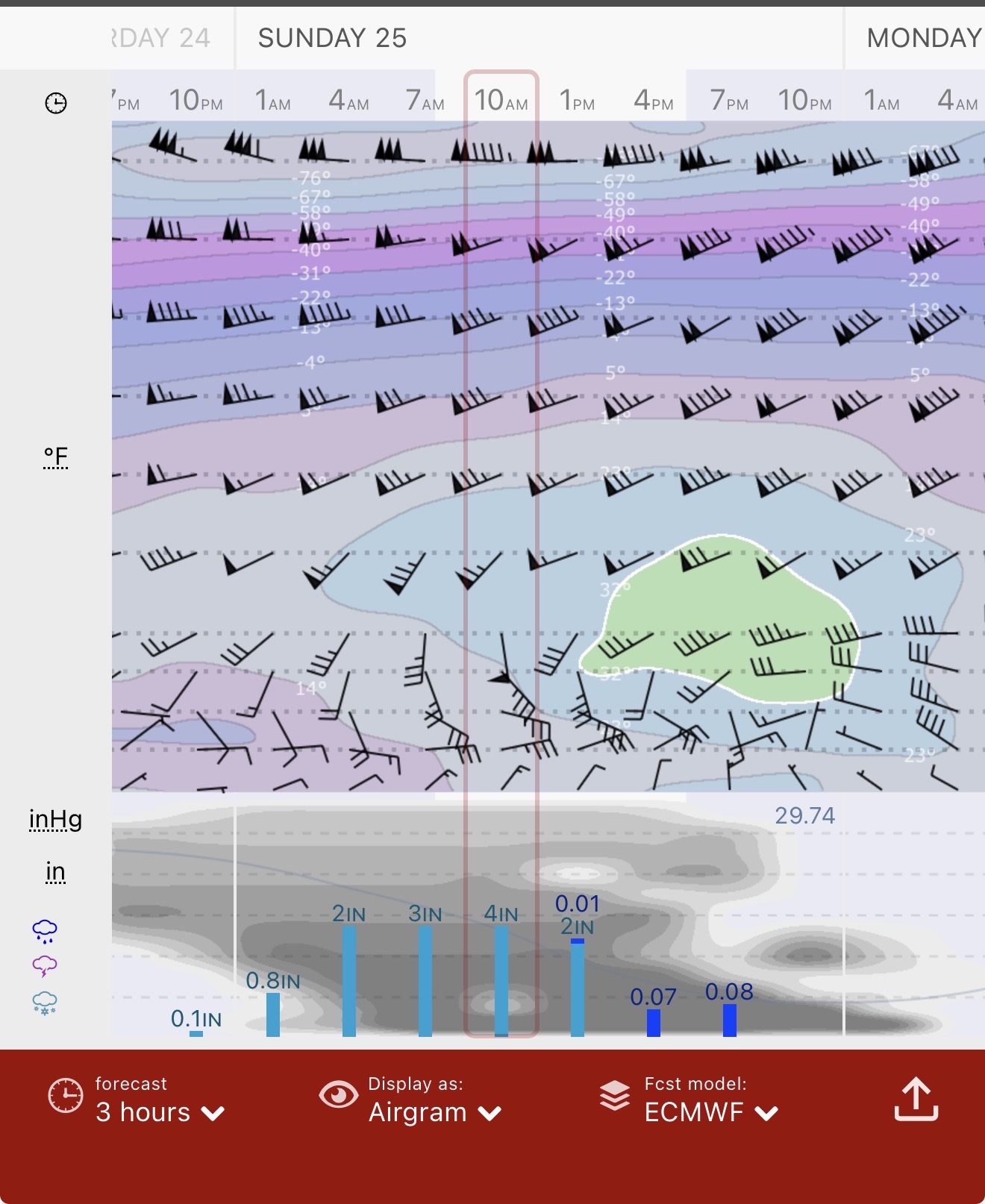
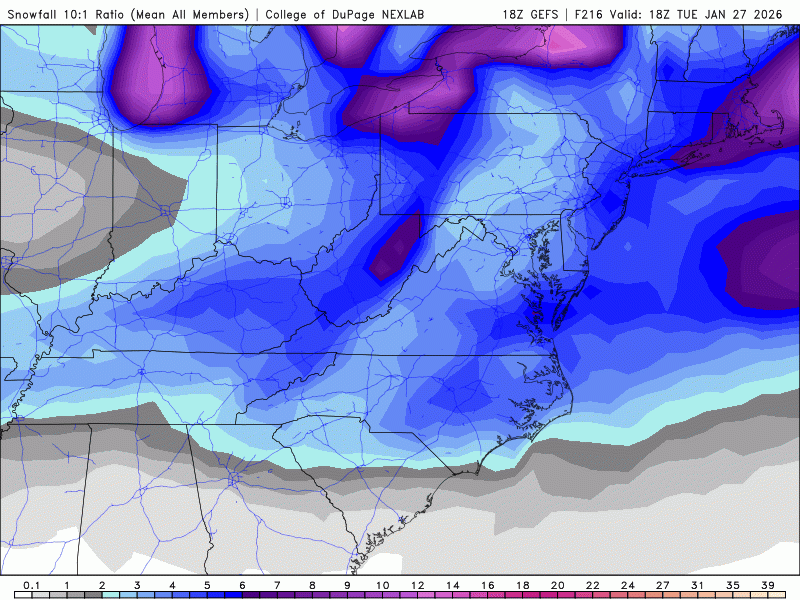
It gets DC to about 1" QPF, all snow. Kuceras are going to be large.
-
This run doesn't bring the warmth anywhere near us.
-
We spent days not wanting the GFS solution, now it is our best hope
-
GFS still with a weak 850 low like this morning. This shouldn't end up like the ICON or even the Euro.
-
One thing that I'm noticing is that the models with a stronger 850 low in the central US are the ones that are able to drive it up to Cleveland and eventually draw up the warm sector for us at the end of the storm. The GFS does not do that, with a weak 850 low that is eventually replaced by a new low that forms off of Cape May, NJ.
-
This is what the Euro looks like above ground over DC. 1000mb at the bottom, going up by 50mb to 800mb and then by 100mb. So, there isn’t necessarily any sneaky layer, it is just the 850-700mb level we lose later on in the storm. Via Windy
-
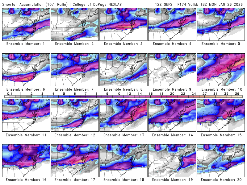
From above, it looks like almost half of the members have 6" or less.
-
Not quite as good
-
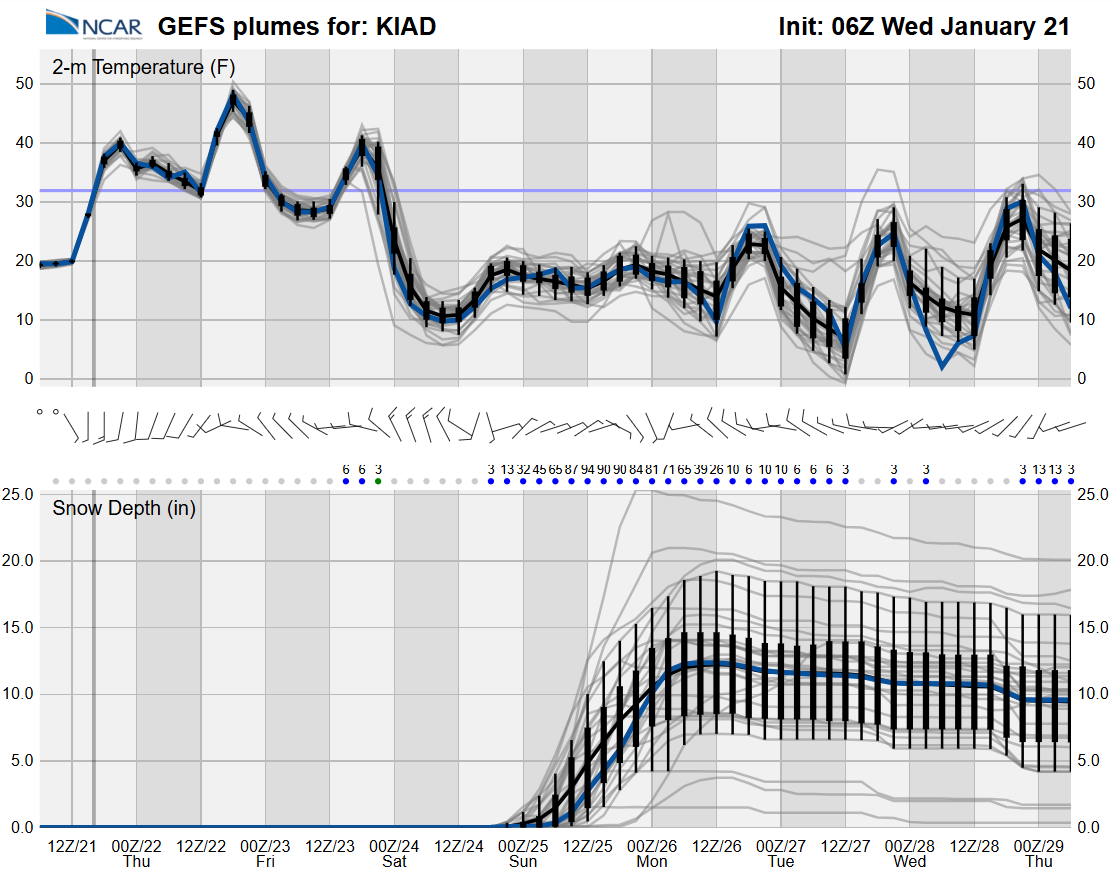
While we are waiting for the GFS, here is a nice visualization of the 06z GEFS members for IAD. https://www2.mmm.ucar.edu/projects/ncar_ensemble/plumes/

-
My brother got a faint glow outside of Frederick. Camera visible only.
-
Went from ~0.06" QPF to ~0.75" around DC from 12z to 18z. Love the GFS.
-
Be careful with Kucera!
-
GDPS is great, but I'd pump the brakes on HECS-level. DC and north looks like it is <1" QPF.
-
Exactly. This is a fail as far as what we want, but that is a solid northern stream vort that does some good work for us. Still a couple to a few inches of snow with temps in the teens.
-
The SW low is in exactly the same spot as the 12z GFS.
-
I was just poking around the Euro and had to go all the way down to Rocky Mount/Raleigh before a warm nose at 725mb showed up. It is amazing how cold these runs are.
-
At least until we get convergence on the individual members. This is still a substantial spread on the GFS. Still ~8 of 20 members that are duds for most of us.
-
And showing the suppressed GFS isn't going to get clicks.
-
The models didn't know. We all did.
-
Chuckles nervously in Minnesota Vikings... Looking back at the prior runs, it was the 12z GFS run yesterday that figured out that the storm was not a cutter. Since then it has been consistently south, but we have plenty of time. The other solutions this morning are really fun to see.