MN Transplant
-
Posts
17,811 -
Joined
-
Last visited
Content Type
Profiles
Blogs
Forums
American Weather
Media Demo
Store
Gallery
Everything posted by MN Transplant
-
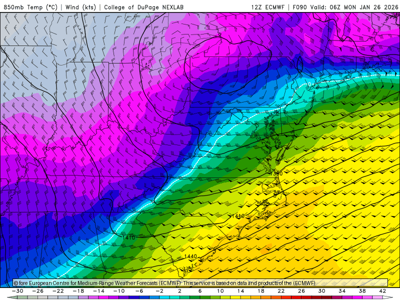
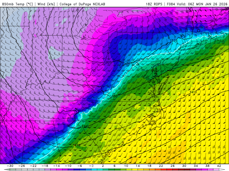
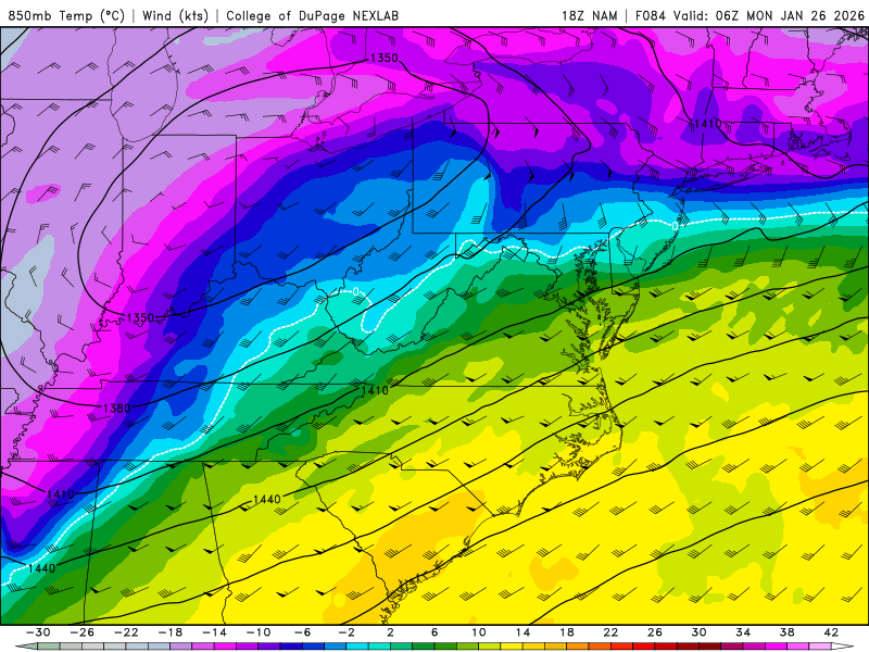
Yeah, the FV3 is a better scenario. Flip isn't until 21z and 1" QPF falls by then in DC. I just don't buy it.
-
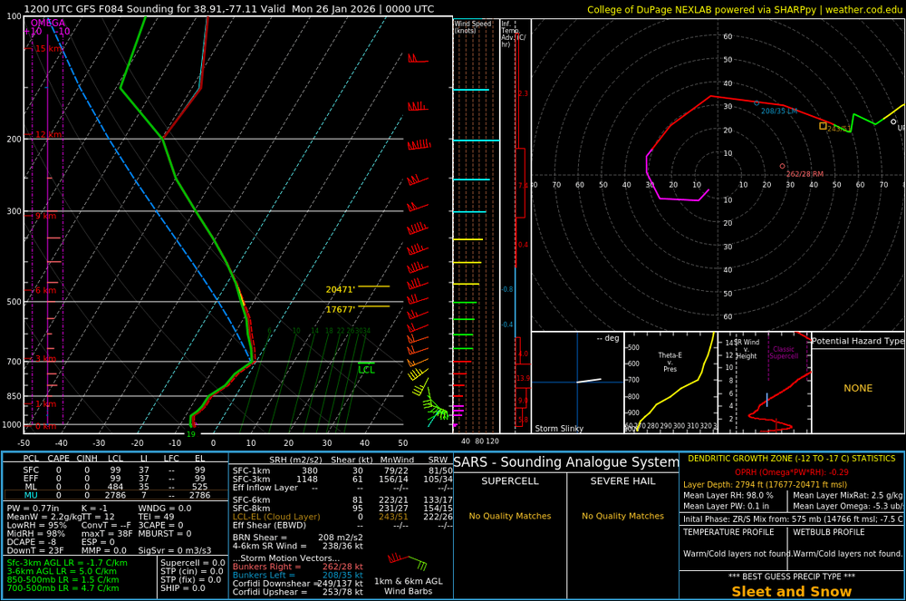
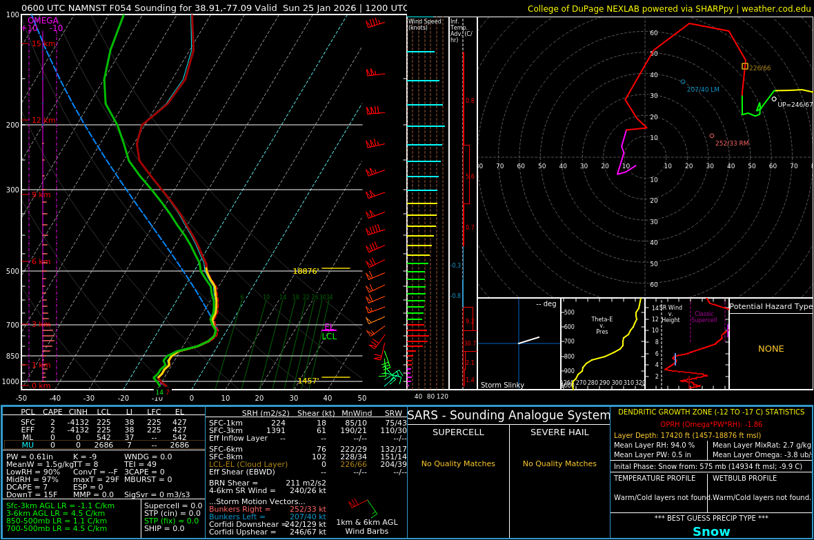
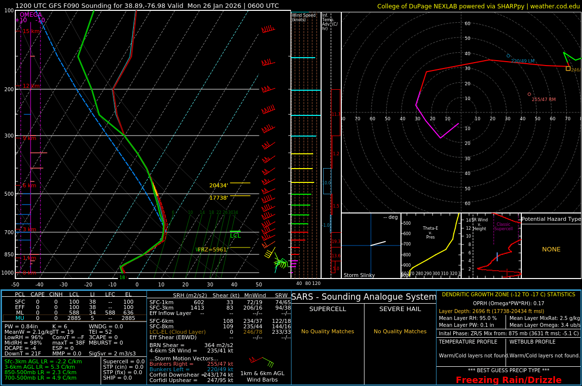
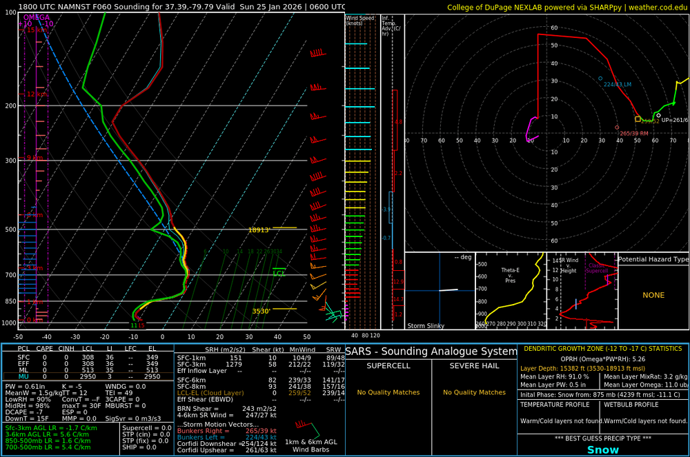
I guess it depends on your definition of "barely any snow". I think a <4" snowfall is still an outlier possibility for DC. Even on the 3k NAM the sounding is perfectly fine up until 15z (12z for reference below).

-
On the upside, this will be the most impressive sleet event since at least 2017, if not 2007.
-
January 24-26: Miracle or Mirage JV/Banter Thread!
MN Transplant replied to SnowenOutThere's topic in Mid Atlantic
Can't wait for my biggest snowstorm since (checks notes) January 2025. -
I don't think I'll need to!
-
Looks like a mix
-
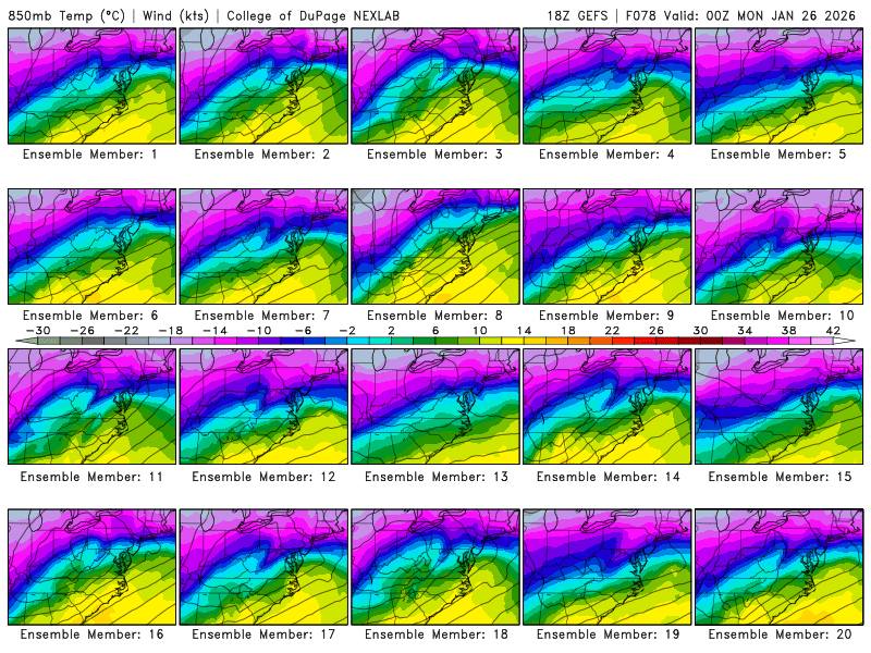
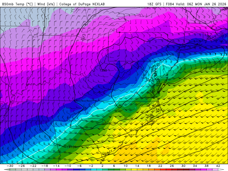
Well, the GFS is either going to score a coup or go down in flames. I'm guessing we already know. Play the game of spot the 850 low.
-
I don't know, I'm looking at West Virginia at 850 as a tell, and the area of above freezing 850s is consistent from 06z to 12z to 18z. I'd expect to see that area larger on the west side of the Apps if it were trending toward keeping a stronger 850 low. The timing is a bit off so you have to loop each of the runs rather than compare hour to hour.
-
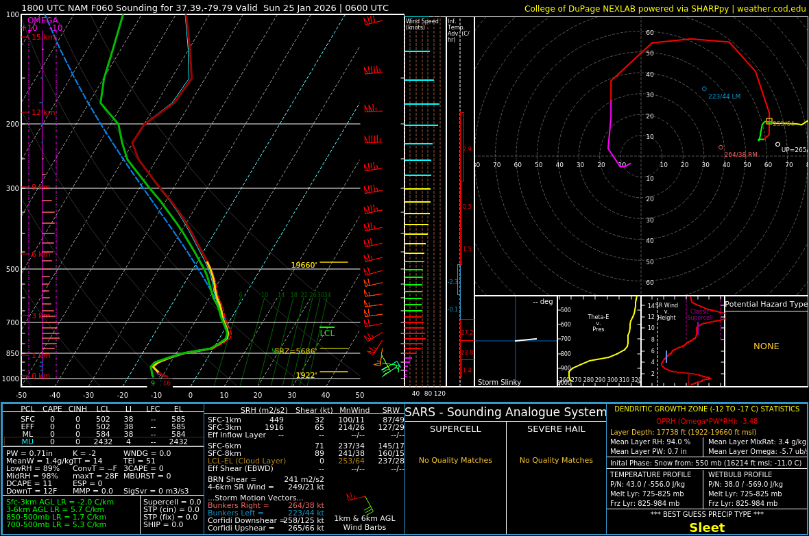
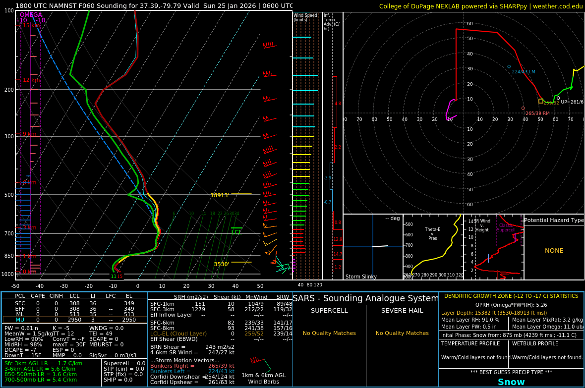
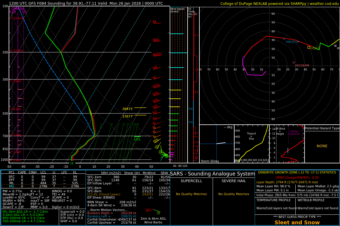
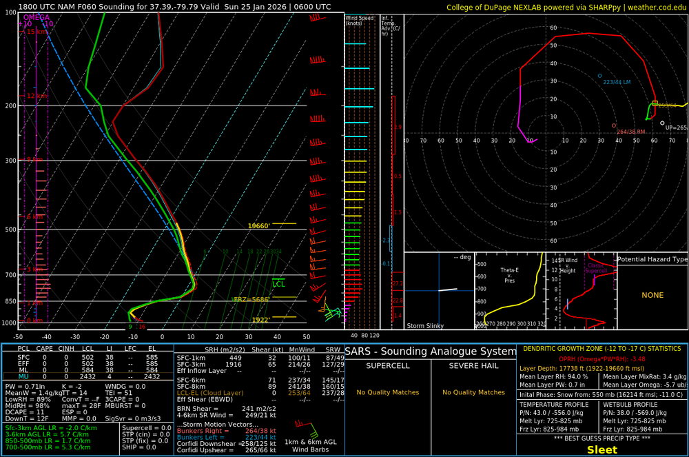
Picked a spot in SW VA where the parent NAM had sleet and 3km NAM had snow for the same time. A couple of degrees difference.
-
We are losing here because of synoptic-scale stuff, not hidden warm layers though. The 850 low is even stronger and further NW than prior runs of almost all models, which just kills us.
-
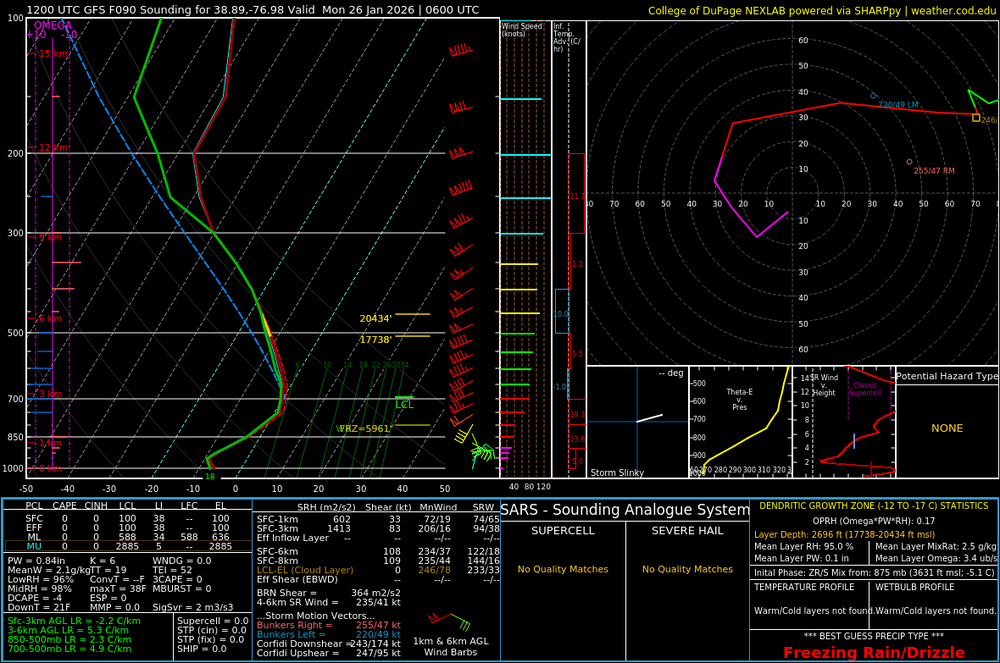
Looks worse to me. We've lost the column by 12z.
-
January 24-26: Miracle or Mirage JV/Banter Thread!
MN Transplant replied to SnowenOutThere's topic in Mid Atlantic
Alright, fair enough! -
January 24-26: Miracle or Mirage JV/Banter Thread!
MN Transplant replied to SnowenOutThere's topic in Mid Atlantic
Fairfax County has end of the quarter teacher workdays on Thurs/Fri and an early dismissal on Wednesday. There's basically no chance my kid will be in school next week. -
January 24-26: Miracle or Mirage JV/Banter Thread!
MN Transplant replied to SnowenOutThere's topic in Mid Atlantic
Yeah, but nobody cares about the models during the time of year it is minus 4 -
I have no doubt that elevation was huge in 2006. That storm is why I don't question the low amount at DCA in borderline events, though. It really is warmer down there.
-
Almost certainly. Sleet counts as accumulation.
-
January 24-26: Miracle or Mirage JV/Banter Thread!
MN Transplant replied to SnowenOutThere's topic in Mid Atlantic
I tried to shut up all week about the Kucera maps. It is pointless to rage against those. -
One of my disappointing storms. My first chance at a big east coast storm and then it snizzles all day, snows overnight, and starts melting immediately in the morning. <9" down at my rental near the Pentagon.
-
January 24-26: Miracle or Mirage JV/Banter Thread!
MN Transplant replied to SnowenOutThere's topic in Mid Atlantic
LOL. Minus 5. -
The crust on top of the snow is going to be amazing by the time Tuesday rolls around. Let's reel the following weekend's storm in and get snow-on-snow.
-
My estimates of the precip before and after the modeled changeover in DC. Model Model Run Prior QPF Time of flip Post-flip QPF Euro 12z Thursday 0.75" 18z Sun 0.65" GFS 12z Thursday 0.90" 02z-07z Mon 0.52" GDPS 12z Thursday 0.80" 15z Sun 0.84" ICON 12z Thursday 0.70" 16z Sun 0.54" UKMET 12z Thursday 1.05" 22z Sun 0.50" AIFS 12z Thursday 0.62" 15z Sun 0.75" AIGFS 12z Thursday 0.75" 15z Sun 0.70" RDPS 12z Thursday 0.84" 13z Sun 0.62"+ 12k NAM 12z Thursday 0.60" 14z Sun 0.90"+
-
~0.75" at that point. Seems about right, 7-9" of snow and then an inch or two of sleet on top.
-
January 24-26: Miracle or Mirage JV/Banter Thread!
MN Transplant replied to SnowenOutThere's topic in Mid Atlantic
Oh yeah -
Yeah, 06z is sleet, but it isn't like we spike way too warm. Like I was talking about yesterday, the 850 low on the GFS is just more diffuse and reforms near or over us.
-
GFS is more of a two-parter than some of the other models. First comes through cold and all snow. Looks like the 2nd is going to be latitudinally-dependent. 00Z Monday DCA