MN Transplant
-
Posts
17,845 -
Joined
-
Last visited
Content Type
Profiles
Blogs
Forums
American Weather
Media Demo
Store
Gallery
Everything posted by MN Transplant
-
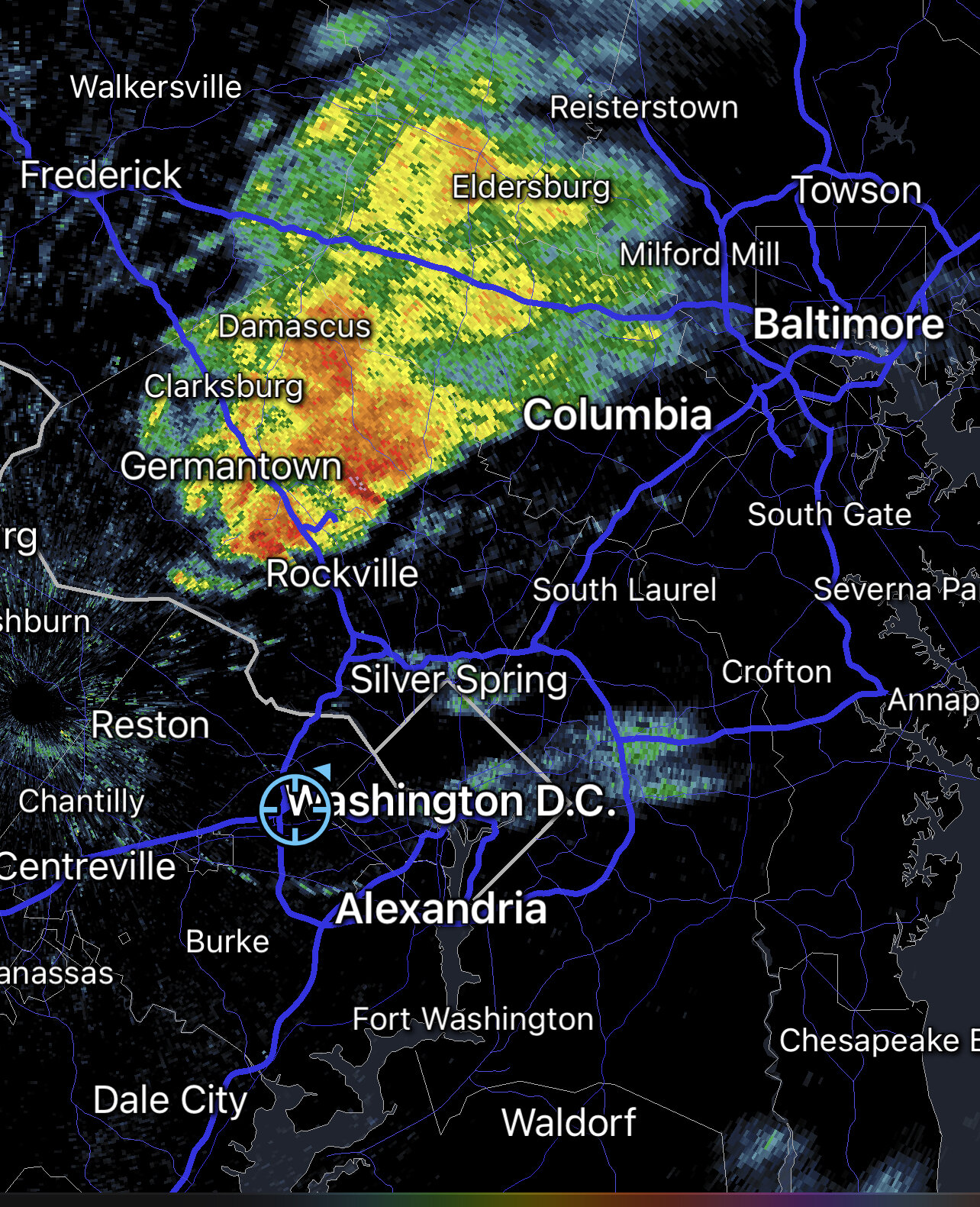
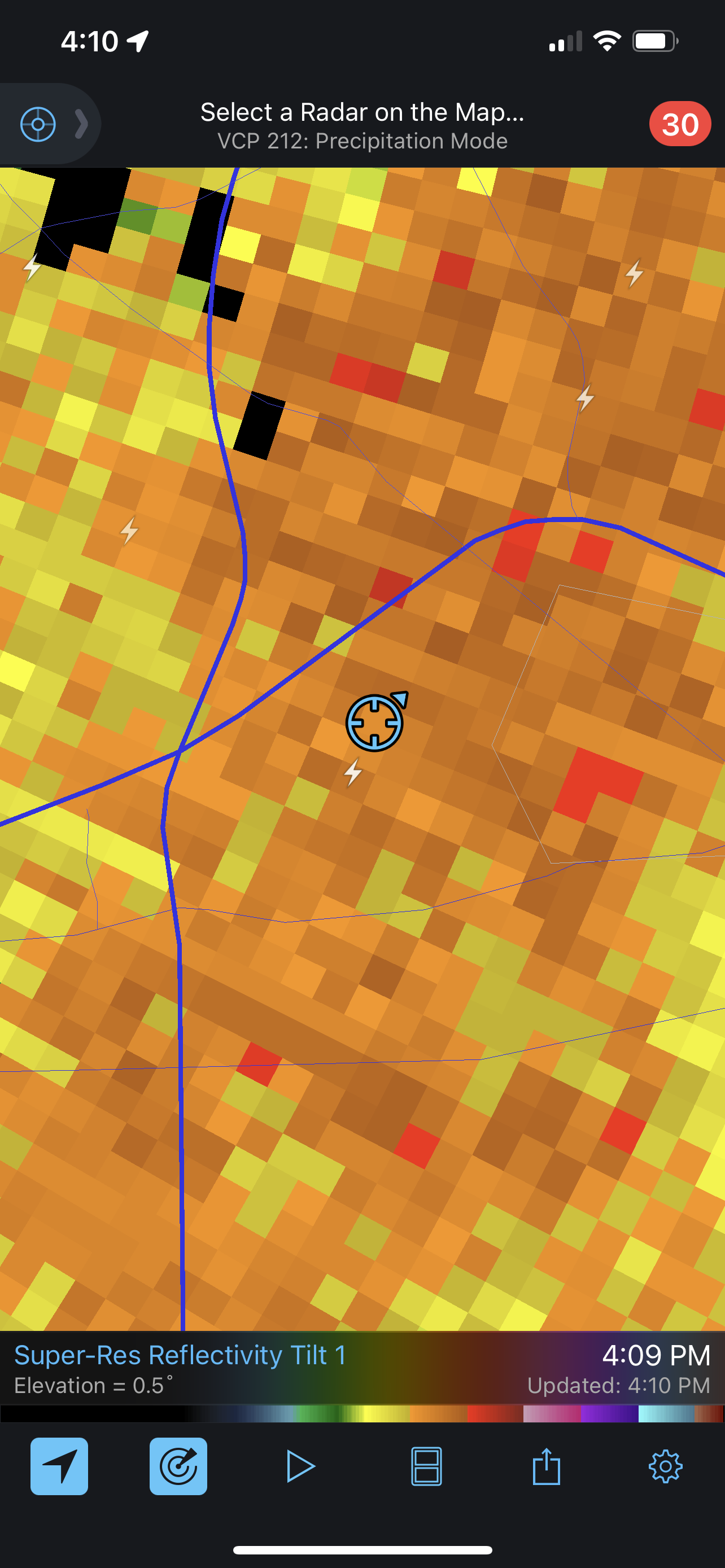
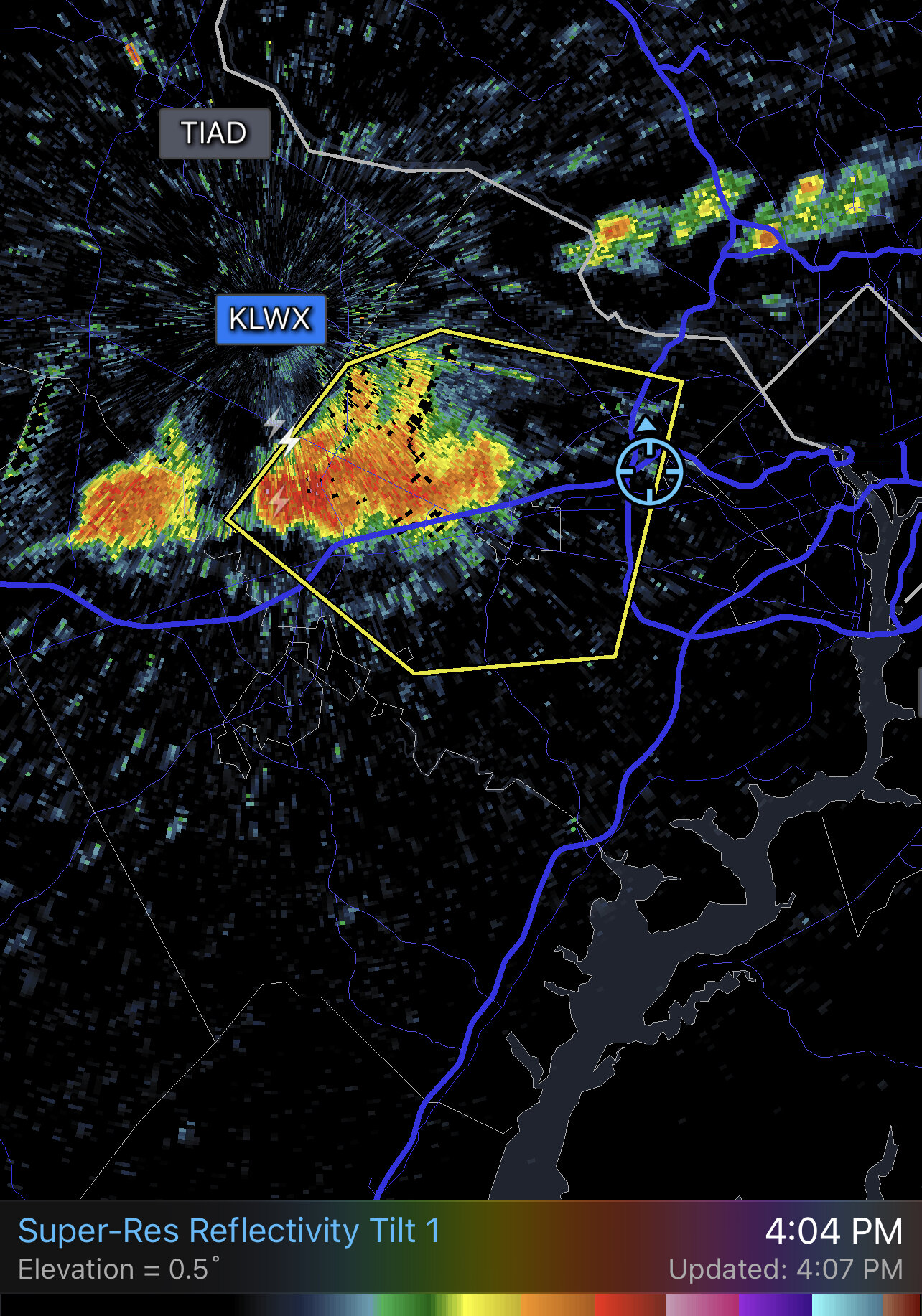
On the edge of the cell that is popping up along 66 inside the Beltway. Rain pulses and then stops.
-
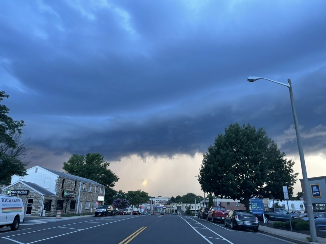
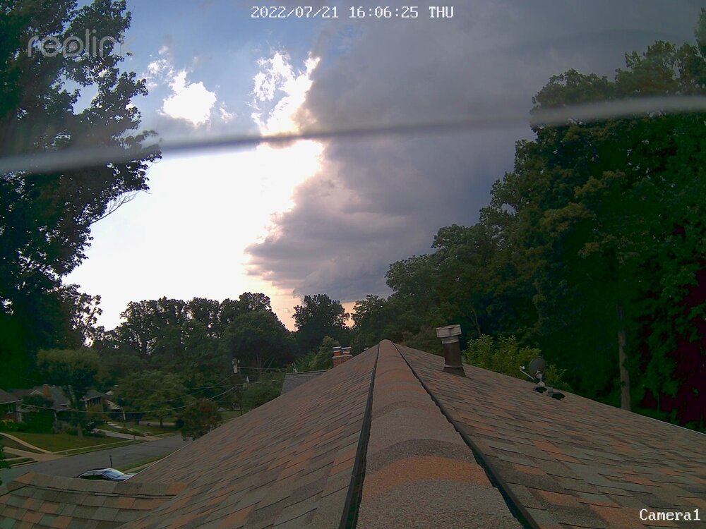
Thought it was an interesting sky with the shelf and the sun behind, but under, the storm. Quick 0.30”

-
Interesting to only have a 5 degrees high/low spread today at DCA. -10 on the high, but above normal on the low.
-
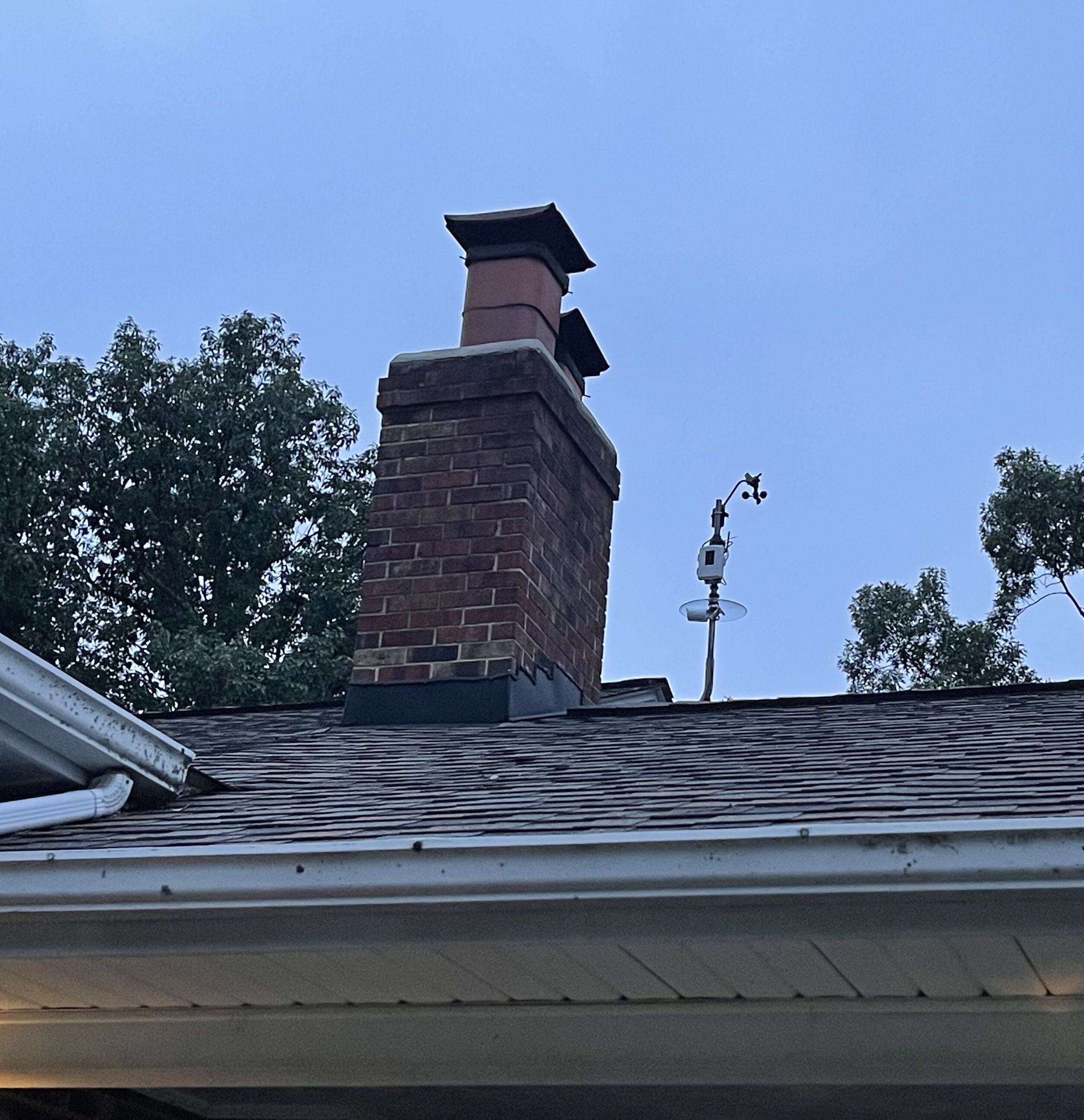
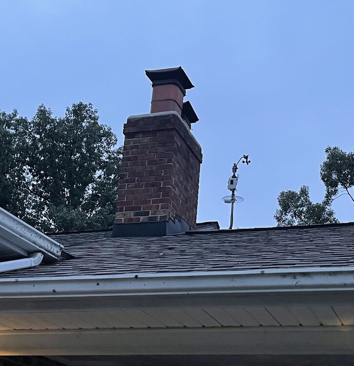
Not too bad. As you can see from the picture, I ended up mounting the camera on my anemometer pole which I’ve had up for almost a decade. I have two different roof levels, the lower one with the roofline going to the chimney is over a carport. It is pretty easy to get up there and get to the peak roofline. I have it as a gable-end mount via this type of pole (https://ambientweather.com/amwewe.html). I have an 8-camera Reolink surveillance system. Power-over-Ethernet so I did spend a good amount of time in the attic and crimping my own ends on the cables. The run to the “skycam” was actually a lot easier because I could go out the attic vent. The impact on the neighbors is negligible because the elevation distance going that direction means that the closer neighbors aren’t in the line of sight. They know I have other cameras too, but I’m friends with all of them so that makes it more comfortable. And none of them are pointed directly at another house.
-
2022 Mid-Atlantic Severe Wx Thread (General Discussion Etc)
MN Transplant replied to Kmlwx's topic in Mid Atlantic
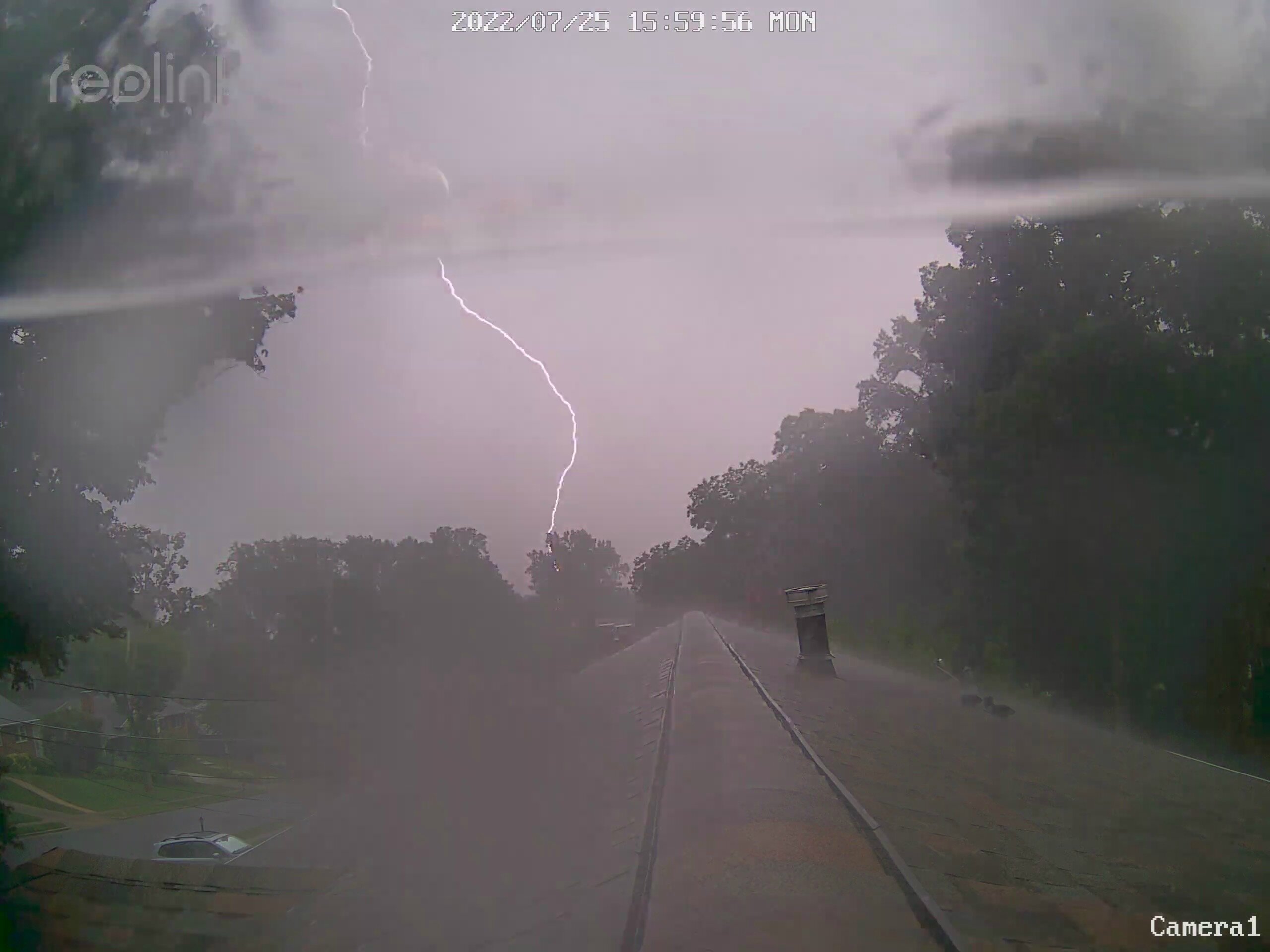
This one was loud. 0.67”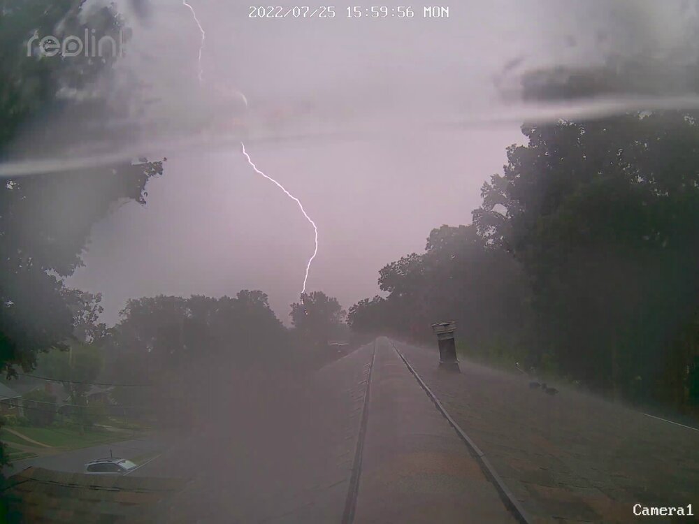

-
DCA now 91/75 for the peak HI of the day of 103.
-
I was only commenting on how today’s run at 100 was a bust. However, since I’m here I will reiterate that there is nothing wrong with DCA’s obs other than being a river site in an urban area.
-
How about 82. Lol
-
IAD to 43 mph with the outflow.
-
98 BWI 96 DCA 94 IAD 94.8 my house
-
Still a fight between the globals and mesos. The mesos think that there will be too much cloudiness around to approach 100. I’m siding with them.
-
The globals are still printing out near 100 temps for Sunday, but the NAM Nest for consecutive runs has shown convective debris coming into the area at peak heating and keeping us much lower. Something to keep an eye on for those rooting for triple digits.
-
Some of the HRRR runs from this morning were dead on with a cell along 66.
-
2022 Mid-Atlantic Severe Wx Thread (General Discussion Etc)
MN Transplant replied to Kmlwx's topic in Mid Atlantic
Nothing even close to severe, but a quick half inch is welcome for the yard/gardens prior to this weekend’s heat. -
2022 Mid-Atlantic Severe Wx Thread (General Discussion Etc)
MN Transplant replied to Kmlwx's topic in Mid Atlantic
Come to papa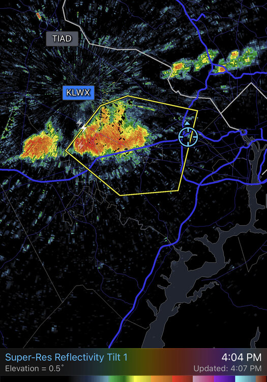
-
Highs so far of 94 at DCA/BWI and 92 at IAD. Topped out at 93.6 here, but now down to 88 with overcast.
-
2022 Mid-Atlantic Severe Wx Thread (General Discussion Etc)
MN Transplant replied to Kmlwx's topic in Mid Atlantic
I also think that the risk to overwarning Severe is less problematic than overwarning Tornadoes. Generally for severe you really want people to be inside. They are going to do that if they know a thunderstorm is coming. It is the tornado warning fatigue in other parts of the country that can really be a problem. -
91/73 at DCA on the ob. 92.4 at home.
-
2022 Mid-Atlantic Severe Wx Thread (General Discussion Etc)
MN Transplant replied to Kmlwx's topic in Mid Atlantic
The replies by Matthew and Ian nail the issue dead-on - trees. We have a densely-treed metropolitan area in an area that (despite this board's complaints) has little wind. So, the trees are not "accustomed" to windy conditions and they fail regularly. Adding to that, much of the area was built in the post-war timeframe and the trees that are here are getting up in age and some of them are failing. Unless you are proposing to change the definition of severe to not include tree disruption, I don't think they can or should reduce the number of warnings. -
Predictably, the models other than the GFS have backed down on the 100 level, but the Euro is holding on to the idea that Monday torches too.
-
The GFS is very likely being overly aggressive. Edit - as evidence, the GFS has Minneapolis going to 115 at the end of the run
-
Go to garage sales in rich neighborhoods and stock up on stuff like tools.
-
Record highs on Sunday are 101 (DCA/BWI) and 99 (IAD). All from 2010.
-
ICON is on board for 100+. Ukie and CMC keep us in the mid-upper 90s. GFS ensembles per Ian's twitter also touch 100.