MN Transplant
-
Posts
17,845 -
Joined
-
Last visited
Content Type
Profiles
Blogs
Forums
American Weather
Media Demo
Store
Gallery
Everything posted by MN Transplant
-
The OP Euro and GFS want to go triple digits on Sunday, but they’ve both been terrible with big heat this summer. Probably best to use the ensembles which are more in the upper 90s range. It’ll be above normal in the hottest part of the year, which is always unpleasant.
-
2022 Mid-Atlantic Severe Wx Thread (General Discussion Etc)
MN Transplant replied to Kmlwx's topic in Mid Atlantic
#alwaysmaryland -
GFS/Euro now putting out some good heat within 6 days.
-
2022 Mid-Atlantic Severe Wx Thread (General Discussion Etc)
MN Transplant replied to Kmlwx's topic in Mid Atlantic
#alwaysmaryland -
Southern Frederick County compared to NW DC over the past 45 days is nuts.
-
Both the GFS and Euro have been occasionally trying to roll over the Plains heat to us in the longer term, and each time they’ve (correctly) backed off.
-
I got 0.01", practically FFW territory.
-
I’m out of town, so get ready for derecho 2 boogaloo
-
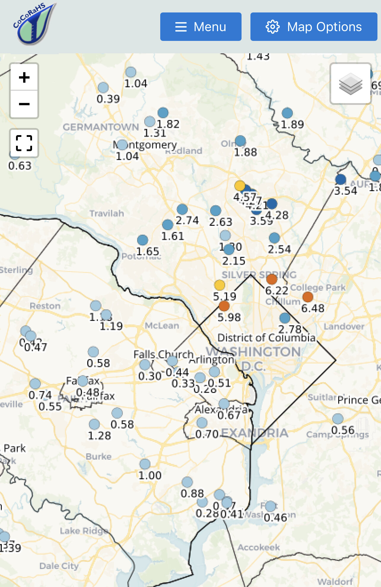
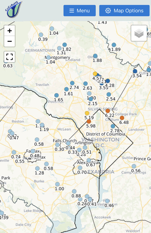
Would love to see a ground truth number from the Congressional/Avanel/Carderock area of MoCo. I found one 6” PWS.
-
5”+ via radar and a weather station near the MD side of Great Falls.
-
Just got woken up by the FFW. 1.63” since midnight and more coming.
-
2022 Mid-Atlantic Severe Wx Thread (General Discussion Etc)
MN Transplant replied to Kmlwx's topic in Mid Atlantic
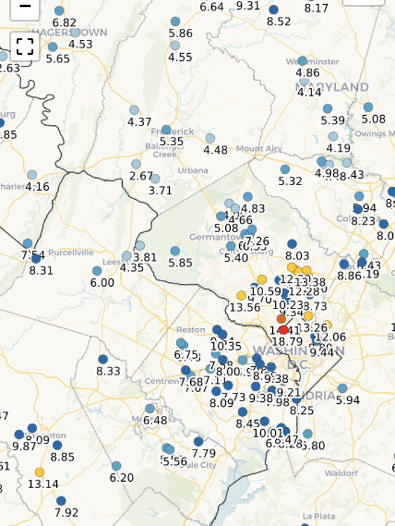
Average Recurrence interval. It is funny to see the AFD talk about widespread 1-3” with lollis to 4-7”, and then have the HRRR runs come in with virtually nothing for the metros. -
2022 Mid-Atlantic Severe Wx Thread (General Discussion Etc)
MN Transplant replied to Kmlwx's topic in Mid Atlantic
Yes, but it overexaggerates the impact. -
2022 Mid-Atlantic Severe Wx Thread (General Discussion Etc)
MN Transplant replied to Kmlwx's topic in Mid Atlantic
18z NAM nest puts down some 10-15" values in spots by Charlottesville, but that model has terrain issues. -
18z HRRR likes south of DC better. Clearly the MD magnet is not programmed in.
-
2022 Mid-Atlantic Severe Wx Thread (General Discussion Etc)
MN Transplant replied to Kmlwx's topic in Mid Atlantic
HRRR is not enthused yet, but give it time. -
That weird N/S storm a couple of weeks ago broke the atmosphere. Our Germantown colleagues can be honorary drought members.
-
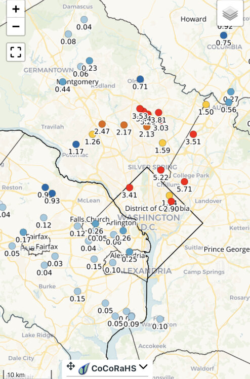
0.38” in the last two weeks. That’s what we want in the middle of Summer, right?
-
Raining in MD again
-
The humidity really soared today. It is thick out there.
-
2022 Mid-Atlantic Severe Wx Thread (General Discussion Etc)
MN Transplant replied to Kmlwx's topic in Mid Atlantic
Let’s just keep that cell rolling down 66 -
Gauge undercatch due to heavy rain isn’t generally going to be that significant. Seems like something else may have been going on.
-
Localized
-
2022 Mid-Atlantic Severe Wx Thread (General Discussion Etc)
MN Transplant replied to Kmlwx's topic in Mid Atlantic
No rain at IAD or DCA while miles away are getting pounded. Mid-Atlantic summer in action.