greenmtnwx
-
Posts
595 -
Joined
-
Last visited
Content Type
Profiles
Blogs
Forums
American Weather
Media Demo
Store
Gallery
Everything posted by greenmtnwx
-
Definitely going to be widespread 6”+ amounts up to 9-10”
-
Writings on wall
-
I’m just glad that it appears we will escape this summer without the extreme heat. Keep it out west.
-
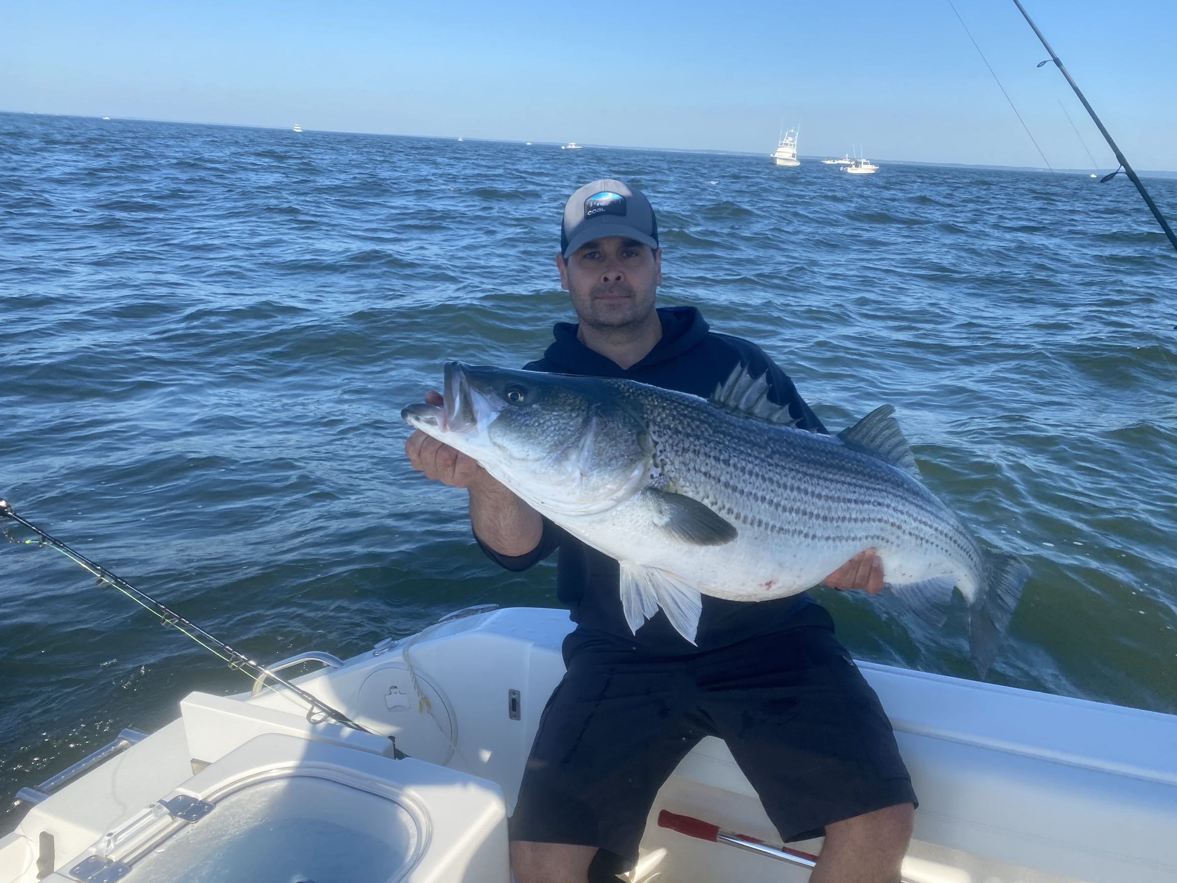
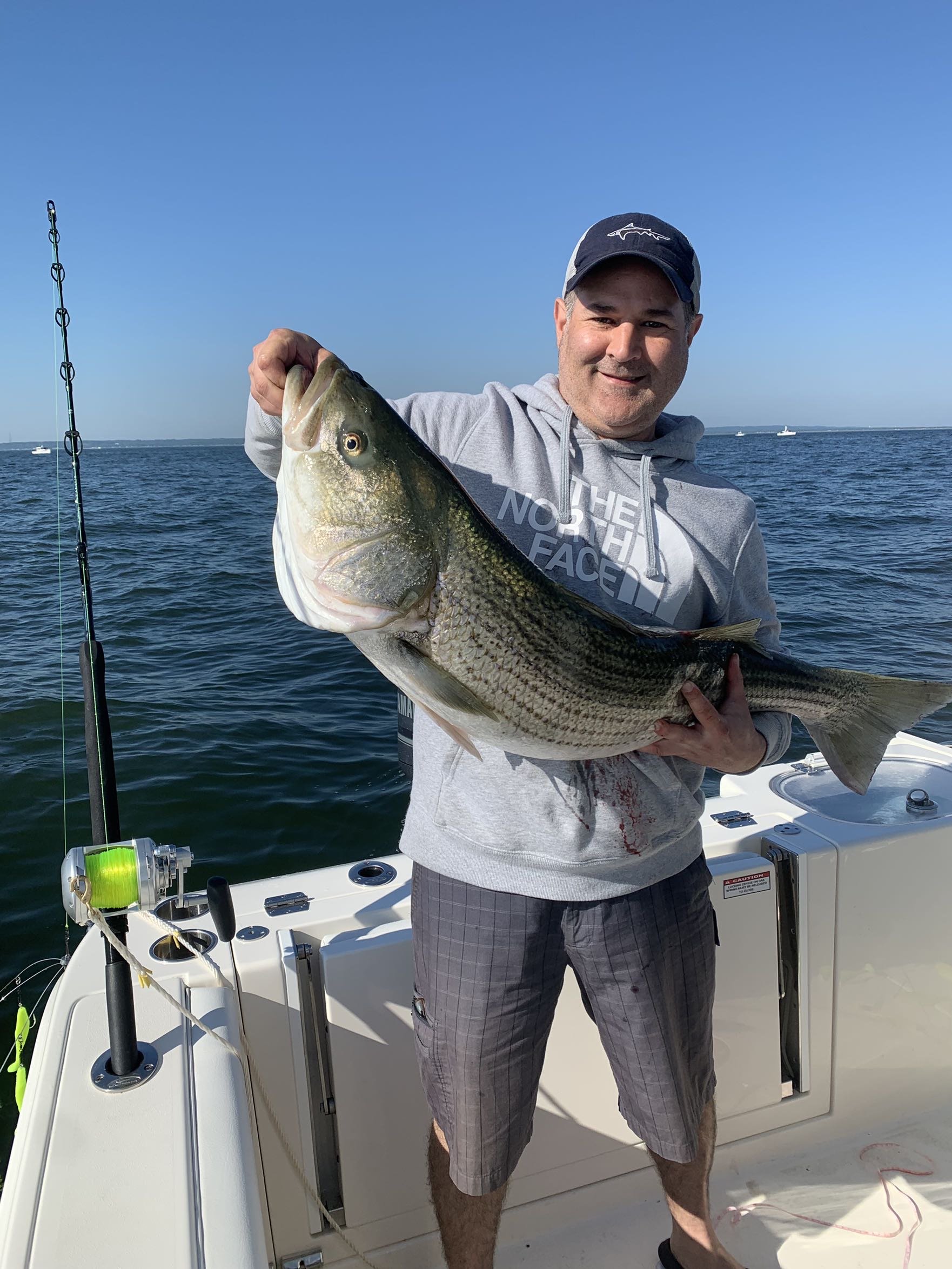
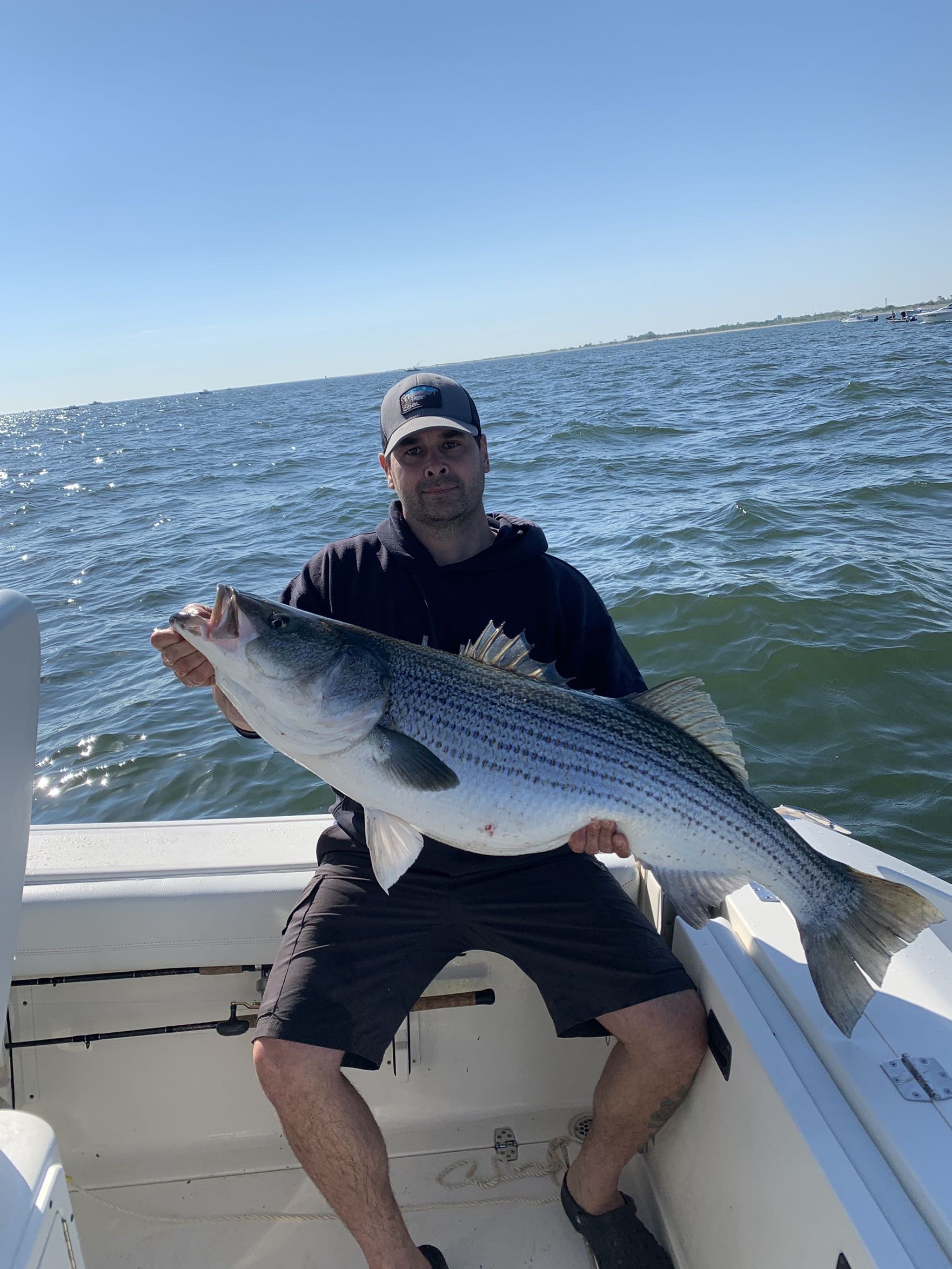
Cape cod canal is world renowned for trophy striper fishing from shore. Boats are not allowed to fish the canal.
-
NJ
-
Oh I thought EDP was younger ones only and stepped up to ECNL. I’ll be headed down to ECNL showcase next weekend NC. Real deal.
-
Low level EDP tourney? Progin or fc stars complex?
-
Is that the crappy EDP tournament? Weak sauce.
-
These things tend to be cyclical. NYC went through some tough years in the 70s-90s with poor leadership. Eventually it swings back to conservative leadership and gets cleaned up. Hopefully we get some republican leadership back in cities in this country and turn the tide. Or at least some Democrats that are not off the friggin rails like the rest of the modern party has gotten. You need law and you need pro business policies, safety, work ethic.
-
Will or PF, any ideas on annual snow for this spot. 1,800 ft

-
Will or PF, thoughts on how KMart does in this storm?
-
PF it always drives my son nuts, why does Stowe close so early, some years with plenty of snow to continue operating?
-
They have a major problem, it’s called Vail Resorts.
-
Warmth?
-
What part hasn’t? If you are familiar with the mountain and “mountain-speak” you will know the last two years there have been horrendous.
-
Stay far away from Epic. Vail Resorts is a disaster. Mount Snow had been horrendous last couple of years and generally anything Vail touches they turn to crap. Obviously dependent on your proximity, but Ikon a much better pass.
-
Comparing Bretton Woods to Stowe is like comparing a chihuahua to a Siberian husky. They are both dogs but not the same animal
-
I was talking with my late teen son about N NH/Whites vs. VT/Greens and the culture and geography of the states. I came up with that NH is the blond with that big rack that you have a good time with. A little bit trashy. VT is the cute smart nerdy brunette that you take home to mom. Each has their own appeal.
-
OBS and nowcast Thursday morning 2/18 - 11PM Friday 2/19/21
greenmtnwx replied to wdrag's topic in New York City Metro
Getting crushed here in monmouth. Very heavy snow several inches already -
The snowy week went poof. No snow and then a rainstorm, can’t win em all.
-
Obs and nowcast Super Bowl Sunday 4A-6P Feb 7, 2021
greenmtnwx replied to wdrag's topic in New York City Metro
That guy is a troll, we all know it. -
Obs and nowcast Super Bowl Sunday 4A-6P Feb 7, 2021
greenmtnwx replied to wdrag's topic in New York City Metro
Dude what do you want, you live in Coney Island lol -
Obs and nowcast Super Bowl Sunday 4A-6P Feb 7, 2021
greenmtnwx replied to wdrag's topic in New York City Metro
You have to put your ruler straight in the snow -
Obs and nowcast Super Bowl Sunday 4A-6P Feb 7, 2021
greenmtnwx replied to wdrag's topic in New York City Metro
Rain picking up here in Middletown NJ, Monmouth. Warmer than anticipated. Going to be a period of rain along coast and boroughs.